5 Best Cultural Map Integrations for Digital Storytelling
Maps tell stories beyond just showing roads and landmarks. You can transform ordinary geographic visualizations into powerful cultural narratives that connect people to place history and community identity.
Modern mapping technology lets you weave together location data with rich storytelling elements like oral histories indigenous knowledge systems and neighborhood folklore. This integration creates more meaningful connections between users and the spaces they navigate.
Whether you’re designing for urban planning tourism or educational purposes cultural narrative mapping helps preserve local stories while making geographic information more accessible and engaging for diverse audiences.
Disclosure: As an Amazon Associate, this site earns from qualifying purchases. Thank you!
P.S. check out Udemy’s GIS, Mapping & Remote Sensing courses on sale here…
Understanding Cultural Narrative Integration in Modern Cartography
Cultural narrative integration transforms traditional mapping by weaving human stories directly into geographic visualization. This approach bridges the gap between technical cartography and community storytelling needs.
Defining Cultural Narratives in Geographic Context
Cultural narratives represent the collective stories, traditions, and experiences that communities attach to specific places. You’ll find these narratives encompass oral histories, migration patterns, cultural landmarks, and social memories tied to geographic locations. Modern GIS platforms like ArcGIS Online and QGIS now support multimedia integration, allowing you to embed audio recordings, photographs, and video testimonials directly into map features. This integration creates layered storytelling where each geographic point becomes a portal to deeper cultural understanding.
The Evolution of Storytelling Through Maps
Digital mapping has revolutionized how you can present cultural stories through geographic visualization. Traditional paper maps limited storytelling to static symbols and text annotations, but web-based platforms like Mapbox and Leaflet enable interactive narrative experiences. You can now create time-based animations showing cultural evolution, implement pop-up windows containing multimedia content, and design custom symbology that reflects cultural significance. Story maps have emerged as a powerful format, combining scrolling narratives with dynamic map visualizations to guide users through cultural journeys across both space and time.
Understand the structure of a one-hour TV drama pilot. This book provides a guide to story mapping for television.

Incorporating Indigenous Knowledge Systems Into Digital Maps
Indigenous knowledge systems offer profound insights into landscape relationships that Western cartography often overlooks. By integrating traditional ecological knowledge with digital mapping platforms, you create more complete representations of cultural geography.
Traditional Land Use Patterns and Sacred Sites
Traditional land use patterns reveal centuries of sustainable resource management practices that GPS coordinates alone cannot capture. You’ll need to work directly with Indigenous communities to identify seasonal hunting grounds, medicine gathering areas, and ceremonial sites through collaborative field mapping sessions. Sacred sites require special consideration – many communities prefer these locations remain unmarked or represented through symbolic rather than precise geographic markers to protect their cultural significance.
Oral History Documentation and Geographic Markers
Oral histories provide rich contextual layers that transform simple coordinates into meaningful cultural landscapes. You can embed audio recordings of elders sharing traditional place names and stories directly into interactive map markers using platforms like ArcGIS StoryMaps or QGIS with multimedia plugins. Document traditional migration routes and seasonal movements through time-enabled features that show how communities historically moved across territories following natural cycles and resource availability patterns.
Community-Led Mapping Initiatives
Community-led mapping initiatives ensure Indigenous voices control how their knowledge appears in digital formats. You should provide GIS training and mobile mapping tools like Survey123 or KoBo Toolbox to community members who can collect data according to their own protocols and privacy preferences. Establish data sovereignty agreements that give communities ownership over their mapped knowledge, allowing them to determine what information gets shared publicly versus what remains within community databases for internal use only.
Utilizing Historical Timeline Overlays for Cultural Context
Timeline overlays transform static maps into dynamic historical narratives that reveal how cultural landscapes evolved over centuries. You’ll discover how temporal layers create compelling connections between geographic locations and their rich cultural heritage.
Layered Historical Events on Geographic Locations
Stack multiple historical periods on your base map to show cultural evolution at specific coordinates. Use ArcGIS Pro’s temporal visualization tools to overlay settlement patterns from different centuries, creating visual layers that demonstrate how communities expanded or relocated over time. Apply graduated symbology to represent population density changes, while incorporating historical event markers like battle sites, trade route intersections, or ceremonial locations. Configure layer transparency settings between 60-80% to maintain visibility across temporal periods, allowing users to observe cultural continuity and transformation at precise geographic points.
Interactive Timeline Features for User Engagement
Implement slider controls that allow users to navigate through historical periods while maintaining geographic focus on cultural sites. Configure web-based timeline widgets using Esri’s Web AppBuilder or open-source alternatives like TimelineJS to create smooth temporal transitions. Enable click-through functionality on timeline markers that trigger popup windows containing historical photographs, documents, or audio recordings tied to specific cultural events. Set animation speeds between 2-4 seconds per transition to provide adequate viewing time while maintaining user engagement throughout the cultural narrative journey.
Connecting Past and Present Through Visual Storytelling
Bridge temporal gaps by using split-screen comparisons that show historical maps alongside contemporary satellite imagery of the same cultural locations. Employ before-and-after visualization techniques using ArcGIS Online’s swipe tool or custom JavaScript applications to reveal landscape changes affecting cultural sites. Integrate historical photographs as georeferenced overlays with modern street-level imagery, enabling users to visualize cultural preservation efforts or document heritage site transformations. Apply consistent color schemes across temporal layers to maintain visual continuity while using contrasting symbology to highlight significant cultural changes between historical periods.
Explore history's most significant maps with *Great Maps*. This book delves into cartographic masterpieces and their historical context.

Integrating Local Art and Visual Elements Into Map Design
Visual design bridges the gap between technical cartography and community storytelling. You’ll create more engaging maps by incorporating artistic elements that reflect local cultural identity.
Community Artist Collaborations for Map Aesthetics
Partner with local artists to develop custom map symbols and design elements that reflect regional aesthetic traditions. Artists bring authentic cultural perspectives to cartographic visualization, creating unique iconography that resonates with community members. You’ll establish collaborative workflows where artists sketch traditional motifs while you translate these designs into scalable vector graphics. This partnership ensures maps carry genuine cultural markers rather than generic symbols, strengthening the connection between geographic data and local identity.
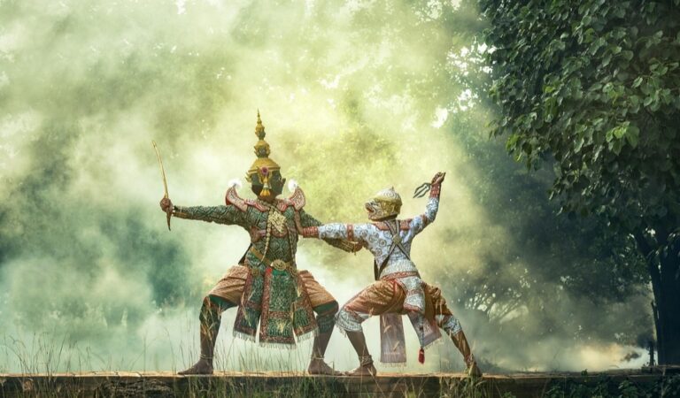
Cultural Symbols and Iconography in Navigation
Incorporate meaningful cultural symbols as navigation markers to replace standard cartographic conventions with locally significant imagery. Traditional patterns, architectural elements, and ceremonial objects serve as intuitive wayfinding tools for community members. You’ll research culturally appropriate symbols through community consultation, ensuring respectful representation while maintaining cartographic clarity. These symbols transform navigation from abstract geographic references into culturally embedded spatial understanding, making maps more accessible to diverse user groups.
Neighborhood Murals and Public Art as Waypoints
Document existing public art as prominent waypoints that provide both navigation assistance and cultural context within mapped environments. Murals, sculptures, and community installations serve as recognizable landmarks while telling neighborhood stories through visual representation. You’ll photograph and catalog these artistic features, creating detailed attribute data that includes artist information, creation dates, and cultural significance. This approach transforms functional navigation into cultural discovery, where each waypoint becomes an opportunity for deeper community engagement.
Embedding Audio Stories and Oral Traditions in Interactive Maps
Audio integration transforms static geographic data into immersive cultural experiences that preserve community voices directly within their spatial context.
Voice Recording Integration for Cultural Preservation
Recording oral histories at their geographic origins creates authentic cultural archives within your mapping platform. You’ll capture storyteller voices using field-ready audio equipment positioned at culturally significant locations. Modern GIS platforms like ArcGIS Online and QGIS support embedded audio files through point-based hotspots that trigger playback when users interact with specific map locations. Your workflow should include compression settings optimized for web delivery while maintaining voice clarity. Community elders and cultural knowledge keepers provide irreplaceable perspectives that written documentation can’t fully capture. Audio preservation requires consistent file formats and metadata standards to ensure long-term accessibility across different mapping systems.
Multilingual Storytelling Options for Diverse Communities
Multilingual audio layers accommodate diverse community languages and expand cultural accessibility across different user groups. You’ll implement language selection controls that allow users to switch between indigenous languages, heritage languages, and contemporary translations of the same geographic stories. Web mapping frameworks support multiple audio track integration through JavaScript libraries that manage concurrent language options. Your interface design should include clear language indicators and seamless switching mechanisms that don’t interrupt the storytelling flow. Cultural authenticity improves when native speakers record stories in their original languages rather than relying on translated versions. Translation accuracy becomes crucial for maintaining cultural nuance while ensuring broader community access to preserved oral traditions.
Sound Mapping for Cultural Heritage Sites
Sound mapping captures acoustic environments that define cultural heritage locations beyond visual elements alone. You’ll record ambient sounds, traditional music, and ceremonial audio that characterize specific cultural sites during different seasons or cultural events. Specialized audio mapping tools like SoundScape Toolkit integrate with GIS platforms to create layered acoustic experiences tied to precise geographic coordinates. Your sound collection should document both natural acoustic environments and human cultural activities that define these spaces. Audio quality standards must balance file size constraints with the fidelity needed to convey cultural atmosphere effectively. Temporal sound mapping reveals how cultural sites change acoustically throughout daily cycles, seasons, and cultural calendar events.
Soundscape (Full Score) is an immersive audio experience. Enjoy the full score in English.

Creating Community-Driven Content Platforms for Cultural Mapping
Building community-driven platforms transforms cultural mapping from expert-led projects into collaborative storytelling ecosystems. These platforms enable communities to share their lived experiences while maintaining technical mapping standards.
User-Generated Story Submissions and Moderation
Establishing submission workflows requires implementing structured forms that capture geographic coordinates alongside narrative content. You’ll need moderation systems that verify location accuracy while preserving authentic community voices. Digital platforms like Omeka S and StoryMapJS provide frameworks for managing user contributions with built-in quality control features. Community moderators familiar with local culture should review submissions for cultural sensitivity and geographic precision before publication.
Social Media Integration for Real-Time Cultural Updates
Connecting social media feeds to mapping platforms enables dynamic cultural content updates through hashtag monitoring and geolocation data. You can integrate Twitter API and Instagram feeds to automatically populate map markers with real-time cultural events and community activities. Platforms like CARTO support social media data streams that update cultural markers based on location-tagged posts. This creates living maps that reflect ongoing community cultural expressions.
Crowdsourced Cultural Event Mapping
Developing event mapping systems allows communities to contribute festival locations, ceremony sites, and cultural gatherings through mobile-friendly interfaces. You should implement calendar integration that displays temporal cultural events alongside permanent cultural landmarks. Tools like Ushahidi and Crowdmap provide frameworks for collecting event data with timestamp verification and location accuracy checks. Community validators ensure submitted events align with local cultural practices and scheduling.
Conclusion
When you implement these cultural narrative integration strategies you’re not just creating mapsâyou’re building bridges between communities and their heritage. Each approach transforms traditional cartography into a living repository of human experience that grows richer with every story added.
Your mapping projects become powerful tools for cultural preservation and community engagement when you prioritize authentic voices and collaborative storytelling. The technology exists to support these initiatives but success depends on meaningful partnerships with the communities whose stories you’re helping to preserve.
Start small with one narrative layer and expand gradually as you build trust and technical expertise. The most impactful cultural maps emerge from sustained community relationships rather than one-time data collection efforts.
Frequently Asked Questions
What is cultural narrative mapping?
Cultural narrative mapping is the integration of human stories, traditions, and experiences with geographic visualization. It goes beyond traditional mapping by combining location data with storytelling elements like oral histories, folklore, and community narratives. This approach bridges technical cartography with community storytelling, creating maps that serve as gateways to deeper cultural understanding and preserve local heritage.
How do modern maps incorporate storytelling elements?
Modern maps use GIS platforms and digital technology to embed multimedia content including audio recordings, historical photographs, videos, and interactive timelines. Story maps combine dynamic visualizations with narratives, allowing users to navigate through cultural journeys across space and time. These interactive experiences transform static geographic data into immersive cultural explorations through clickable hotspots and layered storytelling.
Why is Indigenous knowledge important in digital mapping?
Indigenous knowledge systems provide crucial insights into landscape relationships often overlooked by Western cartography. They reveal traditional land use patterns, sacred sites, migration routes, and cultural connections to place. Incorporating this knowledge requires respectful collaboration with Indigenous communities, ensuring they maintain control over how their cultural information is represented while preserving valuable traditional ecological and cultural wisdom.
What are historical timeline overlays in mapping?
Historical timeline overlays create dynamic narratives by layering historical events onto geographic locations, showing how cultural landscapes evolve over time. Users can navigate through different historical periods using interactive controls like sliders, observing changes in cultural sites and communities. These tools help visualize cultural continuity and transformation, connecting past and present through split-screen comparisons and temporal storytelling.
How can communities contribute to cultural mapping projects?
Communities can participate through user-generated content platforms, submitting their own stories, photographs, and cultural knowledge tied to specific locations. Social media integration allows real-time cultural updates, while crowdsourced event mapping enables documentation of festivals and gatherings. Community-driven platforms ensure local voices are heard while maintaining technical mapping standards and cultural sensitivity through community moderation.
What role does audio play in cultural mapping?
Audio integration transforms static maps into immersive experiences by embedding voice recordings, oral histories, and traditional music at their geographic origins. Sound mapping captures acoustic environments of heritage sites, preserving ambient sounds and cultural expressions. Multilingual storytelling options make content accessible to diverse communities, while audio layers provide authentic cultural context that enhances user engagement and understanding.