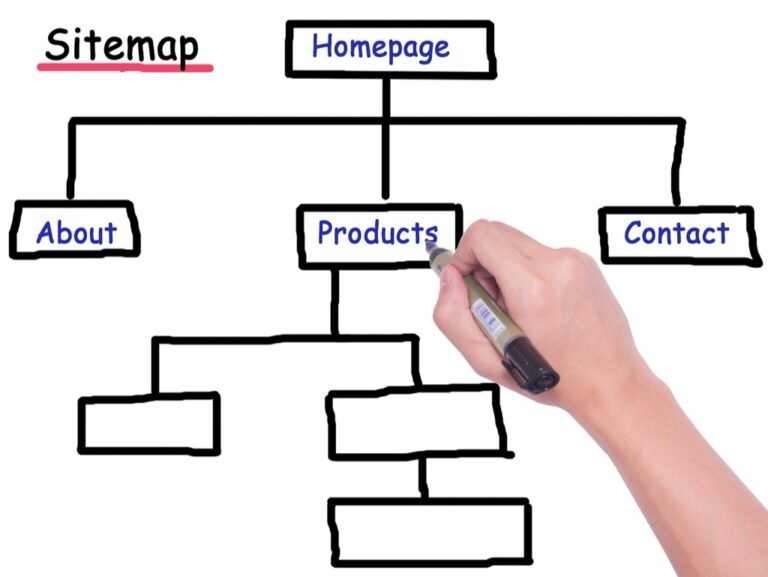
7 Best Map Interaction Patterns for User Experience
You’re building a map-based application and struggling with how users should interact with it. The difference between intuitive navigation and frustrated users often comes down to choosing the right interaction patterns. Seven distinct approaches can transform your map from a confusing interface into a powerful user experience tool.
Disclosure: As an Amazon Associate, this site earns from qualifying purchases. Thank you!
Pan and Zoom Interaction Pattern
Pan and zoom functionality forms the foundation of interactive map navigation, allowing users to explore geographic data at different scales and locations. This fundamental interaction pattern determines how smoothly users can navigate your mapping interface.
Achieve a flawless, even complexion with e.l.f. Flawless Satin Foundation. This lightweight, vegan formula provides medium coverage and a semi-matte finish for all-day wear, while hydrating your skin with glycerin.

Traditional Mouse-Based Navigation
Mouse-based navigation provides precise control through familiar desktop interactions. You’ll implement left-click dragging for panning and scroll wheel manipulation for zoom levels. Standard cursor changes to a hand icon during pan operations signal interactive capability to users. Consider adding momentum scrolling to create fluid transitions between zoom levels. Double-click zoom functionality offers quick magnification to specific map areas. Right-click context menus can expose additional navigation options like “zoom to fit” or “reset view” commands.
P.S. check out Udemy’s GIS, Mapping & Remote Sensing courses on sale here…
Touch Gesture Controls for Mobile Devices
Touch gesture implementation requires responsive multi-touch support for pinch-to-zoom and single-finger panning. You’ll optimize gesture recognition to distinguish between intentional map interactions and accidental touches. Implement momentum-based scrolling that continues briefly after finger release. Two-finger rotation gestures enable map orientation changes when needed. Consider adding haptic feedback for zoom level boundaries or when reaching map extent limits. Touch target sizes should meet accessibility guidelines with minimum 44px touch areas.
Keyboard Shortcuts for Accessibility
Keyboard navigation ensures accessibility compliance through arrow key panning and plus/minus zoom controls. You’ll assign Tab key focus to interactive map elements with visible focus indicators. Implement Page Up/Down keys for larger pan distances and Home/End for zoom extent controls. Consider Ctrl+arrow combinations for fine-tuned movements. Screen reader compatibility requires proper ARIA labels and state announcements. Space bar can trigger default actions while Enter activates focused map features or controls.
Read comfortably with this lightweight, full-page 5X magnifying glass. Its large viewing area and ergonomic handle make it ideal for seniors and those with low vision to easily read small print.

Click-to-Select Interaction Pattern
Click-to-select functionality forms the foundation of most map-based data exploration workflows. You’ll encounter this pattern when users need to identify specific geographic features or access detailed information about map elements.
Single Point Selection Methods
Primary click selection enables users to select individual map features with a single mouse click or tap. You can implement this pattern using direct feature targeting where users click precisely on geographic elements like buildings or boundaries. Proximity-based selection improves usability by detecting clicks within a defined radius around features, accommodating less precise user input. Cursor feedback changes from a standard pointer to a targeting crosshair when hovering over selectable elements, providing clear visual cues for interactive features.
Multi-Selection Capabilities
Ctrl+click functionality allows users to build cumulative selections by holding modifier keys while clicking multiple features. You can enhance this with shift+click range selection that selects all features between two clicked points along a defined path or boundary. Rubber band selection enables area-based multi-selection where users drag to create a selection rectangle encompassing multiple features. Toggle selection modes let users switch between single-select and multi-select behaviors through interface controls or keyboard shortcuts.
Visual Feedback Mechanisms
Highlight states provide immediate visual confirmation when features become selected, typically using color changes or outline modifications. You should implement hover effects that preview potential selections before users commit to clicking, often through subtle color shifts or boundary emphasis. Selection indicators like checkmarks or selection badges clearly identify chosen features within complex map displays. Status feedback displays selection counts and provides clear deselection options, helping users understand their current selection state and available actions.
Hover-to-Reveal Interaction Pattern
Hover interactions provide immediate contextual information without requiring clicks or touch gestures. This pattern maintains map visibility while delivering essential data on demand.
Tooltip Information Display
Tooltips display feature-specific data when users hover over map elements. You’ll want to include essential attributes like names, values, and classification data in these overlays. Position tooltips dynamically to avoid screen edge overflow using offset calculations based on cursor position. Design tooltips with clear typography hierarchies—bold labels, regular values, and subtle separators. Keep content concise with 3-5 key data points maximum to prevent information overload while maintaining readability across different zoom levels.
Progressive Disclosure Techniques
Progressive disclosure reveals information layers based on hover duration and proximity. You can implement staged reveal patterns—basic info appears immediately, detailed data after 500ms delays, and extended information after 1-second hover persistence. Use visual transitions like fade-ins and expand animations to guide user attention naturally. Layer information by importance: primary identifiers first, secondary attributes next, and contextual data last. This approach reduces cognitive load while accommodating both quick scanning and detailed exploration workflows.
Performance Considerations for Dense Data
Dense datasets require optimized hover handling to maintain responsive interactions. You’ll need to implement spatial indexing using quadtrees or R-trees for efficient feature queries at different zoom levels. Debounce hover events with 50-100ms delays to prevent excessive API calls or DOM updates. Cache frequently accessed tooltip data in memory structures and use feature clustering at lower zoom levels to reduce hover target complexity. Monitor frame rates during hover interactions—aim for 60fps performance by limiting simultaneous tooltip rendering and using CSS transforms instead of layout-triggering properties.
Search-Driven Interaction Pattern
Search-driven interactions transform maps from passive display tools into active discovery platforms. You’ll enable users to find specific locations, features, or data points through intelligent query interfaces that reduce cognitive load and eliminate endless panning.
Autocomplete and Suggestion Features
Autocomplete systems predict user intent through real-time query matching against your spatial database. You’ll implement fuzzy string matching algorithms that handle typos and partial addresses while maintaining sub-200ms response times. Geographic suggestion engines rank results by proximity, population density, and user location to surface the most relevant matches first. Consider implementing search history caching and popular destination weighting to improve suggestion accuracy over time.
Geographic Search Functionality
Coordinate-based searches support latitude/longitude inputs, UTM coordinates, and address geocoding through services like Google Maps API or OpenStreetMap Nominatim. You’ll need to handle multiple coordinate formats including decimal degrees, DMS notation, and local grid systems. Implement bounding box searches for area-based queries and radius searches for proximity analysis. Address validation prevents invalid coordinates from breaking your geocoding pipeline while providing helpful error messages for malformed inputs.
Filter Integration Options
Layered filtering systems combine search results with attribute-based constraints like date ranges, categories, or numeric thresholds. You’ll create filter hierarchies that cascade from broad geographic regions down to specific feature types or data values. Multi-select filter controls allow complex boolean queries while maintaining intuitive interfaces. Consider implementing saved filter presets and URL parameter encoding to enable shareable filtered map states across user sessions.
Layer Toggle Interaction Pattern
Layer toggle controls give you granular visibility management across complex map datasets. This pattern prevents visual overload while maintaining user control over information density.
Checkbox-Based Layer Controls
Checkbox controls provide immediate visual feedback for layer visibility states through familiar interface elements. You’ll want to group related layers using indentation or visual separators to create logical hierarchies. Consider implementing tri-state checkboxes for parent categories that show partial selection when some child layers are active. Position controls in expandable panels or fixed sidebars to maintain consistent access without cluttering your primary map interface.
Hierarchical Layer Management
Hierarchical systems organize complex layer structures using expandable tree controls with parent-child relationships. You can implement cascading visibility where parent layer toggles control entire category groups while individual children maintain independent states. Use consistent indentation levels and connecting lines to show relationships clearly. Consider adding “expand all” and “collapse all” controls for datasets with deep nesting structures exceeding three levels.
Dynamic Layer Loading Strategies
Dynamic loading optimizes performance by fetching layer data only when users activate specific toggles. You’ll reduce initial load times by implementing lazy loading for non-essential layers while maintaining cached states for frequently accessed data. Use loading indicators during fetch operations and implement error handling for failed requests. Consider pre-loading high-priority layers based on user behavior patterns while deferring heavy datasets until explicitly requested.
Drawing and Annotation Interaction Pattern
Drawing and annotation tools transform static maps into dynamic workspaces where you can capture field observations, mark important locations, and create collaborative planning documents. This pattern enables real-time spatial communication and data collection directly within your mapping interface.
Freehand Drawing Tools
Freehand drawing capabilities let you sketch irregular boundaries, trace natural features, and capture hand-drawn field notes directly onto map surfaces. You’ll need responsive pen pressure sensitivity for tablet devices and smooth line interpolation to prevent jagged strokes during rapid sketching. Modern drawing engines support vector-based strokes that maintain clarity across zoom levels, while undo/redo functionality preserves your workflow when making corrections or refinements to complex annotations.
Get three Field Notes Kraft Graph memo books for all your notes and sketches. Each 48-page book features graph paper and is made in the USA.

Shape Creation Capabilities
Shape creation tools provide geometric precision for marking boundaries, measuring distances, and defining areas of interest with mathematical accuracy. You can create circles, rectangles, polygons, and polylines using click-to-place vertices or drag-to-define methods. Advanced shape tools include snap-to-grid functionality, angle constraints for precise geometric construction, and automatic area/perimeter calculations that update dynamically as you modify vertex positions during the creation process.
Collaborative Annotation Features
Collaborative annotation systems enable multiple users to contribute simultaneously while maintaining version control and user attribution for each markup element. You’ll benefit from real-time synchronization that displays other users’ annotations as they’re created, along with color-coded user identification and timestamp tracking. Permission-based editing controls let you restrict modification rights, while comment threading on individual annotations facilitates structured discussions around specific map features or planning decisions.
Gesture-Based Interaction Pattern
Modern touch interfaces demand intuitive gesture controls that mirror natural hand movements. You’ll need responsive gesture recognition systems that translate physical interactions into precise map operations while maintaining consistent performance across different devices and screen sizes.
Swipe Navigation Controls
Swipe navigation controls enable fluid directional movement across your map interface through natural finger motions. You can implement horizontal and vertical swipe detection that responds to velocity-based panning with customizable sensitivity thresholds. Modern frameworks like Leaflet and Mapbox support momentum-based scrolling that continues map movement after the swipe gesture ends. You’ll want to configure deceleration curves that feel natural while preventing excessive overshooting beyond your map boundaries.
Pinch-to-Zoom Functionality
Pinch-to-zoom functionality provides precise scale control through multi-touch finger spacing detection on touch-enabled devices. You can implement two-finger gesture recognition that calculates distance changes between touch points to determine zoom levels with smooth interpolation. Popular mapping libraries offer built-in pinch handlers that support configurable zoom limits and center-point anchoring. You’ll need to fine-tune sensitivity parameters to prevent accidental zooming while ensuring responsive scaling across different device pixel densities and screen resolutions.
Custom Gesture Recognition
Custom gesture recognition extends standard touch interactions with application-specific movement patterns tailored to your mapping requirements. You can develop multi-finger swipe combinations for layer switching or rotational gestures for compass-based map orientation using touch event APIs. Advanced implementations include drawing recognition for shape-based queries and pressure-sensitive annotations on supported devices. You’ll want to balance gesture complexity with user discoverability while providing visual feedback during gesture recognition to guide user interactions effectively.
Conclusion
These seven interaction patterns provide you with a comprehensive toolkit for creating engaging map-based experiences. Each pattern serves a unique purpose and can be combined strategically to meet your users’ specific needs and technical requirements.
Your choice of interaction patterns should align with your application’s primary use cases and target audience. Consider implementing multiple patterns together – they’re designed to complement each other rather than compete for your users’ attention.
Remember that successful map interactions feel intuitive and responsive. Start with the core patterns that match your users’ expectations then gradually introduce more advanced features as they become comfortable with your interface.
The key to effective map UX lies in thoughtful implementation rather than feature quantity. Focus on polishing the patterns that deliver the most value to your users’ workflows.
Frequently Asked Questions
What are the essential interaction patterns for map-based applications?
The seven key interaction patterns are: pan and zoom for navigation, click-to-select for data exploration, hover-to-reveal for contextual information, search-driven interactions for discovery, filter integration for data refinement, layer toggle for visibility management, and drawing/annotation for collaborative workspace creation. Each pattern serves specific user needs and enhances overall map functionality.
How does pan and zoom functionality work on different devices?
Pan and zoom adapts to device capabilities. Desktop users employ mouse dragging, scroll wheel zooming, and keyboard shortcuts. Mobile devices utilize touch gestures like pinch-to-zoom and swipe navigation. The functionality includes accessibility features, responsive multi-touch support, and ensures smooth navigation across different scales and map locations for all users.
What is the click-to-select interaction pattern?
Click-to-select enables users to interact with map data by selecting individual points or multiple elements. It provides visual feedback when items are selected, supports both single and multi-selection modes, and serves as the foundation for data exploration. This pattern is essential for accessing detailed information about specific map features.
How does hover-to-reveal enhance user experience?
Hover-to-reveal provides instant contextual information when users move their cursor over map elements without requiring clicks. This pattern offers immediate feedback, reduces cognitive load, and allows quick information scanning. It’s particularly effective for displaying tooltips, preview data, and enhancing map exploration efficiency without cluttering the interface.
What makes search-driven interactions effective for maps?
Search-driven interactions transform maps into active discovery platforms through intelligent query interfaces. Users can search for locations, features, or data points using natural language or specific criteria. This pattern includes autocomplete suggestions, filtered results, and location-based searches, making maps more accessible and user-friendly for finding specific information quickly.
How do layer toggle controls improve map usability?
Layer toggle controls allow users to manage visibility of different data layers through checkbox-based systems and hierarchical organization. Users can show or hide specific information layers, customize their view, and focus on relevant data. This pattern prevents information overload and enables personalized map experiences based on user needs.
What capabilities do drawing and annotation tools provide?
Drawing and annotation tools transform static maps into dynamic collaborative workspaces. Features include freehand drawing with pen pressure sensitivity, geometric shape creation, and real-time collaborative annotations. These tools support field observations, planning activities, version control, and structured discussions, enabling teams to work together effectively on map-based projects.
Why are gesture-based interactions important for modern maps?
Gesture-based interactions provide intuitive touch controls that mirror natural hand movements. They include swipe navigation, pinch-to-zoom, and custom gesture recognition for application-specific functions. These interactions are essential for mobile and tablet users, offering responsive and precise map control while maintaining discoverability and ease of use across different devices.