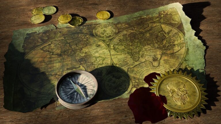
7 Best Map Interpretation Approaches
Why it matters: Map interpretation isn’t just about reading symbols and scales anymore â it’s evolved into a sophisticated skill that draws from multiple academic disciplines to unlock deeper spatial insights.
The big picture: Today’s most effective map readers combine techniques from geography, psychology, data science, anthropology, history, environmental science, and urban planning to extract maximum value from cartographic information.
What’s next: Understanding these seven multidisciplinary approaches will transform how you analyze maps, whether you’re a student, researcher, or professional working with spatial data in any field.
Disclosure: As an Amazon Associate, this site earns from qualifying purchases. Thank you!
P.S. check out Udemy’s GIS, Mapping & Remote Sensing courses on sale here…
Geographic Information Systems (GIS) and Spatial Analysis
Modern map interpretation relies heavily on GIS technology to analyze complex spatial relationships and extract meaningful insights from geographic data. You’ll find that digital tools have revolutionized how cartographers process, visualize, and interpret spatial information.
Digital Mapping Technologies
ArcGIS Pro and QGIS serve as your primary platforms for advanced spatial analysis and map creation. You can leverage vector processing tools to analyze polygon relationships, calculate buffer zones, and perform overlay operations that reveal hidden patterns in your data. Cloud-based solutions like ArcGIS Online enable real-time collaboration and web-based mapping workflows. These platforms integrate seamlessly with GPS data collectors and drone imagery for field-to-desktop workflows.
Spatial Data Visualization
Choropleth mapping techniques help you display statistical data across geographic boundaries using color gradients and classification schemes. You’ll achieve optimal results by selecting appropriate color ramps and classification methods like natural breaks or quantiles. Heat maps and density surfaces reveal concentration patterns in point data, while 3D visualization tools like ArcScene showcase terrain relationships and elevation data. Interactive dashboards combine multiple visualization types for comprehensive spatial storytelling.
Geographic Database Management
PostgreSQL with PostGIS extensions provide robust spatial database capabilities for managing large geographic datasets. You can optimize query performance through proper indexing of spatial columns and coordinate reference system management. File geodatabases offer efficient storage for project-specific data, while enterprise geodatabases support multi-user editing workflows. Regular database maintenance includes topology validation, coordinate system verification, and metadata documentation to ensure data integrity across your mapping projects.
Archaeological and Historical Cartography
Archaeological and historical cartography bridges temporal divides by reconstructing spatial relationships from past civilizations. You’ll apply specialized mapping techniques to interpret artifact distributions, settlement patterns, and historical landscapes through both excavated evidence and documentary sources.
Artifact Distribution Mapping
Spatial clustering analysis reveals cultural patterns through artifact locations across archaeological sites. You’ll use kernel density estimation in GIS software to identify concentration hotspots of pottery, tools, or coins. GPS coordinates from excavation units feed into ArcGIS Pro’s spatial statistics tools, generating density surfaces that highlight activity areas. Field archaeologists typically employ 1-meter grid systems for precise artifact recording, enabling you to create distribution maps that reveal workshop locations, trade routes, and cultural boundaries within ancient settlements.
Settlement Pattern Analysis
Site hierarchy mapping demonstrates how ancient communities organized across landscapes through settlement size relationships. You’ll analyze factors like elevation, water proximity, and defensive positions using digital elevation models combined with archaeological site databases. QGIS buffer analysis tools help identify optimal settlement zones within 500-meter distances of water sources. Thiessen polygons define territorial boundaries between competing settlements, while least-cost path analysis reconstructs probable ancient roadways connecting major population centers across regional archaeological landscapes.
Historical Map Reconstruction
Georeferencing techniques transform historical documents into accurate spatial datasets for comparative landscape analysis. You’ll align 18th-century property maps with modern coordinate systems using control points like surviving building foundations or persistent geographic features. ArcGIS Pro’s georeferencing toolbar enables polynomial transformations that correct historical surveying errors while preserving document authenticity. Vector digitization of historical boundaries, roads, and structures creates layered datasets that reveal landscape evolution over centuries through overlay analysis with contemporary satellite imagery and topographic maps.
Achieve a flawless, even complexion with e.l.f. Flawless Satin Foundation. This lightweight, vegan formula provides medium coverage and a semi-matte finish for all-day wear, while hydrating your skin with glycerin.

Geological and Environmental Mapping
Geological and environmental mapping combines earth science principles with advanced cartographic techniques to visualize natural systems. You’ll analyze physical features, climate patterns, and resource distributions to create comprehensive environmental assessments.
Terrain Analysis and Topographic Interpretation
Digital elevation models (DEMs) serve as your foundation for terrain analysis, with 30-meter USGS data providing adequate resolution for regional studies. You’ll generate slope, aspect, and hillshade derivatives using ArcGIS Spatial Analyst or QGIS terrain analysis tools. Contour interpretation reveals landform characteristics, while watershed delineation identifies drainage patterns and catchment boundaries. Profile analysis tools help you examine elevation changes along specific transects, essential for infrastructure planning and geological cross-sections.
Climate and Weather Pattern Mapping
Interpolation techniques like kriging and inverse distance weighting transform point meteorological data into continuous climate surfaces using tools like ArcGIS Geostatistical Analyst. You’ll process NOAA weather station data and PRISM climate datasets to map temperature, precipitation, and humidity patterns. Isoline mapping effectively displays pressure systems and temperature gradients, while temporal analysis reveals seasonal variations. Microclimate modeling incorporates topographic influences on local weather patterns through elevation, slope, and aspect calculations.
Get real-time weather data with the Ambient Weather WS-2902. This WiFi-enabled station measures wind, temperature, humidity, rainfall, UV, and solar radiation, plus it connects to smart home devices and the Ambient Weather Network.

Natural Resource Distribution Assessment
Geological survey data from USGS mineral databases provides the foundation for resource mapping, combined with geophysical survey results and remote sensing imagery. You’ll create mineral occurrence maps using point symbology scaled by deposit size or grade quality. Petroleum potential mapping integrates sedimentary basin analysis with structural geology interpretation. Water resource assessment combines well data, aquifer mapping, and groundwater flow modeling using tools like MODFLOW to visualize subsurface water distribution and availability patterns.
Anthropological and Cultural Geography
Anthropological and cultural geography transforms map interpretation by examining how human societies create, perceive, and modify spatial relationships. This approach reveals the cultural meanings embedded within geographic spaces.
Cultural Landscape Interpretation
Cultural landscape analysis examines how human activities shape and transform physical environments over time. You’ll identify settlement patterns, agricultural systems, and religious sites that reflect cultural values and practices. Archaeological evidence combined with ethnographic data helps reconstruct historical land use patterns. Modern GIS tools enable overlay analysis of cultural features with topographic data, revealing relationships between human adaptation and environmental constraints. This method proves essential for heritage preservation and understanding cultural continuity across generations.
Indigenous Mapping Traditions
Indigenous cartographic knowledge offers alternative spatial understanding systems that complement Western mapping approaches. You’ll encounter songlines, seasonal calendars, and oral navigation traditions that encode complex geographic information. These systems often prioritize relationships between places rather than precise coordinate locations. Collaborative mapping projects now integrate traditional ecological knowledge with modern GPS technology. Understanding indigenous spatial concepts enhances interpretation of resource distribution patterns and sustainable land management practices that span centuries.
Social Space and Territory Analysis
Territorial analysis reveals how communities establish boundaries and organize social relationships within geographic spaces. You’ll map kinship networks, trade routes, and ceremonial landscapes that define group identity and resource access. Social mapping techniques identify power structures and cultural hierarchies reflected in settlement organization. GIS proximity analysis helps quantify spatial relationships between social groups and resource areas. This approach proves valuable for understanding cultural conflict, migration patterns, and community resilience in changing environments.
Remote Sensing and Satellite Imagery
Remote sensing technologies provide cartographers with unprecedented access to spatial data across multiple scales and temporal dimensions. You’ll find that satellite imagery and aerial photography offer the foundation for contemporary map interpretation that extends far beyond traditional ground-based surveys.
Aerial Photography Analysis
Aerial photography analysis gives you direct visual access to landscape features through high-resolution imagery captured from aircraft platforms. You can identify individual buildings, vegetation patterns, and infrastructure elements with clarity that reaches 6-inch ground resolution in commercial applications. Stereo photography pairs allow you to calculate elevation differences and create three-dimensional terrain models using photogrammetric software like Pix4D or Agisoft Metashape. Your interpretation skills improve when you recognize shadow patterns, texture variations, and geometric relationships that reveal land use classifications and structural conditions.
Multispectral Image Interpretation
Multispectral image interpretation unlocks spectral information beyond visible light wavelengths to reveal hidden landscape characteristics. You’ll work with satellite platforms like Landsat 8 and Sentinel-2 that capture data across 8-13 spectral bands including near-infrared and shortwave infrared ranges. Vegetation health analysis becomes possible through NDVI calculations that highlight stressed crops or forest disturbances invisible to standard photography. Your classification accuracy increases when you combine spectral signatures with machine learning algorithms in software like ENVI or Google Earth Engine to distinguish between land cover types and monitor environmental changes.
Change Detection Mapping
Change detection mapping enables you to quantify landscape transformations by comparing imagery from different time periods. You’ll apply pixel-based comparison techniques that identify urban expansion, deforestation, and coastal erosion with statistical confidence levels above 85% accuracy. Time-series analysis reveals seasonal patterns and long-term trends when you process multi-temporal datasets spanning decades of satellite observations. Your change detection workflow improves when you account for atmospheric corrections, geometric registration errors, and phenological variations that can create false change signals in automated analysis results.
Statistical and Mathematical Modeling
Mathematical modeling transforms cartographic interpretation from subjective observation into objective analysis. You’ll apply statistical methods to quantify spatial relationships and predict geographic phenomena with measurable accuracy.
Quantitative Spatial Analysis
Quantitative spatial analysis uses statistical methods to identify relationships between geographic variables and measure spatial dependencies. You’ll employ tools like Moran’s I statistics in ArcGIS Pro to detect spatial autocorrelation patterns, revealing whether similar values cluster together across your study area. R software packages like spdep and spatstat provide advanced spatial regression models that account for geographic proximity effects. Getis-Ord statistics help you identify statistically significant hot spots and cold spots within your datasets. These quantitative approaches eliminate guesswork by providing confidence intervals and significance levels for your spatial interpretations.
Predictive Mapping Algorithms
Predictive mapping algorithms use machine learning techniques to forecast spatial patterns based on existing data relationships. You’ll implement random forest models in R or Python to predict land use changes by analyzing environmental variables like elevation, slope, and proximity to roads. Maximum entropy modeling through MaxEnt software creates species distribution maps by identifying suitable habitat conditions. Kriging interpolation algorithms in ArcGIS Geostatistical Analyst generate continuous surfaces from point data while quantifying prediction uncertainty. Neural networks can process multiple environmental layers simultaneously to predict complex spatial phenomena like wildfire risk or urban growth patterns.
Pattern Recognition Techniques
Pattern recognition techniques automatically identify recurring spatial arrangements and anomalies within geographic datasets. You’ll use edge detection algorithms in ENVI or ERDAS IMAGINE to identify linear features like roads, rivers, and geological structures from satellite imagery. Cluster analysis through K-means algorithms groups similar geographic units based on multiple attributes simultaneously. Fourier analysis reveals periodic patterns in landscape features, helping you detect regular spacing in settlements or geological formations. Object-based image analysis (OBIA) in eCognition segments imagery into meaningful geographic objects, enabling automated feature extraction and classification of complex landscape patterns.
Cognitive and Perceptual Psychology
Cognitive psychology reveals how your brain processes spatial information and interprets cartographic symbols. Understanding these psychological mechanisms helps you create more effective maps and improve your analytical skills.
Human Spatial Cognition
Spatial cognition determines how you mentally organize geographic information and navigate through mapped environments. Your brain constructs cognitive maps through landmark recognition, route learning, and survey knowledge development. Research shows you process spatial relationships through three distinct systems: egocentric positioning, allocentric mapping, and metric distance calculation. These cognitive frameworks influence how you interpret scale relationships, directional orientation, and spatial hierarchies on maps. Understanding your spatial cognition patterns helps you recognize interpretation biases and develop more accurate analytical techniques.
Map Reading Behavior Analysis
Map reading behavior follows predictable patterns that affect your interpretation accuracy and efficiency. Eye-tracking studies reveal you typically scan maps using Z-pattern movements, focusing first on titles, then legends, before examining data patterns. Your attention prioritizes high-contrast elements, familiar symbols, and centrally positioned features over peripheral details. Cognitive load increases when you process multiple information layers simultaneously, reducing your ability to detect subtle patterns or anomalies. Professional cartographers leverage these behavioral insights to optimize symbol placement, color schemes, and information hierarchy for improved user comprehension.
Visual Perception of Cartographic Elements
Visual perception principles govern how you interpret colors, symbols, and spatial relationships on maps. Your visual system processes cartographic elements through pre-attentive attributes like hue, saturation, size, and orientation before conscious analysis begins. Color perception varies based on surrounding elements, lighting conditions, and individual color vision capabilities, affecting your ability to distinguish data categories. Symbol recognition depends on gestalt principles including proximity, similarity, and closure, which influence how you group related geographic features. Understanding these perceptual limitations helps you select appropriate color palettes, symbol sizes, and contrast levels for clear data communication.
Conclusion
Mastering these seven multidisciplinary approaches transforms you from a basic map reader into a sophisticated spatial analyst. You’ll find that combining techniques from different fields reveals patterns and insights that single-discipline methods often miss.
Your enhanced analytical toolkit now includes everything from advanced GIS processing to understanding cognitive biases in spatial perception. This comprehensive skill set positions you to tackle complex geographic challenges across multiple industries and research domains.
The future of cartography belongs to those who can seamlessly integrate these diverse methodologies. By developing proficiency across these disciplines you’ll unlock new possibilities for spatial analysis and contribute meaningful insights to our understanding of the world around us.
Frequently Asked Questions
What are the seven multidisciplinary approaches to modern map interpretation?
Modern map interpretation integrates geography, psychology, data science, anthropology, history, environmental science, and urban planning. These disciplines work together to provide deeper insights from spatial data. By combining techniques from these fields, map readers can analyze spatial relationships more effectively, understand cultural contexts, interpret historical patterns, and make informed decisions based on comprehensive geographic analysis.
Which GIS platforms are most effective for advanced spatial analysis?
ArcGIS Pro and QGIS are the leading platforms for advanced spatial analysis. ArcGIS Pro offers robust vector processing capabilities and cloud-based collaboration tools, while QGIS provides open-source flexibility with powerful analytical functions. Both platforms support complex spatial operations, real-time data sharing, and comprehensive mapping tools that revolutionize how cartographers process and visualize geographic information.
How do choropleth maps and heat maps enhance data visualization?
Choropleth maps display statistical data using color gradients across geographic boundaries, making patterns easily identifiable. Heat maps reveal concentration patterns and density distributions using color intensity. Both techniques transform complex numerical data into visual formats that highlight spatial relationships, trends, and anomalies, enabling faster interpretation and more effective communication of geographic information.
What role does PostgreSQL with PostGIS play in geographic database management?
PostgreSQL with PostGIS provides robust database management for large spatial datasets. This combination offers advanced spatial indexing, complex query capabilities, and reliable data integrity maintenance. It supports real-time data processing, handles multiple coordinate systems, and enables efficient storage and retrieval of geographic information, making it essential for professional GIS applications and spatial analysis projects.
How does archaeological cartography reconstruct past civilizations?
Archaeological cartography uses spatial clustering analysis and kernel density estimation to interpret artifact distributions and settlement patterns. GIS software processes archaeological data to create distribution maps, analyze site hierarchies, and identify optimal settlement zones using digital elevation models. This approach reveals how ancient civilizations organized their territories and adapted to environmental conditions.
What techniques are used in geological and environmental mapping?
Geological mapping employs digital elevation models (DEMs) for terrain analysis, generating slope, aspect, and hillshade derivatives. Climate mapping uses interpolation techniques to create continuous surfaces from point data. Natural resource assessment combines geological surveys with remote sensing imagery to map mineral occurrences and model groundwater flow patterns for infrastructure planning.
How do indigenous mapping traditions contribute to modern cartography?
Indigenous mapping traditions offer alternative spatial understanding systems that complement modern GPS technology. These traditional approaches integrate ecological knowledge, cultural practices, and territorial concepts that aren’t captured in conventional maps. By combining indigenous knowledge with modern tools, cartographers gain deeper insights into cultural landscapes, resource management practices, and community spatial relationships.
What advantages does remote sensing provide for cartographic analysis?
Remote sensing offers unprecedented access to spatial data across multiple scales and time periods. Multispectral imagery reveals hidden landscape characteristics beyond visible light, while change detection mapping quantifies transformations by comparing different time periods. This technology enables monitoring of urban expansion, deforestation, and environmental changes that would be impossible through traditional ground-based surveying alone.
How do machine learning algorithms improve predictive mapping?
Machine learning algorithms analyze existing spatial relationships to forecast future patterns and identify anomalies. These techniques use statistical models to predict spatial distributions based on environmental variables, historical trends, and geographic patterns. Advanced algorithms can automatically recognize recurring spatial arrangements, improving accuracy in applications like urban planning, environmental monitoring, and resource management.
Why is understanding cognitive psychology important for map interpretation?
Cognitive psychology reveals how the brain processes spatial information and interprets cartographic symbols. Understanding human spatial cognition helps explain how people form mental maps and navigate geographic environments. This knowledge improves map design by considering visual perception principles, reading behavior patterns, and cognitive limitations, ultimately creating more effective and user-friendly cartographic products.