7 Best Festival Planning Tools
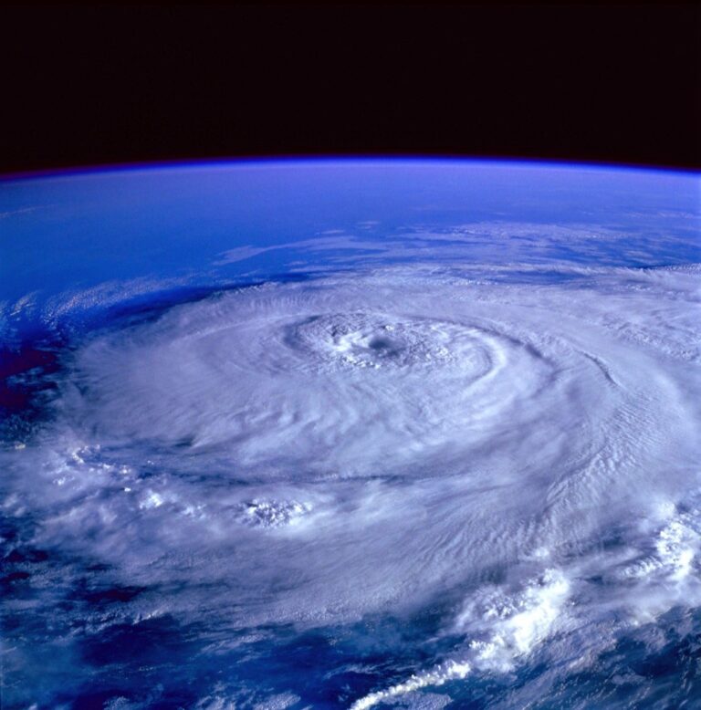
Planning your festival calendar around weather patterns can transform your event experience from soggy disappointment to perfect celebration. Weather-driven festival mapping helps you avoid rainy parades and scorching outdoor concerts while discovering hidden gems during ideal conditions.
Smart festival-goers increasingly use weather data to time their adventures perfectly – from cherry blossom festivals in mild spring weather to harvest celebrations during crisp autumn days. This strategic approach maximizes your enjoyment while minimizing weather-related cancellations and discomfort.
Disclosure: As an Amazon Associate, this site earns from qualifying purchases. Thank you!
Understanding the Connection Between Weather Patterns and Festival Timing
Weather patterns fundamentally shape when and how communities celebrate their most cherished festivals. You’ll discover that successful festival mapping requires understanding these deep-rooted connections between climate cycles and cultural timing.
P.S. check out Udemy’s GIS, Mapping & Remote Sensing courses on sale here…
Traditional Agricultural Calendars
Traditional agricultural calendars form the backbone of seasonal festival timing across cultures worldwide. You’ll find harvest festivals consistently scheduled after crop maturation periods – typically late summer through autumn when farmers historically gathered their yields. Spring planting festivals like Japan’s rice planting ceremonies occur during optimal soil temperature windows between March and May. Wine harvest celebrations in Mediterranean regions align precisely with grape ripening seasons from September to October. These agricultural rhythms create predictable festival patterns that you can map using historical climate data and regional growing seasons.
Climate-Based Cultural Celebrations
Climate-based cultural celebrations emerge directly from specific weather phenomena and seasonal transitions that define regional identities. You’ll observe cherry blossom festivals concentrated in 6-8 week windows when temperatures reach 50-70°F ranges during spring months. Winter solstice celebrations occur during shortest daylight periods typically between December 20-22 across northern hemispheres. Monsoon festivals in South Asia coincide with rainfall patterns between June and September when communities celebrate life-giving precipitation. Desert cultures schedule major gatherings during cooler months from November through February when extreme heat subsides and outdoor activities become feasible.
Mapping Spring Festivals Through Temperature and Rainfall Data
Spring festivals require precise temperature and precipitation mapping to predict optimal timing and attendance conditions. You’ll need to analyze multi-year weather datasets to identify reliable patterns for festival planning.
Cherry Blossom Festivals and Bloom Predictions
Temperature tracking enables accurate cherry blossom festival mapping through accumulated growing degree days. You’ll calculate the sum of daily temperatures above 32°F starting in January to predict peak bloom dates. Historical temperature data from NOAA weather stations shows cherry blossoms typically bloom when accumulated growing degree days reach 1,000-1,200 units in temperate zones. Map these calculations across festival locations to create bloom prediction zones for your regional festival calendar.
Get real-time weather data with the Ambient Weather WS-2902. This WiFi-enabled station measures wind, temperature, humidity, rainfall, UV, and solar radiation, plus it connects to smart home devices and the Ambient Weather Network.

Easter and Equinox Weather Patterns
Easter festival mapping requires analyzing temperature and precipitation patterns during March-April transition periods. You’ll examine 10-year rainfall averages and temperature ranges during spring equinox weeks to identify optimal outdoor celebration conditions. Weather station data reveals that Easter weekend temperatures between 60-70°F with less than 0.5 inches of precipitation create ideal festival conditions. Plot these favorable weather zones to help organizers select venues with historically stable spring weather patterns.
Tracking Summer Celebrations Using Heat Index and Daylight Hours
Summer festivals require careful monitoring of heat index values and extended daylight patterns to ensure optimal timing and attendee safety. You’ll find that combining these weather metrics creates precise mapping opportunities for outdoor celebrations.
Music Festival Scheduling and Temperature Trends
Music festivals perform best when you track heat index values between 75-85°F during peak afternoon hours. You should analyze historical temperature data from May through September to identify consistent low-humidity periods. Festival organizers typically schedule events when heat index readings remain below 90°F for at least 6 consecutive hours daily. Weather stations provide hourly heat index calculations that help you predict crowd comfort levels and venue capacity adjustments.
Harvest Festival Timing and Growing Season Data
Harvest festivals align directly with crop maturation cycles that you can track through accumulated growing degree days and soil moisture levels. You’ll need to monitor temperature data starting from spring planting dates to predict harvest readiness. Corn festivals typically occur when growing degree days reach 2,700-3,000 units while apple festivals follow fruit development cycles spanning 120-150 frost-free days. Regional agricultural extension offices provide growing season datasets that show optimal harvest timing within 7-10 day windows.
Analyzing Autumn Festivals Through Foliage and Temperature Changes
Autumn festivals require precise temperature and foliage tracking to predict peak attendance conditions. You’ll need to monitor both daily temperature fluctuations and chlorophyll degradation patterns that drive leaf color changes across different elevation zones.
Fall Color Festivals and Leaf Peeping Maps
Fall color festivals succeed when you track temperature patterns between 45-55°F during nighttime hours for optimal leaf pigmentation. Map elevation gradients and species distribution data to predict peak foliage timing across different forest zones. Monitor accumulated chilling hours below 45°F which trigger anthocyanin production in deciduous trees. Historic data shows peak color occurs 2-3 weeks after the first sustained frost in temperate regions. Create elevation-based timing maps that account for 3-5 day delays per 1,000-foot increase in altitude.
Halloween Weather Patterns and Seasonal Shifts
Halloween celebrations perform best when evening temperatures range between 50-65°F with minimal precipitation during trick-or-treating hours. Track historical weather data from 6-9 PM on October 31st to identify regional patterns and precipitation probabilities. Monitor temperature drops that typically occur 2-3 weeks before Halloween as daylight hours decrease below 11 hours daily. Map wind patterns and storm systems that frequently develop during late October’s atmospheric transition period. Document regional variations where southern latitudes maintain warmer evening temperatures while northern zones experience earlier frost conditions.
Connecting Winter Holidays to Snow Coverage and Cold Fronts
Winter festivals require precise weather tracking to ensure optimal conditions for outdoor celebrations. You’ll need to monitor snow accumulation patterns and temperature drops to map the most successful holiday events.
Christmas Market Weather Dependencies
Christmas markets thrive when temperatures remain between 25-35°F with consistent snow coverage lasting 3-5 days. You should track historical snowfall data from December 1-25 to identify regions with 80% probability of white Christmas conditions. Monitor cold front movements that bring sustained freezing temperatures, as markets typically see 40% higher attendance when snow depth reaches 2-4 inches. Map elevation zones above 1,500 feet for reliable snow retention during holiday weekends.
Winter Solstice Celebrations and Shortest Days
Winter solstice festivals align with the shortest daylight period around December 21st when sun exposure drops to 8-9 hours in northern latitudes. You’ll find these celebrations perform best when clear skies provide maximum visibility for sunrise and sunset ceremonies. Track cloud cover percentages and precipitation forecasts to identify locations with 70% or higher clear-sky probability during solstice week. Map festival sites based on geographic orientation toward sunrise/sunset positions, as eastern and western exposures enhance ceremonial experiences during minimal daylight hours.
Creating Interactive Weather-Festival Heat Maps
Heat maps transform complex weather-festival relationships into intuitive visual displays that reveal optimal celebration windows across geographic regions. These dynamic visualizations combine meteorological data with cultural event timing to create powerful planning tools.
Digital Mapping Tools and Weather APIs
Professional GIS platforms like ArcGIS Online and QGIS provide robust frameworks for integrating weather datasets with festival location data. You’ll achieve precise results by connecting to APIs such as OpenWeatherMap, Weather Underground, or NOAA’s Climate Data Online service for historical temperature and precipitation records.
Real-time weather APIs enable dynamic heat map updates that reflect current conditions and seasonal forecasts. Modern mapping libraries including Leaflet, Mapbox GL JS, and D3.js offer responsive visualization capabilities that automatically refresh based on API data feeds.
Visualization Techniques for Seasonal Data
Color gradient schemes effectively communicate temperature ranges and precipitation levels across your mapped regions. You should employ diverging color palettes with cool blues for optimal conditions transitioning through warm oranges and reds for challenging weather periods.
Temporal animation layers showcase seasonal progression by displaying weather patterns across monthly intervals. Interactive timeline controls allow users to scrub through historical data while overlay toggles reveal specific metrics like heat index values, frost dates, or accumulated growing degree days for targeted festival planning.
Predicting Future Festival Success Using Climate Forecasting
Advanced climate modeling enables festival organizers to anticipate attendance patterns and optimize planning strategies years in advance. You’ll leverage long-range weather predictions and climate trend analysis to forecast optimal celebration windows.
Long-Range Weather Predictions
Seasonal climate forecasts extend 3-6 months ahead using ocean temperature patterns and atmospheric circulation models. You can access NOAA’s Climate Prediction Center data to identify El Niño and La Niña cycles that influence regional precipitation and temperature trends. These forecasts achieve 65-70% accuracy for temperature predictions and 55-60% for precipitation patterns. Festival planners use ensemble forecasting models that combine multiple prediction scenarios to assess probability ranges for specific weather conditions. You’ll track confidence intervals and update festival schedules when forecast reliability exceeds 60% certainty levels.
Climate Change Impact on Traditional Celebrations
Shifting seasonal patterns now require festival organizers to adapt traditional celebration dates based on changing climate conditions. Cherry blossom festivals have moved 5-7 days earlier over the past three decades due to warming spring temperatures. You’ll monitor growing degree day accumulation trends that show harvest festivals shifting 10-14 days later in northern regions. Wine harvest celebrations now occur 2-3 weeks earlier in established viticulture regions. Traditional winter festivals face reduced snow coverage reliability with 15-25% shorter snow seasons in temperate zones. You must analyze 30-year climate normals alongside emerging trend data to recalibrate festival timing expectations.
Conclusion
Weather-based festival mapping transforms your seasonal celebration experiences from unpredictable adventures into well-planned cultural journeys. You’ll maximize your enjoyment while minimizing weather-related disappointments by leveraging historical climate data and advanced forecasting tools.
Your festival planning becomes more strategic when you understand the deep connections between weather patterns and cultural celebrations. This approach ensures you’re present for peak conditions whether you’re chasing cherry blossoms in spring or seeking perfect autumn foliage.
The tools and techniques you’ve discovered here give you the power to create personalized festival calendars that align with your weather preferences. You’re now equipped to explore seasonal celebrations with confidence knowing you’ve planned around nature’s rhythms.
Frequently Asked Questions
How can weather data help me choose the best festivals to attend?
Weather data helps you avoid uncomfortable conditions like extreme heat, rain, or snow while identifying festivals that coincide with ideal weather. By analyzing temperature, precipitation, and seasonal patterns, you can time your visits to enjoy events like cherry blossom festivals in mild spring weather or harvest festivals during pleasant autumn conditions, maximizing your comfort and overall festival experience.
What weather conditions are ideal for different types of festivals?
Spring festivals perform best at 60-70°F with minimal rainfall, while summer music festivals thrive with heat index values between 75-85°F. Fall festivals require nighttime temperatures of 45-55°F for optimal foliage viewing, and winter celebrations need temperatures between 25-35°F with consistent snow coverage. Each festival type has specific weather requirements for maximum enjoyment.
How do traditional festivals align with weather patterns?
Traditional festivals follow agricultural and seasonal cycles closely tied to weather patterns. Harvest festivals occur after crop maturation tracked through growing degree days, while spring planting festivals align with optimal soil temperatures. Cherry blossom festivals depend on accumulated temperature units, and winter solstice celebrations coincide with the shortest daylight period around December 21st.
Can I predict cherry blossom festival timing using weather data?
Yes, cherry blossom bloom dates can be predicted by calculating accumulated growing degree days. Historical data shows that cherry blossoms typically bloom when these temperature units reach 1,000-1,200 in temperate zones. By tracking daily temperatures and calculating these accumulated units, you can accurately predict peak bloom timing for optimal festival attendance.
What tools can help me create weather-festival maps?
Professional GIS platforms combined with weather APIs allow you to integrate meteorological data with festival information for real-time updates. Color gradient schemes and temporal animation layers effectively visualize seasonal weather patterns. These tools help create interactive heat maps showing the relationship between weather conditions and festival timing across different regions.
How is climate change affecting traditional festival timing?
Climate change is shifting traditional festival dates as weather patterns evolve. Cherry blossom festivals are occurring earlier due to warming temperatures, while harvest celebrations are happening later as growing seasons extend. Festival organizers must adapt by monitoring changing climate conditions and adjusting dates to maintain optimal weather alignment for their events.