5 Best 3D Terrain Modeling Techniques
Why it matters: 3D terrain modeling has revolutionized how you visualize and interact with geographic data, transforming flat maps into immersive digital landscapes that reveal insights impossible to capture in traditional 2D formats.
The big picture: Whether you’re planning urban development, analyzing environmental changes, or creating virtual worlds, choosing the right terrain modeling approach determines the accuracy, performance, and visual quality of your final mapping solution.
What’s ahead: We’ll explore five proven techniques that professionals use to build compelling 3D terrain models, from photogrammetry and LiDAR scanning to procedural generation and satellite imagery processing.
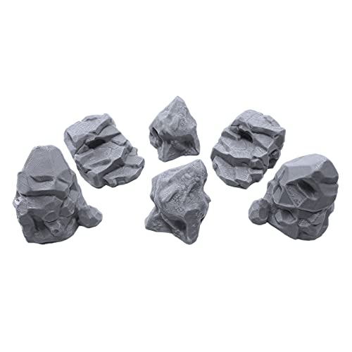
Enhance your tabletop games with this set of six highly detailed, 3D printed stone boulder terrain pieces. Perfect for 28mm miniatures, these paintable PLA plastic models add immersive scenery to any battlefield.
Disclosure: As an Amazon Associate, this site earns from qualifying purchases. Thank you!
P.S. check out Udemy’s GIS, Mapping & Remote Sensing courses on sale here…
Height Map-Based Terrain Generation
Height map-based terrain generation transforms grayscale elevation data into three-dimensional landscape models. This foundational approach uses pixel intensity values to represent elevation differences across geographic areas.
Achieve a flawless, even complexion with e.l.f. Flawless Satin Foundation. This lightweight, vegan formula provides medium coverage and a semi-matte finish for all-day wear, while hydrating your skin with glycerin.

Digital Elevation Model (DEM) Integration
DEM integration provides the spatial framework for accurate terrain representation. You’ll work with standardized elevation datasets that contain precise height measurements for specific geographic coordinates. Popular DEM formats include GeoTIFF and ASCII grid files from sources like USGS National Elevation Dataset or NASA SRTM missions. Modern GIS software like ArcGIS Pro and QGIS can directly import these datasets for immediate 3D visualization. The integration process involves coordinate system alignment and resolution matching to ensure your terrain model maintains geographic accuracy throughout the modeling workflow.
Grayscale to Elevation Conversion Techniques
Grayscale conversion techniques translate pixel brightness values into elevation measurements using mathematical scaling formulas. You’ll typically assign white pixels to represent maximum elevations while black pixels indicate minimum heights or sea level. Linear interpolation methods distribute intermediate gray values proportionally across your elevation range. Advanced conversion workflows use histogram equalization to enhance terrain detail in areas with subtle elevation changes. Software tools like Blender’s displacement modifiers and Unity’s terrain system provide real-time conversion capabilities for interactive applications.
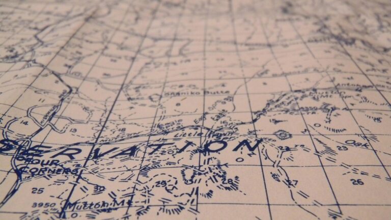
Real-World Topographic Data Sources
Topographic data sources deliver verified elevation measurements from government agencies and commercial providers. You can access free datasets through USGS Earth Explorer, NASA Earthdata, and OpenTopography platforms for North American terrain projects. International coverage comes from ESA Copernicus DEM and ASTER Global Digital Elevation Model programs. Commercial sources like Intermap NEXTMap offer higher resolution data with sub-meter accuracy for detailed mapping projects. Regional geological surveys often provide specialized datasets with enhanced accuracy for specific areas requiring precise terrain modeling applications.
Procedural Terrain Generation Algorithms
Procedural terrain generation creates vast landscapes through mathematical algorithms that simulate natural landform patterns. You’ll find these techniques essential when traditional data sources aren’t available or when creating fictional terrain for immersive mapping applications.
Perlin Noise and Simplex Noise Applications
Perlin noise generates realistic terrain by layering multiple frequencies of random values to create natural-looking height variations. You can implement Perlin noise in software like Blender, Unity, or custom GIS applications to produce rolling hills and mountain ranges. Simplex noise offers improved performance and eliminates directional artifacts common in Perlin implementations. Modern mapping workflows combine these algorithms with octaves and persistence parameters to control terrain roughness and detail levels across different scales.
Fractal-Based Landscape Creation
Fractal algorithms reproduce nature’s self-similar patterns by recursively subdividing terrain surfaces at multiple resolution levels. You’ll achieve realistic coastlines and mountain ridges using fractal dimension values between 1.1 and 1.9 for different landform types. Software like World Machine and Terragen employ fractal erosion models that simulate water flow and weathering processes. These techniques excel at creating believable terrain features that maintain geological accuracy while offering artistic control over landscape aesthetics.
Diamond-Square Algorithm Implementation
Diamond-square algorithm divides terrain grids into progressively smaller squares through iterative height value calculations at grid midpoints. You start with corner elevation values and recursively compute diamond and square steps with decreasing random displacement. This method produces heightmaps suitable for real-time rendering in gaming engines like Unreal Engine or web-based mapping platforms. The algorithm’s deterministic nature allows reproducible terrain generation while maintaining efficient memory usage for large-scale immersive mapping projects.
Photogrammetry-Driven 3D Reconstruction
Photogrammetry transforms real-world aerial photographs into precise 3D terrain models through sophisticated image analysis algorithms. This technique delivers exceptionally detailed topographic reconstructions that capture both geometric accuracy and visual authenticity for immersive mapping applications.
Aerial Photography Processing Methods
Stereo pair analysis forms the foundation of photogrammetric terrain reconstruction by comparing overlapping aerial images to calculate depth information. You’ll achieve optimal results using 60-80% image overlap with consistent flight altitudes between 500-2000 feet above ground level.
Structure from Motion (SfM) algorithms automatically identify matching features across multiple photographs to determine camera positions and scene geometry. Software like Agisoft Metashape and Pix4D streamline this process by processing hundreds of images simultaneously while maintaining sub-meter accuracy standards.
Point Cloud Generation and Mesh Creation
Dense point cloud extraction converts processed photographs into millions of 3D coordinate points representing terrain surface features. Modern photogrammetry software generates point densities of 50-200 points per square meter depending on flight altitude and camera resolution specifications.
Learn close-range photogrammetry and 3D imaging techniques. This textbook provides comprehensive coverage of the subject.

Triangulated mesh generation connects point cloud data into continuous surface models using Delaunay triangulation algorithms. You’ll optimize mesh quality by applying noise filtering and edge detection techniques that preserve natural terrain features while eliminating photographic artifacts and vegetation interference.
Texture Mapping from Real-World Images
Orthophoto projection applies original aerial imagery directly onto 3D mesh surfaces to create photorealistic terrain visualizations. This process corrects geometric distortions while preserving natural color variations and surface details captured during aerial photography missions.
Multi-spectral texture blending combines images from different lighting conditions and seasons to eliminate shadows and enhance surface visibility. You’ll achieve seamless results by using radiometric correction algorithms that normalize brightness levels across overlapping photograph boundaries for consistent terrain appearance.
LiDAR Data Processing and Visualization
LiDAR technology produces remarkably detailed terrain datasets through laser pulse measurements, delivering centimeter-level accuracy for professional mapping applications. You’ll find this precision essential for flood modeling, infrastructure planning, and environmental monitoring where elevation accuracy directly impacts project success.
High-Precision Elevation Capture Techniques
Airborne LiDAR systems capture elevation data using multiple laser pulse returns per square meter, typically achieving 1-2 point density measurements. You can optimize capture parameters by adjusting flight altitude between 500-2000 meters and pulse frequency rates up to 400kHz for maximum ground coverage. Ground-based terrestrial LiDAR scanners provide even higher resolution at 1mm accuracy for detailed slope analysis and cliff face mapping projects.
Create accurate maps with the Yahboom handheld lidar, featuring a 0.05-12m range and IMU anti-shake. It supports APP, ROS2, and Linux, enabling wireless data transmission and real-time mapping.

Point Cloud Filtering and Classification
Raw LiDAR datasets require systematic filtering to separate ground points from vegetation, buildings, and atmospheric noise. You’ll use automated classification algorithms in software like Global Mapper or LAStools to identify ground returns through iterative surface modeling. Manual editing becomes necessary for complex terrain features where vegetation intersects with steep slopes, requiring careful point selection to maintain surface continuity and elevation accuracy.
Surface Mesh Generation from LiDAR Datasets
Converting classified point clouds into continuous terrain surfaces involves Delaunay triangulation algorithms that connect neighboring elevation points. You can generate high-quality meshes using software like CloudCompare or ArcGIS 3D Analyst, which interpolate between sparse data areas while preserving sharp terrain features. Mesh optimization techniques reduce polygon count for real-time visualization while maintaining geological accuracy through adaptive decimation based on slope variation and surface roughness.
Sculpting and Manual Modeling Approaches
Manual terrain sculpting offers complete artistic control over landscape creation, allowing you to craft custom topography that automated techniques can’t achieve. This approach combines traditional artistic principles with digital tools to produce highly stylized or conceptually accurate terrain models.
Digital Sculpting Software Integration
ZBrush and Blender provide powerful terrain sculpting capabilities through their displacement brushes and mesh deformation tools. You’ll work with high-resolution base meshes, applying custom heightmaps and procedural textures to create realistic surface variations. World Machine integrates seamlessly with these sculpting platforms, allowing you to import procedural terrain bases and refine them manually. This workflow maintains geological accuracy while giving you granular control over specific landscape features like riverbed carving and cliff formations.
Artistic Terrain Design Workflows
Layer-based sculpting workflows help you build terrain complexity systematically, starting with major landforms and progressively adding detail through multiple passes. You’ll typically begin with primary elevation features, then sculpt secondary elements like valleys and ridges before adding surface textures and erosion patterns. Reference-driven design ensures geological believability by studying real topographic maps and satellite imagery during the sculpting process. This approach works particularly well for gaming environments and architectural visualization where stylized realism takes precedence over survey-grade accuracy.
Learn essential map reading and navigation skills with this U.S. Army guide. Designed for practical use, it provides clear instructions for navigating any terrain.

Hybrid Manual-Procedural Techniques
Procedural base generation combined with manual refinement creates the most efficient terrain modeling workflow for large-scale projects. You’ll generate initial terrain using algorithms like Perlin noise or Diamond-Square, then selectively sculpt critical areas requiring specific artistic treatment. Mask-based sculpting allows you to isolate different terrain zones for targeted modifications while preserving the overall landscape structure. This technique proves especially valuable when adapting real-world elevation data to meet specific design requirements or visual storytelling needs.
Conclusion
These five terrain modeling approaches give you the flexibility to create stunning 3D landscapes for any mapping project. Whether you’re working with real-world data through photogrammetry and LiDAR or generating entirely new worlds with procedural algorithms you’ll find the right technique for your specific needs.
The key to success lies in understanding when to use each method. Height maps work perfectly for general visualization while LiDAR delivers the precision required for engineering projects. Manual sculpting adds that artistic touch that makes terrains truly compelling.
By combining these techniques you’ll unlock the full potential of immersive mapping. Start with the approach that matches your current project requirements and gradually expand your toolkit as you gain experience with each method.
Frequently Asked Questions
What is 3D terrain modeling and why is it important?
3D terrain modeling creates immersive digital landscapes that go beyond traditional 2D maps, allowing for enhanced visualization and interaction with geographic data. It’s crucial for applications like urban planning, environmental analysis, and flood modeling because the chosen technique directly impacts accuracy and visual quality of mapping solutions.
What are the main techniques used for 3D terrain modeling?
The five primary techniques include photogrammetry, LiDAR scanning, procedural generation, satellite imagery processing, and height map-based terrain generation. Each method offers different advantages depending on your project requirements, data availability, and desired level of accuracy.
How does height map-based terrain generation work?
Height map-based generation transforms grayscale elevation data into 3D landscape models using pixel intensity values to represent elevation differences. Darker pixels represent lower elevations while lighter pixels represent higher elevations, creating realistic terrain through Digital Elevation Models (DEMs) and modern GIS software.
What are Digital Elevation Models (DEMs) and how are they used?
DEMs are standardized elevation datasets that provide accurate terrain representation for 3D visualization. They’re integrated with modern GIS software to create precise terrain models, offering reliable topographic information for various applications from environmental analysis to urban planning projects.
Where can I find real-world topographic data for terrain modeling?
Free datasets are available from USGS and NASA, providing good quality elevation data for basic projects. Commercial providers offer high-resolution data for detailed mapping projects requiring greater accuracy. The choice depends on your project’s precision requirements and budget constraints.
What is procedural terrain generation and when should I use it?
Procedural terrain generation uses mathematical algorithms to create vast landscapes through simulated natural landform patterns. It’s ideal when traditional data sources are unavailable or for creating fictional terrain in games and immersive applications, offering unlimited creative possibilities.
How do Perlin and Simplex noise work in terrain generation?
Perlin and Simplex noise are algorithms that generate realistic terrain patterns by creating natural-looking randomness. They’re commonly implemented in software like Blender and Unity to produce believable landscape features while maintaining geological accuracy and providing artistic control over the final result.
What is photogrammetry and how does it create 3D terrain?
Photogrammetry transforms real-world aerial photographs into precise 3D terrain models through sophisticated image analysis algorithms. It uses stereo pair analysis and Structure from Motion (SfM) to extract dense point clouds, which are then converted into triangulated meshes with photorealistic textures.
How does LiDAR technology work for terrain modeling?
LiDAR produces highly detailed terrain datasets with centimeter-level accuracy by using laser scanning technology. The process involves point cloud filtering, classification, and conversion into continuous terrain surfaces, making it essential for applications requiring precise measurements like infrastructure planning.
Can I combine manual sculpting with automated terrain generation?
Yes, hybrid manual-procedural techniques allow you to combine procedural generation with manual refinement using digital sculpting software like ZBrush and Blender. This approach offers efficient terrain modeling for large-scale projects while allowing targeted modifications to meet specific design requirements.