7 Advanced Thematic Mapping Methods That Reveal Hidden Patterns
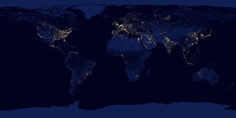
Traditional mapping shows you where things are. Advanced thematic mapping reveals the hidden stories behind your data â transforming raw numbers into compelling visual narratives that drive decision-making across industries from urban planning to market research.
You’re about to discover seven cutting-edge techniques that go far beyond basic choropleth maps. These methods will help you uncover spatial patterns and communicate complex information with unprecedented clarity and impact.
Whether you’re analyzing demographic trends or tracking environmental changes these advanced approaches will revolutionize how you visualize and interpret geographic data.
Disclosure: As an Amazon Associate, this site earns from qualifying purchases. Thank you!
P.S. check out Udemy’s GIS, Mapping & Remote Sensing courses on sale here…
Understanding Advanced Thematic Mapping Fundamentals
Advanced thematic mapping transforms raw geographic data into compelling visual narratives that reveal hidden patterns and spatial relationships. These sophisticated techniques enable you to communicate complex information through strategic use of symbols, colors, and statistical representations.
Definition and Core Principles
Advanced thematic mapping combines statistical analysis with cartographic design to visualize quantitative and qualitative data across geographic space. You’ll work with choropleth maps, proportional symbols, dot density plots, and isopleth surfaces to represent variables like population density, income distribution, or environmental conditions. Core principles include data classification methods, visual hierarchy establishment, and symbology standardization to ensure accurate interpretation. Your maps must balance statistical accuracy with visual clarity while maintaining proper scale relationships and avoiding misleading representations through careful color selection and legend design.
Evolution from Basic to Advanced Methods
Traditional thematic mapping relied on simple choropleth techniques and basic symbol scaling to show geographic distributions. You’ve witnessed the transformation from hand-drawn statistical maps to sophisticated GIS-based cartographic modeling that incorporates multivariate analysis, temporal animation, and interactive elements. Modern workflows integrate remote sensing data, real-time databases, and machine learning algorithms to create dynamic visualizations. Advanced methods now include bivariate mapping, three-dimensional surface modeling, and cartographic animation sequences that reveal spatial-temporal patterns previously invisible in static representations.
Applications in Modern Geography
Contemporary geographic analysis demands advanced thematic mapping for urban planning initiatives, environmental monitoring programs, and demographic research projects. You’ll apply these techniques to visualize climate change impacts through isopleth temperature mapping, analyze population migration patterns using flow maps, and assess economic disparities via bivariate choropleth displays. Emergency management, public health surveillance, and market analysis rely heavily on advanced cartographic methods to identify spatial clusters, predict geographic trends, and support evidence-based decision making across multiple scales from neighborhood-level analysis to continental assessments.
Choropleth Mapping with Statistical Classification
Choropleth mapping transforms raw statistical data into compelling geographic visualizations through systematic data classification methods. You’ll achieve optimal pattern recognition by selecting appropriate classification schemes that balance statistical accuracy with visual interpretation.
Advanced Classification Schemes
Natural Breaks (Jenks) optimizes variance within each class while maximizing differences between classes. You’ll find this method particularly effective for demographic data with irregular distributions like income or population density.
Quantile classification divides your data into equal-sized groups, ensuring balanced visual weight across categories. Standard deviation classification works best when your data follows normal distribution patterns, creating intuitive breaks around the mean.
Manual classification gives you complete control over break points, allowing you to highlight specific policy thresholds or administrative boundaries that automated methods might obscure.
Data Normalization Techniques
Per capita normalization converts raw counts into meaningful ratios, transforming population data into density measurements per square mile or per thousand residents. You’ll avoid misleading visualizations where large geographic areas dominate simply due to size.
Percentage normalization reveals proportional relationships within your dataset, showing crime rates as percentages of total incidents rather than absolute numbers. Z-score standardization helps you compare datasets with different units by converting values to standard deviations from the mean.
Ratio normalization creates meaningful comparisons between related variables, such as jobs-to-housing ratios in urban planning applications.
Color Theory and Visual Hierarchy
Sequential color schemes work best for ordered data like temperature or elevation, progressing from light to dark values. You’ll use diverging palettes for data with meaningful central values, employing contrasting hues on either side of zero or average.
Qualitative color schemes distinguish categorical data without implying order, using distinct hues for land use types or political affiliations. ColorBrewer provides scientifically-tested palettes that remain accessible to colorblind users while maintaining visual clarity.
Value progression should follow intuitive patterns where darker colors represent higher values in most contexts, ensuring your audience can interpret patterns without constant reference to the legend.
Isopleth Mapping for Continuous Data Visualization
Isopleth mapping creates smooth continuous surfaces from discrete data points, making it ideal for visualizing phenomena like temperature, precipitation, or pollution levels across geographic areas.
Interpolation Methods and Algorithms
Kriging algorithms provide the most statistically robust interpolation for environmental data, incorporating spatial autocorrelation principles to predict values at unmeasured locations. Inverse Distance Weighting (IDW) offers faster processing for real-time applications, while spline interpolation works best for topographic surfaces with known elevation controls.
Your choice depends on data density and distribution patterns. Kriging excels with irregularly spaced meteorological stations, while IDW handles uniform point grids effectively. Natural neighbor interpolation prevents overshooting in bounded datasets like water quality measurements.
Contour Line Generation
Contour intervals must match your data’s precision and intended map scale – use 10-foot intervals for detailed site plans but 100-foot intervals for regional topographic analysis. Modern GIS software like ArcGIS Pro and QGIS generate smooth contours through automated algorithms that eliminate jagged edges.
Manual contour editing remains essential for cartographic quality. You’ll need to smooth angular vertices, ensure proper nesting relationships, and add supplementary contours in areas of rapid change. Label placement algorithms now handle most text positioning automatically.
Surface Modeling Applications
Digital Elevation Models (DEMs) support watershed analysis, viewshed calculations, and slope stability assessments through three-dimensional surface representations. Climate mapping applications use temperature and precipitation surfaces to model agricultural zones and species habitat ranges.
Urban heat island analysis relies on thermal surface models derived from satellite imagery and ground station data. You can combine elevation surfaces with land use data to predict flood risk areas and optimize infrastructure placement for maximum efficiency.
Cartogram Construction for Proportional Representation
Cartograms reshape geographic boundaries to represent data values rather than geographic accuracy, creating powerful visualizations where area corresponds directly to statistical importance. This technique transforms traditional maps into analytical tools that immediately communicate proportional relationships.
Area Cartograms for Population Data
Area cartograms resize geographic units proportionally to their population values, making densely populated regions appear larger than their actual geographic size. You’ll find these particularly effective for electoral analysis and demographic studies where population density drives decision-making. States like California expand dramatically while Wyoming shrinks to reflect actual population influence. Modern GIS software like ArcGIS Pro and QGIS offer automated cartogram generation tools that maintain topological relationships while adjusting area proportions.
Distance Cartograms for Accessibility Analysis
Distance cartograms distort geographic space based on travel time or cost rather than physical distance, revealing true accessibility patterns across regions. You can create these specialized maps to show how transportation networks compress or expand perceived distances between locations. Rural areas often appear stretched while urban corridors contract, reflecting actual connectivity. These cartograms prove invaluable for transportation planning and service delivery analysis, where travel time matters more than geographic proximity.
Value-by-Area Distortion Techniques
Value-by-area distortion adjusts polygon sizes to represent statistical values while preserving recognizable geographic shapes and relative positions. You’ll use algorithms like Gastner-Newman or rubber sheet transformations to maintain visual coherence during the distortion process. The technique works best with normalized data such as GDP per capita or crime rates per thousand residents. Dorling cartograms replace original shapes with circles or hexagons, offering cleaner visual results when extreme value differences would create unreadable distortions in traditional area cartograms.
Dot Density Mapping with Spatial Optimization
Dot density mapping with spatial optimization elevates traditional point-based visualization by strategically placing dots to maximize visual clarity while maintaining statistical accuracy. You’ll create more effective population and demographic visualizations through advanced placement algorithms.
Variable Dot Size Implementation
Variable dot size implementation adapts point symbols based on local density conditions and data variance across your study area. You’ll assign larger dots to represent higher value concentrations while using smaller symbols in sparse regions to prevent visual overcrowding. ArcGIS Pro’s dot density renderer automatically calculates optimal dot sizes using statistical variance analysis. Configure dot value ratios between 1:100 and 1:10,000 depending on your population scale and map extent to maintain consistent visual weight distribution.
Spatial Distribution Algorithms
Spatial distribution algorithms position dots using mathematical models that balance statistical representation with cartographic clarity. You’ll implement Poisson disk sampling to ensure minimum distance spacing between points while maintaining random distribution patterns. QGIS’s Random Points algorithm incorporates spatial constraints and boundary conditions to prevent dot clustering near polygon edges. Advanced implementations use Lloyd’s relaxation algorithm to iteratively adjust dot positions, creating more uniform spacing while preserving accurate density representation across administrative boundaries.
Population Density Visualization
Population density visualization through optimized dot placement reveals demographic patterns that traditional choropleth mapping often obscures. You’ll represent each dot as a specific population count, typically ranging from 50 to 1,000 people depending on your study scale and data granularity. Graduated dot density techniques combine multiple dot sizes within single polygons to show both absolute population and local concentration variations. Modern GIS platforms calculate optimal dot placement using census tract centroids and population-weighted algorithms that account for uninhabitable areas like water bodies and protected lands.
Multivariate Mapping for Complex Data Sets
Multivariate mapping enables you to visualize multiple data variables simultaneously within a single map display. These advanced techniques reveal complex relationships between different geographic phenomena that single-variable maps can’t capture.
Bivariate Color Schemes
Bivariate color schemes combine two data variables using dual-color gradients that create unique visual relationships. You’ll design color matrices where each axis represents one variable, producing composite colors that show both values simultaneously. The most effective approach uses complementary colors like blue-orange or red-green combinations.
Joshua Stevens’ bivariate color generator provides standardized 3×3 and 4×4 color matrices for consistent results. You can implement these schemes in QGIS using the “Bivariate Renderer” plugin or create custom color ramps in ArcGIS Pro. Test your color combinations with colorblind accessibility tools to ensure universal readability across all viewer populations.
Symbol Overlay Techniques
Symbol overlay techniques layer multiple visual elements to represent different data dimensions within the same geographic space. You’ll combine base choropleth maps with proportional symbols, creating dual-variable displays that show both area-based and point-based phenomena effectively.
Graduated circles over choropleth backgrounds work exceptionally well for population density combined with economic indicators. You can also use different symbol shapes to represent categorical variables while maintaining size variation for quantitative data. ArcGIS Pro’s symbol layering tools and QGIS’s rule-based symbology enable precise control over overlay transparency and symbol hierarchy.
Multi-dimensional Data Integration
Multi-dimensional data integration incorporates three or more variables using combined visual techniques like size, color, and shape variations. You’ll apply statistical methods such as Principal Component Analysis (PCA) to reduce data complexity while maintaining essential relationships between variables.
Parallel coordinate plots help you identify optimal variable combinations before mapping implementation. Tools like Tableau’s geographic mapping or R’s ggplot2 with spatial packages enable complex multi-variable visualizations. You can also use small multiples or faceted mapping approaches to display temporal variations alongside spatial patterns, creating comprehensive analytical displays.
Create insightful data visualizations with ggplot2. This book guides you through building elegant and effective graphics using the R programming language.

Flow Mapping for Movement and Connection Analysis
Flow mapping transforms static geographic data into dynamic visualizations that reveal movement patterns and spatial connections across landscapes. You’ll discover how these advanced techniques capture the invisible threads linking origins to destinations through specialized cartographic methods.
Desire Line Construction
Desire Line Construction creates straight-line connections between origin and destination points to visualize theoretical movement patterns. You’ll generate these lines using coordinate pairs in GIS software like ArcGIS or QGIS, where the line thickness represents flow volume and color indicates direction or time. Modern desire line algorithms automatically calculate shortest path distances and can incorporate multiple stops or waypoints. You’ll apply weighted scaling to ensure visual hierarchy matches data magnitude, making high-volume flows immediately apparent while preserving lower-volume connections for comprehensive analysis.
Network Flow Visualization
Network Flow Visualization displays movement along actual transportation networks rather than theoretical straight lines. You’ll utilize network analysis tools to route flows through real road, rail, or shipping networks, creating curved paths that follow infrastructure constraints. Advanced techniques include flow bundling algorithms that group similar routes together, reducing visual clutter while maintaining analytical accuracy. You’ll implement graduated line symbology where width corresponds to volume and animated flow effects show temporal patterns. Tools like D3.js and specialized plugins enable interactive network flows with hover details and filtering capabilities.
Migration and Trade Pattern Mapping
Migration and Trade Pattern Mapping captures long-distance human and economic movements through specialized flow visualization techniques. You’ll employ chord diagrams for circular flow representation and Sankey diagrams for hierarchical trade relationships, often combining these with traditional flow maps for comprehensive analysis. Advanced applications include temporal animation showing migration waves over decades and multi-layered displays separating commodity types or demographic groups. You’ll integrate census data APIs and trade databases to ensure accuracy, while applying statistical smoothing to reduce noise in volatile year-to-year patterns and reveal underlying trends.
Conclusion
These seven advanced thematic mapping methods represent a fundamental shift in how you can approach spatial data visualization. You’re no longer limited to basic location-based maps when you have access to techniques that reveal complex patterns and relationships within your geographic data.
By mastering choropleth classification schemes isopleth surface modeling and multivariate visualization techniques you’ll transform raw data into compelling visual narratives. These methods enable you to uncover insights that traditional mapping approaches simply cannot provide.
The integration of flow mapping cartogram construction and optimized dot density visualization opens up new possibilities for your analytical work. Whether you’re conducting urban planning research environmental monitoring or demographic analysis these advanced techniques will enhance your decision-making capabilities and help you communicate complex spatial relationships more effectively to your stakeholders.
Frequently Asked Questions
What is advanced thematic mapping?
Advanced thematic mapping transforms raw geographic data into compelling visual narratives that reveal hidden patterns and spatial relationships. Unlike traditional mapping that simply shows locations, it combines statistical analysis with cartographic design to visualize both quantitative and qualitative data, enabling deeper insights for decision-making in fields like urban planning and environmental monitoring.
How do choropleth maps work?
Choropleth maps use color gradients or patterns to represent statistical data across geographic areas. They rely on classification schemes like Natural Breaks or quantile methods to group data into meaningful categories. Proper data normalization (per capita, percentage) and strategic color selection ensure accurate interpretation and effective visual communication of spatial patterns.
What are isopleth maps used for?
Isopleth maps create smooth continuous surfaces from discrete data points, making them ideal for visualizing phenomena like temperature, pollution levels, or precipitation. They use interpolation methods such as Kriging or Inverse Distance Weighting to predict values between known points, generating contour lines that show gradual changes across geographic space.
How do cartograms differ from regular maps?
Cartograms reshape geographic boundaries to reflect data values rather than actual geographic size. Area cartograms resize regions based on population or economic data, while distance cartograms distort space based on travel time or accessibility. This approach makes data patterns more visually apparent than traditional geographic representations.
What is dot density mapping?
Dot density mapping uses strategically placed dots to represent population or data distribution across geographic areas. Advanced techniques include variable dot sizes that adapt to local density and spatial optimization algorithms that prevent clustering. This method effectively reveals demographic patterns and concentration variations that other visualization methods might obscure.
How does multivariate mapping work?
Multivariate mapping visualizes multiple data variables simultaneously on a single map, revealing complex relationships invisible in single-variable displays. Techniques include bivariate color schemes combining two variables, symbol overlays layering different visual elements, and multi-dimensional integration using combined visual techniques to represent three or more data dimensions effectively.
What are flow maps?
Flow maps transform static geographic data into dynamic visualizations showing movement patterns and spatial connections. They include desire line construction for theoretical movement patterns, network flow visualization along actual transportation routes, and specialized techniques like chord diagrams for migration and trade patterns, revealing complex spatial relationships and dynamics.