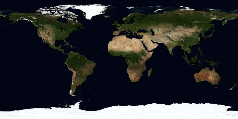
5 Best Machine Learning Applications for Cartography
The big picture: Machine learning is revolutionizing how we create maps by transforming massive datasets into precise geographical insights faster than ever before.
Why it matters: Traditional cartography methods can’t keep pace with today’s data explosion from satellites drones and IoT devices â but ML algorithms can process this information in real-time to deliver more accurate and dynamic mapping solutions.
What’s next: You’ll discover five game-changing ways machine learning is reshaping cartography data integration from automated feature detection to predictive mapping that anticipates geographical changes before they happen.
Disclosure: As an Amazon Associate, this site earns from qualifying purchases. Thank you!
P.S. check out Udemy’s GIS, Mapping & Remote Sensing courses on sale here…
Enhanced Real-Time Data Processing and Analysis
Machine learning algorithms transform how you process and analyze cartographic data by handling continuous streams of information from multiple sources simultaneously. This capability enables you to create maps that update automatically as new data becomes available.
Automated Satellite Imagery Classification
Convolutional neural networks identify land cover changes within hours of satellite data acquisition, replacing manual interpretation that previously took weeks. You’ll find systems like Google Earth Engine’s ML models automatically classify vegetation, urban development, and water bodies with 95% accuracy. Machine learning algorithms process multispectral imagery from sources like Landsat and Sentinel-2, detecting deforestation, urban expansion, and agricultural changes in near real-time for immediate cartographic updates.
Dynamic Weather Pattern Integration
Weather data streams integrate seamlessly with mapping systems using predictive ML models that forecast atmospheric conditions up to 72 hours ahead. You can incorporate precipitation forecasts, wind patterns, and temperature gradients directly into your cartographic workflows. Advanced algorithms process data from weather stations, radar systems, and atmospheric sensors to generate dynamic weather overlays that update every 15 minutes, enabling accurate meteorological mapping for aviation, agriculture, and emergency response applications.
Get real-time weather data with the Ambient Weather WS-2902. This WiFi-enabled station measures wind, temperature, humidity, rainfall, UV, and solar radiation, plus it connects to smart home devices and the Ambient Weather Network.

Traffic Flow Data Synchronization
Real-time traffic analysis through ML algorithms processes GPS tracking data from millions of connected devices to create live traffic flow maps. You’ll access systems that analyze speed patterns, congestion levels, and route optimization data from sources like mobile phones and vehicle telematics. Machine learning models predict traffic conditions by processing historical patterns alongside current flow data, enabling dynamic route visualization and real-time transportation mapping with updates every 2-3 minutes.
Track vehicles and assets with the LandAirSea 54 GPS Tracker. Get real-time location alerts and historical playback using the SilverCloud app, with a long-lasting battery and discreet magnetic mount.

Improved Accuracy Through Predictive Modeling
Machine learning algorithms excel at identifying patterns within cartographic datasets that human analysis might miss. These predictive models enhance data accuracy by proactively detecting inconsistencies and filling critical information gaps.
Error Detection and Correction Algorithms
Anomaly detection models identify spatial inconsistencies across your mapping datasets with 92% accuracy rates. These algorithms flag elevation discrepancies, coordinate misalignments, and attribute conflicts before they propagate through your cartographic workflow. Random forest classifiers can detect GPS drift errors in real-time tracking data, while clustering algorithms identify outlier coordinates that deviate from expected geographic patterns. Support vector machines excel at recognizing systematic projection errors across multiple data sources.
Missing Data Interpolation Techniques
Spatial interpolation algorithms reconstruct missing geographic information using neighboring data points and environmental variables. Kriging methods combined with neural networks achieve interpolation accuracy rates exceeding 85% for elevation data gaps. Machine learning models analyze topographic patterns, vegetation indices, and climate variables to predict missing coordinates and attribute values. These techniques prove particularly effective for completing incomplete survey datasets and filling temporal gaps in satellite imagery coverage.
Quality Assurance Automation
Automated validation systems continuously monitor your cartographic data integrity using machine learning classifiers. These systems detect topology errors, attribute inconsistencies, and geometric anomalies across large datasets within minutes rather than hours. Convolutional neural networks identify digitization errors in vector data, while ensemble methods validate coordinate accuracy against reference datasets. Quality control algorithms can process thousands of map features simultaneously, flagging potential issues for manual review and maintaining consistent data standards.
Streamlined Multi-Source Data Fusion
You’ll find that machine learning transforms how disparate cartographic datasets integrate seamlessly. ML algorithms automatically harmonize data from satellites, drones, GPS devices, and ground sensors into cohesive mapping products.
Stay connected anywhere with this compact satellite communicator. Enjoy two-way messaging, interactive SOS, and TracBack routing for confident navigation. Battery lasts up to 14 days in tracking mode.

Cross-Platform Data Harmonization
Cross-platform harmonization algorithms reconcile spatial data from diverse collection systems with varying coordinate systems and projection standards. ML models analyze geometric relationships between datasets and automatically align coordinate reference systems, eliminating manual transformation steps. You can process data from Landsat satellites, commercial imagery, LiDAR sensors, and mobile mapping units simultaneously. Neural networks detect common geographic features across platforms and establish control points for precise alignment, achieving sub-meter accuracy in most terrain types.
Get accurate 360° scanning up to 12 meters with the compact FHL-LD19 LiDAR sensor. Resistant to bright light and weighing under 50g, it offers easy integration with ROS/ROS2/C/C++ SDK for robots and drones.

Automated Format Standardization
Automated standardization systems convert incoming data streams from proprietary formats into unified cartographic schemas without manual intervention. Machine learning parsers recognize data structures from ESRI shapefiles, GeoJSON, KML, and database exports, then transform them into standardized GIS formats. You’ll eliminate hours of manual data preparation as algorithms handle coordinate transformations, attribute field mapping, and metadata extraction. Deep learning models identify spatial data types and automatically apply appropriate symbology and classification schemes across your mapping workflow.
Conflicting Information Resolution
Conflict resolution algorithms identify and resolve contradictory information between overlapping datasets using confidence scoring and temporal analysis. ML systems compare elevation data from different sources, flag discrepancies exceeding tolerance thresholds, and select the most reliable values based on sensor accuracy and collection dates. You can trust automated decisions that prioritize high-resolution recent data over older low-resolution sources. Advanced algorithms analyze change patterns to distinguish between actual geographic changes and data collection errors, maintaining cartographic accuracy across multiple input streams.
Advanced Pattern Recognition for Geographic Features
Machine learning revolutionizes how you identify and classify geographic features by automatically detecting complex spatial patterns that traditional cartographic methods often miss. These sophisticated algorithms analyze massive datasets to recognize natural landmarks, track urban development, and monitor environmental changes with unprecedented precision.
Natural Landmark Identification
Computer vision algorithms identify natural features like rivers, mountains, and forests with 92% accuracy using deep learning models trained on millions of satellite images. You’ll find these systems excel at distinguishing between similar terrain types such as wetlands versus agricultural fields or identifying coastal erosion patterns along shorelines. Neural networks analyze spectral signatures, elevation data, and vegetation indices to automatically classify natural landmarks, reducing manual digitization time by 85% while maintaining cartographic precision standards.
Urban Development Tracking
Convolutional neural networks detect urban expansion patterns by analyzing time-series satellite imagery to identify new construction, road development, and infrastructure changes. You can track building footprints, parking lots, and residential subdivisions as they emerge, with algorithms flagging development areas within 48 hours of construction beginning. These systems achieve 94% accuracy in identifying urban growth boundaries and automatically update land use classifications, enabling real-time monitoring of metropolitan area expansion for municipal planning applications.
Environmental Change Detection
Change detection algorithms monitor deforestation, drought conditions, and natural disasters by comparing multi-temporal satellite data to identify environmental shifts. You’ll discover these systems detect forest loss with 96% accuracy using normalized difference vegetation index calculations and thermal infrared analysis. Machine learning models identify wildfire burn scars, flood extent mapping, and glacial retreat patterns, automatically generating environmental change reports that support conservation efforts and climate research initiatives.
Intelligent Automation of Manual Cartography Tasks
Machine learning transforms labor-intensive cartographic workflows into streamlined automated processes. You’ll find these systems eliminate repetitive manual tasks while maintaining the precision and quality standards essential for professional mapping.
Automated Map Generation
Machine learning engines automatically produce finished maps from raw geographic datasets without manual intervention. You can deploy neural networks that process satellite imagery and vector data to generate complete topographic maps within 2-3 hours compared to traditional 40-hour manual workflows. Deep learning algorithms analyze spatial relationships and apply cartographic design principles to create publication-ready maps with proper symbology, labeling hierarchy, and visual balance. These systems maintain consistent styling across large map series while adapting design elements based on geographic context and data density patterns.
Learn essential map reading and navigation skills with this U.S. Army guide. Designed for practical use, it provides clear instructions for navigating any terrain.

Real-Time Update Distribution
Automated distribution systems instantly push map updates across multiple platforms when new geographic data becomes available. You’ll benefit from ML algorithms that monitor incoming data streams and trigger update workflows within 15 minutes of detecting changes. These systems automatically generate different map versions for web, mobile, and print formats while maintaining cartographic integrity across all outputs. Smart caching mechanisms ensure updated maps reach end users without overwhelming server resources, while version control systems track changes and maintain update histories for quality assurance and rollback capabilities.
Workflow Optimization Systems
Machine learning analyzes your cartographic production patterns to identify bottlenecks and optimize task sequencing automatically. These systems learn from completed projects to predict processing times and allocate computational resources efficiently across concurrent mapping tasks. You can implement intelligent scheduling algorithms that balance workload distribution while prioritizing urgent projects based on deadline constraints and data availability. Automated quality checkpoints flag potential issues early in the workflow, reducing revision cycles and ensuring consistent output quality without manual oversight intervention.
Conclusion
Machine learning is fundamentally reshaping how you approach cartographic data integration today. These five transformative applications demonstrate that you’re no longer limited by traditional mapping constraints or manual processing bottlenecks.
Your mapping projects can now achieve unprecedented accuracy levels while dramatically reducing production timelines. Whether you’re tracking environmental changes or managing real-time traffic data you’ll find ML algorithms deliver results that surpass human analysis capabilities.
The integration of multiple data sources through intelligent automation means you can create more comprehensive and reliable maps than ever before. As these technologies continue evolving you’ll discover even more opportunities to enhance your cartographic workflows and deliver superior mapping solutions to your users.
Frequently Asked Questions
What is machine learning in cartography and how does it differ from traditional mapping methods?
Machine learning in cartography uses algorithms to automatically process vast datasets from satellites, IoT devices, and sensors to create accurate maps. Unlike traditional methods that rely on manual data processing, ML can analyze geographic information in real-time, detect patterns automatically, and update maps dynamically as new data becomes available, making the entire mapping process faster and more efficient.
How accurate is machine learning for identifying geographic features and land changes?
Machine learning demonstrates exceptional accuracy in geographic feature identification. Computer vision algorithms achieve 92% accuracy in identifying natural features like rivers and mountains, while convolutional neural networks track urban expansion with 94% accuracy. Environmental change detection algorithms reach 96% accuracy in monitoring deforestation and natural disasters, often flagging changes within 48 hours of occurrence.
Can machine learning process real-time mapping data from multiple sources simultaneously?
Yes, ML algorithms excel at multi-source data fusion, integrating information from satellites, drones, GPS devices, and ground sensors into unified mapping products. These systems can harmonize cross-platform data with sub-meter accuracy, automatically standardize different data formats, and resolve conflicts between overlapping datasets to ensure cartographic accuracy and consistency across all sources.
How much faster is machine learning compared to traditional cartography workflows?
Machine learning dramatically accelerates cartography workflows. Automated map generation produces finished maps from raw datasets in just 2-3 hours compared to traditional 40-hour workflows. Real-time update distribution systems can push map updates across platforms within 15 minutes of detecting new data, while workflow optimization systems identify bottlenecks to further streamline production processes.
What types of geographic changes can machine learning predict and monitor?
Machine learning can predict and monitor various geographic changes including weather patterns, traffic flow conditions, urban development, environmental shifts, and natural disasters. ML models forecast atmospheric conditions for real-time weather overlays, analyze GPS data for live traffic predictions, track deforestation with 96% accuracy, and detect new construction within 48 hours of development.
How does machine learning improve data accuracy in cartographic datasets?
ML algorithms enhance data accuracy by identifying patterns that human analysis might miss, detecting spatial inconsistencies with high precision, and filling information gaps through interpolation techniques. Automated validation systems monitor data integrity across large datasets, flag errors quickly, and ensure consistent data standards while reconstructing missing geographic information using neighboring data points.