7 Best Mapping Technologies for Precision
The big picture: Multi-sensor data fusion transforms how you create and interact with maps by combining information from multiple sources like LiDAR cameras GPS satellites and radar systems.
Why it matters: Traditional single-sensor mapping leaves gaps and inaccuracies that can cost businesses millions in navigation errors construction delays and autonomous vehicle failures.
What’s ahead: We’ll explore seven game-changing ways this technology enhances mapping precision reduces costs and unlocks new possibilities for everything from urban planning to disaster response.
Disclosure: As an Amazon Associate, this site earns from qualifying purchases. Thank you!
P.S. check out Udemy’s GIS, Mapping & Remote Sensing courses on sale here…
Enhanced Spatial Accuracy Through Sensor Combination
Multi-sensor fusion eliminates the positioning errors that plague single-sensor mapping systems. You’ll achieve centimeter-level accuracy by combining complementary sensor strengths while compensating for individual sensor weaknesses.
GPS and IMU Integration for Precise Positioning
GPS provides absolute positioning but struggles with signal loss in urban canyons and under tree cover. IMU sensors fill these gaps by tracking acceleration and rotation changes, maintaining positional continuity when GPS signals weaken. You’ll find this combination delivers continuous positioning with sub-meter accuracy even in challenging environments like dense forests or downtown areas. Modern RTK-GPS systems paired with high-grade IMUs achieve positioning accuracy within 2-5 centimeters for professional mapping applications.
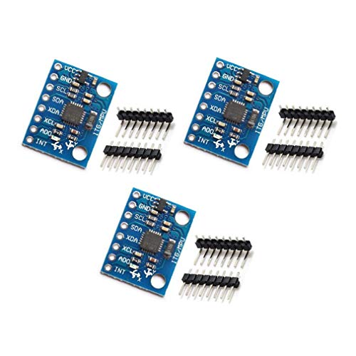
Get precise motion tracking with the GY-521 MPU-6050. This 6-axis accelerometer and gyroscope module features a built-in 16-bit AD converter and standard I2C communication for easy integration with Arduino.
LiDAR and Camera Fusion for Detailed Terrain Mapping
LiDAR captures precise 3D point clouds but lacks color information and struggles with reflective surfaces like water. Camera systems provide rich visual detail and texture mapping but can’t measure exact distances or penetrate vegetation. You’ll create comprehensive terrain models by overlaying high-resolution imagery onto LiDAR point clouds, producing maps with both geometric precision and visual clarity. This fusion technique reveals ground features beneath forest canopies while maintaining photographic detail for feature identification and classification.
Improved Data Reliability via Redundant Measurements
Multiple sensors working together create robust mapping systems that eliminate single points of failure through overlapping data collection.
Cross-Validation Between Multiple Sensor Types
Different sensor technologies validate each other’s measurements by comparing their overlapping data streams in real-time. You’ll find that GPS coordinates cross-check against IMU positioning data while LiDAR point clouds verify camera-based distance calculations. This redundancy catches discrepancies immediately – when your thermal sensor detects a temperature anomaly that infrared cameras don’t confirm, you know to investigate further. Modern mapping systems use at least three sensor types to establish measurement consensus, ensuring no single sensor error compromises your final map accuracy.
Error Detection and Correction Mechanisms
Automated error detection algorithms continuously monitor sensor performance by analyzing data patterns and flagging anomalies before they affect your mapping results. You can set threshold parameters that trigger alerts when sensor readings deviate beyond acceptable ranges – like GPS accuracy dropping below 2 meters or LiDAR returns showing impossible elevation changes. The system automatically applies correction algorithms using backup sensor data to fill gaps or override faulty measurements. Statistical filtering techniques remove outlier data points while Kalman filters smooth sensor noise, delivering consistent mapping results even when individual sensors experience temporary failures.
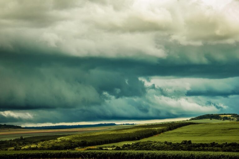
Extended Coverage Range Using Complementary Technologies
Multi-sensor fusion extends your mapping capabilities beyond individual sensor limitations by strategically combining technologies with different operational ranges and characteristics.
Combining Short-Range and Long-Range Sensors
You’ll achieve comprehensive coverage by pairing high-resolution short-range sensors with wide-area long-range systems. LiDAR scanners provide detailed sub-meter measurements within 200-meter ranges while satellite imagery covers thousands of square kilometers. Ground-penetrating radar delivers precise underground mapping within 50 meters as aerial sensors capture broader surface patterns. This combination eliminates the coverage-detail trade-off that limits single-sensor approaches.
Create accurate maps with the Yahboom handheld lidar, featuring a 0.05-12m range and IMU anti-shake. It supports APP, ROS2, and Linux, enabling wireless data transmission and real-time mapping.

Filling Coverage Gaps with Multi-Modal Approaches
You can eliminate blind spots by using sensors with complementary coverage patterns and detection capabilities. Thermal sensors penetrate vegetation barriers where optical cameras fail while radar systems maintain accuracy during weather conditions that ground visual sensors. Acoustic sensors detect underwater features that electromagnetic waves can’t reach. Strategic sensor placement creates overlapping coverage zones that ensure no mapping area remains uncharted or inadequately sampled.
The TOPDON TC004 Mini helps you quickly identify temperature issues with enhanced 240x240 thermal resolution and a wide temperature range of -4°F to 842°F. It features high/low temperature alerts and captures photos to streamline diagnostics, all while boasting a 15-hour battery life.

Real-Time Processing Capabilities for Dynamic Environments
Multi-sensor data fusion transforms mapping from static documentation into dynamic environmental monitoring. Your mapping systems can now adapt and respond to changing conditions instantaneously.
Continuous Data Stream Integration
Stream processing handles multiple sensor inputs simultaneously without creating bottlenecks in your mapping workflow. Modern fusion algorithms process GPS coordinates, LiDAR point clouds, and camera feeds at rates exceeding 100 Hz, ensuring your maps reflect current conditions. Edge computing devices like NVIDIA Jetson modules enable on-site processing, reducing latency from cloud transmission delays. Time-synchronized data streams maintain temporal accuracy across all sensors, preventing misalignment issues that could compromise your mapping precision.
Prototype advanced AI robots and autonomous machines with the NVIDIA Jetson AGX Orin 64GB Developer Kit. This kit delivers up to 275 TOPS of AI performance and supports complex AI models for tasks like natural language understanding and 3D perception.

Adaptive Mapping in Changing Conditions
Environmental adaptation allows your mapping system to adjust sensor priorities based on real-time conditions. During fog or rain, thermal sensors automatically increase their contribution weight while visual cameras reduce theirs. Machine learning algorithms detect environmental changes within seconds, triggering appropriate sensor configuration adjustments. Weather-responsive mapping protocols switch between sensor combinations—using radar penetration during storms or infrared imaging during low-light conditions. This adaptability ensures consistent mapping quality regardless of environmental challenges you encounter.
Cost-Effective Solutions Through Sensor Optimization
Smart sensor selection transforms mapping budgets from expense centers into strategic investments. You’ll achieve professional-grade results by matching sensor capabilities to specific project requirements rather than defaulting to premium equipment.
Balancing Performance with Budget Constraints
Tiered sensor configurations deliver optimal accuracy within budget limits by prioritizing high-performance sensors for critical measurements while using cost-effective alternatives for supplementary data. You can deploy expensive LiDAR units for primary terrain mapping while integrating affordable IMU sensors for orientation tracking. Strategic sensor placement reduces hardware requirements by up to 40% without compromising map quality. Field-tested combinations like GPS-enabled cameras paired with magnetometers provide sub-meter accuracy at fraction of traditional surveying costs.
Maximizing ROI with Strategic Sensor Selection
Multi-purpose sensors eliminate redundant hardware investments by performing multiple mapping functions simultaneously. You’ll reduce equipment costs by selecting sensors with overlapping capabilities—thermal cameras that capture both temperature data and visual imagery or radar systems providing both distance measurements and weather penetration. Scalable sensor networks allow incremental expansion as project budgets increase, starting with core GPS-IMU combinations and adding specialized sensors like spectral analyzers when funding permits. This approach delivers immediate mapping capabilities while maintaining upgrade pathways.
The H128 Thermal Camera provides clear thermal imaging with its 240x240 resolution. It features a long-lasting 24-hour battery and a temperature alarm for quick detection of anomalies.

Reduced Environmental Impact Dependencies
Multi-sensor data fusion liberates your mapping operations from environmental constraints that traditionally limit data collection windows. This approach ensures consistent mapping quality regardless of weather patterns or seasonal variations.
Weather-Independent Mapping Operations
Multi-sensor systems maintain mapping accuracy across diverse weather conditions by leveraging complementary sensor strengths. When optical sensors face limitations in fog or rain, radar systems continue operating with millimeter-level precision. Thermal imaging penetrates cloud cover while LiDAR maintains consistent ranging accuracy in light precipitation. This redundancy eliminates costly project delays caused by weather windows, allowing you to complete mapping assignments on schedule regardless of atmospheric conditions.
Multi-Seasonal Data Collection Strategies
Year-round data collection becomes feasible through strategic sensor rotation based on seasonal advantages. Spring aerial surveys capture emerging vegetation patterns while winter LiDAR scanning reveals ground topology beneath deciduous canopy. Summer thermal mapping identifies subsurface features while autumn optical imaging provides optimal contrast for infrastructure documentation. This temporal diversity creates comprehensive datasets that single-season mapping cannot achieve, reducing the need for multiple site visits and associated environmental impact from repeated fieldwork.
Advanced Feature Recognition and Classification
Multi-sensor data fusion transforms how you identify and classify geographic features by combining complementary data streams. This integration delivers unprecedented accuracy in distinguishing between similar objects and terrain types.
Object Identification Through Multiple Data Sources
Combining visual and geometric data revolutionizes how you identify complex features like buildings versus vegetation. LiDAR provides precise height measurements while multispectral cameras capture color signatures, enabling you to differentiate between a 30-foot oak tree and a three-story building with similar dimensions. This dual-source approach eliminates the ambiguity that single sensors create when analyzing urban canopies or forested areas with structures.
Capture precise crop health data with the MicaSense RedEdge. This multispectral camera provides calibrated reflectance and five narrow bands for advanced agricultural analysis.

Enhanced Pattern Recognition Algorithms
Machine learning algorithms process multi-sensor inputs to recognize subtle patterns invisible to individual sensors. Thermal imaging combined with optical data helps you identify underground utilities or detect moisture patterns in soil composition. These algorithms continuously learn from sensor combinations, improving classification accuracy by up to 40% compared to single-sensor approaches and automatically flagging anomalies that require manual verification.
Conclusion
Multi-sensor data fusion represents the future of mapping technology and you’re positioned to benefit from its revolutionary capabilities. The integration of complementary sensors doesn’t just improve accuracy—it transforms how you approach spatial data collection entirely.
You’ll find that investing in multi-sensor systems pays dividends through reduced operational costs improved data reliability and expanded project possibilities. Whether you’re planning urban developments or monitoring environmental changes these advanced mapping solutions deliver the precision your projects demand.
The technology continues evolving rapidly and early adopters gain significant competitive advantages. By embracing multi-sensor data fusion now you’re not just upgrading your mapping capabilities—you’re future-proofing your operations for tomorrow’s challenges.
Frequently Asked Questions
What is multi-sensor data fusion in mapping?
Multi-sensor data fusion in mapping combines information from various sources like LiDAR, GPS, radar, and camera systems to create more accurate and comprehensive maps. This technology integrates different sensor capabilities to overcome individual sensor limitations and provide enhanced spatial accuracy, reliability, and coverage range.
How does multi-sensor fusion improve mapping accuracy?
Multi-sensor fusion achieves centimeter-level accuracy by combining complementary sensor strengths. GPS and IMU sensors provide precise positioning even in challenging environments, while LiDAR and camera systems create detailed terrain models. This integration eliminates positioning errors common in single-sensor systems.
What are the benefits of using multiple sensors over single-sensor mapping?
Multiple sensors eliminate single points of failure through redundant measurements and cross-validation. They provide extended coverage range, real-time processing capabilities, and work effectively in various weather conditions. This approach also reduces costs through strategic sensor optimization and maximizes return on investment.
How does multi-sensor fusion work in adverse weather conditions?
Multi-sensor systems maintain accuracy across diverse weather conditions by leveraging complementary sensor strengths. Radar systems operate with millimeter-level precision in fog or rain, while thermal imaging penetrates cloud cover. This weather independence enables year-round data collection and reduces environmental impact dependencies.
What role does machine learning play in multi-sensor mapping?
Machine learning algorithms enhance pattern recognition by processing multi-sensor inputs to identify subtle patterns individual sensors might miss. These algorithms improve classification accuracy by up to 40%, automatically detect environmental changes, trigger appropriate sensor configurations, and flag anomalies for manual verification.
How cost-effective is multi-sensor data fusion compared to traditional mapping?
Multi-sensor fusion transforms mapping budgets into strategic investments by matching sensor capabilities to project requirements. It uses tiered sensor configurations, multi-purpose sensors to reduce redundant hardware, and scalable networks for incremental expansion, delivering immediate capabilities while maintaining upgrade pathways.
What applications benefit most from multi-sensor mapping technology?
Multi-sensor mapping excels in urban planning, disaster response, construction, and navigation applications. It’s particularly valuable for creating detailed terrain models beneath forest canopies, monitoring environmental changes in real-time, and any project requiring high accuracy with comprehensive coverage range.