5 Best Navigation Tools
Why it matters: You’re probably stuck using the same old map app every day but there are fascinating alternatives that could revolutionize how you navigate the world.
The big picture: These five unique navigation experiences go beyond basic turn-by-turn directions to offer everything from gamified exploration to augmented reality overlays that transform your daily commute into an adventure.
What’s next: We’ll walk you through each alternative so you can discover which one matches your navigation style and maybe even rediscover the joy of getting from point A to point B.
Disclosure: As an Amazon Associate, this site earns from qualifying purchases. Thank you!
P.S. check out Udemy’s GIS, Mapping & Remote Sensing courses on sale here…
Augmented Reality Navigation Apps That Overlay Digital Directions on Real World Views
AR navigation transforms your smartphone into a sophisticated wayfinding tool by merging digital directions with real-world camera views. These apps eliminate the confusion of traditional map interfaces by placing arrows, destination markers, and route information directly onto your live environment.
Experience vivid content on the Galaxy A16 5G's 6.7" display and capture stunning photos with its triple-lens camera. Enjoy peace of mind with a durable design, six years of updates, and Super Fast Charging.

Live View Feature in Google Maps for Street-Level AR Guidance
Google Maps’ Live View uses your phone’s camera to display directional arrows and street names directly on your screen. You’ll see floating arrows pointing toward your destination while viewing the actual street through your camera. The feature works best in well-mapped urban areas with clear street signs and recognizable landmarks. Simply tap the Live View button after entering your destination to activate this AR overlay system.
AR City for Interactive Urban Exploration with Historical Overlays
AR City combines navigation with historical storytelling by overlaying digital information about buildings, monuments, and neighborhoods. You’ll discover historical photos, architectural details, and cultural stories as you explore city streets. The app identifies points of interest through your camera and displays relevant content cards with images and text. This navigation experience transforms routine walks into educational adventures through interactive urban archaeology.
Blippar’s AR Navigation for Indoor and Outdoor Wayfinding
Blippar’s AR platform provides precise navigation for complex indoor environments like shopping malls, airports, and office buildings. You’ll receive step-by-step directions overlaid on your camera view, including floor changes and specific store locations. The app works seamlessly between indoor and outdoor spaces, maintaining accuracy through GPS and visual positioning systems. Blippar’s technology excels in environments where traditional GPS signals struggle to provide reliable location data.
Voice-Only Navigation Systems That Guide Through Audio Cues Alone
Audio-only navigation transforms how you experience direction-finding by removing visual distractions entirely. These systems rely on spatial audio and descriptive cues to guide you through environments.
Soundscape by Microsoft for Audio-Based Spatial Awareness
Soundscape creates 3D audio beacons that help you navigate using spatial sound alone. You’ll hear landmarks and points of interest positioned around you through stereo audio cues. The app uses bone conduction technology to layer navigation sounds over ambient noise, letting you maintain environmental awareness while following directions. Microsoft’s system works particularly well for urban exploration where visual navigation becomes overwhelming.
BlindSquare App for Accessible Navigation Through Sound
BlindSquare combines GPS positioning with detailed audio announcements about your surroundings. You’ll receive spoken descriptions of nearby businesses, street intersections, and navigation landmarks as you move through areas. The app integrates with Foursquare’s database to provide real-time information about shops, restaurants, and services within your vicinity. Its voice-guided system announces turns and distance measurements clearly, making complex route navigation accessible through audio alone.
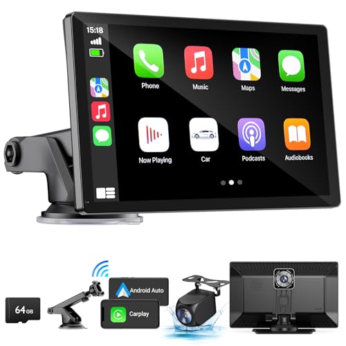
Voice-Activated Car Systems for Hands-Free Driving Directions
Modern vehicle integration systems like Apple CarPlay and Android Auto offer completely hands-free navigation experiences. You’ll interact with these systems using voice commands to set destinations, modify routes, and receive turn-by-turn directions without touching any controls. Advanced systems from BMW and Mercedes-Benz include natural language processing that understands conversational requests like “find the nearest gas station with good reviews.” These platforms prioritize safety by minimizing visual interface dependence during driving.
Upgrade your drive with this 9" wireless Apple CarPlay and Android Auto car stereo. Enjoy hands-free control, GPS navigation, and a clear view with the included 4K front camera and 1080p backup camera.
Gamified Navigation Platforms That Turn Travel Into Interactive Adventures
Gaming elements transform mundane navigation into engaging adventures that motivate exploration. These platforms reward you for discovering new locations while providing alternative navigation experiences.
Geocaching Apps That Transform Navigation Into Treasure Hunting
Retrieve lost items in tight spaces with this telescoping magnetic pickup tool. It features a strong magnet, extendable handle, and bright LED flashlight for easy retrieval in any environment.

Geocaching turns your smartphone into a GPS treasure hunter’s tool by directing you to hidden containers worldwide. You’ll navigate to specific coordinates using apps like Geocaching.com’s official platform or c:geo for Android devices. Adventure Lab creates location-based experiences where you solve puzzles at specific landmarks. These apps provide turn-by-turn directions to cache locations while encouraging you to explore off-the-beaten-path destinations. Munzee combines QR code scanning with GPS navigation, creating scavenger hunts that require precise location finding.
Zombies, Run! for Fitness-Focused Route Planning
Zombies, Run! transforms your jogging routes into survival missions where audio storytelling guides your path. You’ll receive directional cues through an immersive narrative that adapts to your chosen running route. The app tracks your GPS location while delivering story segments that correspond to specific areas along your path. Interval training modes adjust the storyline based on your pace changes and route selections. Supply collection mechanics encourage you to explore different neighborhoods and parks. The platform’s GPS tracking creates custom routes based on your fitness goals while maintaining the gaming narrative structure.
Track vehicles and assets with the LandAirSea 54 GPS Tracker. Get real-time location alerts and historical playback using the SilverCloud app, with a long-lasting battery and discreet magnetic mount.

Pokemon GO’s Adventure Sync for Location-Based Gaming Navigation
Pokemon GO’s Adventure Sync uses your phone’s built-in fitness tracking to guide exploration through real-world locations. You’ll discover PokeStops and Gyms that serve as waypoints for navigation while collecting in-game rewards. The app’s buddy system provides walking directions to specific locations where rare Pokemon appear. Community Day events create temporary navigation objectives that lead you to popular gathering spots in your area. Route recommendations appear based on Pokemon spawn patterns and player activity data. The platform’s AR mapping helps you navigate complex areas like parks and shopping centers through crowdsourced location data.
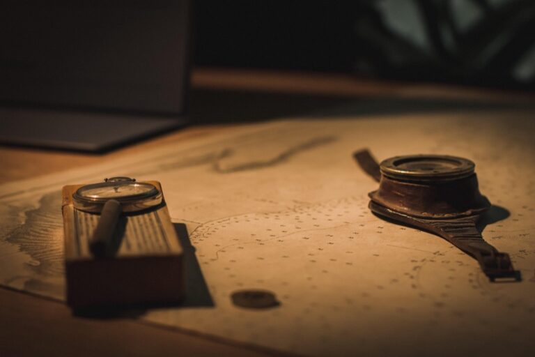
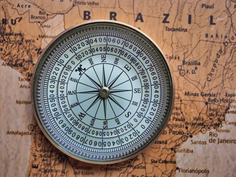
Offline Paper Map Resources Combined With Digital Enhancement Tools
Physical maps paired with digital supplements create a hybrid navigation system that combines traditional reliability with modern convenience. You’ll maintain your orientation skills while accessing real-time updates and enhanced data layers.
National Geographic Trail Maps with QR Code Integration
Navigate the outdoors confidently with this durable, waterproof map. Featuring clearly marked trails, detailed topography, and points of interest, it ensures easy and accurate navigation with UTM and lat/long grids.

National Geographic’s waterproof trail maps feature QR codes that connect to their Trails Illustrated mobile app, providing GPS coordinates and real-time trail conditions. You’ll scan codes to access current weather data, elevation profiles, and user-submitted trail updates without relying on continuous cell coverage. The physical maps remain functional when your device battery dies, while the digital integration offers crowd-sourced information about trail closures, wildlife sightings, and seasonal hazards that traditional paper maps can’t provide.
Ordnance Survey Maps with Companion Mobile Apps
Explore the Cotswolds with this detailed 1:25K scale Ordnance Survey map. Covering Burford, Chipping Campden, and Cirencester, it's perfect for hiking and navigating the region.
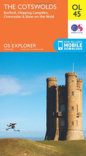
Ordnance Survey’s detailed paper maps integrate seamlessly with their OS Maps app, allowing you to plot your paper route digitally for backup GPS tracking. You’ll use the physical map for primary navigation while the app provides precise location confirmation and stores your planned route as a digital breadcrumb trail. The hybrid system excels in remote areas where you need the reliability of paper maps combined with GPS coordinate verification and emergency location sharing capabilities.
Topographic Map Reading with GPS Coordinate Backup Systems
Professional topographic maps paired with handheld GPS units create the most reliable navigation system for wilderness exploration. You’ll plot waypoints on your paper map and input corresponding GPS coordinates as digital checkpoints throughout your journey. This dual-system approach ensures you maintain traditional map reading skills while having electronic backup for critical navigation decisions, especially valuable when traversing unmarked terrain or during low-visibility conditions where landmark identification becomes challenging.
Community-Driven Navigation Networks That Rely on Local Knowledge Sharing
These platforms harness collective intelligence to create navigation experiences that commercial apps can’t replicate. Local users contribute real-time insights that transform how you navigate unfamiliar territories.
Waze’s User-Generated Traffic and Route Information
Waze transforms your smartphone into a community reporting tool that crowdsources traffic conditions in real-time. You’ll receive instant updates about accidents, police presence, road closures, and construction delays from fellow drivers. The app learns from your driving patterns and combines them with millions of other users’ data to suggest optimal routes. Community editors verify and moderate user reports to maintain accuracy, creating a self-policing system that improves navigation reliability for everyone.
iOverlander for Traveler-Recommended Camping and Service Locations
iOverlander connects you with a global network of overlanders who share camping spots, fuel stations, and service locations through firsthand experience. You’ll find detailed reviews of wild camping areas, border crossings, and mechanic shops that aren’t listed in traditional guidebooks. The platform works offline, allowing you to access community-verified locations even in remote areas without internet connectivity. Fellow travelers upload GPS coordinates, photos, and detailed descriptions of amenities, creating a comprehensive database of road trip essentials.
Local Guide Forums and Facebook Groups for Insider Navigation Tips
Local Facebook groups and specialized forums provide navigation insights that algorithms can’t capture, connecting you with residents who know hidden shortcuts and seasonal route changes. You’ll discover which roads become impassable during rainy seasons, where to find the best parking spots, and how to navigate complex city centers like a local. These communities often share real-time updates about temporary road closures, festival traffic patterns, and alternative routes during major events. Members frequently post photos and detailed directions for challenging locations, creating a visual guide that supplements traditional navigation apps.
Conclusion
These alternative navigation experiences offer you exciting ways to break free from conventional mapping routines. Whether you’re drawn to AR overlays that transform your surroundings or voice-only systems that free your eyes from screens you’ll discover new dimensions to everyday travel.
Your navigation preferences are unique and these diverse options ensure there’s something that matches your specific needs. From gamified adventures that turn commutes into quests to community-driven networks sharing local insights you can customize your journey experience.
The future of navigation isn’t limited to standard GPS apps. By exploring these alternatives you’ll not only reach your destinations more efficiently but also rediscover the joy of exploration in your daily travels.
Frequently Asked Questions
What are AR navigation apps and how do they work?
AR navigation apps merge digital directions with real-world views through your phone’s camera. Instead of looking at traditional maps, you see directional arrows and street names overlaid directly on your screen. Google Maps’ Live View is a popular example that displays navigation cues on top of your camera view, making it easier to navigate urban areas without the confusion of interpreting traditional map interfaces.
How do voice-only navigation systems help reduce distractions?
Voice-only navigation systems guide users through audio cues alone, eliminating the need to look at screens while traveling. Apps like Microsoft’s Soundscape use 3D audio beacons with spatial sound, while BlindSquare provides detailed audio announcements about surroundings. Modern car systems like Apple CarPlay and Android Auto also offer hands-free voice commands, prioritizing safety by minimizing visual interface dependence.
What makes gamified navigation different from traditional GPS apps?
Gamified navigation transforms travel into interactive adventures by adding gaming elements to exploration. Instead of simply getting directions, apps like Geocaching turn navigation into treasure hunting, Zombies, Run! converts jogging routes into survival missions, and Pokémon GO creates navigation objectives based on in-game rewards. These platforms motivate users to explore new areas while making travel more entertaining and engaging.
How do hybrid paper-digital navigation systems work?
Hybrid navigation combines traditional paper maps with digital enhancement tools for reliability and convenience. National Geographic’s waterproof maps include QR codes linking to mobile apps with GPS coordinates, while Ordnance Survey maps integrate with their digital app for route plotting. This dual-system approach maintains traditional map reading skills while providing electronic backup, making it ideal for wilderness exploration and remote areas.
What are community-driven navigation networks?
Community-driven navigation networks rely on local knowledge sharing from real users rather than just commercial data. Waze crowdsources real-time traffic conditions through user reports, iOverlander connects travelers sharing camping spots and service locations, and local guide forums provide insider navigation tips. These platforms leverage collective intelligence and firsthand experiences to enhance navigation beyond what standard commercial apps can offer.
Why should I consider alternatives to conventional map applications?
Conventional map apps can become repetitive and may not suit every navigation need or preference. Alternative navigation options offer unique features like augmented reality overlays, gamified exploration, voice-only guidance, and community insights that can transform routine commutes into exciting adventures. These alternatives help you rediscover the joy of travel while finding a navigation style that better matches your specific needs and interests.