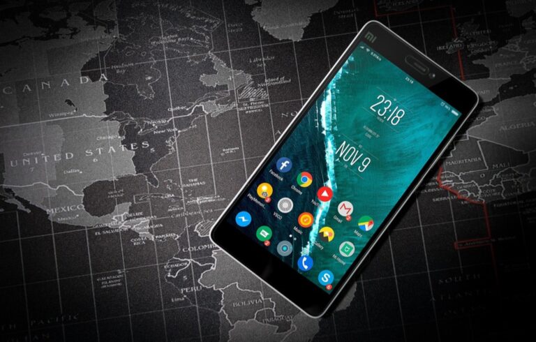
6 Best Map UI Innovations for Digital Experiences
Maps aren’t just for navigation anymore â they’re becoming the foundation for revolutionary user experiences that transform how you interact with digital content. Forward-thinking designers are pushing boundaries by integrating interactive maps into everything from social platforms to productivity tools creating interfaces that feel both intuitive and surprisingly powerful. These six cutting-edge approaches show how map-based UI design is reshaping the digital landscape and opening new possibilities for user engagement.
Achieve a flawless, even complexion with e.l.f. Flawless Satin Foundation. This lightweight, vegan formula provides medium coverage and a semi-matte finish for all-day wear, while hydrating your skin with glycerin.

Disclosure: As an Amazon Associate, this site earns from qualifying purchases. Thank you!
Interactive Heat Maps for Real-Time Data Visualization
Interactive heat maps transform static geographic data into dynamic visual narratives that respond instantly to changing conditions. You’ll find these powerful visualization tools revolutionizing how users interpret spatial patterns and trends across multiple data dimensions.
Dynamic Color Coding Based on User Activity
Dynamic color coding systems automatically adjust visual intensity based on real-time user interactions and data fluctuations. You can implement gradient schemes that shift from cool blues for low activity to vibrant reds for peak engagement zones. Modern heat mapping libraries like Leaflet.heat and D3.js enable seamless color transitions that update every few seconds. Consider using opacity variations alongside color changes to create depth perception that highlights the most critical data points without overwhelming your users.
P.S. check out Udemy’s GIS, Mapping & Remote Sensing courses on sale here…
Customizable Data Layers and Filtering Options
Customizable filtering systems empower users to isolate specific data sets within complex heat map visualizations. You should provide toggle controls for different temporal ranges, demographic segments, or activity types that users can combine for targeted analysis. Layer management panels work best when they include preset filter combinations alongside custom selection tools. Implement smooth animation transitions between filter states to maintain visual continuity, and consider adding a reset function that quickly returns users to the default view configuration.
Augmented Reality Navigation Overlays
AR navigation transforms traditional mapping by overlaying digital information directly onto real-world environments through your device’s camera feed. This technology creates immersive wayfinding experiences that bridge the gap between digital maps and physical navigation.
GPS-Integrated AR Directional Indicators
GPS-integrated AR systems display directional arrows and distance markers floating above street views in real-time. You’ll see precise turn-by-turn indicators positioned at exact intersection points using ARCore for Android or ARKit for iOS frameworks. Popular implementations include Google Live View and Apple Maps’ AR walking directions, which maintain sub-meter accuracy through visual-inertial odometry. These systems combine GPS coordinates with device sensors to provide contextual guidance that adapts to your walking pace and direction changes.
Context-Aware Point of Interest Highlighting
Context-aware POI systems intelligently surface relevant locations based on your current activity and preferences using machine learning algorithms. You’ll discover restaurants during meal times, gas stations when fuel is low, or tourist attractions near landmarks through dynamic content filtering. Advanced implementations like Foursquare’s AR SDK analyze user behavior patterns and location history to prioritize POI visibility. These systems utilize geofencing technology to trigger contextual overlays within specific proximity ranges, ensuring information appears precisely when and where you need it most.
Collaborative Map Annotation Systems
Real-time collaborative mapping transforms how teams interact with spatial data, enabling multiple users to simultaneously edit and annotate shared map projects. These systems leverage WebSocket connections and operational transformation algorithms to ensure seamless synchronization across all connected users.
Multi-User Real-Time Editing Capabilities
Multi-user editing systems utilize conflict resolution protocols that automatically merge simultaneous changes from different contributors. Vector-based editing platforms like Mapbox Studio and ArcGIS Online provide real-time cursor tracking, showing exactly where each team member is working on the map. You’ll see live updates as colleagues add markers, draw polygons, or modify feature attributes, with changes propagating instantly through cloud-based synchronization engines that maintain data integrity across all connected sessions.
Version Control and Comment Threading
Version control systems maintain complete edit histories with timestamp logging and user attribution for every map modification. Advanced platforms implement branching workflows similar to Git, allowing you to create experimental map versions while preserving the main project. Comment threading features enable contextual discussions directly on map elements, with threaded conversations that link specific geographic coordinates to feedback messages, creating a comprehensive audit trail for collaborative decision-making processes.
Gesture-Controlled 3D Map Interfaces
Modern 3D mapping interfaces are embracing touchless interaction through sophisticated gesture recognition systems. These interfaces allow users to navigate complex spatial data without physical contact, creating more intuitive and immersive mapping experiences.
Touch-Free Navigation Using Hand Gestures
Pinch-to-zoom gestures enable precise scale control in 3D map environments without touching surfaces. Hand tracking sensors like Leap Motion and Intel RealSense detect finger movements with millimeter accuracy, translating natural gestures into smooth zoom transitions. Rotation gestures using wrist movements allow users to orbit around geographic features, while push-pull motions control terrain elevation views. Applications like ArcGIS Pro’s 3D scene viewer now support gesture-based layer toggling through simple hand waves.
Capture smooth, high-resolution video with the Intel RealSense D455 Webcam. It delivers 1280 x 800 video at up to 90 fps via a fast USB 3.1 connection.

Voice-Activated Zoom and Pan Functions
Voice commands streamline 3D map navigation through natural language processing integrated with spatial databases. Users can execute commands like “zoom to downtown Seattle” or “pan northeast 500 meters” for precise positioning. Speech recognition systems like Google’s Web Speech API and Amazon Lex process geographic queries in real-time, converting spoken instructions into coordinate-based actions. Multi-language support enables global accessibility, while custom voice macros allow users to create personalized navigation shortcuts for frequently accessed locations and zoom levels.
Predictive Route Intelligence Displays
Advanced mapping interfaces now anticipate your travel needs through intelligent prediction systems. These displays transform static navigation into dynamic, forward-thinking route guidance that adapts to changing conditions before you encounter them.
Machine Learning-Based Traffic Forecasting
Pattern recognition algorithms analyze historical traffic data to predict congestion patterns hours or days in advance. You’ll see traffic predictions based on seasonal trends, weather patterns, and local events that typically affect specific road segments. Google Maps’ DeepMind integration processes millions of data points to forecast traffic conditions with 97% accuracy up to one hour ahead. Machine learning models like TensorFlow and PyTorch enable real-time analysis of traffic cameras, GPS probe data, and incident reports to generate predictive heat maps that update every few minutes.
Personalized Route Recommendations
Adaptive routing systems learn your travel preferences and suggest routes tailored to your specific needs and habits. You’ll receive recommendations based on your historical route choices, preferred arrival times, and tolerance for highway versus surface street travel. Waze’s routing algorithm considers your past behavior alongside real-time conditions to suggest optimal paths that match your driving style. Personalization engines analyze factors like fuel efficiency preferences, scenic route interest, and time-of-day patterns to deliver customized navigation experiences that improve with each trip you take.
Immersive Virtual Reality Map Environments
Virtual reality map environments create unprecedented spatial immersion that transforms how you interact with geographic data. These systems leverage advanced VR headsets and motion tracking to place users directly within three-dimensional map spaces.
Experience immersive mixed reality, blending digital content with your real world. Enjoy enhanced graphics and wireless freedom for gaming, entertainment, and productivity, plus a 3-month trial of Meta Horizon+.

360-Degree Exploration Capabilities
Navigate spatial data through complete spherical movement using VR headsets like Oculus Quest and HTC Vive. You’ll manipulate terrain models by physically turning your head and body, creating natural exploration patterns that mirror real-world movement. Experience Google Earth VR’s implementation, which processes satellite imagery into immersive environments where you can fly through canyons or walk city streets. Control viewing angles through hand controllers that enable seamless transitions between street-level and aerial perspectives within seconds.
Virtual Walkthrough Integration
Combine street-view photography with 3D mapping data to create photorealistic virtual environments using platforms like Matterport and A-Frame. You’ll transition between mapped locations through teleportation points that maintain spatial orientation and context. Integrate real-time GPS coordinates with VR rendering engines to synchronize virtual positions with actual geographic locations. Access building interiors and outdoor spaces through seamless transitions that preserve scale relationships and directional awareness throughout your virtual journey.
Conclusion
These map-based UI innovations represent a fundamental shift in how you’ll interact with spatial data in the coming years. From gesture-controlled 3D interfaces to immersive VR environments each approach addresses specific user needs while pushing the boundaries of what’s possible in digital mapping.
The success of implementing these technologies depends on your ability to match the right solution to your specific use case. Whether you’re developing a collaborative platform or creating an AR navigation system understanding your users’ context and goals will determine which innovation delivers the most value.
As these technologies mature you’ll find new opportunities to enhance user experiences through thoughtful integration of multiple approaches. The future of map-based interfaces lies not in choosing a single solution but in combining these innovations to create seamless intuitive and powerful spatial experiences.
Frequently Asked Questions
What are the six advanced approaches to map-based UI design mentioned in the article?
The article highlights interactive heat maps with real-time data visualization, augmented reality navigation overlays, context-aware POI highlighting, collaborative map annotation systems, gesture-controlled 3D interfaces, and predictive route intelligence displays. These approaches transform traditional mapping by incorporating dynamic data visualization, AR technology, machine learning, multi-user collaboration, touchless controls, and intelligent prediction systems to enhance user engagement and interaction.
How do interactive heat maps enhance user experience?
Interactive heat maps provide real-time data visualization that allows users to interpret spatial patterns dynamically. They utilize dynamic color coding systems that adjust visual intensity based on user activity, using libraries like Leaflet.heat and D3.js for smooth transitions. Users can customize data layers and apply filtering options to isolate specific datasets, enabling more targeted analysis through intuitive controls.
What makes AR navigation overlays different from traditional mapping?
AR navigation overlays transform traditional mapping by overlaying digital information onto real-world environments through device cameras. GPS-integrated AR systems provide real-time directional indicators and distance markers with precise turn-by-turn guidance. Popular implementations like Google Live View and Apple Maps’ AR walking directions offer enhanced accuracy and contextual adaptability for improved wayfinding experiences.
How do collaborative map annotation systems work?
Collaborative map annotation systems enable real-time interaction among multiple users who can edit and annotate shared map projects simultaneously. They utilize conflict resolution protocols for seamless synchronization and platforms like Mapbox Studio and ArcGIS Online for real-time cursor tracking. Version control systems maintain complete edit histories, while comment threading features facilitate contextual discussions linked to specific geographic coordinates.
What technologies enable gesture-controlled 3D map interfaces?
Gesture-controlled 3D map interfaces use sophisticated gesture recognition systems with hand tracking sensors like Leap Motion and Intel RealSense. Users can perform touch-free navigation through hand gestures such as pinch-to-zoom and rotation. Voice-activated zoom and pan functions utilize natural language processing through systems like Google’s Web Speech API and Amazon Lex for enhanced accessibility.
How accurate are predictive route intelligence systems?
Predictive route intelligence systems achieve remarkable accuracy through machine learning-based traffic forecasting. Pattern recognition algorithms analyze historical data to predict congestion patterns, with Google Maps’ DeepMind integration achieving 97% accuracy in traffic predictions. These systems also provide personalized route recommendations by learning user preferences and adapting to real-time conditions for tailored navigation experiences.
What makes VR map environments immersive?
VR map environments create unprecedented spatial immersion by leveraging advanced VR headsets and motion tracking to place users directly within three-dimensional map spaces. Users can navigate through complete 360-degree exploration capabilities, manipulating terrain models by physically moving their heads and bodies. Virtual walkthrough integration combines street-view photography with 3D mapping data for photorealistic environments.