6 Key Differences: Equal Area vs Conformal Projections Revealed
Why it matters: When you’re working with maps or analyzing geographic data, choosing the right map projection can make or break your results. Equal area and conformal projections serve completely different purposes — one preserves size relationships while the other maintains shape accuracy.
The big picture: These two projection types represent a fundamental trade-off in cartography that affects everything from navigation systems to climate research. Understanding their key differences helps you select the most appropriate projection for your specific mapping needs and avoid costly misinterpretations of spatial data.
Disclosure: As an Amazon Associate, this site earns from qualifying purchases. Thank you!
Understanding the Fundamental Purpose: Area Preservation vs Shape Preservation
These two projection categories serve fundamentally different cartographic purposes. Your choice between them determines whether you’ll maintain accurate size relationships or preserve geometric shapes across your mapped area.
P.S. check out Udemy’s GIS, Mapping & Remote Sensing courses on sale here…
Equal Area Projections Maintain Accurate Relative Sizes
Equal area projections guarantee that any region on your map represents the same proportional area as it does on Earth’s surface. You’ll find these projections essential when analyzing density distributions, comparing regional statistics, or conducting spatial analysis where accurate area measurements matter. The Albers Equal Area Conic projection works exceptionally well for continental mapping, while the Mollweide projection handles global datasets effectively. However, you’ll notice significant shape distortion, particularly near projection boundaries where landmasses appear stretched or compressed.
Conformal Projections Preserve Local Angles and Shapes
Conformal projections maintain accurate angular relationships and local shape fidelity across your mapped area. You’ll rely on these when navigation accuracy and geometric precision are paramount, such as creating nautical charts or surveying maps. The Mercator projection remains the standard for web mapping applications, while the Lambert Conformal Conic excels for regional mapping projects. Your trade-off involves accepting area distortion that increases dramatically with distance from the projection’s central meridian or standard parallels.
Learn to navigate confidently with this guide to nautical charts! Understand both electronic and paper charts, including a complete reference to Chart #1 symbols and abbreviations.

Analyzing Distortion Patterns: Where Each Projection Type Compromises
Understanding where projections fail helps you make informed mapping decisions. Each projection type introduces specific distortions that compromise different spatial properties.
Equal Area Projections Sacrifice Shape Accuracy for Size Integrity
Equal area projections distort shapes significantly while preserving area relationships across your map. You’ll notice landmasses appear stretched or compressed, particularly near projection boundaries. The Mollweide projection creates oval-shaped continents, while the Albers Equal Area Conic stretches features at the projection’s northern and southern limits. Angular measurements become unreliable, making these projections unsuitable for navigation applications where bearing accuracy matters.
Conformal Projections Trade Area Accuracy for Angular Relationships
Conformal projections maintain local angles but dramatically distort area measurements across different latitudes. You’ll see extreme size exaggerations in the Mercator projection, where Greenland appears larger than Africa despite being fourteen times smaller. The Lambert Conformal Conic shows similar area distortions away from standard parallels. Distance calculations become increasingly inaccurate as you move from the projection’s central reference points, affecting spatial analysis requiring precise area measurements.
Examining Mathematical Properties: The Science Behind Each Approach
The mathematical foundation of each projection type determines how coordinates transform from the curved Earth surface to flat maps. Understanding these underlying formulas helps you select the most appropriate projection for your specific mapping requirements.
Achieve a flawless, even complexion with e.l.f. Flawless Satin Foundation. This lightweight, vegan formula provides medium coverage and a semi-matte finish for all-day wear, while hydrating your skin with glycerin.

Equal Area Projections Use Equivalent Projection Formulas
Equal area projections apply mathematical constraints that maintain constant area ratios across the entire map surface. You’ll find these projections use determinant calculations where the Jacobian matrix equals one, ensuring that any region’s area on the map directly corresponds to its actual Earth surface area. The Lambert Azimuthal Equal Area projection, for example, uses specific trigonometric functions that compress shapes while preserving size relationships, making it ideal for statistical mapping and demographic analysis.
Conformal Projections Employ Orthomorphic Mathematical Principles
Conformal projections utilize complex mathematical functions that preserve angles at every point on the map surface. You’ll encounter these projections using Cauchy-Riemann equations, which ensure that local shapes remain undistorted even as areas become increasingly exaggerated with distance from the projection’s center. The Mercator projection demonstrates this principle through its use of logarithmic functions that maintain perpendicular grid lines, creating the rectangular coordinate system essential for marine navigation and web mapping applications.
Exploring Practical Applications: When to Use Each Projection Type
Understanding when to implement each projection type ensures your maps serve their intended purpose effectively. The following applications demonstrate where each projection excels based on their mathematical properties.
Equal Area Projections Excel in Statistical and Demographic Mapping
Population density studies require equal area projections like the Albers Equal Area Conic to maintain accurate proportional relationships between regions. You’ll find these projections essential for census mapping, agricultural land use analysis, and environmental impact assessments where size comparisons matter. Statistical choropleth maps benefit from preserved area ratios, preventing visual bias when comparing demographic data across different geographic regions.
Conformal Projections Dominate Navigation and Engineering Applications
Marine navigation systems rely on conformal projections like the Mercator because straight lines represent true compass bearings for ship routing. You’ll use Lambert Conformal Conic projections for topographic mapping and engineering surveys where maintaining local angles ensures accurate measurements. GPS applications and surveying work require the shape preservation that conformal projections provide for precise coordinate transformations and boundary delineation.
Comparing Visual Appearance: How Maps Look Different Between Types
You’ll notice immediate visual differences when comparing equal area and conformal projection maps side by side. These appearance variations directly reflect each projection type’s mathematical priorities and compromises.
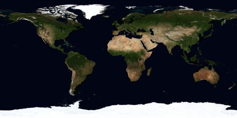
Equal Area Maps Show Realistic Continental Proportions
Equal area maps display landmasses with accurate size relationships that match their true proportions on Earth’s surface. You’ll see Africa appearing appropriately large compared to Greenland, maintaining the continent’s actual 14:1 size ratio. The Mollweide projection demonstrates this principle clearly, showing Antarctica’s true massive scale while preserving accurate area comparisons between all continents and countries for demographic analysis.
Conformal Maps Display Familiar Shapes but Distorted Sizes
Conformal maps present landmasses with recognizable outlines that preserve local angles and geometric shapes. You’ll find coastlines appearing natural and familiar, with countries maintaining their characteristic silhouettes. However, the Mercator projection dramatically inflates polar regions, making Greenland appear similar in size to Africa despite being 14 times smaller, creating misleading visual impressions for area-dependent spatial analysis.
Evaluating Real-World Examples: Famous Projections in Each Category
Professional cartographers rely on established projection systems that have proven their effectiveness across decades of real-world applications.
Notable Equal Area Projections Like Mollweide and Albers
Mollweide projection excels in global thematic mapping where continental size relationships matter most. You’ll find this projection displaying world population density maps and climate data visualizations because it maintains accurate proportional areas across all continents. Albers Equal Area Conic serves regional mapping needs perfectly, particularly for countries like the United States and Canada. Statistical agencies use Albers for census mapping and demographic analysis since it preserves area relationships within its coverage zone while minimizing distortion across mid-latitude regions.
Popular Conformal Projections Including Mercator and Lambert
Mercator projection remains the gold standard for marine navigation and web mapping applications like Google Maps. You’ll recognize its characteristic polar exaggeration, but it preserves angles and directions perfectly for navigation purposes. Lambert Conformal Conic dominates topographic mapping and aviation charts because it maintains shape accuracy across regional extents. Survey departments and engineering firms rely on Lambert for precise measurements and boundary mapping, as it preserves local angles while minimizing shape distortion across specific latitude zones.
Conclusion
Your success as a cartographer or GIS professional depends on making informed projection choices that align with your project’s specific requirements. Whether you’re analyzing population distributions or planning navigation routes the fundamental trade-offs between preserving area accuracy and maintaining shape integrity will guide your decision-making process.
Remember that there’s no universally perfect map projection – each serves distinct purposes and audiences. Equal area projections excel when statistical accuracy matters most while conformal projections shine in applications requiring geometric precision and recognizable shapes.
The key lies in understanding your data’s purpose and your audience’s needs. By mastering these projection principles you’ll create more effective maps that communicate spatial information accurately and avoid common misinterpretations that can compromise your analysis or mislead your viewers.
Frequently Asked Questions
What is the main difference between equal area and conformal projections?
Equal area projections preserve size relationships and maintain accurate area measurements, making them ideal for statistical analysis and density studies. Conformal projections preserve shape accuracy and local angles, making them essential for navigation and geometric precision. The key trade-off is that equal area projections distort shapes while conformal projections distort sizes.
When should I use equal area projections?
Use equal area projections for statistical and demographic mapping, population density studies, census data visualization, and any analysis requiring accurate proportional relationships between regions. They’re perfect when you need to compare the true sizes of different areas or analyze spatial distributions where area accuracy is crucial.
When are conformal projections most appropriate?
Conformal projections are best for navigation, engineering applications, topographic mapping, and situations requiring shape accuracy. They’re essential for marine navigation, aviation charts, web mapping applications, and any work where maintaining local angles and recognizable landmass shapes is more important than preserving area relationships.
What are some popular examples of equal area projections?
The Mollweide projection is excellent for global thematic mapping and displaying world population or climate data. The Albers Equal Area Conic projection is widely used for census mapping and regional analysis in mid-latitude areas. Both maintain accurate size relationships while sacrificing shape precision.
Which conformal projections are most commonly used?
The Mercator projection is the gold standard for marine navigation and web mapping applications like Google Maps. The Lambert Conformal Conic projection is preferred for topographic mapping, aviation charts, and engineering surveys due to its excellent shape accuracy and minimal distortion in mid-latitude regions.
How do these projections affect visual appearance on maps?
Equal area maps show continents in their true proportional sizes, with Africa and Antarctica appearing accurately relative to other landmasses. Conformal maps maintain familiar, recognizable shapes but can dramatically distort sizes, as seen in Mercator projections where polar regions appear much larger than they actually are.
What mathematical principles govern these projection types?
Equal area projections use mathematical constraints where the Jacobian matrix determinant equals one, maintaining constant area ratios. Conformal projections employ complex mathematical functions like Cauchy-Riemann equations to preserve angles, using logarithmic functions to maintain perpendicular grid lines and local geometric relationships.
Can a projection be both equal area and conformal?
No, it’s mathematically impossible for any map projection to be both perfectly equal area and conformal simultaneously. This is a fundamental limitation in cartography – you must choose between preserving area accuracy or shape accuracy, as maintaining both properties on a flat map is impossible.