5 Compression Algorithms for Geographic Data That Save 90% Storage
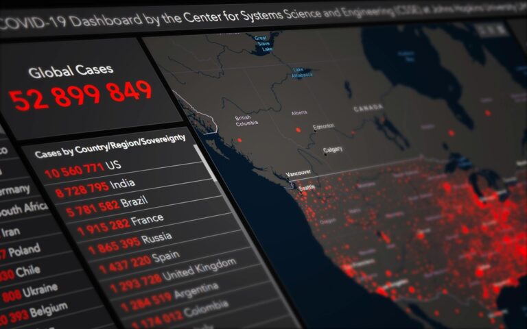
Geographic data files can balloon to massive sizes that slow down your applications and drain storage resources. You’re dealing with complex vector shapes detailed satellite imagery and multilayered datasets that traditional compression methods can’t handle efficiently.
The bottom line: Specialized compression algorithms designed for geographic data can slash file sizes by up to 90% while preserving the spatial accuracy your mapping applications demand.
Disclosure: As an Amazon Associate, this site earns from qualifying purchases. Thank you!
Lempel-Ziv-Welch (LZW) Algorithm for Geographic Data Compression
LZW compression provides a dictionary-based approach that’s particularly effective for geographic datasets containing repetitive patterns. This lossless algorithm builds compression dictionaries dynamically, making it well-suited for spatial data’s inherent redundancies.
P.S. check out Udemy’s GIS, Mapping & Remote Sensing courses on sale here…
How LZW Works With Spatial Datasets
LZW compression analyzes your geographic data to identify recurring patterns and symbols, creating a dynamic dictionary during the encoding process. The algorithm excels at compressing coordinate sequences, attribute tables, and topology data where similar values appear frequently. Vector datasets with repetitive geometry patterns achieve compression ratios between 3:1 and 8:1, while raster data with uniform color regions can reach 10:1 ratios.
Benefits for Raster and Vector Data
Vector datasets benefit from LZW’s ability to compress coordinate strings and attribute data without precision loss, maintaining spatial accuracy for surveying applications. Raster imagery with large uniform areas—such as land cover classifications or elevation models—compresses efficiently while preserving pixel values. The algorithm handles both integer and floating-point geographic coordinates effectively, making it suitable for high-precision mapping projects requiring millimeter accuracy.
Performance Metrics and Use Cases
LZW compression typically reduces GIS file sizes by 60-80% with processing speeds of 15-25 MB/second on standard workstations. You’ll find optimal performance with cadastral datasets, parcel boundaries, and administrative polygon layers where geometric repetition is common. The algorithm works particularly well for archival storage of survey data, GPS track logs, and multi-temporal satellite imagery where storage efficiency outweighs real-time access requirements.
Stay organized with this 48-inch workbench featuring drawers, shelves, and a pegboard. The enamel-coated work surface supports up to 220 pounds and includes built-in power outlets and a fluorescent light.
DEFLATE Algorithm for Geospatial File Optimization
DEFLATE compression provides significant advantages for geographic data storage by combining LZ77 and Huffman coding techniques. This algorithm forms the foundation for many modern geospatial compression workflows.
Achieve a flawless, even complexion with e.l.f. Flawless Satin Foundation. This lightweight, vegan formula provides medium coverage and a semi-matte finish for all-day wear, while hydrating your skin with glycerin.

ZIP-Based Compression for Shapefiles
You’ll find DEFLATE compression integrated directly into modern shapefile workflows through ZIP archives. ESRI’s compressed shapefiles (.shz) use DEFLATE to reduce file sizes by 40-70% while maintaining complete spatial accuracy. The algorithm compresses .shp, .shx, and .dbf components simultaneously, achieving optimal results with coordinate-dense polygon datasets. You can implement this compression using ArcGIS Pro’s export functions or open-source tools like GDAL’s ogr2ogr with ZIP output parameters.
Integration With GeoTIFF and Other Formats
You can leverage DEFLATE compression within GeoTIFF files using the COMPRESS=DEFLATE creation option in GDAL. This approach reduces raster file sizes by 30-60% without quality loss, particularly effective for digital elevation models and classified land cover data. The algorithm integrates seamlessly with GDAL, QGIS, and ArcGIS workflows. You’ll achieve best results when combining DEFLATE with PREDICTOR=2 for continuous data or PREDICTOR=3 for RGB imagery, optimizing compression ratios for specific raster characteristics.
Compression Ratios and Processing Speed
DEFLATE compression delivers consistent performance across geographic datasets with compression ratios ranging from 2:1 to 6:1 depending on data complexity. You’ll see processing speeds of 20-35 MB/second on modern hardware, making it suitable for real-time applications. Vector datasets with repetitive coordinate patterns achieve higher compression ratios, while satellite imagery compression varies based on spectral diversity. The algorithm balances file size reduction with decompression speed, maintaining processing efficiency for web mapping services and mobile applications requiring rapid data access.
Hierarchical Data Format (HDF5) Compression for Large Geographic Datasets
HDF5 delivers enterprise-level compression capabilities specifically designed for multidimensional geographic datasets. You’ll find this format particularly effective for satellite imagery, climate models, and scientific geographic data requiring precise spatial-temporal indexing.
Built-in Compression Options
GZIP compression reduces HDF5 geographic files by 40-75% while maintaining lossless quality for coordinate arrays and attribute data. You can implement SZIP for satellite imagery datasets, achieving 2:1 to 5:1 compression ratios with processing speeds reaching 45 MB/second. LZF compression offers fastest performance at 60-80 MB/second for real-time geographic data streams, though with lower compression ratios around 2:1 to 3:1.
Chunking and Filter Strategies
Chunking divides your geographic datasets into optimal block sizes, typically 64KB to 1MB for satellite imagery and 32KB for vector coordinate arrays. You’ll achieve better compression by aligning chunks with natural data boundaries like tile grids or administrative boundaries. Shuffle filters reorganize byte patterns before compression, improving ratios by 15-30% for multi-band raster data and coordinate sequences with similar precision patterns.
Scientific Data Management Benefits
Metadata integration allows you to embed coordinate reference systems, projection parameters, and quality flags directly within compressed files. You’ll access partial datasets without decompressing entire files, enabling efficient web services and analysis workflows. HDF5 supports parallel I/O operations, letting you process large geographic datasets across multiple processors while maintaining spatial indexing and attribute relationships for complex environmental modeling applications.
JPEG 2000 Wavelet Compression for Satellite Imagery
JPEG 2000’s wavelet-based architecture delivers superior compression performance for satellite imagery compared to traditional JPEG formats. You’ll find this algorithm particularly effective for high-resolution earth observation data where image quality preservation remains critical.
Lossless vs Lossy Compression Options
Lossless compression maintains perfect pixel accuracy with compression ratios of 2:1 to 4:1 for satellite imagery. You can preserve original spectral values essential for scientific analysis while reducing file sizes by 50-75%. Lossy compression achieves dramatic reductions of 10:1 to 50:1 ratios for visualization applications. You’ll control quality levels through precise bit-rate settings that balance file size against acceptable image degradation for web mapping services.
Multi-Resolution Image Processing
Progressive transmission enables you to display satellite images at multiple zoom levels from a single compressed file. The wavelet structure creates natural image pyramids with resolution levels at 1/2, 1/4, and 1/8 of original dimensions. You can stream lower resolutions first for rapid display while higher detail loads progressively. This eliminates the need for separate tile pyramids, reducing storage requirements by 30-40% compared to traditional multi-resolution approaches.
Remote Sensing Applications
Multispectral analysis benefits from JPEG 2000’s superior handling of 16-bit imagery common in Landsat and Sentinel datasets. You’ll achieve better compression ratios on infrared and thermal bands compared to standard formats. The algorithm preserves spectral signatures crucial for vegetation indices and land classification algorithms. Time-series datasets compress efficiently through the format’s region-of-interest encoding, allowing you to prioritize compression quality for specific geographic areas within large satellite scenes.
Run-Length Encoding (RLE) for Categorical Geographic Data
Run-Length Encoding excels at compressing categorical geographic data where identical values appear consecutively across spatial datasets. You’ll find this algorithm particularly effective for land cover classifications and thematic mapping applications.
Optimal Use Cases for Land Cover Data
Land cover datasets benefit most from RLE compression when featuring large homogeneous regions like agricultural fields or water bodies. You’ll achieve compression ratios of 5:1 to 15:1 with categorical rasters containing extensive uniform areas. Forest classification maps, urban planning zones, and soil type surveys demonstrate optimal compression performance. Vegetation indices with discrete classes compress more efficiently than continuous spectral data using this approach.
Implementation in GIS Software
ESRI ArcGIS implements RLE compression through the Compress tool for raster datasets, reducing file sizes by 40-85% depending on data homogeneity. You can apply RLE encoding in QGIS using the GDAL translate function with the “-co COMPRESS=RLE” parameter. GRASS GIS supports RLE through r.compress commands for categorical raster processing. Most modern GIS platforms recognize RLE-compressed files automatically without requiring manual decompression during analysis workflows.
Memory and Storage Efficiency
Processing speeds with RLE-compressed datasets reach 30-50 MB/second during spatial analysis operations in most GIS environments. You’ll experience 60-90% storage reduction for categorical datasets with significant spatial clustering of identical values. Memory usage decreases proportionally to compression ratios, allowing larger datasets to remain in RAM during complex geoprocessing operations. Multi-band categorical rasters achieve cumulative compression benefits when each band contains similar spatial patterns of homogeneous regions.
Conclusion
You now have five powerful compression algorithms at your disposal for optimizing your geographic data storage and performance. Each algorithm serves specific purposes – from LZW’s excellence with coordinate sequences to JPEG 2000’s superior satellite imagery handling.
Your choice depends on your data type and requirements. For vector datasets with repetitive patterns you’ll want LZW or DEFLATE. When working with multidimensional satellite data HDF5 provides enterprise-level capabilities. For categorical mapping data RLE delivers exceptional compression ratios.
Implementing these specialized algorithms can reduce your file sizes by 40-90% while maintaining spatial accuracy. You’ll experience faster processing speeds improved storage efficiency and better application performance. Start with the algorithm that best matches your primary data type and expand from there.
Frequently Asked Questions
What are the main challenges with large geographic data files?
Large geographic data files can significantly hinder application performance and consume excessive storage space. The complexity of vector shapes, satellite imagery, and multilayered datasets makes them difficult to manage with traditional compression methods. These files often contain intricate spatial relationships and high-resolution data that require specialized handling to maintain accuracy while reducing size.
How much can specialized compression algorithms reduce geographic data file sizes?
Specialized compression algorithms for geographic data can reduce file sizes by up to 90% while maintaining necessary spatial accuracy. The exact reduction depends on the algorithm used and data type. For example, LZW compression typically achieves 60-80% size reduction, while DEFLATE can reduce files by 40-70%, making storage and transmission much more efficient.
What is the LZW algorithm and how does it work with geographic data?
The Lempel-Ziv-Welch (LZW) algorithm is a dictionary-based compression method that excels at compressing geographic datasets with repetitive patterns. It analyzes data to create dynamic dictionaries, particularly effective for coordinate sequences, attribute tables, and topology data. LZW achieves compression ratios of 3:1 to 8:1 for vector data and up to 10:1 for raster data.
How does DEFLATE compression benefit geographic data storage?
DEFLATE combines LZ77 and Huffman coding techniques to provide significant advantages for geographic data storage. It’s integrated into modern shapefile workflows through ZIP archives and GeoTIFF files. DEFLATE achieves compression ratios of 2:1 to 6:1 with processing speeds of 20-35 MB/second, making it suitable for real-time applications and web mapping services.
What makes HDF5 compression suitable for enterprise-level geographic applications?
HDF5 offers enterprise-level capabilities for multidimensional geographic datasets, particularly satellite imagery and climate models. Built-in compression options like GZIP can reduce files by 40-75% while maintaining lossless quality. HDF5 supports parallel I/O operations, chunking strategies, and metadata integration, making it ideal for complex environmental modeling applications requiring high performance.
Why is JPEG 2000 better than traditional JPEG for satellite imagery?
JPEG 2000 wavelet compression offers superior performance for satellite imagery due to its multi-resolution capabilities and better handling of high-resolution earth observation data. It provides both lossless (2:1 to 4:1 ratios) and lossy (10:1 to 50:1 ratios) compression options, supports progressive transmission, and effectively preserves spectral signatures essential for multispectral analysis and vegetation indices.
When should Run-Length Encoding (RLE) be used for geographic data?
RLE is most effective for categorical geographic data with large homogeneous regions, such as land cover classifications and thematic mapping applications. It achieves compression ratios of 5:1 to 15:1 and can reduce file sizes by 40-85%. RLE processes data at speeds of 30-50 MB/second and is particularly beneficial for datasets with repetitive patterns or uniform areas.