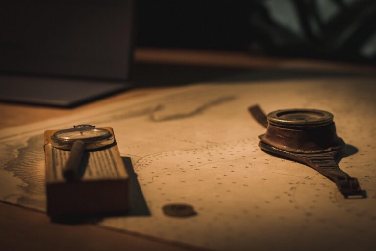
7 Best Map Creation Materials
Why it matters: Traditional paper maps are becoming obsolete as digital mapping dominates, but creative map-making using unconventional materials is experiencing a renaissance among educators, artists, and DIY enthusiasts.
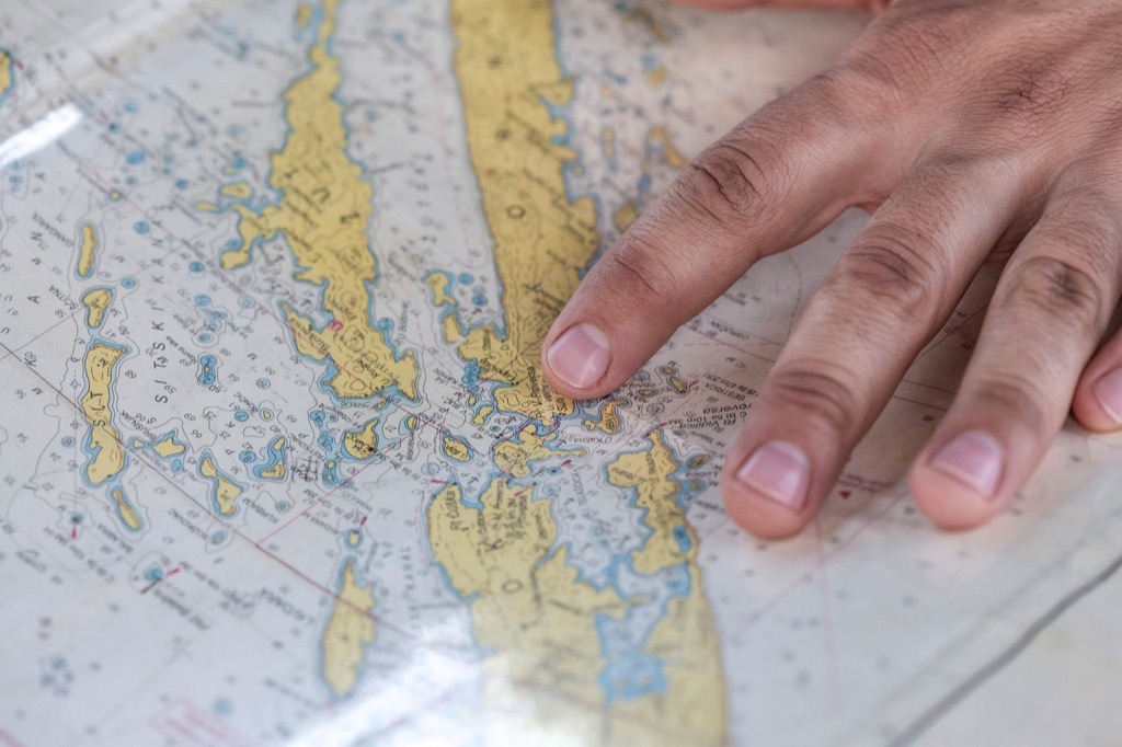
The big picture: You don’t need expensive cartography software or professional printing equipment to create engaging, tactile maps that capture attention and enhance learning experiences.
What’s next: These seven alternative materials will transform how you think about map creation â from household items to natural resources that make geography come alive in unexpected ways.
Disclosure: As an Amazon Associate, this site earns from qualifying purchases. Thank you!
P.S. check out Udemy’s GIS, Mapping & Remote Sensing courses on sale here…
Coffee Grounds and Tea Stains for Aged Parchment Maps
Enjoy the classic Dunkin' taste at home with this 30-ounce canister of pre-ground Original Blend medium roast coffee. Specially blended for a rich, smooth flavor, it's the coffee that made Dunkin' famous.

Coffee grounds and tea create stunning weathered effects that transform ordinary paper into authentic-looking historical maps. These natural materials produce organic staining patterns that commercial aging techniques can’t replicate.
Creating Realistic Weathered Textures
Brush used coffee grounds directly onto damp paper to create irregular terrain patterns and natural wear marks. The coarse texture mimics centuries of handling while darker particles settle into paper fibers. Apply grounds in circular motions around map edges and fold lines where historical wear would naturally occur. Press firmly with a cloth to embed particles, then shake off excess material before the paper dries completely.
Layering Different Stain Intensities for Depth
Start with light tea washes using chamomile or green tea for subtle base tones across your entire map surface. Apply stronger black tea concentrations around borders and high-wear areas like port cities or trade routes. Use concentrated coffee for darkest shadows in corners and along fold creases. Build layers gradually allowing each application to dry completely before adding the next intensity level for authentic depth variation.
Fabric and Textile Materials for Tactile Cartography
Fabric materials offer unique dimensional qualities that transform flat geography into touchable terrain, creating maps you can feel with your fingertips.
Using Canvas and Burlap for Rustic Appeal
Canvas provides an excellent foundation for relief maps because its tight weave holds paint and mixed media exceptionally well. You’ll find that heavy-weight cotton canvas (12-16 oz) creates the most durable base for topographical features. Burlap’s loose weave naturally represents grasslands and agricultural regions through its organic texture. Apply different fabric stains like walnut ink or coffee solutions to achieve varied landscape tones. Layer rope fibers onto burlap sections to represent mountain ridges and river systems effectively.
Incorporating Embroidery and Cross-Stitch Techniques
Cross-stitch techniques allow you to create precise political boundaries and city locations using contrasting thread colors. French knots work perfectly for marking individual settlements and population centers on your textile maps. You can represent different elevation levels by varying your thread thickness – use embroidery floss for lowlands and yarn for mountainous terrain. Satin stitch creates smooth highways and major transportation routes that stand out against textured backgrounds. Chain stitch effectively outlines coastlines and river systems with flowing, organic curves.
Natural Elements and Organic Materials for Eco-Friendly Maps
Sustainable mapping materials connect geography with environmental consciousness while creating authentic textures that digital tools can’t replicate.
Sand and Salt for Desert and Coastal Terrains
Sand grains create realistic desert topography when mixed with clear adhesive or mod podge on your map base. Fine beach sand works best for representing the Sahara or Mojave regions while coarser construction sand mimics rocky desert terrain. Salt crystals simulate salt flats and coastal features with stunning accuracy. Spread table salt over wet glue to create the Bonneville Salt Flats or Dead Sea shorelines. Layer different grain sizes to show elevation changes and add food coloring to represent mineral deposits found in natural salt formations.
Pressed Flowers and Leaves for Geographic Features
Pressed flowers transform botanical geography into tactile learning experiences by representing specific regional flora. Small wildflowers work perfectly for marking prairie regions while fern fronds indicate temperate rainforest areas. Dried leaves create forest canopy representations with maple leaves showing deciduous forests and pine needles marking coniferous regions. Arrange pressed materials in clusters to show vegetation density and use different leaf colors to indicate seasonal changes. Apply clear contact paper over delicate specimens to preserve them while maintaining their natural textures and educational value.
Recycled Paper and Cardboard for Sustainable Map Making
Recycled materials offer cartographers an environmentally conscious approach to creating detailed maps while reducing printing costs and material waste.
Newspaper Collages for Urban Planning Maps
Newspaper sections create realistic urban textures that mirror the complexity of city districts. You’ll find that financial pages work perfectly for business districts, sports sections represent recreational areas, and classified ads simulate residential neighborhoods. Layer different newspaper types to show population density variations. Cut articles into building-shaped pieces to represent individual structures. The varying text densities naturally create visual hierarchy that distinguishes commercial zones from residential areas.
Corrugated Cardboard for Topographical Relief
Corrugated cardboard layers build authentic elevation models with distinct topographical features. Stack multiple cardboard sheets to create mountain ranges, cutting each layer progressively smaller to form realistic slopes. The natural ridges in corrugated material simulate terrain texture perfectly. Use single-wall cardboard for gentle hills and double-wall for dramatic peaks. Paint or stain the cardboard edges to enhance elevation contrast. This technique creates tactile maps where users can physically feel altitude changes.
Digital and Tech-Based Alternative Materials
Modern technology offers innovative approaches to cartographic creation that blend traditional mapping principles with contemporary tools. These digital alternatives provide precision and interactivity that enhance geographic understanding.
LED Strips and Circuit Boards for Interactive Maps
Control these 100ft RGB LED strip lights via Bluetooth app or remote to customize colors and brightness. Sync them to music for a dynamic party atmosphere and set timers for automatic on/off.

LED strips transform static maps into dynamic educational tools by illuminating different geographic features on command. You can program individual LED segments to highlight trade routes, population density, or elevation changes through simple microcontroller circuits like Arduino or Raspberry Pi. Circuit boards create interactive buttons that trigger specific map elements, allowing users to explore layers of geographic data through touch-activated lighting sequences that make complex spatial relationships immediately visible.
3D Printing Filaments for Custom Cartographic Models
Create 3D art with the SCRIB3D P1 3D Pen! This easy-to-use pen features adjustable speed control and includes PLA filament, a stencil book, and project guide to get you started.

3D printing filaments enable precise topographical reproduction with materials like PLA plastic for detailed terrain models and flexible TPU for tactile geographic features. You can print elevation data directly from digital elevation models, creating accurate relief maps with color-coded filaments representing different altitude ranges. Multi-material printing allows combination of rigid base layers with flexible overlay features, producing durable educational models that showcase everything from watershed boundaries to urban development patterns with millimeter-level accuracy.
Edible Materials for Temporary and Educational Maps
You can transform geography lessons into memorable experiences using edible materials that students can touch, build, and eventually consume. These temporary mapping solutions create interactive learning opportunities while making abstract geographic concepts tangible and engaging.
Cookie Dough and Icing for Geography Lessons
Enjoy warm, homemade chocolate chip cookies in minutes with Pillsbury's Ready to Bake dough. This 16oz package makes 24 cookies and is made with real chocolate, free from high fructose corn syrup and artificial colors.

Cookie dough serves as an excellent base material for creating topographical relief maps that students can shape and modify during lessons. You’ll find sugar cookie dough works best because it holds its form while remaining pliable enough for detailed terrain features. Roll the dough to different thicknesses to represent elevation changes, then use colored icing to mark political boundaries, rivers, and climate zones. Students can press their fingers into the dough to create valleys and mountain ranges, making the learning process both tactile and delicious.
Chocolate and Candy for Sweet Cartography Projects
Chocolate provides versatile mapping material that you can mold into three-dimensional geographic features while maintaining educational accuracy. Melted chocolate can be poured into custom molds to create consistent landmasses, while chocolate chips represent cities and settlements at appropriate scales. Combine different candy types to distinguish geographic elements – use green gummy bears for forests, blue rock candy for water bodies, and crushed graham crackers for desert regions. This approach transforms complex cartographic concepts into engaging projects that students remember long after the lesson ends.
Mixed Media and Art Supply Innovations
Art supply stores offer endless possibilities for creative cartographers seeking unique textures and visual effects that traditional materials can’t achieve.
Watercolor and Acrylic Paint Combinations
Create vibrant watercolor art with this portable set. It includes 40 colors (metallic & fluorescent), a brush pen, watercolor paper, and more, all in a stylish tin box.

Watercolor transparency creates realistic elevation gradients while acrylic paint adds dimensional features to your maps. Apply watercolor washes first to establish base terrain colors like blues for water bodies and greens for forests. Layer acrylic paint strategically over dried watercolor sections to highlight mountain ridges and urban areas. You’ll achieve depth by mixing wet-on-wet watercolor techniques with precise acrylic detailing for roads and boundaries.
Collage Techniques with Magazine Cutouts and Photos
Magazine photographs transform abstract geography into recognizable landscapes that engage viewers immediately. Cut architectural images from travel magazines to represent different urban areas and paste landscape photos to show regional terrain variations like deserts or forests. Layer translucent materials over magazine cutouts to create atmospheric effects while maintaining the recognizable imagery underneath. This technique works especially well for thematic maps focusing on cultural geography or tourism.
Conclusion
Your journey into alternative map creation opens up endless possibilities for bringing geography to life. These unconventional materials transform static cartography into dynamic hands-on experiences that engage multiple senses and learning styles.
Whether you’re an educator seeking innovative teaching tools or an artist exploring creative expression you’ll find these techniques both accessible and rewarding. From coffee-stained vintage maps to LED-illuminated interactive displays each method offers unique advantages for different projects and audiences.
The beauty of alternative map-making lies in its flexibility and sustainability. You can combine multiple techniques create entirely new approaches or adapt these ideas to fit your specific needs and available resources.
Start experimenting with materials you already have at home and watch as your maps become conversation pieces that inspire curiosity and deeper geographic understanding.
Frequently Asked Questions
What are the main benefits of using alternative materials for map-making?
Alternative materials make geography more interactive and engaging while being cost-effective. They create tactile learning experiences that digital tools can’t replicate, allowing users to physically feel topographical features. These materials also promote environmental consciousness through sustainable practices and transform abstract geographic concepts into tangible, memorable experiences.
How can coffee grounds and tea stains be used to create aged-looking maps?
Coffee grounds and tea stains create authentic weathered effects that mimic historical maps. Apply used coffee grounds to paper surfaces for texture, then use tea stains of varying intensities to create depth and aging effects. Layer different stain concentrations to achieve realistic vintage appearances that look and feel authentically aged.
What fabric materials work best for tactile map-making?
Canvas serves as an excellent durable base for relief maps, while burlap’s organic texture effectively represents grasslands and agricultural regions. These materials can be enhanced with fabric stains and layered rope fibers to create topographical features. Embroidery and cross-stitch techniques can depict political boundaries and elevation levels for added dimension.
How can natural elements be incorporated into eco-friendly maps?
Sand and salt effectively represent desert and coastal terrains, with sand grains creating realistic topography and salt crystals simulating salt flats. Pressed flowers and leaves can represent vegetation and geographic features, indicating density and seasonal changes. These organic materials connect geography with environmental consciousness while creating authentic textures.
What role does recycled paper and cardboard play in sustainable map-making?
Recycled materials offer environmental benefits and cost-effectiveness. Newspaper collages create realistic urban planning maps using different sections for city districts. Corrugated cardboard can be layered to build topographical relief models, allowing users to physically feel elevation changes while promoting sustainability in cartographic creation.
How can modern technology enhance traditional map-making techniques?
LED strips and circuit boards create interactive maps with touch-activated lighting to explore spatial relationships. 3D printing filaments enable precise topographical reproduction and durable educational models. These digital alternatives blend traditional mapping principles with contemporary tools, enhancing geographic understanding through interactive learning experiences.
What are the advantages of using edible materials for educational maps?
Edible materials transform geography lessons into memorable, engaging experiences. Cookie dough can be shaped into topographical relief maps with colored icing marking boundaries and climate zones. Chocolate and candy create three-dimensional features, making abstract geographic concepts tangible, delicious, and particularly effective for student engagement and retention.
How do mixed media techniques improve map visualization?
Combining watercolor and acrylic paints creates realistic elevation gradients and dimensional features through layering techniques. Collage methods using magazine cutouts and photos transform abstract geography into recognizable landscapes. These approaches are especially effective for thematic maps focusing on cultural geography or tourism, enhancing visual appeal and viewer engagement.