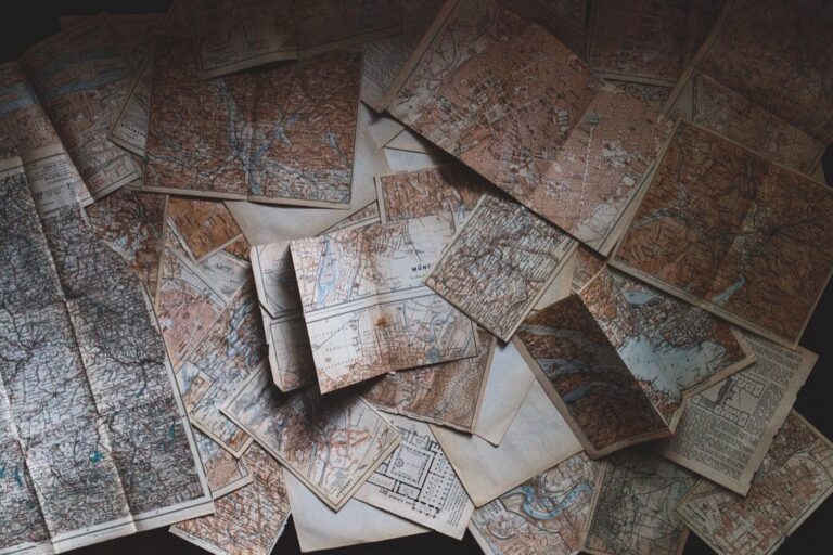
6 Historical Methods of Map Reproduction Lost to Modern Maps
You’ve probably never thought about how maps were copied before photocopiers and digital printing transformed the world. For centuries cartographers and publishers faced the monumental challenge of reproducing detailed geographical information accurately and efficiently to meet growing demand for navigation and exploration.
From ancient hand-copying techniques to revolutionary printing innovations these six historical methods shaped how knowledge spread across continents and changed the course of human discovery. Understanding these reproduction methods reveals the incredible ingenuity behind the maps that guided explorers merchants and armies throughout history.
Disclosure: As an Amazon Associate, this site earns from qualifying purchases. Thank you!
Hand-Drawn Manuscript Maps: The Art of Medieval Cartography
Medieval cartographers faced the monumental task of creating each map entirely by hand, transforming geographical knowledge into intricate artistic masterpieces. You’ll discover that these manuscript maps weren’t just functional tools but represented the pinnacle of medieval craftsmanship and scholarly dedication.
P.S. check out Udemy’s GIS, Mapping & Remote Sensing courses on sale here…
Illuminated Manuscripts and Monastic Scriptoriums
Monastic scriptoriums served as the primary centers for map production during the medieval period, where dedicated monks spent months creating single geographical works. You’ll find that these religious institutions combined artistic illumination with geographical knowledge, producing maps like the famous Hereford Mappa Mundi around 1300. Scribes used gold leaf, vibrant pigments, and elaborate decorative borders to transform functional cartography into sacred art. Each manuscript map required specialized knowledge of both geography and artistic techniques, making these works incredibly valuable and rare.
Vellum and Parchment as Primary Materials
Vellum and parchment provided the durable foundation for medieval map reproduction, with calfskin vellum being the premium choice for important cartographic works. You’ll notice that mapmakers preferred these materials because they could withstand repeated handling and resist fading better than paper alternatives. The preparation process involved stretching, scraping, and treating animal skins to create smooth writing surfaces that accepted ink and pigments effectively. Quality vellum could last centuries, which explains why many medieval maps like the Cantino Planisphere from 1502 remain remarkably well-preserved today.
Achieve a flawless, even complexion with e.l.f. Flawless Satin Foundation. This lightweight, vegan formula provides medium coverage and a semi-matte finish for all-day wear, while hydrating your skin with glycerin.

The Role of Scribes in Geographic Knowledge Preservation
Scribes functioned as the critical link between geographical discoveries and public knowledge, manually copying and updating maps based on travelers’ accounts and scholarly sources. You’ll understand that these skilled professionals didn’t simply reproduce existing maps but often combined multiple sources to create more comprehensive geographical representations. Master scribes developed standardized symbols and conventions that became the foundation for modern cartographic practices. Their meticulous work ensured that valuable geographical information survived through political upheavals and natural disasters, creating an unbroken chain of cartographic knowledge transmission.
Woodblock Printing: Revolutionizing Map Distribution in the 15th Century
Woodblock printing transformed cartography from an exclusive craft to a mass medium. This relief printing method allowed mapmakers to produce identical copies at unprecedented scales, fundamentally changing how geographic knowledge spread across continents.
Chinese Origins and European Adoption
Chinese craftsmen perfected woodblock printing for maps during the Tang Dynasty, creating detailed geographical works centuries before European adoption. European mapmakers embraced this technique in the 1400s after observing its effectiveness for reproducing complex illustrations. You’ll find that German and Italian printing centers became the first to adapt woodblock methods for Western cartographic needs. The transition from manuscript to print revolutionized European mapmaking, enabling publishers like Sebastian Münster to distribute standardized atlases across multiple countries.
Carved Relief Printing Techniques
Skilled artisans carved map details into wooden blocks using specialized gouges and knives, creating raised surfaces that held ink during printing. You’d reverse-carve all text and geographical features since the printing process created mirror images of the original design. Master carvers spent weeks on single map blocks, meticulously cutting coastlines, mountain ranges, and place names into hardwoods like boxwood or pearwood. The relief printing process required precise pressure application to transfer ink from raised surfaces to paper without smudging fine details.
Inspire creativity with this 100-piece Melissa & Doug wooden block set. Featuring 4 colors and 9 shapes, these FSC-certified blocks are perfect for building and early math exploration.

Mass Production Capabilities and Limitations
Woodblock printing enabled publishers to produce hundreds of map copies from a single carved block, dramatically reducing per-unit costs compared to hand-copying methods. You could print approximately 1,000-2,000 impressions before block deterioration affected map quality. However, corrections required re-carving entire sections, making updates expensive and time-consuming. The technique excelled at bold geographical features but struggled with fine detail reproduction, limiting the precision of smaller-scale maps and coastal surveys that required intricate linework.
Copper Plate Engraving: The Golden Age of Detailed Cartography
Copper plate engraving emerged in the 16th century as the most sophisticated map reproduction technique of its era. This method produced maps with unprecedented precision and artistic quality that dominated cartographic publishing for over 300 years.
Intaglio Printing Process and Precision
Intaglio printing revolutionized map accuracy by allowing cartographers to incise incredibly fine lines directly into copper plates using specialized tools called burins. You’d achieve remarkable detail levels because the engraved lines held ink below the plate surface, creating sharp impressions when pressed onto dampened paper. This process enabled mapmakers to reproduce coastal features, mountain ranges, and political boundaries with precision that exceeded woodblock capabilities by significant margins. The technique required skilled craftsmen who could control line depth and spacing to create consistent, high-quality reproductions across multiple print runs.
Dutch and Italian Mastery of the Technique
Dutch publishers dominated copper plate cartography during the 17th century’s Golden Age, establishing Amsterdam as Europe’s premier map production center. Companies like Blaeu and Hondius perfected large-scale atlas production, creating works such as the Atlas Maior that contained over 600 detailed maps. Italian engravers in Venice and Rome contributed significant innovations in decorative cartouches and compass roses that became standard elements. You’ll find that Dutch workshops employed teams of specialized craftsmen who could produce atlas pages measuring up to 24 by 18 inches with consistent quality standards that remained unmatched for centuries.
Explore the world with this 1665 Atlas Maior reproduction. Features multilingual text in English, French, and German.

Enhanced Detail and Artistic Flourishes
Enhanced copper plate maps featured intricate decorative elements that transformed functional navigation tools into artistic masterpieces collectors prized. You’d discover elaborate cartouches containing publication information, mythological sea creatures populating ocean areas, and detailed city views inserted as insets within larger regional maps. Engravers added topographical shading techniques called hachuring to represent mountain ranges and elevation changes with three-dimensional effects. These artistic flourishes didn’t compromise accuracy but enhanced readability while demonstrating the publisher’s craftsmanship and attention to aesthetic detail that distinguished premium cartographic products from basic navigation charts.
Lithographic Printing: The 19th Century Innovation
Lithographic printing emerged in the late 1790s as a revolutionary technique that transformed map reproduction by utilizing the chemical properties of oil and water repulsion. This method offered cartographers unprecedented flexibility in creating detailed maps with superior artistic quality compared to previous engraving techniques.
Stone Surface Printing Technology
Stone surface printing relies on specially prepared limestone blocks that accept both oil-based inks and water simultaneously. You’ll find that Bavarian limestone became the preferred material because of its fine grain structure and porosity. The process begins when cartographers draw directly onto the stone surface using greasy crayons or lithographic pencils. Chemical treatments then fix the image permanently onto the stone. Water applied to the surface adheres only to non-image areas while oil-based printing inks stick exclusively to the drawn portions, creating clean reproductions.
Learn the complete ink manufacturing process, from raw materials to finished products. This guide covers writing, copying, safety, and printing inks, plus ink pencils.

Improved Color Reproduction Methods
Color reproduction improved dramatically through lithographic printing’s ability to layer multiple colored inks precisely. You can achieve vibrant topographical maps by printing separate stones for each color – typically blue for water features, brown for elevation contours, and green for vegetation. Registration marks ensure perfect alignment between color layers. Hand-coloring remained common for premium atlas editions, but lithography enabled consistent color application across large print runs. French cartographers particularly excelled at chromolithography, producing maps with up to twelve distinct colors that rivaled hand-painted manuscripts.
Explore Texas with this comprehensive atlas. It features detailed topographic maps, back roads, and points of interest for outdoor enthusiasts.

Faster Production Times and Cost Effectiveness
Production times decreased significantly compared to copper plate engraving because lithographic stones required less preparation and could print hundreds of copies without quality degradation. You’ll discover that a skilled lithographer could complete detailed map artwork in days rather than weeks. Stone durability allowed publishers to store printing surfaces for future editions and reprints. Cost savings reached 60-70% compared to engraving methods, making detailed maps accessible to middle-class buyers for the first time. Large publishing houses like Justus Perthes in Germany capitalized on these efficiencies to dominate European map markets throughout the 19th century.
Photomechanical Reproduction: Bridging Traditional and Modern Methods
Photomechanical reproduction emerged in the mid-19th century as a revolutionary technique that combined traditional printing methods with emerging photographic technologies. This approach eliminated many human errors inherent in hand-copying geographic features while maintaining the precision cartographers demanded.
Early Photography Applications in Cartography
Photography transformed map reproduction by allowing you to capture existing maps directly onto light-sensitive materials. French cartographer Aimé Laussedat pioneered photogrammetric techniques in the 1850s, using camera measurements to create accurate topographical surveys. You could reduce original maps to smaller scales through photographic reduction processes, maintaining proportional accuracy across different editions. Military surveyors adopted these methods during the American Civil War, producing battlefield maps within hours rather than weeks. Camera-based reproduction eliminated transcription errors that plagued hand-copying methods, ensuring consistent geographic detail across multiple printed copies.
Zinc Plate Etching Processes
Zinc plate etching revolutionized map production by combining photographic images with chemical etching techniques. You’d transfer photographic negatives of maps onto zinc plates coated with light-sensitive emulsion, creating precise printing surfaces through acid-etching processes. This method produced sharper line quality than traditional woodblock printing while reducing production costs compared to copper plate engraving. German publishers like Justus Perthes perfected zinc etching techniques in the 1870s, creating detailed topographical maps with consistent line weights. You could make corrections directly on zinc plates using specialized tools, allowing for rapid updates to geographic information without recreating entire printing surfaces.
Standardization of Map Accuracy
Photomechanical reproduction established consistent standards for geographic accuracy across different map series and publishers. You could reproduce survey measurements with mathematical precision, eliminating variations introduced by individual engravers’ interpretations of source materials. Government mapping agencies adopted standardized scales and projection systems, ensuring compatibility between different cartographic products. The U.S. Geological Survey implemented systematic photomechanical processes in the 1880s, creating uniform topographical map series with consistent symbol systems and elevation representations. You’d follow established protocols for feature classification and boundary delineation, producing maps that met scientific standards for navigation and land surveying applications.
Offset Printing: The Industrial Revolution of Map Making
Offset printing emerged in the early 20th century as the most revolutionary advancement in cartographic reproduction, fundamentally transforming how you could produce maps at commercial scales. This technique combined the precision of lithographic principles with industrial machinery, enabling mass production of high-quality maps that met the growing demands of urbanization and global commerce.
Rubber Blanket Transfer Technology
Offset printing utilizes a rubber blanket cylinder that transfers ink from the printing plate to paper, creating consistently sharp map details across thousands of copies. You’ll find this indirect transfer method prevents direct plate-to-paper contact, preserving the printing surface for extended production runs. The rubber blanket’s flexibility allows you to print on various paper textures and weights, from lightweight survey sheets to heavy atlas stock. This technology eliminated the uneven impressions common in direct lithographic printing, ensuring every topographical line and place name appears with identical clarity throughout your entire print run.
High-Volume Commercial Production
Commercial offset presses revolutionized map publishing by producing thousands of identical copies per hour, making detailed cartographic products affordable for schools, businesses, and government agencies. You can now run continuous production schedules that were impossible with earlier reproduction methods, meeting the demands of rapidly expanding educational markets and military requirements. Major publishing houses like Rand McNally capitalized on these capabilities, establishing factory-scale operations that produced standardized road atlases and reference maps. The economies of scale achieved through offset printing reduced individual map costs by up to 90% compared to lithographic reproduction, democratizing access to accurate geographical information.
Plan your next road trip with the Rand McNally 2026 Large Scale Road Atlas. Featuring detailed maps of the United States, Canada, and Mexico, this atlas offers comprehensive coverage for easy navigation.

Color Registration and Quality Control
Offset printing introduced sophisticated color registration systems that ensure precise alignment of multiple ink layers, creating vibrant topographical maps with accurate color coding for elevation, vegetation, and political boundaries. You’ll benefit from mechanical registration marks and automated monitoring systems that maintain consistent color placement throughout extended print runs. Quality control procedures include densitometry measurements and color matching protocols that guarantee uniform cartographic standards across different production batches. This systematic approach to color management enabled the development of standardized cartographic color schemes that remain industry standards today, ensuring your maps maintain professional accuracy and visual consistency.
Conclusion
These six reproduction methods fundamentally shaped how geographical knowledge spread throughout history. Each technique represented a significant leap forward in accessibility and accuracy that transformed exploration and commerce.
You can trace the evolution from painstaking hand-copying to industrial-scale printing through these innovations. The progression demonstrates how technological advances consistently lowered costs while improving quality and distribution speed.
Understanding these historical methods gives you insight into the challenges early cartographers faced and the ingenuity they employed. Their dedication to sharing geographical knowledge laid the foundation for today’s digital mapping technologies that you use every day.
Frequently Asked Questions
What were the main methods of map reproduction before photocopiers and digital printing?
Before modern technology, cartographers used six primary reproduction techniques: hand-copying in medieval scriptoriums, woodblock printing from the 15th century, copper plate engraving in the 16th century, lithographic printing from the late 18th century, photomechanical reproduction in the mid-19th century, and offset printing in the early 20th century. Each method progressively improved accuracy, efficiency, and accessibility of geographical information.
How did medieval monks contribute to early map reproduction?
Medieval monks in monastic scriptoriums served as the primary map producers, combining artistic illumination with geographical knowledge. They hand-copied maps on durable materials like vellum and parchment, preserving geographic information through manual copying and updating based on travelers’ accounts. Famous examples include the Hereford Mappa Mundi, showcasing their craftsmanship and scholarly dedication to maintaining valuable geographical knowledge.
What advantages did woodblock printing offer over hand-copying methods?
Woodblock printing, introduced in the 15th century, revolutionized map distribution by enabling identical copies at unprecedented scales. It significantly reduced production costs compared to hand-copying and allowed mass production capabilities. However, it had limitations in reproducing fine details and making corrections was time-consuming, as changes required carving new wooden blocks entirely.
Why was copper plate engraving considered the most sophisticated reproduction technique?
Copper plate engraving, emerging in the 16th century, used intaglio printing to incise fine lines into copper plates, producing sharp impressions with unprecedented precision. This technique significantly improved accuracy of coastal features, mountain ranges, and political boundaries. Dutch publishers dominated during the 17th century’s Golden Age, creating detailed atlases that transformed functional navigation tools into prized artistic masterpieces.
How did lithographic printing change map reproduction in the late 18th century?
Lithographic printing utilized oil and water repulsion properties, providing unprecedented flexibility and superior artistic quality. It used specially prepared limestone blocks for clean reproductions, enabled vibrant color reproduction through precise ink layering, and significantly reduced production times and costs compared to copper plate engraving. This made detailed maps accessible to broader audiences for the first time.
What role did photomechanical reproduction play in 19th century cartography?
Photomechanical reproduction combined traditional printing with photographic technologies, reducing human errors while maintaining precision. Pioneers like Aimé Laussedat used photogrammetric techniques for accurate topographical surveys. Military surveyors adopted these methods during the American Civil War for rapid map production. This technique standardized map accuracy and enabled government agencies to ensure consistent geographic representation.
How did offset printing revolutionize 20th century map production?
Offset printing combined lithographic principles with industrial machinery for mass production, meeting demands of urbanization and global commerce. It featured rubber blanket transfer technology ensuring sharp details across thousands of copies, high-volume production capabilities making maps affordable for schools and businesses, and sophisticated color registration systems that established standardized cartographic color schemes still used today.