5 Best Map Export Formats for Digital Projects
Why it matters: Choosing between vector and raster formats for your map exports can make or break your project’s success.
The big picture: Vector maps use mathematical equations to create scalable graphics while raster maps rely on pixel grids that capture detailed imagery. Your choice impacts everything from file size and print quality to web performance and editing capabilities.
What’s next: Understanding these five critical differences will help you select the right format for your specific mapping needs and avoid costly mistakes down the road.
Disclosure: As an Amazon Associate, this site earns from qualifying purchases. Thank you!
P.S. check out Udemy’s GIS, Mapping & Remote Sensing courses on sale here…
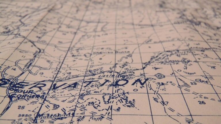
Understanding Vector and Raster Map Formats
These two fundamental formats serve different purposes in cartographic workflows and export strategies.
What Are Vector Maps
Vector maps store geographic data as mathematical points, lines, and polygons using coordinate systems. Your GPS navigation system relies on vector data to calculate routes and display road networks. Vector formats like SVG, PDF, and KML maintain their crisp appearance at any zoom level because they’re resolution-independent. Vector maps excel for navigation applications, print cartography, and web mapping where users need to zoom without losing detail. They’re perfect for displaying boundaries, transportation networks, and point locations with infinite scalability.
Navigate confidently with the Garmin Drive™ 53 GPS. This navigator features a bright, high-resolution touchscreen and provides helpful driver alerts for school zones, speed changes, and more.

What Are Raster Maps
Raster maps consist of pixel grids where each cell contains specific color and attribute information. Satellite imagery, aerial photography, and topographic maps typically use raster formats like GeoTIFF, JPEG, and PNG. Raster maps provide photorealistic detail and continuous data representation that’s essential for terrain analysis and environmental mapping. They’re ideal when you need to display complex imagery, elevation models, or land cover data where every pixel represents a measured value or captured detail.
Plan your next adventure with the 2025 National Geographic Road Atlas, covering the United States, Canada, and Mexico. Its durable, folded format (11 x 15 in) makes it ideal for hiking and camping trips.

Common Export Scenarios
Export decisions depend on your intended use and audience requirements. Web mapping applications typically favor vector formats for interactive features and fast loading times, while printed atlases often require high-resolution raster outputs for detailed imagery. Mobile apps benefit from vector data’s smaller file sizes and offline capabilities. Scientific publications frequently combine both formats – vector overlays for boundaries and labels with raster backgrounds for satellite imagery or elevation data.
File Size and Storage Requirements
Your choice between vector and raster exports directly impacts storage needs and file transfer efficiency. Understanding these size differences helps you plan storage infrastructure and optimize delivery methods.
Vector Maps Maintain Compact File Sizes
Vector maps store geographic data as mathematical coordinates and formulas rather than individual pixels. This approach creates remarkably small files—a detailed city map might occupy only 2-5 MB as a vector file. Complex road networks with thousands of street segments compress efficiently because they’re stored as coordinate pairs and styling instructions. You’ll find that adding map layers increases file size minimally since each feature adds just coordinate data.
Raster Maps Create Larger Files
Raster maps store every pixel individually, creating substantially larger files than their vector counterparts. A high-resolution satellite image covering the same city area can easily reach 50-200 MB or more. Print-quality raster maps at 300 DPI generate files that often exceed 500 MB for poster-sized outputs. Each pixel requires color information storage, and detailed imagery with millions of pixels quickly accumulates significant file sizes.
Impact on Storage and Transfer
Storage requirements multiply rapidly when managing multiple raster exports across different projects. You’ll need robust server infrastructure to handle hundreds of high-resolution map files efficiently. Network transfer becomes critical—vector files upload and download within seconds while large raster files may require minutes over standard connections. Mobile applications particularly benefit from vector’s compact size, ensuring faster app performance and reduced data consumption for users.
Scalability and Resolution Quality
Vector and raster formats handle scaling and resolution fundamentally differently, directly impacting your map’s visual quality across various output sizes.
Vector Maps Scale Without Quality Loss
Vector maps maintain crisp, sharp edges at any zoom level because they’re built from mathematical equations rather than fixed pixels. You can enlarge a vector map from business card size to billboard dimensions without losing detail or introducing artifacts. This resolution independence makes vector exports ideal for multi-platform projects where you need consistent quality across print materials, web displays, and mobile screens. Professional cartographers rely on vector formats when creating base maps that’ll be reproduced at multiple scales, ensuring text remains readable and line weights stay proportional.
Explore and map the wilderness for the Queen in Cartographers! Draw unique terrain shapes and score points based on randomly selected goals each game, but beware of monster ambushes.

Raster Maps Face Pixelation Issues
Raster maps lose quality when scaled beyond their original resolution, creating visible pixelation and blurred edges that compromise professional appearance. You’ll notice jagged lines and fuzzy text when enlarging raster exports, particularly problematic for print applications requiring high DPI outputs. A 300 DPI raster map designed for 8×10 inches becomes unusable when stretched to poster size, forcing you to recreate the entire export at higher resolution. This limitation requires careful planning of your final output dimensions before beginning the mapping process.
Best Practices for Different Use Cases
Choose vector exports for interactive web maps, multi-scale print projects, and applications requiring frequent zoom operations across different devices. Select raster formats when working with satellite imagery, aerial photography, or detailed terrain visualizations where photorealistic quality takes precedence over scalability. For hybrid projects, consider exporting vector base layers separately from raster imagery overlays, allowing you to maintain scalability for cartographic elements while preserving photographic detail. Always test your chosen format at the intended final output size before committing to large-scale production runs.
Editing Capabilities and Flexibility
Your post-export editing workflow differs dramatically between vector and raster formats, affecting project timelines and revision capabilities.
Vector Maps Allow Individual Element Editing
Vector exports preserve your map elements as separate, editable objects in design software like Adobe Illustrator or Inkscape. You can modify individual roads, adjust label positioning, or change polygon fills without affecting surrounding elements. This granular control lets you fine-tune cartographic details, update specific features, and maintain design consistency across multiple map versions. Professional cartographers often prefer vector exports because they enable precise adjustments to typography, symbology, and spatial relationships after the initial GIS export process.
Learn Adobe Illustrator with the 2025 release of this comprehensive guide. Master essential skills through hands-on lessons.

Raster Maps Require Pixel-Level Changes
Raster exports flatten your map into a single image layer, limiting editing options to pixel-based modifications in software like Photoshop or GIMP. You’ll need to use painting tools, selection masks, and layer techniques to make changes, which can be time-consuming for complex edits. Color corrections and overall adjustments work well with raster formats, but modifying specific map elements requires careful masking and often results in quality degradation. These limitations make raster exports less suitable for projects requiring frequent revisions or client feedback cycles.
Software Compatibility Considerations
Vector formats integrate seamlessly with professional design suites, allowing import into InDesign layouts, Illustrator compositions, and web development workflows. Most vector editing software supports common formats like SVG, AI, and PDF, ensuring broad compatibility across platforms. Raster formats offer universal compatibility but limit your editing tools to image processing software. Consider your team’s software capabilities and project requirements when choosing export formats, as vector workflows require design software subscriptions while raster editing can utilize free alternatives like GIMP or online editors.
Loading Speed and Performance
When you’re selecting between vector and raster exports, loading speed directly impacts user experience and system performance. Understanding how each format processes data helps you optimize your mapping projects for different delivery methods.
Vector Maps Process Mathematical Calculations
Vector maps require real-time mathematical rendering, which means your device’s processor calculates each line and polygon during display. This computational overhead can slow initial loading times, especially for complex datasets with thousands of geographical features. However, once rendered, vector maps cache efficiently and respond quickly to user interactions like zooming and panning without requiring additional data downloads.
Raster Maps Display Pre-Rendered Images
Raster maps load as static image files, eliminating processing overhead since all visual elements are already rendered. Your browser or application simply displays the pre-calculated pixels, resulting in faster initial load times for complex geographical areas. However, you’ll need multiple resolution versions for different zoom levels, increasing total bandwidth requirements and storage needs across your mapping platform.
Performance Factors to Consider
Network bandwidth significantly affects loading performance, with vector maps typically requiring 60-80% less data transfer than equivalent raster versions. Device processing power influences vector rendering speed, while raster performance depends primarily on image compression and download speeds. Consider your target audience’s device capabilities and internet connectivity when choosing export formats for optimal user experience.
Conclusion
Your choice between vector and raster map exports will shape your project’s success from start to finish. Each format serves distinct purposes and understanding their core differences helps you avoid costly mistakes and performance issues.
Vector formats excel when you need scalability flexibility and compact file sizes while raster formats deliver unmatched visual detail for specific applications. Consider your project’s primary use case – whether it’s interactive web mapping print production or mobile deployment.
The key is matching your export format to your project’s technical requirements and user needs. Test your chosen format at the intended output size and remember that you can always combine both formats strategically for optimal results.
Frequently Asked Questions
What is the main difference between vector and raster map formats?
Vector maps use mathematical equations to create scalable graphics with points, lines, and polygons, while raster maps are composed of pixel grids that provide photorealistic detail. Vector formats maintain sharp quality at any size, whereas raster formats can become pixelated when enlarged beyond their original resolution.
Which format is better for web mapping applications?
Vector formats are typically better for web mapping applications because they offer interactive features, faster loading times, and smaller file sizes. They require 60-80% less data transfer than equivalent raster versions and cache efficiently for quick user interactions, making them ideal for online maps.
How do file sizes compare between vector and raster map exports?
Vector maps have significantly smaller file sizes, typically ranging from 2-5 MB for detailed city maps, as they store mathematical coordinates. Raster maps create much larger files, with high-resolution images potentially exceeding 500 MB for print-quality outputs, affecting storage and transfer efficiency.
Can I edit vector and raster maps after exporting them?
Vector maps offer superior editing flexibility, allowing individual element modification in design software like Adobe Illustrator while preserving separate, editable objects. Raster maps require pixel-level changes in image processing software like Photoshop, which is more time-consuming and can lead to quality degradation.
Which format should I choose for print materials?
For print materials, the choice depends on your needs. Vector formats are ideal for multi-scale print projects requiring sharp edges and text clarity. Raster formats work better when you need photorealistic detail or satellite imagery. High-resolution raster outputs are often preferred for detailed printed maps.
Navigate the US with ease using this Rand McNally map. Its large, clear print ensures readability for trip planning and travel.

Do vector or raster maps load faster?
Raster maps load faster initially as static images, while vector maps require real-time mathematical rendering which can slow initial loading for complex datasets. However, vector maps cache efficiently for subsequent interactions and use significantly less bandwidth overall, making them more performance-friendly long-term.
Which format is better for mobile applications?
Vector formats are generally better for mobile applications due to their smaller file sizes, which reduce data usage and storage requirements. They also scale well across different screen sizes and resolutions without quality loss, making them ideal for responsive mobile map interfaces.