9 Best Archival Resources for Mapping Success
Why it matters: Historical archives hold the key to creating precise maps that tell the complete story of our changing landscape.
The bottom line: You can dramatically improve your mapping accuracy by tapping into centuries of documented geographic data hidden in libraries museums and government repositories.
What’s next: We’ll show you exactly how to locate evaluate and integrate these archival treasures into modern mapping projects that deliver professional-grade results.
Disclosure: As an Amazon Associate, this site earns from qualifying purchases. Thank you!
P.S. check out Udemy’s GIS, Mapping & Remote Sensing courses on sale here…
Understanding the Value of Archival Resources in Modern Mapping Projects
Archival resources provide the foundation for accurate mapping by offering verified historical data that modern surveys often can’t replicate. You’ll discover how these documented records serve as critical validation tools for contemporary cartographic work.
Achieve a flawless, even complexion with e.l.f. Flawless Satin Foundation. This lightweight, vegan formula provides medium coverage and a semi-matte finish for all-day wear, while hydrating your skin with glycerin.

Historical Context and Documentation
Historical maps reveal landscape changes that satellites can’t capture. You’ll find property boundaries, waterway alterations, and settlement patterns documented across decades in government land offices, county clerks’ offices, and state archives. These records include original survey notes, plat maps from the 1800s, and township drawings that show precise measurements using chains and compass bearings. Your mapping accuracy improves significantly when you cross-reference modern GPS coordinates with these historical survey markers and boundary descriptions.
Accuracy Verification Through Multiple Sources
Multiple archival sources eliminate single-point-of-failure errors in your mapping data. You can verify coordinates by comparing USGS topographic maps from different decades, aerial photographs from various agencies, and cadastral records from multiple jurisdictions. Insurance company fire maps, railroad company surveys, and military reconnaissance photos provide independent verification of geographic features. This triangulation approach helps you identify discrepancies between modern digital sources and creates more reliable base maps for professional projects.
Plan your next adventure with the 2025 National Geographic Road Atlas, covering the United States, Canada, and Mexico. Its durable, folded format (11 x 15 in) makes it ideal for hiking and camping trips.

Identifying the Right Archives for Your Mapping Needs
Selecting appropriate archival repositories requires matching your project’s geographic scope with institutional holdings and specialized collections.
National Archives and Government Repositories
Federal agencies maintain the most comprehensive cartographic collections for large-scale mapping projects. The National Archives houses USGS quadrangle maps dating back to 1884, Coast and Geodetic Survey charts, and military topographic surveys. NARA’s cartographic division provides digitized aerial photography from 1935-present, offering crucial elevation and land-use data for accuracy verification. You’ll find General Land Office plat maps documenting original property boundaries across 30 western states, essential for cadastral mapping applications.
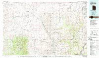
Explore Hanksville, Utah with this detailed 1:100,000-scale topographic map. This 60x30-minute quadrangle provides comprehensive geographical information.
Local Historical Societies and Museums
County historical societies preserve region-specific mapping materials that federal repositories often overlook. These institutions typically house Sanborn fire insurance maps, city planning documents, and property deed records with precise surveyor measurements. Local museums frequently maintain aerial photograph collections from regional airports and utility companies spanning 50-80 years. You’ll discover hand-drawn settlement maps, railroad surveys, and mining claim documentation that provides ground-truth data for verifying modern coordinate systems in rural areas.
University Special Collections and Libraries
Academic institutions specialize in thematic cartographic archives supporting research-grade mapping accuracy. Universities with geography or geology departments maintain extensive USGS topographic map libraries, often including rare preliminary editions with survey notes. Special collections feature donated surveyor records, environmental monitoring data, and student thesis maps documenting local geographic changes. You’ll access digitization services and GIS-compatible formats that streamline integration with modern mapping software like ArcGIS or QGIS.
Researching Historical Maps and Survey Records
Effective historical map research requires systematic examination of multiple document types to establish accurate geographic foundations. You’ll need to cross-reference various archival sources to verify coordinates and understand how landscapes have evolved over time.
Land Survey Plats and Boundary Documents
Survey plats provide the most precise historical coordinate data for your mapping projects. You can find original township plats from the General Land Office (GLO) that include exact metes and bounds descriptions with magnetic declination corrections. Property deed records often contain detailed survey notes that reference natural landmarks and artificial monuments still visible today. These documents typically include chain-and-compass measurements that you can convert to modern coordinate systems using established conversion formulas.
Topographic and Cadastral Maps
USGS topographic quadrangles from the early 1900s offer detailed elevation and feature data before modern development altered landscapes. You’ll discover that cadastral maps show property ownership patterns and lot divisions that help establish historical settlement boundaries. Fire insurance maps like Sanborn atlases provide building-level detail for urban areas between 1867-1970, including structural materials and lot dimensions. These maps often include street widths and utility locations that modern surveys may have missed.
Military and Navigation Charts
Coast Survey charts from the 1800s contain precise bathymetric data and shoreline positions that predate coastal erosion and development. You can access military reconnaissance maps that document terrain features and transportation networks during specific historical periods. Aeronautical charts from the 1920s-1940s show early airport locations and flight paths that influenced regional development patterns. These specialized charts often include magnetic declination values and coordinate references that help align historical data with modern mapping systems.
Utilizing Aerial Photography and Satellite Imagery Archives
Aerial photography and satellite imagery archives provide unique temporal perspectives that complement traditional cartographic sources. These collections offer documented landscape changes spanning decades, enabling accurate verification of geographic features and settlement patterns.
Historical Aerial Survey Collections
Historical aerial photographs from the 1930s through 1980s capture landscape conditions before modern development. The USDA’s National Agriculture Imagery Program maintains county-level flight records dating to 1936, while the USGS stores over 6 million aerial photographs from systematic surveys. You’ll find property boundaries, vegetation patterns, and infrastructure development clearly documented in these high-resolution black-and-white images. Local planning departments often house additional flight collections specific to urban development projects and environmental monitoring efforts.
Declassified Military Reconnaissance Photos
Declassified military reconnaissance imagery provides exceptional detail for areas of strategic importance during wartime periods. The CIA’s declassified satellite programs, including CORONA and GAMBIT missions from 1960-1972, offer 6-foot resolution coverage of global locations. These archives contain precise geographic coordinates and elevation data that civilian mapping programs couldn’t access during classified periods. You can access these collections through the USGS Earth Resources Observation and Science Center, which maintains searchable databases by geographic region and acquisition date.
Early Satellite Imagery Databases
Early satellite programs like Landsat 1-3 (1972-1983) established consistent multispectral imaging protocols that modern GIS systems can process directly. NASA’s Earth Resources Technology Satellite archive contains over 3 million scenes with 80-meter resolution coverage spanning five decades. You’ll discover consistent imaging intervals that document seasonal changes, urban expansion, and environmental modifications across standardized grid systems. The European Space Agency’s historical Envisat and ERS satellite collections provide additional coverage for international mapping projects requiring cross-platform data verification.
Accessing Property Records and Land Registry Documents
Property records and land registry documents form the legal backbone of accurate mapping projects. These official records provide verified boundary descriptions and ownership histories essential for establishing precise geographic coordinates.
Deed Records and Property Transfers
Deed records contain the most detailed property boundary descriptions available in archival collections. You’ll find metes and bounds surveys with specific bearing and distance measurements that translate directly into coordinate systems. County clerk offices typically maintain these records dating back to initial land grants, while state archives preserve the earliest territorial surveys. Access digitized deed books through FamilySearch or county government websites, focusing on warranty deeds and quitclaim deeds that include surveyor measurements and adjacent property references.
Tax Assessment Maps and Records
Tax assessment maps provide standardized property layouts with parcel identification numbers linking to detailed ownership records. You can obtain these materials from county assessor offices, which maintain both current and historical versions showing property subdivisions over time. Many jurisdictions digitize tax maps back to the 1940s, available through GIS portals or direct archive requests. Cross-reference assessment records with plat books to verify acreage calculations and identify discrepancies between legal descriptions and mapped boundaries for your mapping accuracy validation.
Zoning and Planning Commission Archives
Zoning maps and planning commission records document approved land use changes and development patterns crucial for understanding property evolution. Municipal archives preserve master plans, rezoning applications, and subdivision approvals with attached survey drawings. You’ll find detailed site plans showing building footprints, setback requirements, and infrastructure improvements that affect property boundaries. Access these materials through city planning departments or regional planning commissions, focusing on comprehensive plans and zoning ordinance maps that establish official land use boundaries for integration with your base mapping layers.
Digitizing and Georeferencing Historical Materials
Converting physical archival materials into digital formats requires specialized techniques that preserve data integrity while enabling modern GIS integration. You’ll need to balance preservation requirements with spatial accuracy demands.
Scanning Techniques for Fragile Documents
Flatbed scanners with overhead lighting systems work best for delicate maps and documents. Set resolution to 600-1200 DPI for detailed cartographic materials to preserve fine line work and text legibility. Use archival-quality scanner beds with UV-filtered glass to prevent document damage during extended scanning sessions. Position documents flat without pressure to avoid creasing or tearing aged paper materials.
Get clear, detailed scans of photos and documents with the Epson Perfection V39 II. Its 4800 dpi resolution captures fine details, while one-touch buttons simplify scanning.

Geographic Information System (GIS) Integration
Import scanned maps directly into ArcGIS Pro or QGIS using raster data management tools for immediate georeferencing workflows. Create separate project files for each historical map series to maintain organized data structures. Link attribute tables to original archival metadata including creation dates, scale information, and coordinate system details. Export georeferenced files in standard GeoTIFF format for compatibility across multiple GIS platforms.
Coordinate System Conversion Methods
Transform historical coordinate systems using EPSG database parameters to match modern mapping standards like WGS84 or NAD83. Apply datum transformation grids from NOAA or NGS to convert between historical datums such as NAD27 and contemporary systems. Use control points from known landmarks visible in both historical and current maps to establish accurate transformation parameters. Verify conversion accuracy by comparing known intersection coordinates between historical and modern reference points.
Cross-Referencing Multiple Archival Sources for Accuracy
Professional mapmakers rely on systematic cross-referencing to eliminate errors that can compromise geographic accuracy. You’ll achieve the most reliable results by comparing data points across multiple archival collections and institutional holdings.
Validating Information Across Different Archives
Verify coordinates by comparing identical features across three or more independent sources like USGS archives, state geological surveys, and military cartographic collections. Check boundary descriptions in county deed records against federal land office plats and township surveys to confirm measurement accuracy. Document discrepancies in a reference table noting source dates, coordinate systems, and measurement methods to track reliability patterns across different archival institutions.
Resolving Discrepancies in Historical Records
Prioritize sources based on survey accuracy standards, with federal land office records typically providing the highest precision for boundary measurements. Apply temporal analysis to identify which records reflect actual ground conditions versus drafting errors or outdated information. Use modern GPS verification points to test historical coordinate accuracy and determine systematic measurement biases that may affect entire archival collections.
Building Comprehensive Reference Libraries
Organize digital copies of verified archival materials in standardized folder structures by geographic region, time period, and source institution for efficient cross-referencing workflows. Create metadata spreadsheets linking each archival source to its verification status, coordinate system, and known accuracy limitations. Maintain contact databases for archival institutions to facilitate future requests and updates when new materials become available for your mapping regions.
Preserving and Organizing Your Archival Research
Successful archival mapping projects require systematic organization of digital materials and proper documentation standards. Professional cartographers must establish robust storage systems to maintain data integrity throughout project lifecycles.
Explore and map the wilderness for the Queen in Cartographers! Draw unique terrain shapes and score points based on randomly selected goals each game, but beware of monster ambushes.

Digital File Management Systems
Organize your archival materials using hierarchical folder structures that separate collections by source type and geographic region. Create standardized naming conventions that include acquisition dates, source institutions, and map series identifiers like “USGS_1942_Quadrangle_Denver_West.tif” for consistent file retrieval.
Implement version control systems to track document modifications and georeferencing adjustments. Use professional GIS data management tools like ArcCatalog or open-source alternatives to maintain searchable databases that link file paths with geographic extents and coordinate system information.
Metadata Documentation Standards
Document essential archival information including source institution, creation dates, original coordinate systems, and scanning specifications for each digital file. Follow Federal Geographic Data Committee (FGDC) metadata standards to ensure compatibility with professional mapping workflows and institutional requirements.
Record georeferencing parameters, control point coordinates, and transformation accuracy statistics in standardized XML formats. Maintain detailed logs of data processing steps, including coordinate system conversions and quality control procedures, to support reproducible mapping results and peer review processes.
Backup and Long-term Storage Solutions
Establish redundant storage systems using both local drives and cloud-based archives to protect against data loss during extended mapping projects. Implement automated backup schedules that synchronize processed archival materials across multiple storage locations, including offline systems for critical historical datasets.
Plan for format migration by storing master files in uncompressed formats like TIFF for raster data and shapefile formats for vector information. Test data recovery procedures quarterly and maintain documentation of storage locations, access credentials, and restoration workflows to ensure long-term accessibility of archived mapping resources.
Collaborating with Archivists and Historical Experts
Professional collaboration with archivists transforms complex archival navigation into efficient research workflows. Building these relationships unlocks specialized knowledge that significantly improves mapping accuracy.
Building Professional Research Networks
Establishing connections with institutional archivists creates lasting partnerships that streamline your future mapping projects. Contact reference librarians at state archives, historical societies, and university special collections to introduce your mapping work and specific research needs.
Join professional organizations like the Society of American Archivists to access networking events and specialized mapping groups. These connections provide direct access to experts who understand cartographic collections and can identify relevant materials you might otherwise miss.
Maintain regular communication with archivists who’ve assisted your projects previously. They’ll notify you about new acquisitions, digitization projects, and related collections that enhance your ongoing mapping research.
Requesting Specialized Assistance and Guidance
Schedule consultation appointments with archivists before visiting repositories to maximize your research efficiency. Prepare specific geographic areas, time periods, and mapping objectives to help them identify the most relevant collections for your project.
Request guidance on collection organization and search strategies to navigate complex archival systems. Archivists can explain local cataloging methods, suggest related collections, and provide context about document provenance that affects data reliability.
Ask for recommendations on handling fragile materials and institutional digitization policies. Many archives offer professional scanning services or have specific protocols for photographing documents that ensure you capture high-quality images while preserving materials.
Contributing Back to Archival Collections
Share your completed mapping projects with contributing archives to demonstrate how their materials supported professional cartographic work. This feedback helps archivists understand user needs and justify collection development decisions.
Provide georeferenced versions of historical maps you’ve processed back to archives when permitted. Your technical work adds value to their collections and supports future researchers who might benefit from accurate coordinate data.
Offer to present your mapping research at institutional events or professional conferences. These presentations showcase archival resources to broader audiences and strengthen collaborative relationships that benefit the entire mapping community.
Leveraging Technology Tools for Archival Research
Modern mapping professionals can significantly enhance their archival research efficiency by integrating specialized digital tools with traditional research methods. These technology solutions streamline data discovery, processing, and integration workflows.
Online Database Search Strategies
Optimize your archival searches using advanced Boolean operators and metadata filters across multiple database platforms. Target specific collections through DPLA (Digital Public Library of America) and HathiTrust, which aggregate millions of historical documents. Use controlled vocabulary terms like “cadastral,” “plat,” and “survey” to locate precise cartographic materials. Set up automated alerts in databases like WorldCat and Archive Grid to monitor new acquisitions matching your geographic parameters and time periods.
Digital Mapping Software Integration
Create accurate digital maps effortlessly with the Plott Carta digital measuring wheel. Measure any surface and instantly calculate area, perimeter, and material costs using the Lets Plott app for streamlined project estimation and easy data sharing.

Import scanned archival materials directly into GIS platforms like ArcGIS Pro and QGIS using their native georeferencing tools. Configure coordinate transformation parameters to convert historical datums (NAD27, State Plane zones) to modern standards like WGS84. Establish feature templates that preserve original archival metadata while enabling spatial analysis. Use plugins like Georeferencer GDAL in QGIS to batch-process multiple historical maps, maintaining consistent accuracy standards across your entire archival dataset.
Automated Data Extraction Techniques
Deploy OCR software like ABBYY FineReader or Adobe Acrobat to extract coordinate data from scanned survey documents and property records. Configure pattern recognition algorithms to identify common surveying notations, bearing measurements, and distance calculations. Implement scripting solutions using Python’s OpenCV library to automatically detect and extract coordinate tables from historical maps. Set up batch processing workflows that convert extracted text data into CSV format for direct import into your mapping software’s attribute tables.
Conclusion
Your mapping accuracy depends heavily on leveraging the wealth of historical data preserved in archives across the country. By systematically combining traditional research methods with modern digital tools you’ll create more reliable and comprehensive maps than relying solely on contemporary sources.
The investment you make in archival research pays dividends through enhanced data quality and professional credibility. Building relationships with archivists and maintaining organized digital workflows ensures your future projects benefit from streamlined access to verified historical resources.
Remember that each archival source you incorporate strengthens your mapping foundation. Whether you’re working with century-old survey plats or declassified aerial photography these materials provide the historical context and verification points that transform good maps into exceptional ones.
Frequently Asked Questions
What are historical archives and how do they improve mapping accuracy?
Historical archives are collections of documented geographic data housed in libraries, museums, and government repositories. They improve mapping accuracy by providing centuries of verified historical data that modern surveys cannot replicate, including property boundaries, settlement patterns, and landscape changes that can be cross-referenced with modern GPS coordinates.
Which institutions house the most valuable mapping archives?
The National Archives maintains extensive cartographic collections including USGS quadrangle maps and aerial photography. Local historical societies preserve region-specific materials like Sanborn fire insurance maps, while university special collections offer thematic cartographic archives with digitization services for modern mapping software integration.
What types of historical documents are most useful for mapping projects?
Land survey plats and boundary documents provide precise historical coordinate data. Topographic and cadastral maps reveal elevation data and property ownership patterns. Military and navigation charts contain terrain features and transportation networks. Aerial photographs and satellite imagery offer temporal perspectives of landscape development.
How do I convert historical measurements to modern mapping systems?
Historical coordinate data can be converted using GIS software like ArcGIS Pro or QGIS. The process involves georeferencing scanned maps, transforming historical coordinate systems to modern standards, and linking attribute tables to original archival metadata while verifying conversion accuracy against multiple sources.
What’s the best approach for digitizing fragile historical maps?
Use flatbed scanners with overhead lighting at high resolution (minimum 600 DPI) to maintain detail while protecting fragile documents. Handle materials with cotton gloves, scan in sections if necessary, and create multiple file formats for different uses while maintaining original metadata documentation.
How can I verify the accuracy of historical archival data?
Cross-reference data points across multiple collections and institutional holdings. Compare coordinates against independent sources, prioritize records based on established accuracy standards, and build comprehensive reference libraries. Use triangulation methods with USGS maps, aerial photographs, and cadastral records for verification.
What collaboration opportunities exist with archivists and historical experts?
Build professional networks with institutional archivists through organizations like the Society of American Archivists. Schedule consultations to maximize research effectiveness, contribute georeferenced versions of historical maps back to collections, and participate in mapping community initiatives to strengthen overall resources.
Which modern technology tools can enhance archival research efficiency?
Use advanced Boolean operators and metadata filters for online database searches. Integrate digital mapping software with GIS platforms, employ OCR software for text extraction, and utilize scripting solutions to automate historical document processing while maintaining data integrity standards.