6 Best Augmented Reality Navigation Features
You’re probably still using GPS navigation the same way you did a decade ago â staring at a flat map on your phone while trying to match street names to reality. Augmented reality (AR) maps are about to change that forever by overlaying digital directions directly onto your real-world view through your smartphone camera or AR glasses.
Navigate confidently with the Garmin Drive™ 53 GPS. This navigator features a bright, high-resolution touchscreen and provides helpful driver alerts for school zones, speed changes, and more.

The technology transforms navigation from guesswork into precision guidance. Instead of wondering whether you’ve reached the right building or missed your turn AR maps place virtual arrows floating above actual streets and highlight your exact destination in the physical world around you.
Disclosure: As an Amazon Associate, this site earns from qualifying purchases. Thank you!
Real-Time Visual Overlay Navigation Will Replace Traditional GPS Interfaces
AR navigation transforms how you’ll interact with GPS by placing digital directions directly onto your smartphone‘s camera view. This technology eliminates the need to interpret flat maps and translate them to your surroundings.
P.S. check out Udemy’s GIS, Mapping & Remote Sensing courses on sale here…
Experience vivid content on the Galaxy A16 5G's 6.7" display and capture stunning photos with its triple-lens camera. Enjoy peace of mind with a durable design, six years of updates, and Super Fast Charging.

Enhanced Directional Arrows and Path Visualization
Floating arrows appear directly on your screen showing exactly where to turn at each intersection. These three-dimensional indicators hover above the actual street in your camera view, making navigation decisions instant and intuitive. You’ll see the exact path highlighted with bright colored lines that follow the real road surface, eliminating guesswork about which lane to choose or when to make your next move.
Contextual Information Display on Live Camera Feed
Street names and building numbers overlay directly onto the structures you’re viewing through your camera. Distance markers appear above businesses and landmarks, showing “Coffee Shop – 50 feet” or “Target Destination – 0.2 miles” in real-time. Your screen displays relevant information like traffic conditions, parking availability, and business hours without requiring you to look away from your actual surroundings.
Elimination of Map Reading Confusion
Traditional GPS requires you to mentally translate a flat map representation into your three-dimensional environment. AR navigation removes this cognitive burden by showing directions exactly where you need to go in the real world. You’ll never again wonder “Is this the street I’m supposed to turn on?” because the correct path lights up directly on your camera feed with unmistakable visual cues.
Indoor Navigation Will Become as Precise as Outdoor Routing
AR mapping technology will eliminate the frustration of getting lost inside complex buildings by providing the same precision you experience with outdoor GPS navigation.
Mall and Airport Wayfinding Solutions
Complex retail environments will display virtual pathways directly on your smartphone screen, guiding you through multi-level shopping centers with exact turn-by-turn directions. AR overlays will highlight store locations, restroom facilities, and food courts while showing real-time wait times at popular restaurants. Airport terminals will feature dynamic gate directions that update automatically when flights change, displaying walking distances and estimated travel times to help you catch connecting flights without stress.
Office Building and Campus Navigation
Large corporate facilities will integrate AR wayfinding into their visitor management systems, allowing guests to scan QR codes at reception desks for instant navigation assistance. Your phone will display floating arrows leading to specific conference rooms, elevators, and department locations while highlighting amenities like coffee stations and emergency exits. University campuses will offer similar precision for students navigating between lecture halls, libraries, and administrative buildings across sprawling grounds.
Underground Transit System Guidance
Subway stations will transform into easily navigable spaces through AR overlays that show platform directions, train schedules, and optimal car positioning for your destination. Virtual signs will appear above escalators and stairwells, indicating which exits lead to specific street addresses or landmarks. Complex transfer stations will display the fastest routes between different train lines, showing real-time delays and alternative pathways when service disruptions occur.
Location-Based Information Will Be Instantly Accessible Through Visual Markers
You’ll access contextual information about your surroundings simply by pointing your device at any location or building. AR maps will transform how you gather information about places, displaying relevant data directly over what you’re viewing.
Restaurant Reviews and Business Details on Demand
Restaurant information will appear instantly when you point your device at any dining establishment. You’ll see ratings, reviews, and pricing levels floating above restaurant entrances, along with current wait times and availability. Menu highlights and dietary options will display through visual overlays, helping you make informed decisions without opening separate apps. Popular dishes and customer photos will appear alongside operating hours and contact information, streamlining your dining choices.
Historical Landmarks and Cultural Information
Historical context will emerge automatically as you approach significant locations and monuments. You’ll view detailed information about architectural styles, construction dates, and historical significance through AR overlays on buildings and landmarks. Interactive timelines will appear when you focus on heritage sites, showing how locations have evolved over time. Cultural significance and notable events will display alongside visitor information, creating an immersive educational experience that brings history to life.
Real Estate Data and Property Information
Property details will become visible when you look at any residential or commercial building through your AR device. You’ll access current market values, recent sale prices, and property specifications without contacting real estate agents. Square footage, lot size, and tax information will overlay on buildings, while neighborhood statistics and school ratings appear for residential properties. Rental availability and pricing will display for apartment buildings, helping you evaluate potential living spaces efficiently.
Personalized Navigation Experiences Will Adapt to Individual Preferences
AR navigation systems will learn from your daily movements and preferences to create truly customized routing experiences. This adaptive technology goes beyond simple route calculation to understand your unique navigation style.
Navigate with ease using this 7-inch GPS navigator, featuring real-time voice guidance and pre-loaded 2025 maps. Customize routes based on your vehicle type to avoid restrictions and receive speed & red light warnings.

Customizable Route Options Based on User Behavior
Pattern recognition algorithms will analyze your movement habits to suggest optimal routes tailored to your preferences. The system learns whether you prefer main roads or scenic shortcuts, tracks your walking speed, and adapts timing estimates accordingly. You’ll receive route suggestions that prioritize bike lanes if you’re a cyclist, highlight pedestrian-friendly paths for walking, or avoid highways during your preferred driving times. Machine learning continuously refines recommendations based on your choices, creating a navigation experience that feels intuitive and matches your personal travel style perfectly.
Accessibility Features for Different Physical Abilities
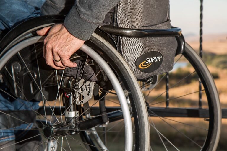
Universal design principles will make AR navigation inclusive for users with diverse physical needs and mobility requirements. The system provides audio descriptions for visually impaired users, vibration patterns for directional guidance, and high-contrast visual elements for better visibility. Wheelchair users receive routes with accessible entrances, ramps, and elevator locations highlighted throughout their journey. Voice commands replace touch interactions for users with limited hand mobility, while customizable text sizes and color schemes accommodate various visual impairments to ensure everyone navigates confidently.
Language and Cultural Localization
Multilingual support will adapt navigation instructions to your preferred language and cultural communication style. The system automatically translates street names, landmark descriptions, and directional phrases into your native language while respecting local cultural norms. You’ll see familiar measurement units, recognize culturally relevant landmarks, and receive navigation cues that align with your regional communication patterns. Cultural preferences influence route suggestions, highlighting places of worship, community centers, or food establishments that match your background and interests for a more personalized navigation experience.
Social Navigation Features Will Connect Users in Real-Time
AR maps will transform navigation from a solitary experience into a collaborative journey. You’ll share your location and coordinate with others through immersive visual experiences that make group navigation effortless.
Friend Location Sharing with AR Visualization
Friend location sharing displays your contacts’ positions as floating avatars in your AR view. You’ll see real-time indicators showing exactly where your friends are located relative to your current position. Distance markers and directional arrows guide you toward meeting points while live status updates show if someone’s running late. Privacy controls let you choose who sees your location and for how long. Group chat integration allows instant communication without leaving the AR interface.
Crowdsourced Traffic and Hazard Reporting
Crowdsourced reporting transforms every AR navigation user into a traffic reporter. You’ll contribute real-time updates about accidents, construction zones, and road conditions by simply tapping on your screen. Visual markers from other users appear in your AR view, warning you about hazards ahead with specific icons for different types of obstacles. Verification systems use multiple user reports to confirm accuracy before displaying warnings. Community ratings help identify the most reliable contributors in your area.
Group Navigation and Meeting Point Coordination
Group navigation synchronizes multiple users’ routes to optimize meeting times and locations. You’ll coordinate with friends or colleagues through shared AR waypoints that appear simultaneously on everyone’s device. The system calculates optimal meeting spots based on each person’s current location and preferred arrival time. Real-time ETA updates keep everyone informed about delays or changes. Virtual breadcrumbs show where group members have traveled, making it easy to follow the same path to your destination.
Transportation Integration Will Streamline Multi-Modal Journeys
AR maps will connect various transportation modes into a single, unified navigation experience. You’ll seamlessly transition between walking, public transit, rideshares, and personal vehicles with continuous visual guidance.
Public Transit Schedule and Platform Information
Public transit information will appear directly on your AR display as you approach stations and stops. Real-time arrival times, platform numbers, and delay notifications will float above train platforms and bus stops. You’ll see visual indicators for crowded cars, wheelchair accessibility, and service disruptions without checking separate transit apps. AR overlays will highlight the exact boarding location for your specific train car or bus door, while route changes and alternative connections appear instantly when delays occur.
Ride-Sharing and Vehicle Location Tracking
Ride-sharing coordination becomes effortless with AR vehicle tracking that shows your driver’s exact location and arrival path. Your Uber or Lyft will appear as a highlighted vehicle moving toward you in real-time, eliminating confusion about which car is yours. Visual markers will guide you to optimal pickup locations, while driver details and vehicle information display above the approaching car. You’ll receive turn-by-turn notifications showing your driver’s progress, estimated arrival adjustments, and alternative pickup suggestions during heavy traffic.
Parking Availability and Payment Integration
Parking searches will transform through AR displays showing available spaces, pricing, and payment options in real-time. Empty parking spots will appear highlighted in green as you drive or walk through areas, while red indicators mark occupied spaces. Pricing information will float above each parking zone, displaying hourly rates, maximum stay limits, and current availability. You’ll complete parking payments directly through AR interfaces, with digital receipts and expiration reminders appearing on your display without handling physical meters or apps.
Conclusion
The future of navigation is rapidly approaching and it’s more exciting than you might imagine. AR maps represent the next evolutionary leap in how you’ll interact with your surroundings making every journey more intuitive and informative.
You’ll soon experience navigation that adapts to your unique needs whether you’re exploring a new city or finding your way through familiar spaces. The technology promises to eliminate the frustration of getting lost while opening up new possibilities for discovery and connection.
As AR mapping technology continues to develop you can expect your smartphone to become an even more powerful tool for exploring the world around you. The days of squinting at tiny screens and second-guessing directions are numbered.
Frequently Asked Questions
What is AR navigation and how does it differ from traditional GPS?
AR navigation uses augmented reality to overlay digital directions directly onto your smartphone’s camera view of the real world. Unlike traditional flat maps, AR navigation shows virtual arrows, highlighted paths, and contextual information superimposed on your actual surroundings, eliminating the need to interpret 2D maps into 3D environments.
Can AR navigation work indoors where GPS doesn’t function well?
Yes, AR navigation technology can provide precise indoor navigation in complex environments like shopping malls, airports, office buildings, and university campuses. It displays virtual pathways, real-time store locations, wait times, and can even guide users through multi-level facilities and underground transit systems.
What kind of location-based information can AR navigation provide?
AR navigation offers instant access to contextual information by pointing your device at any location. This includes restaurant ratings and wait times, historical landmark details, real estate market values, building specifications, and general information about businesses and points of interest in your immediate surroundings.
How does AR navigation personalize the experience for different users?
AR navigation systems learn from your daily movement patterns and preferences to suggest customized routes. They can accommodate preferences for main roads versus scenic shortcuts, provide accessibility features for users with diverse physical needs, and offer multilingual navigation instructions adapted to your preferred language and cultural communication style.
What social features does AR navigation offer?
AR navigation includes collaborative features like friend location sharing with floating avatars in your AR view, crowdsourced traffic and hazard reporting with visual warning markers, and group navigation that synchronizes multiple users’ routes to optimize meeting times and locations through shared waypoints.
Can AR navigation integrate different transportation modes?
Yes, AR navigation seamlessly integrates walking, public transit, rideshares, and personal vehicles into a unified experience. It provides real-time transit information, AR vehicle tracking for rideshares, optimal pickup point guidance, and even highlights available parking spaces with pricing information.