6 Key Differences: Analog vs Digital Map-Making That Transform Cartography
Why it matters: The way we create and interact with maps has fundamentally transformed from hand-drawn charts to GPS-powered digital interfaces, reshaping everything from navigation to urban planning.
The big picture: While analog maps once required skilled cartographers spending months crafting detailed representations by hand, digital mapping now leverages satellite imagery and real-time data to create interactive experiences that update instantly.
Explore and map the wilderness for the Queen in Cartographers! Draw unique terrain shapes and score points based on randomly selected goals each game, but beware of monster ambushes.

What’s ahead: Understanding these six core differences between traditional and modern map-making methods will help you appreciate how technology has revolutionized spatial information and why both approaches still matter in today’s world.
Disclosure: As an Amazon Associate, this site earns from qualifying purchases. Thank you!
P.S. check out Udemy’s GIS, Mapping & Remote Sensing courses on sale here…
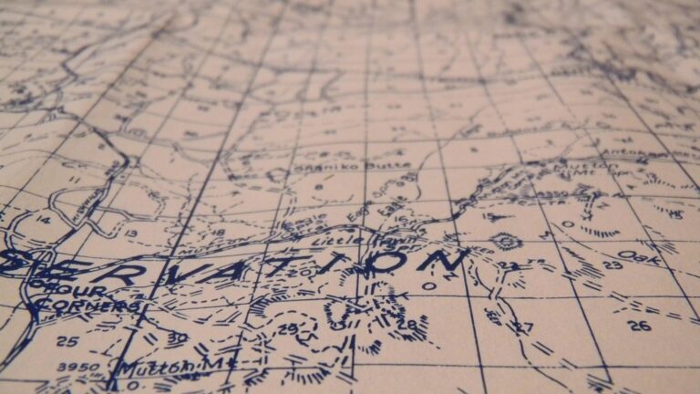
Traditional Tools and Equipment Used in Analog Map-Making
Traditional cartographers relied on precise manual instruments and specialized equipment to create accurate maps before digital technology revolutionized the field.
Hand-Drawn Instruments and Drafting Materials
Drafting tables served as the foundation workspace, while technical pens like Rapidograph and Rotring models provided consistent line weights. You’d use ruling pens for curved lines and compass sets for perfect circles and arcs.
This adjustable drafting table features a durable, tempered glass top that tilts from 0-65°. It offers ample storage with built-in trays and drawers, plus smooth-rolling casters (with brakes) or optional rubber feet for stability.

Mylar film and vellum offered stable drawing surfaces that resisted moisture and dimensional changes. Lettering guides like Leroy sets ensured uniform text placement, while triangles and T-squares maintained geometric precision throughout your map construction process.
Maximize light in your grow room with this 4ft x 100ft reflective mylar film. The durable, easy-to-clean material improves reflectivity by up to 95% for efficient light distribution.

Surveying Equipment and Measurement Tools
Get accurate leveling with the KEZERS 32X Optical Level Kit. It features 32X magnification, a self-leveling system, and comes with a tripod and grade rod for easy setup.

Theodolites measured horizontal and vertical angles with incredible precision, often accurate to seconds of arc. You’d employ steel measuring tapes, chains, and optical rangefinders to determine distances across terrain.

Plane tables combined with alidades allowed direct field plotting, while levels and transit instruments established elevation benchmarks. Aerial cameras mounted on aircraft captured photogrammetric imagery, which you’d later interpret using stereoscopes to extract topographic details for your hand-drafted maps.
Get accurate leveling with the Siteline Transit/Level, featuring 20x magnification and 1/4" accuracy at 100ft. This package includes a tripod, grade rod, carrying case, and essential accessories for projects up to 200ft.

Digital Software and Technology in Modern Map-Making
Modern cartography relies on sophisticated digital tools that’ve revolutionized how you create, analyze, and distribute spatial information. These technologies enable precision and efficiency that traditional methods simply couldn’t match.
Geographic Information Systems (GIS) and Mapping Software
ArcGIS Pro and QGIS serve as your primary platforms for professional digital cartography, offering comprehensive tools for spatial analysis and visualization. You’ll find specialized software like Adobe Illustrator integrates seamlessly with GIS outputs for final design refinement. Cloud-based platforms such as ArcGIS Online enable real-time collaboration and instant map publishing across multiple devices and user groups.
Satellite Imagery and GPS Technology
High-resolution satellite imagery from providers like Maxar and Planet Labs delivers sub-meter accuracy for your base mapping needs. You can access real-time GPS corrections through services like RTK networks, achieving centimeter-level precision for field data collection. Modern GNSS receivers integrate multiple satellite constellations including GPS, GLONASS, and Galileo for enhanced positioning reliability in challenging environments.
Time Investment Required for Each Map-Making Method
Time investment varies dramatically between analog and digital approaches, with traditional methods requiring exponentially more hours for completion. Understanding these temporal differences helps you make informed decisions about project planning and resource allocation.
Labor-Intensive Process of Manual Cartography
Manual cartography demands hundreds of hours for even basic maps, with detailed topographic sheets requiring 6-12 months of continuous work. You’ll spend 40-60 hours creating precise coastlines, carefully drafting contour lines, and hand-lettering place names using technical pens. Complex projects like city planning maps or geological surveys often consume 300-500 hours, requiring multiple cartographers working in sequence. Field verification alone adds 50-100 hours to your timeline, as you must physically visit locations to confirm accuracy and gather supplementary data.
Automated Features That Speed Digital Production
Digital mapping software reduces production time by 80-90% through automated processes and real-time data integration. You can generate base maps in minutes using satellite imagery, with GIS software automatically calculating contours, watersheds, and road networks from elevation data. Batch processing allows you to update hundreds of maps simultaneously, while template systems let you apply consistent styling across entire map series. Real-time GPS integration eliminates weeks of field verification, and cloud-based collaboration enables multiple cartographers to work simultaneously on different map sections.
Accuracy and Precision Levels in Map Creation
Digital mapping achieves superior accuracy compared to traditional analog methods through advanced computational systems and GPS technology. You’ll find precision differences of several meters between hand-drafted maps and modern digital cartography.
Human Error Factors in Analog Methods
Manual cartography introduces multiple error sources that compound throughout the mapping process. You’ll encounter measurement mistakes during field surveys, transcription errors when transferring data to paper, and scale inconsistencies from hand calculations. Drafting imprecision affects line placement accuracy by 0.5-2mm on paper maps, which translates to 50-200 meters at standard topographic scales. Weather conditions during field work further impact measurement reliability, creating systematic errors that persist in final analog products.
Enhanced Precision Through Digital Calculations
Digital mapping systems eliminate human calculation errors through automated processing and GPS coordinates accurate to 1-3 meters. You can achieve sub-meter precision using Real-Time Kinematic (RTK) GPS corrections and survey-grade GNSS equipment. GIS software automatically handles coordinate transformations, scale calculations, and geometric corrections that would require manual computation in analog workflows. Modern mapping platforms integrate multiple data sources simultaneously, cross-referencing elevation models, satellite imagery, and ground truth measurements to validate spatial accuracy across entire map datasets.
Cost Considerations for Map Production and Updates
Financial planning for mapping projects requires careful evaluation of both upfront investments and long-term operational costs. Digital mapping systems typically demand higher initial software investments but deliver substantial cost savings through automated workflows and reduced labor requirements.
Initial Investment and Ongoing Material Expenses
Analog map-making requires significant material investments including drafting tables ($800-2,500), technical pens ($200-500), and specialized papers like Mylar film ($3-5 per sheet). You’ll also need surveying equipment such as theodolites ($15,000-50,000) and measuring instruments that require regular calibration and replacement.
Digital mapping eliminates ongoing material costs but demands higher software investments. Professional GIS licenses range from $1,500-7,000 annually per user, while specialized surveying software adds $5,000-15,000 to your initial setup costs.
Software Licensing vs Long-Term Efficiency Savings
Software licensing represents 60-70% of digital mapping startup costs but generates substantial long-term savings through automation. Professional licenses like ArcGIS Pro ($7,000 annually) or Global Mapper ($500-2,500) eliminate repetitive manual tasks that consume hundreds of billable hours in traditional workflows.
Digital systems reduce labor costs by 80-90% compared to hand-drafted methods. You’ll recover software investments within 6-12 months through faster project completion and reduced revision cycles, making digital approaches more cost-effective for ongoing mapping operations.
Flexibility and Ease of Making Map Revisions
Map revision capabilities represent one of the most dramatic differences between analog and digital cartography. Your choice of method fundamentally determines how efficiently you can update spatial information and respond to changing requirements.
Permanent Nature of Hand-Drawn Maps
Hand-drawn maps create permanent marks that resist modification once applied to paper or drafting film. You’ll find that ink lines, pencil markings, and adhesive symbols become fixed elements requiring complete redrafting for significant changes. Minor corrections demand careful erasure techniques that often damage the base material and compromise map quality. Major revisions typically necessitate starting the entire drafting process over, making analog maps essentially static documents. You can’t easily update street names, add new features, or correct measurement errors without investing substantial time in recreation work.
Real-Time Editing Capabilities in Digital Platforms
Digital mapping platforms enable instant modifications through software interfaces that preserve original data integrity. You can edit vector layers, adjust symbology, and update attribute information without affecting other map elements or requiring complete reconstruction. Modern GIS software like ArcGIS Pro and QGIS provide non-destructive editing workflows where you maintain version control and can revert changes instantly. Cloud-based platforms allow multiple cartographers to make simultaneous updates with automatic synchronization across team members. You’ll achieve immediate visual feedback for all modifications, enabling rapid prototyping and iterative design improvements that would take weeks using traditional methods.
Conclusion
The transformation from analog to digital map-making represents one of the most significant technological shifts in cartography. You’ve seen how digital tools revolutionize everything from production speed to accuracy levels while dramatically reducing long-term costs.
Your choice between analog and digital methods depends on your specific needs budget and project requirements. Digital mapping offers unmatched efficiency and precision for most modern applications while traditional methods still hold value for specialized artistic or historical purposes.
Understanding these six key differences empowers you to make informed decisions about your mapping projects. Whether you’re planning urban development conducting research or simply exploring cartographic possibilities you now have the knowledge to leverage the right tools for optimal results.
Frequently Asked Questions
What is the main difference between traditional and digital map-making?
Traditional map-making relies on hand-drawn charts created using manual tools like technical pens and drafting tables, while digital mapping uses GPS technology, satellite imagery, and specialized software. Digital methods offer real-time data integration, automated processes, and interactive experiences, whereas traditional methods involve labor-intensive manual processes and static paper-based outputs.
How much time does traditional map-making require compared to digital methods?
Traditional analog map-making can take 300-500 hours for complex projects, including extensive field verification and manual drafting. Digital mapping reduces production time by 80-90% through automated processes and real-time data integration, allowing cartographers to generate base maps rapidly and collaborate simultaneously on projects.
Which mapping method offers better accuracy and precision?
Digital mapping achieves superior accuracy through GPS technology and automated computational systems, with precision typically within 1-3 meters. Traditional hand-drafted maps are prone to human errors like measurement mistakes, transcription errors, and scale inconsistencies, resulting in accuracy differences of several meters compared to digital methods.
What are the cost differences between analog and digital mapping?
Digital mapping requires higher initial software investments but offers long-term cost savings through automated workflows and reduced labor requirements. Traditional mapping involves significant material costs for drafting tables, technical pens, and surveying equipment with ongoing expenses, while digital methods eliminate material costs but require professional GIS licenses and specialized software.
How easy is it to make revisions to traditional versus digital maps?
Traditional hand-drawn maps are permanent documents requiring complete redrafting for significant changes, making them static and inflexible. Digital platforms allow real-time editing with instant modifications, non-destructive workflows, version control, and simultaneous updates by multiple users, enabling rapid prototyping and iterative improvements without compromising original data integrity.
What tools are essential for traditional map-making?
Traditional cartography requires drafting tables, technical pens for consistent line weights, specialized materials like Mylar film and vellum for stable drawing surfaces, theodolites for measuring angles, steel measuring tapes for distance measurement, and aerial cameras for capturing topographic details. These manual instruments demand precision and expertise from cartographers.
What software and technology power modern digital mapping?
Modern digital cartography relies on Geographic Information Systems (GIS) like ArcGIS Pro and QGIS, design software such as Adobe Illustrator, cloud-based platforms like ArcGIS Online for collaboration, high-resolution satellite imagery, GPS technology, and GNSS receivers. These tools enable comprehensive spatial analysis, visualization, and real-time data integration for enhanced mapping capabilities.