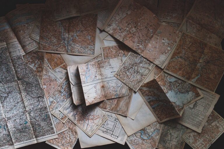
5 Best Map Ideas for Storytelling
Why it matters: Personalized maps transform abstract data into compelling visual narratives that make complex information instantly digestible for your audience.
The big picture: Whether you’re documenting a family’s immigration journey or tracking business expansion across regions, custom maps turn raw location data into engaging stories that resonate with viewers on both emotional and practical levels.
What’s next: These five innovative approaches will help you leverage mapping technology to create memorable storytelling experiences that capture attention and drive meaningful engagement with your content.
Disclosure: As an Amazon Associate, this site earns from qualifying purchases. Thank you!
P.S. check out Udemy’s GIS, Mapping & Remote Sensing courses on sale here…
Create a Visual Timeline Map of Your Life’s Journey
Transform your personal history into a compelling visual narrative by mapping the geographical progression of your life experiences. This chronological mapping approach connects the “where” with the “when” of your story.
Mark Significant Life Events and Milestones
Pin major life moments to their exact locations using GPS coordinates or street addresses for precision. Birth hospitals, graduation venues, wedding locations, and career milestones create anchor points that define your journey’s trajectory. Use custom map markers with distinct symbols—graduation caps for education, rings for marriages, or briefcases for career changes. Include brief descriptive text with each marker containing dates and context to enhance the storytelling impact.
Include Personal Photos and Memory Markers
Embed photographs directly onto map locations where memories were created to add emotional depth to your geographic story. Upload images from family vacations, first apartments, or significant celebrations as pop-up elements that appear when viewers click specific map points. Scan old photos and documents like birth certificates or diplomas to create authentic visual connections. This multimedia approach transforms static location data into rich, personal experiences that resonate with viewers.
Use Color Coding for Different Life Phases
Apply distinct color schemes to represent various chapters of your life journey for immediate visual comprehension. Childhood locations might use soft blues, educational years in greens, career phases in bold reds, and retirement in warm purples. Create a legend that clearly defines each color’s meaning and time period. This systematic approach allows viewers to quickly identify patterns in your geographic movements and understand how different life stages influenced your location choices.
Design a Family Heritage Map Tracing Your Ancestral Roots
Building on the personal journey mapping approach, you can expand your storytelling scope to encompass multiple generations and trace your family’s geographical heritage across time.
Plot Immigration Routes and Settlement Patterns
Mark departure points and destination cities using historical immigration data from Ellis Island records or ship manifests. Trace ocean crossings with curved lines showing actual shipping routes your ancestors traveled. Add settlement markers at first arrival locations and subsequent moves within the country. Include migration dates and reasons for relocation such as job opportunities or family reunification. Use different line styles to distinguish between voluntary moves and forced migrations throughout your family’s history.
Add Historical Context and Cultural Elements
Layer historical events onto your family map using timeline markers that correspond to major world events during your ancestors’ lifetimes. Include cultural symbols representing your family’s ethnic background such as traditional patterns or religious icons. Add historical boundaries showing how political changes affected your family’s homeland. Incorporate period-appropriate imagery like vintage photographs of neighborhoods where your ancestors lived. Use color schemes that reflect cultural heritage such as flag colors or traditional textile patterns.
Incorporate Family Stories and Oral Traditions
Document family legends directly on the map using text boxes or audio recordings linked to specific locations. Mark places mentioned in family stories even if exact addresses aren’t known. Include oral histories about why certain moves happened or what life was like in particular locations. Add family recipe origins or traditional craft locations to show cultural preservation across generations. Use photo overlays showing family members at significant locations to connect personal memories with geographical places.
Build an Adventure Map Documenting Your Travel Experiences
Adventure maps transform your scattered travel memories into cohesive visual narratives that capture the full scope of your journeys. You’ll create a comprehensive record that goes beyond simple location tracking to showcase the richness of your travel experiences.
Highlight Memorable Destinations and Hidden Gems
Plot your most significant travel destinations using custom markers that differentiate between popular attractions and your personal discoveries. Mark hidden gems like that secluded beach in Croatia or the family-run restaurant in Tuscany using distinctive icons. Add brief descriptions highlighting what made each location special, whether it’s a breathtaking sunrise viewpoint or an unexpected cultural encounter. This approach ensures your map captures both bucket-list destinations and those serendipitous moments that often become your most treasured travel memories.
Include Travel Photos and Journal Excerpts
Embed high-quality photos directly onto your map markers to create instant visual connections between locations and experiences. Add excerpts from your travel journal as popup text, capturing emotions and observations from specific moments. Include details like weather conditions, local interactions, or personal reflections that photographs alone can’t convey. This multimedia approach transforms your adventure map into an interactive travel memoir where clicking on locations reveals the full story behind each destination through both visual and written memories.
Capture your adventures in this compact travel journal. Features include 176 pages of premium, dotted paper, a ribbon bookmark, and an expandable inner pocket, all secured with an elastic closure.

Create Different Layers for Various Trip Categories
Organize your travels using separate map layers for different types of adventures: solo journeys, family vacations, business trips, and romantic getaways. Assign unique color schemes and marker styles to each category, making it easy to filter and view specific types of experiences. Add seasonal layers to show summer hiking trips versus winter ski adventures, or create activity-based layers for food tours, cultural experiences, and outdoor adventures. This systematic organization helps you identify travel patterns and plan future trips based on your preferred adventure styles.
Develop a Literary Map Bringing Book Settings to Life
Literary maps transform fictional worlds into visual experiences that deepen your connection to beloved stories and characters.
Map Fictional Locations from Favorite Novels
Pinpoint specific fictional locations mentioned in your favorite novels using geographic references from the text. Create custom markers for places like Tolkien’s Middle-earth landmarks, Hogwarts castle grounds, or the districts of Panem from The Hunger Games. Reference detailed descriptions and author notes to ensure accurate placement of fictional cities, forests, and kingdoms. Layer multiple locations from book series to show the complete fictional geography, helping readers visualize the scope and scale of imaginary worlds they’ve explored through reading.
Connect Real-World Inspirations to Literary Places
Identify real locations that inspired fictional settings by researching author backgrounds and documented influences. Map connections between actual places like Oxford’s colleges that inspired Tolkien’s fantasy architecture or the Scottish Highlands that influenced Harry Potter’s landscape. Overlay historical photographs and modern satellite imagery to show how real-world locations transformed into fictional counterparts. Document author interviews and literary analysis that reveal specific geographic inspirations, creating educational connections between literature and actual geography.
Add Character Journey Paths and Plot Points
Trace character movement patterns throughout the story using different colored path lines for each major character’s journey. Plot key story events at specific map locations where crucial scenes occurred, such as battles, meetings, or character revelations. Annotate major plot points with brief descriptions and chapter references to help readers follow narrative progression geographically. Synchronize character paths with story timeline markers, showing how different storylines intersect at specific locations and times throughout the novel’s progression.
Craft a Community Impact Map Showcasing Local Stories
Community impact maps transform neighborhoods into visual narratives that celebrate local achievements and document social change. You’ll create powerful storytelling tools that connect residents with their shared history while highlighting the people and projects that shape their community’s identity.
Document Neighborhood History and Changes
Plot historical landmarks and significant locations using archival photographs and census data to show how your community evolved over decades. Mark former businesses, demolished buildings, and lost gathering spaces with custom icons that tell the story of urban development. Add timeline layers showing population shifts, economic changes, and infrastructure improvements to create a comprehensive historical record. Include oral history markers where longtime residents share memories of specific locations, connecting personal experiences with geographic places.
Feature Local Heroes and Community Contributors
Identify influential community members and mark their contributions using custom profile markers that highlight their achievements and impact areas. Create biographical pop-ups featuring local teachers, activists, business owners, and volunteers who’ve shaped neighborhood character through their dedication. Add photo galleries showcasing community events, volunteer projects, and grassroots initiatives that demonstrate collective action. Use color-coded categories to distinguish different types of contributions, from environmental stewardship to youth mentorship programs.
Include Before and After Transformation Stories
Document community improvement projects by overlaying historical aerial imagery with current street-level photography to show dramatic neighborhood changes. Mark revitalization efforts like park renovations, mural installations, and housing developments with slider tools that reveal transformation timelines. Add project details including funding sources, volunteer hours, and measurable outcomes like increased property values or reduced crime rates. Feature resident testimonials describing how specific improvements affected their daily lives and community pride.
Conclusion
These five personalized mapping approaches give you powerful tools to transform ordinary data into compelling visual stories. Whether you’re documenting your life journey or celebrating community achievements each method helps you create meaningful connections between places and experiences.
Your maps become more than navigation tools—they evolve into interactive storytelling platforms that engage audiences on emotional and intellectual levels. The combination of geographical data with personal narratives creates lasting impressions that traditional storytelling methods can’t match.
Start with whichever approach resonates most with your story goals. Remember that the most effective personalized maps blend accurate location data with authentic personal touches that make your narrative uniquely yours.
Frequently Asked Questions
What are personalized maps and why are they useful for storytelling?
Personalized maps transform complex data into engaging visual narratives that are easily understood by audiences. They make information relatable by connecting geographical locations with personal experiences, business growth, or family history. These custom maps enhance audience engagement by turning static data into rich, emotional experiences that viewers can connect with on both practical and personal levels.
How do I create a visual timeline map of my life journey?
Start by marking major life milestones using GPS coordinates and custom map markers – include birthplaces, graduation venues, and career changes in chronological order. Add personal photos and memory markers at specific locations for emotional depth. Use color coding to represent different life phases, making it easy for viewers to identify patterns in your geographic movements and life stages.
What is a family heritage map and how can I build one?
A family heritage map traces ancestral roots across generations by plotting immigration routes and settlement patterns. Mark departure points and destination cities using historical immigration data. Add timeline markers for major world events, cultural symbols representing your ethnic background, and incorporate family stories directly onto the map with photo overlays to connect personal memories with geographical places.
How can I document my travel experiences using adventure maps?
Create cohesive visual narratives by highlighting memorable destinations and hidden gems with custom markers and brief descriptions. Embed travel photos and journal excerpts onto map markers to create instant visual connections. Organize travels using different map layers for various trip categories, allowing easy filtering to identify travel patterns and plan future adventures.
What is a literary map and how do I create one?
A literary map brings book settings to life by pinpointing fictional locations from favorite novels using geographic references. Create custom markers for places like Middle-earth or Hogwarts, then connect real-world inspirations by researching authors’ backgrounds. Add character journey paths and plot points to help readers follow narrative progression geographically while overlaying historical and modern imagery.
How can community impact maps showcase local stories?
Community impact maps transform neighborhoods into visual narratives celebrating local achievements and documenting social change. Plot historical landmarks using archival photographs and census data to show community evolution. Feature local heroes with custom profile markers, include before-and-after transformation stories, and add resident testimonials to connect individuals with their shared history and highlight collective community impact.