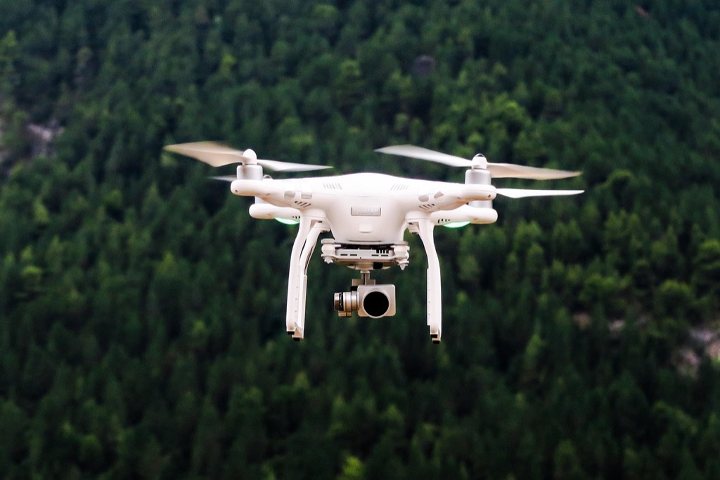
7 Best Drone Mapping Software Options That Transform Aerial Data
The bottom line: Drone mapping software transforms raw aerial footage into actionable data that drives better business decisions across industries from construction to agriculture.
Why it matters: You’re collecting massive amounts of drone data but without the right software you can’t turn those pixels into profits or insights that matter to your bottom line.
What’s ahead: We’ve tested and ranked the top 7 drone mapping platforms based on ease of use pricing accuracy and real-world performance to help you choose the software that fits your specific needs and budget.
Disclosure: As an Amazon Associate, this site earns from qualifying purchases. Thank you!
P.S. check out Udemy’s GIS, Mapping & Remote Sensing courses on sale here…
DroneDeploy: Cloud-Based Mapping for Professional Workflows
DroneDeploy stands out as a comprehensive cloud-based platform that transforms raw drone imagery into actionable maps and 3D models through automated processing workflows.
Real-Time Processing and Collaboration Features
Real-time processing capabilities allow you to upload drone images directly from the field and receive processed maps within hours. You’ll access live project dashboards where team members can view progress updates and share annotations instantly. The platform’s collaborative workspace enables multiple stakeholders to review maps simultaneously, add comments, and track project changes through version control systems that maintain data integrity across your organization.
Pricing Plans and Enterprise Solutions
Starter plans begin at $299 monthly for individual users with basic mapping features and 1,000 images per month. Pro subscriptions cost $999 monthly and include advanced analytics tools plus 5,000 image processing credits. Enterprise solutions offer custom pricing based on your organization’s volume requirements, with dedicated support teams and unlimited processing capacity for large-scale operations across multiple project sites.
Integration Capabilities with Third-Party Tools
API integrations connect DroneDeploy with popular construction management platforms like Procore, Autodesk, and PlanGrid for seamless data transfer. You’ll export processed maps directly to CAD software including AutoCAD and SketchUp in multiple file formats. The platform supports GIS workflows through ArcGIS Online integration, while cloud storage connections with Dropbox, Google Drive, and Box ensure your mapping data synchronizes across existing project management systems.
Pix4D: Industry-Leading Photogrammetry and 3D Modeling
Pix4D stands as the gold standard for professional photogrammetry software, delivering precise 3D reconstruction from drone imagery across multiple industries. This Swiss-developed platform processes aerial data into highly accurate maps, models, and measurements that meet surveying-grade requirements.
Learn close-range photogrammetry and 3D imaging techniques. This textbook provides comprehensive coverage of the subject.

Advanced Analytics and Measurement Tools
Volume calculations reach centimeter-level accuracy through Pix4D’s advanced algorithms, making it essential for stockpile monitoring and earthwork analysis. You’ll access comprehensive measurement tools including distance calculations, area computations, and elevation profiles directly within the interface. The software generates detailed reports with statistical analysis, error assessments, and quality indicators that meet professional surveying standards for construction and mining applications.
Specialized Modules for Different Industries
Pix4Dmapper serves surveying and mapping professionals with high-precision outputs, while Pix4Dfields targets agricultural applications with crop health analysis and variable rate application maps. Mining operations benefit from Pix4Dsurvey’s specialized tools for quarry monitoring and blast planning. Each module includes industry-specific templates, processing workflows, and output formats tailored to sector requirements like NDVI calculations for agriculture or cut-fill analysis for construction.
Hardware Compatibility and System Requirements
Desktop processing requires Windows 10/11 or macOS with minimum 16GB RAM, though 32GB delivers optimal performance for large datasets. You’ll need dedicated graphics cards with 4GB+ VRAM for efficient 3D model generation and visualization. The software supports major drone manufacturers including DJI, senseFly, and Parrot, with direct integration for popular models like Phantom 4 RTK and Mavic 3 Enterprise through automated flight log import.
Replace your damaged Phantom 4 Pro V2.0 drone body with this new aircraft, which includes a gimbal camera and carry case. Compatible with GL300L and GL300K remotes only; excludes battery, charger, propellers, and other accessories.

Agisoft Metashape: Professional Desktop Processing Power
Agisoft Metashape stands as a powerhouse desktop application that delivers exceptional processing capabilities for complex drone mapping projects requiring maximum precision and control.
High-Quality Reconstruction Algorithms
Metashape’s advanced Structure from Motion (SfM) algorithms produce exceptionally detailed 3D reconstructions from drone imagery. You’ll achieve sub-centimeter accuracy through dense point cloud generation and sophisticated bundle adjustment techniques. The software’s multi-view stereo processing creates highly detailed orthomosaics and digital elevation models that rival traditional surveying methods. Professional surveyors rely on Metashape’s robust geometric processing for mission-critical projects where accuracy can’t be compromised.
Batch Processing and Automation Features
You can streamline repetitive workflows through Metashape’s comprehensive batch processing capabilities and Python scripting integration. The software processes multiple datasets simultaneously while maintaining consistent quality parameters across all projects. Custom automation scripts handle routine tasks like image alignment, dense cloud generation, and report creation without manual intervention. Network processing distributes computational workloads across multiple machines, significantly reducing processing times for large-scale mapping operations.
Export Options and File Format Support
Metashape supports over 40 export formats including industry-standard options like LAS, PLY, OBJ, and GeoTIFF for seamless integration with CAD and GIS platforms. You’ll export directly to specialized formats for construction software, engineering applications, and 3D modeling programs. The software maintains coordinate system integrity throughout the export process, ensuring accurate georeferencing in downstream applications. Professional-grade metadata embedding preserves processing parameters and quality metrics within exported files for comprehensive project documentation.
Maps Made Easy: User-Friendly Solution for Beginners
Maps Made Easy stands out as an accessible entry point for newcomers to drone mapping. You’ll find this cloud-based platform eliminates the complexity that often intimidates first-time users.
Simplified Upload and Processing Workflow
Upload your drone images through a straightforward drag-and-drop interface that requires no technical expertise. You’ll receive processed orthomosaics and elevation models within 24-48 hours without configuring complex parameters. The platform automatically handles image overlap analysis, GPS coordinate extraction, and ground control point integration. Processing reports include clear quality metrics and visual indicators that help you understand your map’s accuracy levels.
Cost-Effective Pricing Structure
Pay-per-map pricing starts at $39 for basic orthomosaics covering up to 1,000 acres. You’ll access volume discounts for multiple projects and subscription plans beginning at $199 monthly for unlimited processing. Educational institutions receive 50% discounts on all services. Small businesses benefit from flexible credit systems that don’t require long-term commitments or expensive software licenses.
Mobile App Integration and Field Capabilities
Download the companion mobile app to plan missions and upload images directly from your device. You’ll capture flight logs, weather conditions, and project notes that integrate seamlessly with your processed maps. The app includes basic measurement tools for quick field calculations and supports offline data collection in remote locations. Real-time progress tracking keeps you informed about processing status while you’re still in the field.
WebODM: Open-Source Freedom and Customization
WebODM delivers complete control over your drone mapping workflow through its open-source architecture. You’ll gain unrestricted access to processing algorithms while maintaining full ownership of your geospatial data.
Self-Hosted Processing and Data Privacy
Self-hosted deployment keeps your sensitive mapping data entirely within your infrastructure boundaries. You’ll process orthomosaics and point clouds on your own servers without uploading imagery to third-party cloud platforms. This approach proves essential for defense contractors, utilities, and government agencies requiring strict data sovereignty. Your processing capacity scales with your hardware investments, eliminating per-project processing fees that accumulate with commercial alternatives.
Community Support and Plugin Ecosystem
Active development community contributes regular updates and specialized processing modules to expand WebODM’s capabilities. You’ll access plugins for lightning detection, crop health analysis, and construction monitoring through the community marketplace. GitHub repositories contain over 200 contributor modifications, while the Discord community provides real-time troubleshooting support. Documentation wikis offer step-by-step tutorials for custom algorithm integration and workflow automation.
Technical Setup and Learning Curve Considerations
Docker containerization simplifies the initial WebODM installation process across Windows, macOS, and Linux systems. You’ll need basic command-line familiarity and 16GB RAM minimum for effective processing performance. The learning curve spans 2-4 weeks for users transitioning from commercial platforms, requiring Python scripting knowledge for advanced customizations. Pre-configured virtual machines reduce setup complexity while maintaining processing flexibility for specialized mapping applications.
Site Scan for ArcGIS: Enterprise-Grade Mapping Integration
Site Scan for ArcGIS delivers professional-grade drone mapping capabilities designed specifically for organizations already invested in Esri’s mapping ecosystem. You’ll find this platform excels at handling complex enterprise workflows that require seamless integration with existing GIS infrastructure.
Seamless ArcGIS Ecosystem Integration
Site Scan connects directly with your existing ArcGIS Online or Portal for ArcGIS environment, eliminating data silos that plague many mapping workflows. You can publish processed orthomosaics and 3D models directly to your organization’s web maps and feature services without manual data transfers. The platform automatically syncs with your ArcGIS field data collection apps like Survey123 and Collector, creating unified project datasets. Your drone-captured imagery integrates with enterprise geodatabases and existing spatial analysis tools, maintaining data governance standards your organization requires.
Advanced Workflow Management Tools
Site Scan provides sophisticated project management capabilities that handle multi-site operations and complex approval processes. You can create standardized flight mission templates that ensure consistent data collection across different operators and locations. The platform supports role-based access controls, allowing you to assign specific permissions for flight planning, data processing, and results sharing. Advanced scheduling tools let you coordinate multiple drone operations while tracking progress through automated status updates. Integration with ArcGIS Workforce enables seamless handoffs between drone pilots, data analysts, and field crews.
Security Features for Enterprise Deployment
Site Scan meets enterprise security requirements with SOC 2 Type 2 compliance and FedRAMP authorization for government deployments. You’ll benefit from encrypted data transmission and storage that aligns with your organization’s cybersecurity policies. The platform supports single sign-on (SSO) integration with Active Directory and other enterprise authentication systems, eliminating password management overhead. On-premises deployment options ensure sensitive geospatial data never leaves your network infrastructure. Role-based security controls extend to data sharing, with granular permissions that protect confidential project information while enabling necessary collaboration.
Drone2Map for ArcGIS: Desktop Processing with GIS Integration
Drone2Map for ArcGIS bridges the gap between aerial imagery collection and professional desktop GIS workflows. This desktop application processes drone imagery directly within your existing ArcGIS environment without requiring cloud uploads or external platforms.
Direct Integration with ArcGIS Desktop
Seamless workflow integration makes Drone2Map your go-to solution when you’re already invested in the ArcGIS ecosystem. You’ll process drone imagery directly within ArcMap or ArcGIS Pro, eliminating data transfer bottlenecks between platforms. The software automatically inherits your existing coordinate systems, symbology preferences, and project templates. Your processed orthomosaics, digital surface models, and point clouds appear as native ArcGIS layers ready for immediate analysis and cartographic production.
Advanced Orthorectification and Georeferencing
Professional-grade georeferencing capabilities deliver survey-accurate results through advanced bundle adjustment algorithms and ground control point integration. You’ll achieve sub-centimeter accuracy when using properly distributed GCPs with RTK/PPK positioning data. The software handles complex terrain correction automatically while allowing manual refinement of tie points and camera calibration parameters. Drone2Map supports multiple coordinate reference systems and datum transformations, ensuring your outputs align perfectly with existing GIS datasets and legal survey requirements.
Professional Mapping Output Options
Comprehensive output formats support both traditional mapping deliverables and modern 3D visualization requirements. You’ll generate high-resolution orthomosaics, contour maps, digital elevation models, and textured 3D meshes optimized for ArcGIS workflows. The software produces industry-standard formats including GeoTIFF, LAS point clouds, and Esri file geodatabases. Your processed data integrates directly with ArcGIS Online for web mapping applications while maintaining full attribute information and metadata standards required for professional cartographic production.
Conclusion: Choosing the Right Drone Mapping Software for Your Needs
The right drone mapping software can transform your aerial data collection from a simple photography exercise into a powerful business intelligence tool. Whether you’re managing construction projects or monitoring agricultural fields your choice of platform will directly impact your operational efficiency and data accuracy.
Your specific requirements should guide your decision-making process. If you need enterprise-level integration consider Site Scan or Drone2Map for ArcGIS. For budget-conscious users Maps Made Easy offers excellent value while professionals demanding maximum precision will find Pix4D and Agisoft Metashape worth the investment.
Don’t overlook the importance of your team’s technical expertise when making this choice. Cloud-based solutions like DroneDeploy provide user-friendly interfaces while open-source options like WebODM offer complete customization at the cost of complexity.
Take advantage of free trials and demos to test these platforms with your actual data before committing to a subscription.
Frequently Asked Questions
What is drone mapping software and why is it important?
Drone mapping software converts aerial footage from drones into valuable data like maps, 3D models, and analytics. It’s crucial because raw drone footage alone doesn’t provide actionable insights. The right software transforms this data into business intelligence that enhances decision-making across industries like construction, agriculture, and surveying, ultimately leading to increased profits and operational efficiency.
Which drone mapping software is best for beginners?
Maps Made Easy is ideal for beginners due to its user-friendly cloud-based platform and simple drag-and-drop interface. It simplifies the entire workflow from upload to processing, delivering orthomosaics and elevation models within 24-48 hours. Starting at just $39, it’s also budget-friendly for those new to drone mapping without sacrificing quality results.
What’s the difference between cloud-based and desktop drone mapping software?
Cloud-based software like DroneDeploy processes data on remote servers, offering convenience and collaboration features but requiring internet connectivity. Desktop applications like Pix4D and Agisoft Metashape process data locally, providing more control and privacy but requiring powerful hardware. Cloud solutions are better for teams, while desktop apps suit users needing maximum processing control.
How much does professional drone mapping software cost?
Pricing varies significantly based on features and target users. Professional solutions like DroneDeploy start at $299/month, while Pix4D offers various pricing tiers for different industries. Budget-friendly options like Maps Made Easy start at $39. Open-source alternatives like WebODM are free but require technical expertise. Enterprise solutions typically cost more but include advanced features and support.
What hardware requirements do I need for drone mapping software?
Desktop applications like Pix4D require minimum 16GB RAM, Windows or macOS systems, and dedicated graphics cards for optimal performance. Agisoft Metashape needs similar specifications for processing large datasets. Cloud-based solutions have minimal hardware requirements since processing occurs remotely, needing only a stable internet connection and basic computer specifications.
Can drone mapping software integrate with existing GIS systems?
Yes, many platforms offer GIS integration. Site Scan for ArcGIS and Drone2Map are specifically designed for Esri’s ecosystem, providing seamless data flow with existing GIS infrastructure. Agisoft Metashape supports over 40 export formats compatible with CAD and GIS platforms. This integration eliminates data silos and streamlines workflow for organizations already using GIS systems.
Is there free drone mapping software available?
WebODM is a powerful open-source platform that’s completely free and provides full control over your mapping workflow. While free, it requires technical expertise and basic command-line familiarity. The learning curve is 2-4 weeks for advanced customizations, but it offers complete data ownership and privacy, making it popular among government agencies and defense contractors.