7 Best Interactive Map Techniques
Why it matters: Tactile elements transform scaled maps from flat surfaces into interactive experiences that engage multiple senses and improve spatial understanding.
The big picture: You can enhance your map-making projects by incorporating textures, raised features and materials that users can actually feel. These additions make maps more accessible for visually impaired users while creating memorable experiences for everyone.
What’s next: From simple sandpaper coastlines to complex 3D-printed topography, there’s a tactile solution for every mapping project and budget level.
Get a smooth finish on any project with this 24-piece sandpaper set. Featuring 12 assorted grits from 120 to 3000, these wet/dry sheets are labeled for easy identification and can be cut to your desired size.

Disclosure: As an Amazon Associate, this site earns from qualifying purchases. Thank you!
P.S. check out Udemy’s GIS, Mapping & Remote Sensing courses on sale here…
Raised Relief Textures for Topographic Features
Raised relief textures transform flat maps into three-dimensional experiences that communicate elevation changes through touch. These tactile topographic elements help users understand terrain relationships and navigate complex landscapes with their fingertips.
Creating Mountain Ranges with Foam Layers
Stack foam sheets of varying densities to build convincing mountain profiles on your scaled maps. Cut each layer slightly smaller than the previous one, creating natural-looking slopes that users can feel. Use high-density foam for base layers and softer foam for peaks to simulate different rock formations. Sand the edges between layers to create smooth transitions that mirror actual mountain contours. This layering technique works exceptionally well for ranges like the Rockies or Appalachians where distinct elevation zones exist.
Get creative with this 100-pack of 5.5 x 8.5-inch EVA foam sheets in 20 assorted colors. The 2mm thickness offers pliable material that's easy to cut, shape, and glue for all your arts and crafts projects.

Building Valley Depths with Carved Materials
Carve valley systems directly into dense foam or cork boards to create realistic depression depths that contrast with surrounding elevations. Route out river channels using heated tools for smooth water flow patterns. Create graduated depths by carving multiple passes, making major valleys deeper than tributary systems. Use fine-grit sandpaper to smooth carved surfaces and eliminate sharp edges that might distract from the natural feel. This subtractive approach works particularly well for river systems and glacial valleys.
Share ideas and stay organized with this stylish 18" x 24" cork bulletin board. Its light birch wood frame complements any space, while the dense cork surface hides pin holes for lasting use.

Adding Coastal Variations with Textured Surfaces
Apply specialized textures to coastal areas using materials that distinguish beaches, cliffs, and wetlands through distinctive tactile signatures. Use fine sand mixed with adhesive for beach areas, rough sandpaper strips for rocky coastlines, and soft fabric patches for marshlands. Layer different materials to show tidal zones and elevation changes from sea level to coastal bluffs. This technique helps users understand complex coastal geography and identify safe landing areas or potential hazards.
Braille Integration for Accessible Navigation
Braille integration transforms your tactile maps into fully accessible navigation tools that serve blind and visually impaired users independently. Strategic placement of Braille labels creates seamless reading experiences while maintaining the map’s overall design integrity.
Incorporating Standard Braille Labels
Create Braille labels quickly and easily with this handheld label maker. It embosses Braille letters and numbers on 3/8" or 1/2" labeling tape and features a Braille and print dial for simple operation.

Grade 2 Braille offers the most efficient labeling system for map features using contractions that reduce space requirements by up to 30%. You’ll position labels for major landmarks like “library,” “hospital,” and “school” using standard abbreviations that experienced Braille readers recognize instantly. Adhesive Braille tape provides durable labeling that withstands repeated handling, while embossed Braille dots create permanent identification that won’t separate from your map surface over time.
Create clear Braille labels with this transparent tape, perfect for use with Braille Superstore labelers and writing slates. The tape allows you to add Braille without obscuring existing print.
Creating Custom Braille Legend Systems
Develop consistent symbol codes that represent unique map elements through abbreviated Braille combinations specific to your mapping project. You’ll assign two-letter codes like “PK” for parking areas, “TR” for transit stops, and “EM” for emergency services to create memorable navigation shortcuts. Custom legends work best when you limit abbreviations to 15-20 essential categories and provide a separate Braille reference card that explains each symbol’s meaning and location pattern.
Positioning Braille for Optimal Reading Flow
Place Braille labels in the lower-right quadrant of each map feature to maintain consistent finger positioning while users explore tactile elements with their left hand. You’ll create clear reading paths by spacing labels at least one inch apart and aligning them horizontally to prevent confusion during navigation. Strategic placement near raised relief features allows simultaneous tactile exploration of terrain and text identification without repositioning hands across the map surface.
Fabric and Material Differentiation for Land Types
Different fabric textures create instant recognition patterns that help users distinguish between various land types through touch alone. You’ll transform your scaled maps into intuitive navigation tools by selecting materials that mirror the natural characteristics of each terrain.
Using Sandpaper for Desert Regions
Sandpaper provides the perfect rough texture to represent arid desert landscapes on your tactile maps. You’ll want to use medium-grit sandpaper (120-220 grit) to simulate the granular feel of sand dunes without creating an overly abrasive surface that might damage fingers during extended use.
Apply the sandpaper in overlapping sections to cover large desert areas, ensuring smooth transitions at the edges. Different grit levels can represent varying desert conditions – finer grits for smooth sand plains and coarser textures for rocky desert terrain with scattered debris.
Applying Velvet for Grassland Areas
Velvet’s soft, directional pile creates an ideal representation of grassland regions that users can immediately identify through gentle touch. You’ll achieve the best results by cutting velvet pieces slightly larger than your designated grassland areas, then trimming to fit precisely around borders and neighboring terrain features.
Position the velvet with the pile running in the same direction across all grassland sections to maintain consistency. This uniform approach helps users recognize transition zones between grasslands and other land types like forests or agricultural areas through the distinct textural shift.
Incorporating Corduroy for Agricultural Zones
Corduroy fabric‘s raised ridges perfectly simulate the linear patterns found in cultivated farmland and agricultural zones. You’ll create realistic field representations by aligning the corduroy’s ridges to match typical farming patterns – running parallel ridges for row crops or perpendicular orientations for different agricultural practices.
Create stylish DIY projects with this camel corduroy fabric. The soft, breathable polyester is easy to cut and sew for clothing, crafts, upholstery, and more.

Cut corduroy pieces to match your agricultural zone boundaries, ensuring the ridge direction remains consistent within each field area. This technique allows users to distinguish between individual farm plots and understand agricultural land organization through tactile exploration of the varying ridge patterns.
Temperature-Responsive Elements for Climate Zones
Temperature-responsive materials add a sophisticated tactile dimension to climate zone mapping by providing immediate thermal feedback that reinforces geographic understanding. These innovative materials help users physically experience climate variations while exploring your scaled maps.
Implementing Heat-Sensitive Materials
Thermochromic pigments transform your climate maps by changing color when touched, shifting from dark blues to bright reds as body heat activates the material. You’ll apply these pigments mixed with acrylic medium to desert regions, creating instant visual feedback for hot climate zones. Heat-absorbing materials like black foam or metal strips warm noticeably under ambient light, making tropical and arid regions feel distinctly warmer than surrounding areas when users explore your map through touch.
Creating Cool-Touch Surfaces for Arctic Regions
Metal elements provide immediate cooling sensations that effectively represent polar and tundra regions on your tactile maps. You’ll embed thin aluminum strips or copper sheets into foam backing to create surfaces that feel noticeably cooler than body temperature. Smooth ceramic tiles offer another cooling option, providing both temperature contrast and texture differentiation for arctic zones. These materials maintain their cool temperature even in warm rooms, giving users consistent tactile feedback for cold climate identification.
Adding Warm Textures for Tropical Areas
Cork surfaces naturally retain heat and provide organic texture that represents tropical rainforest regions effectively on your scaled maps. You’ll layer cork sheets of varying thicknesses to create both thermal and topographic variation in humid climate zones. Textured rubber materials absorb and hold heat from ambient light while offering grip patterns that simulate tropical vegetation density. These warm-touch surfaces contrast sharply with cooler climate zone materials, helping users immediately identify equatorial and subtropical regions through temperature sensation alone.
Magnetic Components for Interactive Features
Magnetic elements transform static tactile maps into dynamic learning tools that allow users to manipulate and customize their geographic experience in real-time.
Installing Magnetic Markers for Points of Interest
Magnetic markers provide flexible identification systems for landmarks, businesses, and geographic features that change over time. You’ll attach small neodymium magnets to raised symbols using industrial adhesive, creating removable markers that maintain their hold strength across temperature variations. Different marker shapes—circles for cities, triangles for mountains, squares for buildings—help users distinguish feature types through touch alone while enabling easy repositioning when updating map information.
Creating Removable Route Planning Elements
Removable magnetic strips enable users to plan and modify travel routes directly on tactile maps without permanent alterations. You’ll embed flexible magnetic tape beneath the map surface along major transportation corridors, allowing magnetic route markers to snap into position. Color-coded magnetic ribbons represent different transportation modes—red for highways, blue for waterways, green for walking trails—while maintaining strong enough adhesion to prevent accidental displacement during active route planning sessions.
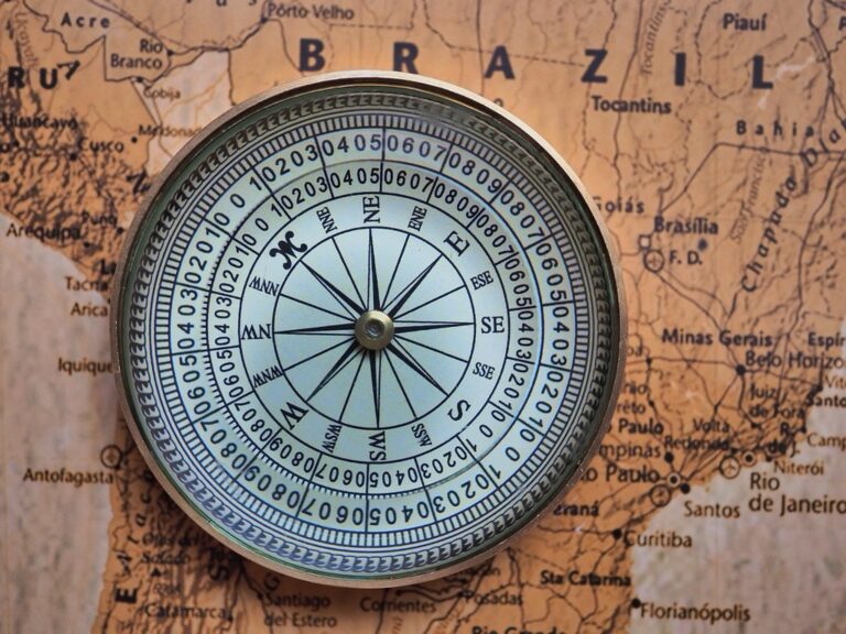
Adding Magnetic Compass Integration
Magnetic compass integration provides real-time directional reference that enhances spatial orientation on tactile maps. You’ll mount a liquid-filled compass with oversized numerals directly onto the map frame, positioning it where magnetic interference from other map elements remains minimal. The compass needle’s magnetic response helps users correlate map directions with actual cardinal bearings, while raised directional indicators around the compass rim provide tactile confirmation of north-south and east-west orientations.
Sound-Producing Elements for Audio Feedback
Sound-producing elements transform tactile maps into multi-sensory navigation tools that provide instant audio confirmation of geographic features. These components work alongside touch-based elements to create comprehensive mapping experiences for users with varying sensory needs.
Incorporating Pressure-Activated Sound Chips
Pressure-activated sound chips respond to touch by playing pre-recorded audio messages when users press specific map locations. Install these thin electronic components beneath key landmarks like capital cities, mountain peaks, and major rivers to provide instant identification feedback. Choose chips with adjustable volume controls and battery life exceeding 10,000 activations for long-term classroom or museum use. Position the chips strategically under raised relief features so users can locate them through touch exploration.
Creating Musical Tones for Different Regions
Musical tones help users distinguish between geographic regions through unique audio signatures that represent different land types. Assign high-pitched bell sounds to mountain ranges, low drum beats to valleys, and flowing water sounds to river systems for intuitive audio mapping. Program different musical scales for climate zones – major keys for temperate regions and minor keys for harsh environments like deserts or tundra. Use simple two-note chimes for political boundaries and complex harmonies for metropolitan areas to create memorable audio landmarks.
Adding Voice Recording Capabilities
Voice recording capabilities allow you to update map information dynamically by recording new audio content directly onto the tactile surface. Install recordable sound modules with 20-60 second capacity at major geographic features to provide detailed descriptions of topography, climate, and cultural significance. Use different voice actors or languages for various regions to enhance the cultural authenticity of your mapped areas. Connect multiple recording modules through a central control system that lets you update all audio content simultaneously when geographic or political changes occur.
Modular Puzzle Pieces for Educational Engagement
Modular puzzle pieces transform tactile maps into interactive learning systems where students physically manipulate geographic sections. You’ll create hands-on experiences that reinforce spatial relationships while building geographic knowledge through direct engagement.
Designing Removable Geographic Sections
Design individual regions as separate puzzle pieces using 6mm foam board for durability and easy handling. You’ll cut state boundaries, watershed divisions, or climate zones with precise laser cutting to ensure perfect fits. Each removable section includes raised textures matching the parent map’s tactile elements, maintaining consistency when pieces connect. Add small finger grips along edges using raised dots or indented handles for easy manipulation.
Creating Interlocking Boundary Elements
Create interlocking edges using traditional puzzle tab-and-blank connections scaled appropriately for your map size. You’ll machine precise cuts with 3mm tolerances to ensure snug fits without forcing pieces together. Political boundaries work exceptionally well with straight-edge connections, while natural features like rivers benefit from curved interlocking patterns. Test each connection point during prototyping to guarantee smooth assembly and disassembly during educational sessions.
Adding Layered Historical Timeline Pieces
Add temporal layers using stackable components that represent different historical periods on the same geographic area. You’ll create base layers showing modern boundaries with overlay pieces depicting historical territories, migration routes, or territorial changes. Use translucent materials like acrylic sheets for overlay pieces, allowing students to see underlying geography while exploring historical progression. Color-code each time period using consistent tactile patterns and maintain chronological stacking order from bottom to top.
Conclusion
Creating tactile maps opens up new possibilities for spatial learning and accessibility. By combining textures raised features Braille integration and interactive elements you’ll develop mapping solutions that serve diverse learning styles and abilities.
These seven approaches give you practical starting points whether you’re working with basic craft materials or advanced technologies. The key lies in understanding your audience and selecting techniques that match both your project goals and available resources.
Start with simple texture additions and gradually incorporate more complex features as you gain experience. Your tactile mapping journey will create more inclusive and engaging geographic experiences for everyone who uses your maps.
Frequently Asked Questions
What are tactile maps and why are they important?
Tactile maps are interactive maps that incorporate textures, raised features, and various materials to engage multiple senses beyond sight. They’re crucial for making maps accessible to visually impaired users while enhancing spatial understanding for everyone. These maps transform flat surfaces into three-dimensional experiences, helping users better comprehend terrain relationships, coastal geography, and other geographic features through touch.
How can I create raised relief textures on maps?
You can create raised relief using several techniques: stack foam layers of varying densities to simulate mountain slopes, carve valley systems into dense foam or cork boards for realistic depressions, and add textured surfaces for coastal variations. Simple materials like sandpaper work for basic projects, while complex 3D-printed topography suits advanced applications.
What is the best way to integrate Braille into tactile maps?
Strategic placement is key for seamless Braille integration. Use Grade 2 Braille for efficient labeling of major landmarks, and consider adhesive Braille tape or embossed dots for durability. Position labels in the lower-right quadrant with proper spacing to ensure clear reading flow. Create custom Braille legend systems with consistent symbol codes for unique map elements.
How do temperature-responsive elements enhance tactile maps?
Temperature-responsive materials provide immediate thermal feedback that enhances geographic understanding. Thermochromic pigments change color when touched, while heat-absorbing materials create warmth for tropical regions. Metal elements offer cooling sensations for polar areas, and cork surfaces provide thermal variation for rainforest regions, making climate zones more distinguishable through touch.
What role do magnetic components play in tactile mapping?
Magnetic components transform static maps into dynamic learning tools. Magnetic markers allow flexible identification of landmarks with easy repositioning as information changes. Removable magnetic strips help plan travel routes with color-coded ribbons for different transportation modes. Adding a magnetic compass provides real-time directional reference, enhancing spatial orientation and correlation with cardinal bearings.
How can sound elements improve tactile map accessibility?
Sound-producing elements provide instant audio feedback for geographic features. Pressure-activated sound chips play pre-recorded messages when users touch specific locations, enhancing identification and engagement. Musical tones can differentiate geographic regions with unique audio signatures, while voice recording capabilities allow dynamic updates of map information and cultural authenticity.
What are modular puzzle pieces in tactile mapping?
Modular puzzle pieces transform tactile maps into interactive learning systems, allowing physical manipulation of geographic sections. These removable geographic sections use durable foam board with interlocking boundary elements for smooth assembly. Layered historical timeline pieces can represent different periods, reinforcing spatial relationships and building geographic knowledge through hands-on engagement.
What materials work best for different tactile map features?
Material choice depends on the feature: foam layers work well for mountains, cork boards suit valleys and tropical regions, metal elements provide cooling for polar areas, and sandpaper offers basic texture. For durability, consider adhesive Braille tape, embossed dots, and thermochromic pigments. The key is matching material properties to the geographic feature you’re representing.