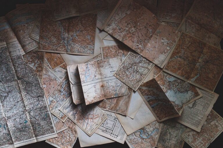
5 Best Digital Map Innovations
The mapping industry is experiencing its biggest revolution since GPS went mainstream. Crowdsourced data from millions of smartphones users and volunteers is transforming how we create and update maps in real-time. You’re witnessing the shift from traditional surveying methods to dynamic community-driven cartography that’s faster more accurate and incredibly detailed.
Experience vivid content on the Galaxy A16 5G's 6.7" display and capture stunning photos with its triple-lens camera. Enjoy peace of mind with a durable design, six years of updates, and Super Fast Charging.

Traditional mapping relied on expensive equipment and specialized teams that could take years to update a single region. Now everyday people contribute geographic information through apps like Waze Google Maps and specialized platforms creating a continuous stream of location data. This democratization of mapmaking isn’t just changing who creates maps – it’s revolutionizing what maps can show and how quickly they reflect our changing world.
Disclosure: As an Amazon Associate, this site earns from qualifying purchases. Thank you!
Real-Time Map Updates Will Replace Static Cartographic Models
Traditional cartographic workflows that relied on scheduled updates and manual verification are becoming obsolete as crowdsourced data enables continuous map refreshing.
P.S. check out Udemy’s GIS, Mapping & Remote Sensing courses on sale here…
Instant Geographic Changes Through User Contributions
Crowdsourced platforms now capture geographic changes within hours of occurrence. When you contribute location data through apps like Waze or OpenStreetMap you’re feeding algorithms that instantly update base maps. Your smartphone automatically detects new roads construction sites and business openings then transmits this information to mapping databases. This real-time data collection means maps can reflect street closures within 15 minutes and new developments within 24 hours rather than waiting months for traditional surveying updates.
Dynamic Infrastructure Mapping for Urban Development
Urban planners now access live infrastructure data through crowdsourced mapping networks. Your contributions help track utility installations traffic pattern changes and zoning modifications as they happen. Mapping platforms like Mapbox and HERE integrate user-generated data to show construction progress sidewalk accessibility and public transit changes in real-time. This dynamic approach lets city planners make data-driven decisions based on current conditions rather than outdated static maps that might be 6-12 months behind actual development.
Emergency Response Mapping During Natural Disasters
Emergency responders rely on crowdsourced data for critical real-time disaster mapping. When you report road blockages flooding or structural damage through emergency apps you’re directly supporting rescue operations. Platforms like Crisis Mapping and Ushahidi aggregate citizen reports to create live hazard maps that update every few minutes. Your GPS-enabled photos and location tags help emergency teams identify safe routes evacuation centers and areas needing immediate assistance when traditional mapping infrastructure fails during disasters.
Community-Driven Geographic Information Will Enhance Map Accuracy
Community contributions create more precise maps by leveraging millions of on-ground observers who spot inaccuracies that satellite imagery and traditional surveys miss.
Local Knowledge Integration for Remote Area Mapping
Local residents provide invaluable geographic details about remote areas where official surveys are infrequent or outdated. Mountain communities document unmarked trails, seasonal road closures, and hidden water sources that don’t appear on government maps. Indigenous populations contribute traditional place names and navigation landmarks that enhance cultural accuracy. Rural farmers identify property boundaries, access roads, and agricultural features that satellite imagery can’t distinguish. These ground-truth contributions fill critical gaps in areas where professional cartographers rarely venture, creating comprehensive coverage of previously unmapped territories.
Crowd-Verified Points of Interest and Landmarks
Multiple users verify the same geographic features, creating reliable consensus data that surpasses single-source mapping accuracy. Business owners update their locations, hours, and services directly through mapping platforms, ensuring commercial data stays current. Travelers confirm hiking trail conditions, parking availability, and accessibility features that official sources often overlook. Local experts validate historical landmarks, cultural sites, and natural features with precise GPS coordinates and detailed descriptions. This collective verification process eliminates outdated information and reduces mapping errors through redundant confirmation from independent sources.
Error Correction Through Collective Intelligence
Crowdsourced networks identify and fix mapping errors faster than traditional quality control processes. Users report road changes, new construction, and closed businesses within hours of occurrence, triggering immediate map updates. Geographic inconsistencies get flagged by multiple contributors, creating automated error detection systems that prioritize corrections. Community moderators review disputed edits and resolve conflicts through collaborative decision-making processes. Machine learning algorithms analyze user contribution patterns to identify reliable contributors and weight their edits accordingly, improving overall data quality through intelligent crowd management.
Democratized Mapping Will Make Cartography Accessible to Everyone
Crowdsourced data transforms mapping from an exclusive professional domain into a collaborative endeavor where anyone can contribute to and create geographic information. This democratization removes traditional barriers that previously limited cartographic participation to trained surveyors and expensive equipment owners.
Open-Source Mapping Platforms for Global Collaboration
Open-source platforms like OpenStreetMap enable global collaboration by providing free access to mapping tools and geographic databases. You can contribute to worldwide mapping projects without expensive software licenses or specialized training programs. Community-driven initiatives allow volunteers from different countries to work together on disaster response maps, humanitarian aid projects, and infrastructure documentation. These collaborative environments foster knowledge sharing between experienced cartographers and newcomers, creating mentorship opportunities that accelerate skill development across diverse geographic regions.
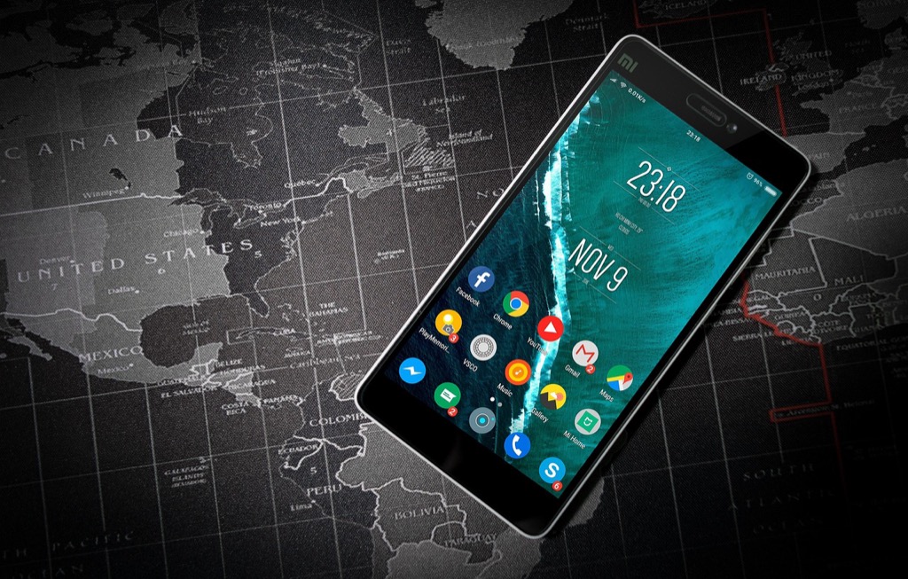
Mobile Technology Enabling Citizen Cartographers
Explore and map the wilderness for the Queen in Cartographers! Draw unique terrain shapes and score points based on randomly selected goals each game, but beware of monster ambushes.

Mobile devices transform everyday users into capable cartographers by providing GPS-enabled data collection tools in everyone’s pocket. You can capture precise geographic coordinates, photographs, and attribute data using smartphone applications like KoBoToolbox, Survey123, or Field Maps. Camera integration allows instant documentation of geographic features, while offline capabilities ensure data collection continues in remote areas without internet connectivity. Touch-screen interfaces simplify complex mapping workflows, making geographic information systems accessible to users without technical GIS backgrounds or expensive desktop software.
Reduced Barriers to Geographic Data Collection
Traditional geographic data collection required expensive surveying equipment, specialized training, and significant time investments that excluded most potential contributors. You now access free or low-cost mapping applications that automate complex processes like coordinate transformation, data validation, and feature attribution. Cloud-based storage eliminates the need for expensive server infrastructure, while automated quality control algorithms reduce the technical expertise required for data verification. Simplified user interfaces guide contributors through data collection protocols, ensuring consistent results without extensive cartographic education or professional certification requirements.
Get accurate leveling with the KEZERS 32X Optical Level Kit. It features 32X magnification, a self-leveling system, and comes with a tripod and grade rod for easy setup.

Hyper-Local Data Collection Will Create Unprecedented Detail Levels
Crowdsourced data collection transforms traditional mapping by capturing geographic details at resolutions previously impossible through conventional surveying methods. You’ll witness mapping precision that extends far beyond what satellites and aerial photography can achieve.
Street-Level Mapping Through Smartphone Integration
Smartphone-equipped volunteers collect centimeter-accurate positioning data through GPS integration while walking city streets. You can document precise building entrances, street furniture locations, and curb cuts that wheelchair users need. Popular apps like StreetComplete and MapComplete enable contributors to photograph and geo-tag specific features including fire hydrants, mailboxes, and traffic signals. This street-level documentation creates detailed urban infrastructure maps that support accessibility planning and emergency response coordination.
Micro-Geographic Features Documentation
Crowdsourced mapping captures micro-geographic elements that traditional surveys often overlook due to cost constraints. You’ll find contributors documenting park benches, drinking fountains, public restrooms, and bicycle repair stations with precise coordinates. Local residents identify seasonal flooding areas, temporary construction barriers, and community garden plots that change frequently. Apps like iNaturalist and Seek help mappers record specific tree species, geological features, and natural landmarks that enhance environmental and recreational mapping accuracy.
Pedestrian and Cycling Path Comprehensive Coverage
Community contributors map detailed pedestrian and cycling infrastructure that official surveys frequently miss or generalize. You can access precise trail conditions, surface materials, and grade information collected by regular path users. Cyclists document bike lane connectivity, parking availability, and hazardous intersections through specialized apps like Cyclopath and Bikemap. Hiking enthusiasts contribute trail difficulty ratings, seasonal accessibility, and waypoint locations that help outdoor recreation planning and safety management efforts.
Collaborative Mapping Will Transform Professional Cartographic Workflows
Professional cartographers are integrating community-generated data streams into established workflows, creating hybrid mapping systems that combine traditional accuracy with real-time updates.
Integration of Crowdsourced Data with Traditional Surveying Methods
Professional surveyors now incorporate crowdsourced data as a verification layer for field measurements, using community reports to identify areas requiring resurvey. GIS specialists merge volunteer-collected GPS coordinates with official survey data, creating comprehensive datasets that capture both precise measurements and local knowledge. Traditional cartographic workflows benefit from crowdsourced temporal data, allowing professionals to track seasonal changes and infrastructure modifications between formal survey cycles. Quality assessment protocols now include community feedback validation, where professional cartographers cross-reference user reports with established geodetic control points to maintain accuracy standards.
Quality Control Systems for User-Generated Geographic Content
Automated verification algorithms filter crowdsourced submissions through multiple validation layers, comparing user data against existing authoritative sources and flagging inconsistencies for manual review. Professional cartographers implement consensus-based quality control, requiring multiple user confirmations before accepting geographic updates into official datasets. Machine learning systems analyze contributor reliability scores, prioritizing submissions from users with proven accuracy records while flagging potential errors from new contributors. Statistical outlier detection identifies geographic anomalies in crowdsourced data, triggering professional verification workflows that combine algorithmic screening with expert human judgment to ensure cartographic integrity.
New Career Opportunities in Community Map Management
Community mapping coordinators manage volunteer contributor networks, developing training programs and quality standards that bridge amateur enthusiasm with professional cartographic requirements. Data validation specialists focus exclusively on reviewing crowdsourced geographic content, applying statistical methods and field verification to maintain dataset accuracy. Geographic community managers facilitate collaboration between professional cartographers and citizen contributors, creating workflows that leverage both expert knowledge and local insights. Crowdsourced data analysts specialize in extracting meaningful patterns from user-generated geographic information, supporting urban planning and infrastructure development with real-time community intelligence.
Conclusion
The future of cartography lies in your hands—literally. As crowdsourced data continues to reshape how maps are created and maintained you’re witnessing the birth of a more accurate responsive and democratic mapping ecosystem.
Whether you’re contributing through your daily smartphone usage or actively participating in mapping projects you’re part of a global movement that’s making geographic information more accessible than ever before. This shift doesn’t just benefit tech companies or urban planners—it creates better navigation experiences disaster response capabilities and community planning tools for everyone.
The traditional barriers between professional cartographers and everyday users are dissolving creating opportunities for collaboration that enhance both accuracy and coverage. Your local knowledge combined with advanced verification systems is building the foundation for the next generation of maps that truly reflect our dynamic world.
Achieve a flawless, even complexion with e.l.f. Flawless Satin Foundation. This lightweight, vegan formula provides medium coverage and a semi-matte finish for all-day wear, while hydrating your skin with glycerin.

Frequently Asked Questions
What is crowdsourced mapping and how does it work?
Crowdsourced mapping involves collecting geographic data from smartphone users and volunteers rather than traditional surveyors. Everyday people contribute information through GPS-enabled apps, photographing locations, reporting road conditions, and documenting points of interest. This community-driven approach creates real-time, detailed maps by leveraging millions of on-ground observers who can capture geographic changes as they happen.
How does crowdsourced mapping differ from traditional cartography?
Traditional mapping relies on scheduled surveys, expensive equipment, and trained professionals, resulting in infrequent updates and higher costs. Crowdsourced mapping enables continuous updates from community contributors using smartphones, allowing maps to reflect changes within hours rather than months or years. This creates more dynamic, accurate representations of our evolving environment.
What are the main benefits of crowdsourced mapping?
Crowdsourced mapping offers real-time updates, enhanced accuracy through multiple verifications, detailed coverage of micro-geographic features, and democratized access to mapmaking. It captures information that satellites and traditional surveys miss, such as seasonal changes, accessibility features, and local landmarks. The approach also reduces costs while increasing the speed of geographic data collection.
How do platforms ensure the accuracy of crowdsourced data?
Quality control systems use automated verification algorithms and consensus-based validation processes. Multiple users must confirm geographic features before they’re accepted, creating reliable data through community verification. Professional surveyors often review contributions, and GIS specialists merge volunteer-collected data with official survey information to maintain accuracy standards.
What role does crowdsourced mapping play in emergency response?
During natural disasters, citizen reports help create live hazard maps that assist rescue operations. Volunteers can quickly document road closures, flooding areas, and safe passages, providing real-time information that traditional mapping systems cannot deliver fast enough. This immediate geographic intelligence proves crucial for coordinating emergency response efforts and saving lives.
How has mobile technology transformed mapping participation?
GPS-enabled smartphones allow anyone to become a citizen cartographer without expensive equipment or specialized training. Free mapping applications enable users to collect centimeter-accurate positioning data, photograph geo-tagged locations, and contribute to detailed infrastructure maps. This technology has removed traditional barriers, making geographic data collection accessible to millions of everyday users.
What types of geographic details can crowdsourced mapping capture?
Community contributors document micro-geographic features like building entrances, park benches, trail conditions, seasonal flooding areas, and accessibility features. They map pedestrian and cycling infrastructure, document unmarked trails, report business hours, and identify agricultural features that satellite imagery cannot distinguish. This comprehensive coverage exceeds what traditional surveys typically capture.
How are professional cartographers adapting to crowdsourced data?
Professional surveyors now integrate community-generated data as a verification layer in their workflows. GIS specialists create hybrid systems combining traditional accuracy with real-time updates. New career opportunities have emerged, including community mapping coordinators and data validation specialists who bridge amateur contributions with professional standards, creating collaborative cartographic processes.