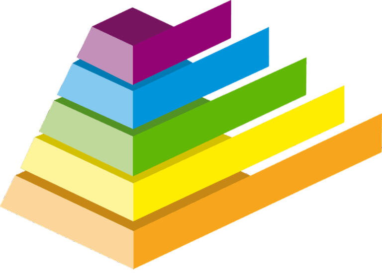
7 Best Digital Map Shading Techniques
Why it matters: Terrain shading transforms flat digital maps into visually stunning representations that communicate elevation and landscape features with remarkable clarity.
The big picture: Whether you’re creating maps for hiking apps, urban planning projects, or data visualization dashboards, mastering terrain shading techniques separates amateur cartographers from professionals who capture attention and convey complex geographic information effortlessly.
Explore and map the wilderness for the Queen in Cartographers! Draw unique terrain shapes and score points based on randomly selected goals each game, but beware of monster ambushes.

What’s ahead: These seven proven rules will help you create terrain shading that enhances readability, maintains visual hierarchy, and delivers the impact your maps deserve.
Disclosure: As an Amazon Associate, this site earns from qualifying purchases. Thank you!
P.S. check out Udemy’s GIS, Mapping & Remote Sensing courses on sale here…
Understanding the Fundamentals of Light and Shadow in Terrain Shading
You’ll need to master the interplay between light direction, elevation changes, and slope angles to create convincing terrain shading. These three elements form the foundation of all effective relief visualization techniques.
Achieve a flawless, even complexion with e.l.f. Flawless Satin Foundation. This lightweight, vegan formula provides medium coverage and a semi-matte finish for all-day wear, while hydrating your skin with glycerin.

Identifying Your Primary Light Source Direction
Establish your light source at a 315-degree azimuth (northwest) with a 45-degree elevation angle for optimal terrain readability. This standard configuration prevents visual confusion that occurs with southern light sources, which can make ridges appear as valleys. Set your illumination parameters in ArcGIS Pro or QGIS using these exact values to maintain consistency across your mapping projects. Document your light source settings in your project metadata to ensure reproducible results when updating or revising your terrain models.
Recognizing How Elevation Affects Shadow Intensity
Calculate shadow intensity using elevation differentials and your chosen vertical exaggeration factor to achieve realistic terrain representation. Higher elevations cast longer shadows on adjacent lower areas, creating depth perception that guides map readers through topographic complexity. Apply a 2-3x vertical exaggeration in mountainous regions and 5-10x in subtle terrain to enhance visibility without distorting geographic accuracy. Test your shadow intensity against known landmarks to verify that prominent features like ridgelines and valley floors display appropriate contrast levels.
Mastering the Relationship Between Slope Angle and Shading
Adjust your shading algorithms to emphasize slope breaks and terrain transitions rather than uniform gradient coverage. Steep slopes (>30 degrees) require darker shading values to maintain visual separation from gentler terrain, while slopes under 5 degrees benefit from subtle highlighting to prevent them from appearing flat. Use histogram analysis in your GIS software to identify slope distribution patterns, then customize your shading ramp to allocate 60% of your tonal range to the most common slope angles in your study area.
Establishing Consistent Light Source Direction Throughout Your Map
Building on the recommended 315-degree azimuth standard, you must maintain this light direction consistently across all terrain features to create professional-quality relief visualization.
Choosing the Optimal Light Angle for Maximum Contrast
Northwest illumination at 315 degrees produces the strongest visual hierarchy for most terrain types. This angle creates optimal shadow placement on southern and eastern slopes while highlighting northern and western faces. You’ll achieve maximum contrast when combining this azimuth with a 45-degree elevation angle, particularly effective for mountainous regions with elevation changes exceeding 1,000 feet. Test alternative angles like 300 or 330 degrees only when specific terrain orientations require enhanced ridge definition.
Maintaining Uniform Lighting Across Different Terrain Features
Apply identical light parameters across valleys, ridges, and plateaus to prevent visual inconsistencies that confuse map readers. Your shading algorithm should use the same azimuth and elevation values regardless of local terrain complexity. Lock these settings in your GIS software before processing different elevation zones. Avoid adjusting light direction for individual features – this creates a patchwork effect that destroys the map’s visual unity and makes elevation interpretation difficult for users.
Avoiding Common Light Direction Mistakes
Don’t rotate light sources to “improve” specific mountain faces or canyon features, as this breaks the fundamental lighting model. Multiple light directions within a single map create impossible shadow patterns that violate natural lighting physics. Resist using due south (180-degree) illumination despite its intuitive appeal – this angle flattens north-facing slopes and reduces overall terrain definition. Similarly, avoid perfectly overhead lighting (90-degree elevation) which eliminates crucial shadow information needed for depth perception.
Creating Realistic Shadow Gradients Based on Elevation Changes
Building on your consistent 315-degree light source, you’ll need to calculate precise shadow intensity values that reflect actual elevation differences in your terrain data.
Calculating Shadow Intensity for Different Altitude Levels
Calculate shadow intensity using elevation differential ratios to create authentic terrain relief. Apply a base intensity value of 0.3 for sea-level features and increase by 0.1 increments per 500-meter elevation gain. Your mountain peaks above 2,000 meters should reach maximum intensity values of 0.8-0.9. Use your DEM’s native resolution to determine precise elevation steps and avoid artificial banding in shadow transitions. Test your intensity calculations against known terrain profiles like the Grand Canyon or Swiss Alps for reference validation.
Blending Shadows Smoothly Between Elevation Transitions
Blend shadow transitions using gaussian blur algorithms with radius values proportional to your map scale. Apply 2-3 pixel blur radius for 1:50,000 scale maps and 5-7 pixels for 1:10,000 detail maps. Create seamless gradients by overlapping shadow zones by 15-20% of their total width at elevation boundaries. Your transition zones should span 3-5 elevation contour intervals to prevent harsh breaks between highland and lowland areas. Use feathering techniques in QGIS or ArcGIS to soften abrupt elevation changes automatically.
Using Gradient Tools for Natural-Looking Shadow Effects
Use radial gradient tools to simulate natural light falloff across complex terrain surfaces. Configure your gradient editor with 4-6 color stops ranging from pure black (valleys) to 70% transparency (ridgelines). Apply non-linear gradient curves that follow logarithmic light decay patterns found in natural environments. Your gradient should compress shadow detail in the darkest 20% of values while expanding mid-tone variations. Tools like Blender’s shader nodes or Photoshop’s gradient maps provide precise control over these natural light distribution patterns.
Adjusting Shading Intensity to Match Slope Steepness
Your terrain’s slope steepness directly determines how dark your shadows should appear. Proper intensity scaling creates realistic depth perception while maintaining terrain readability across varying gradients.
Determining Shadow Darkness for Steep Versus Gentle Slopes
Steep slopes (>30 degrees) require maximum shadow intensity values of 0.8-0.9 to accurately represent their dramatic elevation changes. Configure your shading algorithms to calculate slope angles using DEM derivatives, then assign darkness values proportionally. Gentle slopes (0-15 degrees) work best with lighter intensity values of 0.2-0.4 to prevent terrain flattening. Use GIS software like ArcGIS Pro’s hillshade function with custom z-factor settings to achieve these precise intensity ratios.
Creating Dynamic Contrast Through Variable Shading Intensity
Variable intensity scaling transforms flat-looking terrain into visually compelling relief maps. Apply logarithmic scaling functions to compress intensity ranges for subtle slopes while amplifying dramatic terrain features. Set your base intensity at 0.1 for minimal slopes, scaling exponentially to 0.9 for cliff faces and ridgelines. QGIS users can leverage the hillshade renderer with custom color ramps to automate this scaling process across large datasets.
Explore the United States with this 3D raised relief map. Feel the terrain and understand topography through its tactile, vacuum-formed design.

Balancing Dramatic Effect with Readability
Excessive contrast sacrifices map readability for visual drama, creating unusable terrain representations. Limit your maximum intensity difference to 0.7 between adjacent slope categories to maintain smooth transitions. Test your shading at various zoom levels to ensure text and symbols remain legible over shaded terrain. Professional cartographers recommend keeping shadow intensity below 0.6 in areas containing critical map labels or dense feature symbology.
Applying Proper Color Temperature to Enhance Terrain Depth
Color temperature transforms flat terrain representations into compelling three-dimensional visualizations that guide readers through elevation changes intuitively.
Selecting Warm and Cool Tones for Different Elevations
Higher elevations benefit from cool blue-purple tones that naturally recede from the viewer, creating atmospheric perspective. Apply temperatures between 6500K-8000K for mountain peaks and ridgelines to simulate distant atmospheric haze effects.
Lower elevations require warm yellow-orange undertones (3000K-4500K) that advance toward the viewer, establishing visual hierarchy. Valleys and depressions should incorporate burnt sienna or raw umber bases with 15-20% saturation to maintain depth perception while preserving terrain readability.
Using Color Psychology to Convey Terrain Characteristics
Desert regions respond to warm ochre and terracotta palettes that communicate aridity and heat, using color temperatures around 3200K to reinforce environmental context. Rocky terrain benefits from neutral gray-brown combinations that suggest stability and permanence.
Forested areas require muted green undertones with cool temperature shifts (5500K-6000K) in shadowed slopes to suggest vegetation density. Alpine zones should transition from warm valley colors to cool summit tones, creating natural elevation narratives that enhance user comprehension of topographic relationships.
Avoiding Oversaturation in Shadow Areas
Shadow regions must maintain color fidelity below 40% saturation to prevent chromatic interference with terrain features and map symbology. Oversaturated shadows create visual noise that competes with elevation data and reduces overall map legibility.
Neutral density approaches work best for deep canyon shadows and north-facing slopes, using desaturated versions of your base terrain colors rather than pure black or gray. Maintain shadow temperature consistency at 6000K-6500K to avoid conflicting color casts that could misrepresent elevation relationships or confuse terrain interpretation.
Maintaining Visual Balance Between Highlighted and Shadowed Areas
Effective terrain shading requires careful balance between light and dark areas to prevent visual dominance that compromises map functionality. You’ll need to maintain strategic contrast ratios while ensuring all terrain details remain accessible to users.
Preserving Map Readability Through Strategic Contrast
Strategic contrast management keeps your terrain features visible without sacrificing dimensional depth. You should maintain a 60:40 ratio between highlighted and shadowed areas across your map extent to ensure optimal readability. Configure your shading algorithm to preserve mid-tone values between 0.4-0.6 for critical terrain transitions, allowing labels and symbols to remain legible. Test contrast ratios at multiple zoom levels using tools like ColorBrewer to verify that text overlays maintain adequate separation from terrain backgrounds.
Preventing Overwhelming Dark Areas That Obscure Details
Overwhelming shadow regions destroy map usability by hiding essential geographic information beneath impenetrable darkness. You must limit shadow intensity to maximum values of 0.7 in deep valleys and canyon systems to preserve feature visibility. Apply gradient masks to shadow edges using 20-pixel feathering in Photoshop or similar blur radius in QGIS to prevent harsh boundaries. Configure your hillshade parameters with ambient lighting values above 0.2 to maintain subtle detail visibility in shadowed terrain areas.
Creating Focal Points Through Selective Shading Emphasis
Selective shading emphasis directs reader attention to primary terrain features while maintaining overall map hierarchy. You should identify 2-3 dominant elevation features per map extent and increase their shadow contrast by 0.1-0.2 intensity values above surrounding areas. Use masking techniques to isolate prominent ridgelines or peaks, applying enhanced shading selectively rather than globally. Configure your GIS software to create custom shading classes that emphasize specific elevation ranges, ensuring focal areas don’t exceed 15% of total map coverage to maintain visual balance.
Adapting Shading Techniques for Different Map Scales and Purposes
Your shading approach must adapt to serve different map scales and intended uses. Each application demands specific adjustments to detail level, complexity, and visual emphasis.
Modifying Detail Level for Large-Scale Versus Small-Scale Maps
Large-scale maps (1:10,000 or larger) require detailed shadow gradients that reveal micro-terrain features like individual ridges and gullies. You’ll need shadow intensity values ranging from 0.1-0.9 with smooth transitions every 10-meter elevation change. Configure your shading algorithms to preserve fine slope breaks and use gaussian blur radius settings below 2 pixels to maintain crisp terrain definition.
Small-scale maps (1:100,000 or smaller) benefit from simplified shading that emphasizes major landform patterns. Reduce shadow intensity ranges to 0.2-0.7 and increase blur radius to 5-8 pixels for broader shadow zones. Focus your detail on prominent mountain ranges and valley systems while suppressing minor topographic variations that create visual noise.
Adjusting Shading Complexity for Digital Versus Print Media
Digital maps support dynamic shading layers with multiple illumination angles and real-time shadow adjustments. You can implement adaptive shading that responds to zoom levels, using detailed relief at close scales and generalized patterns for overview displays. Configure shadow opacity between 30-50% to ensure underlying map elements remain visible on backlit screens.
Print media requires optimized shading for CMYK color reproduction and paper texture considerations. Increase shadow contrast by 15-20% to compensate for ink absorption and dot gain effects. Use spot color overlays for critical terrain features and limit your shading palette to 4-6 distinct tonal values to ensure consistent reproduction across different printing processes.
Customizing Techniques for Topographic, Relief, and Artistic Maps
Topographic maps demand precise elevation representation with standardized shadow angles at 315 degrees and consistent intensity scaling. Your shading should complement contour lines without obscuring elevation values, using shadow opacity below 40% in areas with dense contour spacing.
Plan your next adventure with the 2025 National Geographic Road Atlas, covering the United States, Canada, and Mexico. Its durable, folded format (11 x 15 in) makes it ideal for hiking and camping trips.

Relief maps emphasize dramatic terrain visualization through enhanced shadow contrast and exaggerated vertical scaling. Apply 3-5x vertical exaggeration and shadow intensity values reaching 0.9 for maximum visual impact while maintaining accurate relative elevation relationships.
Artistic maps allow creative interpretation through varied light sources, color temperature adjustments, and stylized shadow patterns. You can experiment with multiple illumination angles, warm-cool color transitions, and painterly shadow effects while preserving essential terrain information for navigation purposes.
Conclusion
Mastering these seven terrain shading rules will transform your maps from basic elevation displays into professional-quality visualizations that guide users effortlessly through complex landscapes. Remember that consistency in light direction and careful attention to shadow gradients create the foundation for readable terrain representation.
Your choice of color temperature and balanced contrast ratios will determine whether your terrain shading enhances or hinders map comprehension. Don’t forget to adapt your techniques based on your specific map scale and intended audience.
With practice these principles become second nature allowing you to create terrain visualizations that not only inform but also inspire. Your maps will stand out in a crowded digital landscape where poor shading techniques are unfortunately common.
Frequently Asked Questions
What is terrain shading and why is it important in digital maps?
Terrain shading is a cartographic technique that uses light and shadow effects to visually represent elevation changes and landscape features on digital maps. It transforms flat 2D representations into intuitive 3D visualizations, making it easier for users to understand topography. This technique is crucial for professional map creation in hiking apps, urban planning, and data visualization, as it significantly enhances map readability and user comprehension.
What is the optimal light source positioning for terrain shading?
The recommended standard for terrain shading is a primary light source positioned at a 315-degree azimuth (northwest direction) with a 45-degree elevation angle. This positioning creates optimal terrain readability and prevents visual confusion by providing maximum contrast for most terrain types. Maintaining consistent light direction across all terrain features is essential for achieving professional-quality relief visualization.
How do I calculate shadow intensity for different elevations?
Start with a base intensity value of 0.3 for sea-level features, then increase by 0.1 increments per 500 meters of elevation gain. Mountain peaks should reach maximum intensity values of 0.8-0.9. Use gaussian blur algorithms and overlapping shadow zones at elevation boundaries to ensure smooth transitions. This systematic approach creates realistic shadow gradients that accurately reflect elevation differences.
What vertical exaggeration should I use for terrain shading?
For mountainous regions, use 2-3x vertical exaggeration to enhance terrain definition without distortion. For subtle terrain with gentle elevation changes, apply 5-10x exaggeration to make features more visible. The key is balancing enhancement with accuracy – enough exaggeration to reveal important terrain details while maintaining realistic proportions that don’t mislead map users.
How should slope steepness affect shading intensity?
Steep slopes (>30 degrees) require maximum shadow intensity values of 0.8-0.9 for accurate representation, while gentle slopes (0-15 degrees) should use lighter intensity values of 0.2-0.4 to maintain readability. Use logarithmic scaling functions for dynamic contrast, but avoid excessive contrast that compromises legibility. Keep maximum intensity difference below 0.7 between adjacent slope categories.
What color temperature techniques work best for terrain shading?
Use cool blue-purple tones for higher elevations and warm yellow-orange undertones for lower elevations to establish clear visual hierarchy. Apply terrain-specific palettes: warm ochre for deserts, muted greens for forests. Keep shadow regions below 40% saturation to prevent visual noise, and maintain consistent shadow temperature throughout the map to avoid conflicting color casts.
How do I maintain visual balance in terrain shading?
Aim for a 60:40 ratio between highlighted and shadowed areas to ensure all terrain details remain accessible. Configure shading algorithms to preserve mid-tone values for critical terrain transitions. Limit shadow intensity in deep valleys to prevent detail loss, and apply gradient masks to shadow edges. Keep enhanced shading below 15% of total map coverage to maintain overall visual balance.
Should terrain shading vary for different map scales and purposes?
Yes, adapt shading complexity based on scale and purpose. Large-scale maps need detailed shadow gradients for micro-terrain features, while small-scale maps benefit from simplified shading emphasizing major landforms. Digital maps can use dynamic shading layers, while print media requires optimized shading for color reproduction. Customize techniques for topographic precision, dramatic relief visualization, or artistic interpretation as needed.