7 Best Home Mapping Ideas for Visualization
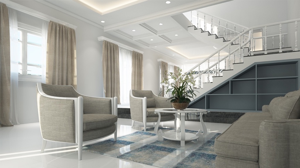
Why it matters: Your private spaces deserve more than basic floor plans – they need creative mapping solutions that maximize functionality while reflecting your personal style.
The big picture: Smart mapping transforms cramped apartments into efficient sanctuaries and turns awkward room layouts into purposeful living areas that work for your lifestyle.
What’s next: These seven innovative approaches will help you reimagine your space through strategic mapping techniques that interior designers use to create stunning private environments.
Disclosure: As an Amazon Associate, this site earns from qualifying purchases. Thank you!
P.S. check out Udemy’s GIS, Mapping & Remote Sensing courses on sale here…
Understanding the Importance of Mapping Private Spaces
Accurate spatial documentation transforms how you interact with your personal environment. Strategic mapping reveals hidden opportunities within your living areas while establishing clear boundaries for different activities.
Benefits of Spatial Awareness in Personal Areas
Spatial awareness through detailed mapping helps you identify underutilized corners, awkward alcoves, and dead spaces that could serve specific functions. You’ll discover natural traffic patterns that influence furniture placement and room flow. Mapping reveals sight lines that affect privacy between different zones within your home. Understanding your space’s dimensions prevents costly furniture purchases that won’t fit properly. You can optimize natural light distribution by documenting window placement and seasonal sun patterns throughout each room.
How Mapping Enhances Privacy and Security
Privacy mapping identifies vulnerable areas where sound travels between rooms or where visual access compromises personal activities. You’ll locate blind spots that need additional lighting or security coverage for enhanced safety. Strategic documentation helps you create buffer zones between public entertaining areas and private retreats. Mapping exterior access points reveals potential security weaknesses around windows, doors, and hidden entry routes. You can establish clear boundaries for different privacy levels throughout your home by understanding how each space connects to others.
Creating Digital Floor Plans Using Smartphone Apps
Experience vivid content on the Galaxy A16 5G's 6.7" display and capture stunning photos with its triple-lens camera. Enjoy peace of mind with a durable design, six years of updates, and Super Fast Charging.

Modern mapping technology puts professional-grade floor planning capabilities directly in your pocket. Today’s smartphone apps can transform your device into a precise surveying tool for creating detailed digital floor plans.
Best Mobile Apps for Room Mapping
MagicPlan leads the market with LiDAR integration for iOS devices, delivering sub-inch accuracy measurements. You’ll capture room dimensions by simply pointing your camera at corners and walls. RoomScan Pro offers excellent Android compatibility, using your phone’s sensors to map spaces as you touch walls around room perimeters. Floor Plan Creator provides comprehensive drawing tools for manual adjustments after initial scans. These apps eliminate the need for traditional measuring tapes while producing professional-quality results suitable for renovation planning and space optimization projects.
Get accurate measurements with this 25-foot retractable tape measure. Features an easy-to-read blade and durable construction with a riveted end hook.
Step-by-Step Guide to Digital Mapping
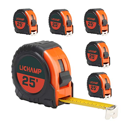
Start by calibrating your app using a known measurement reference like a standard door frame. Walk slowly around room perimeters, keeping your phone steady at chest height for consistent readings. Mark architectural features including windows, doors, and built-in fixtures as you progress through each space. Verify measurements by cross-checking critical dimensions with physical measurements using a tape measure. Export your completed floor plan in multiple formats including PDF, DWG, and image files for maximum compatibility with design software and sharing purposes.
This 25-foot Komelon Power Tape features an automatic blade lock for easy measuring and retracts with the push of a button. Its durable, nylon-coated blade and impact-resistant case ensure long-lasting performance.

Sketching Hand-Drawn Maps with Artistic Flair
Hand-drawn mapping transforms technical documentation into personal artwork that captures your space’s unique character. You’ll create maps that serve as both functional references and meaningful representations of your home’s spatial relationships.
Essential Tools for Creative Map Drawing
Quality drawing materials form the foundation of your hand-drawn mapping project. You’ll need precision tools like architectural rulers, compass sets, and fine-tip pens ranging from 0.3mm to 0.7mm for different line weights. Graph paper provides essential measurement guidance while maintaining artistic flexibility.
Achieve a flawless, even complexion with e.l.f. Flawless Satin Foundation. This lightweight, vegan formula provides medium coverage and a semi-matte finish for all-day wear, while hydrating your skin with glycerin.

Measuring instruments ensure accuracy in your creative process. Digital laser measures, traditional tape measures, and angle finders help you capture precise dimensions. You’ll also benefit from having pencils in various hardnesses (2H for initial sketches, HB for final lines) and quality erasers for clean corrections.
Get accurate distance measurements up to 100 feet with the Bosch GLM100-23 laser measure. Its simple two-button operation and backlit display make measuring easy, even in dark areas.

Adding Personal Style and Character
Artistic elements transform basic floor plans into personalized spatial stories. You can incorporate watercolor washes to indicate different room functions, decorative borders that reflect your home’s architectural style, or hand-lettered room labels using calligraphy techniques. Small illustrations of furniture, plants, or personal belongings add meaningful details.
Create vibrant watercolor art with this portable set. It includes 40 colors (metallic & fluorescent), a brush pen, watercolor paper, and more, all in a stylish tin box.

Creative techniques make your maps uniquely yours while maintaining functionality. Try using different textures for various surfaces – crosshatching for hardwood floors, stippling for carpeted areas, or flowing lines for outdoor spaces. You can also include directional indicators, natural light patterns, or seasonal elements that show how your space changes throughout the year.
Building 3D Models for Comprehensive Visualization
Creating physical and digital 3D models transforms flat mapping concepts into tangible visualizations that reveal spatial relationships your traditional maps can’t capture. These dimensional representations help you identify design challenges and spatial opportunities before committing to costly renovations.
Materials and Techniques for Physical Models
Foam core boards provide the foundation for precise architectural models, offering clean cuts and professional-looking surfaces. Cut walls to exact scale using architectural rulers and craft knives for accuracy.
Cardboard and posterboard work well for quick conceptual models when testing furniture arrangements or traffic flow patterns. Layer different textures using sandpaper strips for flooring and fabric swatches for wall finishes.
3D printing filament enables detailed custom elements like built-in furniture, unique architectural features, or scaled room accessories that standard materials can’t replicate effectively.
Digital 3D Modeling Software Options
SketchUp Free delivers intuitive 3D modeling with drag-and-drop functionality, making it ideal for beginners creating room layouts and furniture placement studies without technical expertise.
Sweet Home 3D specializes in interior design visualization, offering extensive furniture libraries and realistic rendering capabilities for comprehensive space planning projects.
Blender provides professional-grade modeling tools for complex architectural details, advanced lighting simulations, and photorealistic renderings when presentation quality matters most.
Autodesk Fusion 360 combines parametric modeling with precise measurement tools, perfect for technical accuracy in renovation planning and contractor communication.
Designing Interactive Maps with Smart Technology
Smart technology transforms static private space maps into dynamic systems that respond to your daily activities and environmental changes.
Incorporating IoT Devices and Sensors
Smart sensors create data-rich mapping environments that track occupancy patterns, temperature variations, and lighting conditions throughout your home. Motion detectors like Philips Hue sensors integrate with mapping software to show real-time room usage, while smart thermostats such as Nest provide temperature mapping data for HVAC optimization. Door and window sensors from brands like SimpliSafe feed security status directly into your interactive maps, creating comprehensive monitoring dashboards. WiFi-enabled devices including smart switches, plugs, and appliances contribute location-specific data that enhances your spatial understanding and automates responses based on occupancy patterns.
Creating Dynamic, Real-Time Space Monitoring
Real-time monitoring systems display live data overlays on your private space maps, showing current conditions and usage patterns as they happen. Platforms like Home Assistant integrate multiple sensor feeds into unified mapping interfaces that update automatically throughout the day. Environmental monitoring tracks air quality, humidity levels, and noise patterns room by room, while occupancy heatmaps reveal which spaces get used most frequently. Smart home dashboards such as Hubitat display this information directly on floor plan layouts, enabling you to make immediate adjustments to lighting, climate control, and security settings based on current spatial conditions.
Developing Color-Coded Systems for Organization
Color-coded mapping systems transform complex private space layouts into intuitive visual guides that streamline daily navigation and task management. Strategic color implementation creates instant recognition patterns that enhance spatial organization efficiency.
Choosing Effective Color Schemes
Select high-contrast color combinations that maintain visibility under various lighting conditions throughout your private spaces. Primary colors like red, blue, and yellow work effectively for major zones, while secondary colors handle subcategories within each area.
Implement consistent color temperature groupings by using warm colors (reds, oranges, yellows) for active spaces like kitchens and home offices, and cool colors (blues, greens, purples) for relaxation areas including bedrooms and reading nooks. This psychological color association reinforces functional boundaries naturally.
Test color accessibility by ensuring your chosen palette remains distinguishable for color-blind individuals, using tools like Coblis or Colour Contrast Analyser to verify readability standards.
Implementing Functional Zoning Strategies
Assign primary zone colors based on activity intensity levels, using red for high-energy spaces, yellow for moderate-activity areas, and blue for low-energy zones. This creates an intuitive hierarchy that guides movement patterns throughout your private space.
Layer secondary color indicators for specific functions within each zone, such as green dots for plants, purple for storage areas, and orange for technology hubs. These micro-zones provide detailed organizational guidance while maintaining the broader color framework.
Create transition zones using gradient colors or neutral buffers between major functional areas, helping to establish natural flow patterns and preventing visual overwhelm in open-concept layouts.
Integrating Photography and Visual Documentation
Visual documentation transforms your private space mapping from basic measurements into comprehensive spatial records. Strategic photography captures details that traditional mapping often misses.
Techniques for Comprehensive Photo Mapping
Systematic photo mapping requires capturing overlapping images from consistent heights and angles throughout your space. Take wide-angle shots from each room’s corners at standing height, then document specific features like built-in storage, electrical outlets, and architectural details with close-up photos. Create a photo grid by shooting every 3-4 feet along walls, ensuring 30% overlap between adjacent images for complete coverage. You’ll want to photograph during different times of day to document natural light patterns and shadow variations. Include reference objects like measuring tapes or coins in detailed shots to establish scale relationships that enhance your mapping accuracy.
Creating Visual Inventories and Archives
Digital photo inventories organize your spatial documentation into searchable databases that support long-term space management. Create folder structures based on room names, feature types, and documentation dates to maintain systematic organization. Tag photos with descriptive keywords like “electrical,” “plumbing,” “storage,” or “damage” for quick retrieval during renovation planning. You should maintain before-and-after photo series to track spatial changes over time, creating valuable reference materials for insurance claims or property assessments. Cloud storage platforms like Google Photos or Adobe Lightroom enable automatic backup and cross-device access to your visual mapping archives.
Conclusion
These seven creative mapping approaches give you the tools to transform your private spaces from basic layouts into intelligent living environments. Whether you choose digital apps smart sensors or artistic hand-drawn plans each method offers unique advantages for optimizing your home’s functionality.
The key lies in selecting techniques that match your lifestyle and technical comfort level. You don’t need to implement every approach—start with one method that resonates with your goals and expand from there.
Your private spaces deserve more than basic floor plans. By embracing these creative mapping solutions you’re investing in a home that truly works for you adapting to your needs while reflecting your personal style and enhancing your daily experience.
Frequently Asked Questions
What is creative mapping for private spaces?
Creative mapping for private spaces goes beyond basic floor plans to enhance functionality and reflect personal style. It involves strategic documentation and visualization techniques that help optimize room layouts, improve spatial awareness, and transform living environments into more efficient and purposeful spaces through innovative design approaches.
How can mapping help optimize small apartments?
Mapping helps optimize small apartments by identifying underutilized areas, improving furniture placement, and enhancing natural light distribution. It reveals hidden opportunities in awkward layouts, establishes clear activity boundaries, and maximizes space efficiency through strategic planning and smart design solutions.
What are the best smartphone apps for creating digital floor plans?
The top smartphone apps for digital floor plans include MagicPlan, RoomScan Pro, and Floor Plan Creator. These apps offer professional-grade accuracy, allowing users to capture room dimensions, create detailed layouts, and generate precise measurements for renovation planning and space optimization projects.
What tools do I need for hand-drawn mapping?
Essential tools for hand-drawn mapping include architectural rulers, fine-tip pens, measuring instruments, and quality paper. Additional creative supplies like watercolor paints, colored pencils, and decorative materials help transform technical documentation into personalized artwork that captures your space’s unique character.
How do 3D models enhance space visualization?
3D models transform flat mapping concepts into tangible visualizations that reveal spatial relationships not captured by traditional maps. They help identify design challenges, test furniture arrangements, and visualize renovation possibilities before committing to costly changes, making the design process more efficient and accurate.
What smart technology can be integrated into mapping systems?
Smart technology integration includes IoT devices like motion detectors, smart thermostats, and lighting sensors that create data-rich mapping environments. Platforms like Home Assistant provide real-time monitoring systems with live data overlays, enabling automatic adjustments to lighting, climate control, and security settings.
How do color-coded mapping systems work?
Color-coded mapping systems transform complex layouts into intuitive visual guides using strategic color schemes for functional zoning. They assign colors based on activity intensity, create transition zones for natural flow patterns, and use high-contrast combinations to improve navigation and task management efficiency.
Why should I include photography in my mapping process?
Photography captures spatial details that traditional mapping often misses, creating comprehensive visual documentation. Digital photo inventories support long-term space management, track changes over time, and enhance mapping accuracy by providing searchable databases of spatial features and renovation progress.