6 Best Map Styles for Data Visualization
Why it matters: Understanding different map styles transforms how you present geographic data and helps your audience grasp complex information at a glance.
The big picture: Thematic maps tell stories through data visualization while reference maps provide geographic context — and choosing the wrong style can confuse rather than clarify your message.
What’s next: We’ll explore six contrasting examples that showcase how map design choices dramatically impact user comprehension and engagement.
Disclosure: As an Amazon Associate, this site earns from qualifying purchases. Thank you!
P.S. check out Udemy’s GIS, Mapping & Remote Sensing courses on sale here…
Understanding the Fundamental Differences Between Thematic and Reference Maps
These two fundamental mapping approaches serve distinct purposes in cartographic communication. You’ll create more effective visualizations when you understand how each style addresses different user needs and information requirements.
Definition and Purpose of Thematic Maps
Thematic maps visualize specific data patterns or phenomena across geographic areas. You’ll use these maps to tell data-driven stories about population density, election results, climate patterns, or economic indicators. They emphasize statistical relationships and spatial distributions rather than comprehensive geographic reference. Popular thematic formats include choropleth maps, dot density maps, and proportional symbol maps that transform raw data into compelling visual narratives.
Definition and Purpose of Reference Maps
Reference maps provide comprehensive geographic context and spatial orientation for navigation and location identification. You’ll rely on these maps to understand terrain features, political boundaries, transportation networks, and settlement patterns. They prioritize accuracy, completeness, and usability over data storytelling. Topographic maps, road atlases, and general-purpose world maps exemplify reference mapping by offering detailed geographic information without emphasizing specific data themes.
Key Visual and Functional Distinctions
Visual hierarchy distinguishes these mapping styles through color usage, symbol selection, and information density. You’ll notice thematic maps employ bold color schemes and simplified base layers to highlight data patterns, while reference maps use consistent symbology and detailed base information. Functionally, thematic maps answer “what” and “where” questions about specific phenomena, whereas reference maps address “where is” and “how do I get there” queries through comprehensive geographic detail.
Choropleth Maps vs. Topographic Maps: Population Density Visualization
Plan your next adventure with the 2025 National Geographic Road Atlas, covering the United States, Canada, and Mexico. Its durable, folded format (11 x 15 in) makes it ideal for hiking and camping trips.

These two contrasting map styles reveal how different visualization approaches can dramatically alter your data presentation effectiveness.
How Choropleth Maps Display Statistical Data Through Color Coding
Choropleth maps transform population density data into intuitive color gradients across geographic boundaries like counties or census tracts. You’ll typically see darker shades representing higher population concentrations, with lighter tones indicating sparse areas. This thematic approach lets viewers instantly identify population hotspots and patterns without needing to interpret numerical values. The standardized color progression creates an immediate visual hierarchy that guides your eye to the most densely populated regions first.
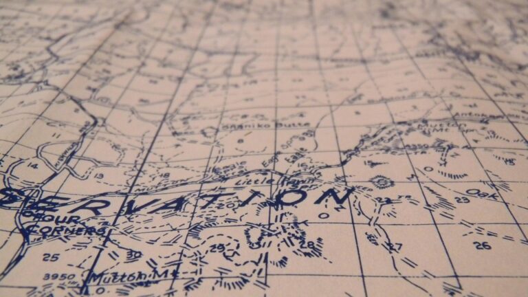
How Topographic Maps Show Physical Terrain Features
Topographic maps emphasize elevation changes and physical landforms through contour lines, shading, and terrain symbols rather than statistical overlays. You’ll find these reference maps display mountains, valleys, water bodies, and elevation markers that explain why populations cluster in certain areas. The detailed terrain information reveals the geographic constraints that influence settlement patterns, showing flat valleys where cities develop and mountainous regions where populations remain sparse.
Contrasting Use Cases and Target Audiences
Urban planners and demographers prefer choropleth maps for policy decisions and resource allocation since the statistical emphasis highlights service gaps and growth trends. Outdoor enthusiasts and emergency responders rely on topographic maps for navigation and terrain assessment where elevation data proves critical for safety. Your choice between these styles depends on whether you need to communicate population patterns quickly or provide comprehensive geographic context for field operations.
Heat Maps vs. Street Maps: Urban Activity Analysis
Urban activity analysis requires two fundamentally different mapping approaches that serve distinct analytical purposes. Your choice between heat maps and street maps determines whether you’ll reveal data patterns or provide navigational context.
Heat Map Visualization of Data Concentration and Intensity
Heat maps transform complex urban activity data into intuitive visual patterns using color gradients and density clustering. You’ll see concentrated activity areas as bright hotspots while low-activity zones appear as cooler colors. These maps excel at revealing foot traffic patterns, crime concentration zones, and economic activity clusters across neighborhoods. Urban planners use heat maps to identify service gaps and optimize resource allocation based on actual usage patterns rather than geographic boundaries.
Street Map Focus on Navigation and Location Reference
Street maps prioritize accurate geographic relationships and navigation functionality over data visualization. You’ll find detailed road networks, landmark identification, and precise address locations that support wayfinding and location-based services. These maps maintain consistent symbology and comprehensive street-level detail to ensure reliable navigation. Emergency responders depend on street maps for rapid location identification and route planning during critical response situations.
Different Applications in Urban Planning and Daily Navigation
Urban planners leverage heat maps for policy decisions and infrastructure investment by analyzing population movement and service demand patterns. You’ll use these density visualizations to identify underserved areas and optimize public transit routes. Street maps serve daily navigation needs through GPS applications and location-based marketing for businesses. Retail analysts combine both approaches – using heat maps to identify high-traffic areas and street maps to pinpoint exact storefront locations for site selection.
Flow Maps vs. Political Maps: Movement and Boundary Representation
Get durable, tear-resistant posters made in the USA. Each 18" x 29" poster features high-quality 3 MIL lamination for lasting protection.

Flow maps and political maps represent opposite approaches to visualizing geographic relationships—one emphasizing dynamic movement patterns while the other focuses on static territorial boundaries.
Flow Map Illustration of Migration and Trade Patterns
Flow maps use directional arrows and line thickness to visualize movement patterns across geographic space. You’ll see migration flows represented through curved lines that connect origin and destination points, with arrow width indicating volume intensity. Trade route visualizations demonstrate how goods move between economic centers, revealing global supply chain dependencies. These maps excel at showing temporal patterns, seasonal variations, and network connectivity that static boundary maps can’t capture effectively.
Political Map Emphasis on Administrative Boundaries
Political maps prioritize precise territorial divisions through bold boundary lines and distinct color coding for each administrative unit. You’ll find clear delineation between countries, states, and municipalities using standardized cartographic symbols and consistent color schemes. These maps focus on sovereignty, jurisdiction, and legal boundaries rather than natural geographic features or human movement patterns. Electoral districts, census tracts, and municipal boundaries receive equal visual weight to ensure accurate representation of administrative control.
Contrasting Approaches to Geographic Relationships
Flow maps reveal dynamic connections between places through movement visualization, while political maps establish static territorial relationships through boundary demarcation. You’ll notice flow maps use continuous gradients and organic line patterns to show interconnectedness, whereas political maps employ discrete color blocks and rigid geometric boundaries. Flow maps answer questions about “how things move,” while political maps address “who controls what territory.” These contrasting approaches serve different analytical purposes in geographic analysis and policy decision-making.
Dot Density Maps vs. Physical Maps: Distribution Patterns
Navigate the US with ease using this Rand McNally map. Its large, clear print ensures readability for trip planning and travel.

Dot density maps and physical maps represent fundamentally different approaches to spatial visualization, with dot density maps emphasizing statistical distribution patterns while physical maps focus on natural terrain characteristics.
Dot Density Representation of Population or Resource Distribution
Dot density maps use individual dots to represent specific quantities of data, creating intuitive visualizations where each dot equals a predetermined value like 100 people or 50 barrels of oil. You’ll find these maps particularly effective for showing uneven distribution patterns across geographic areas, as dots cluster naturally in high-density regions while sparse areas contain few or no dots. The technique works exceptionally well for census data, agricultural production, and mineral resources since viewers can quickly assess concentration levels without interpreting complex color schemes or numerical legends.
Physical Map Display of Natural Geographic Features
Physical maps prioritize accurate representation of terrain features through elevation data and natural landmarks. You’ll see these maps utilize contour lines, shading techniques, and color gradients to show mountains, valleys, rivers, and coastal features with precise geographic positioning. Unlike statistical visualizations, physical maps focus on permanent landscape characteristics that influence human settlement patterns and resource accessibility. The terrain information proves essential for understanding why population clusters occur in specific locations, as mountainous regions typically show lower settlement density than river valleys or coastal plains.
Different Methods for Conveying Spatial Information
These contrasting map styles employ completely different visual languages to communicate geographic information effectively. Dot density maps rely on point symbols and clustering patterns to reveal statistical relationships, while physical maps use topographic symbology and elevation modeling to show natural features. You’ll notice that dot density maps answer questions about “how much” and “where most,” whereas physical maps address “what terrain” and “how accessible.” Cartographers often combine both approaches in layered visualizations, overlaying population dots on terrain backgrounds to reveal how natural features influence human distribution patterns across landscapes.
Explore and map the wilderness for the Queen in Cartographers! Draw unique terrain shapes and score points based on randomly selected goals each game, but beware of monster ambushes.

Isopleth Maps vs. Road Maps: Continuous Data vs. Transportation Networks
These two mapping approaches represent fundamentally different philosophies in geographic visualization. Isopleth maps excel at displaying continuous data patterns across space, while road maps prioritize discrete transportation infrastructure for navigation purposes.
Isopleth Map Visualization of Continuous Phenomena
Isopleth maps use contour lines to connect points of equal value, creating smooth transitions between data zones. You’ll find temperature gradients, precipitation patterns, and elevation changes represented through these flowing line networks. Unlike discrete boundary maps, isopleth visualization assumes data varies continuously across geographic space. Weather forecasters rely on isopleth maps to show pressure systems and temperature zones. Scientists use these maps to display pollution concentrations, noise levels, and population density gradients that don’t follow administrative boundaries.
Road Map Focus on Transportation Infrastructure
Road maps emphasize discrete transportation networks through hierarchical line symbols and junction markers. You’ll see highways, arterials, and local streets displayed with different line weights and colors for navigation clarity. These maps prioritize accuracy in route connectivity and distance measurements between specific points. GPS navigation systems depend on road map databases for turn-by-turn directions and traffic routing. Emergency responders use detailed road maps to identify the fastest routes to incident locations and plan evacuation procedures.
Navigate confidently with the Garmin Drive™ 53 GPS. This navigator features a bright, high-resolution touchscreen and provides helpful driver alerts for school zones, speed changes, and more.

Distinct Purposes in Scientific Analysis vs. Travel Planning
Isopleth maps answer analytical questions about spatial patterns and gradual changes in environmental or social phenomena. You’ll use these maps to identify trend zones, predict future conditions, and understand continuous spatial relationships. Road maps solve practical navigation problems by showing exact routes, travel distances, and infrastructure connections. Urban planners combine both approaches when analyzing traffic flow patterns (isopleth) and specific intersection improvements (road map). The choice depends on whether you’re studying continuous spatial phenomena or planning discrete movement through transportation networks.
Conclusion
Your mapping success depends entirely on matching the right style to your specific communication goals. Whether you’re revealing data patterns through thematic approaches or providing geographic context with reference maps you’ll achieve clarity only when your choice aligns with your audience’s needs.
These six contrasting examples demonstrate that effective cartography isn’t about using the most sophisticated techniques—it’s about selecting the approach that best serves your story. You now have the foundation to make informed decisions that transform confusing data into compelling visual narratives.
Achieve a flawless, even complexion with e.l.f. Flawless Satin Foundation. This lightweight, vegan formula provides medium coverage and a semi-matte finish for all-day wear, while hydrating your skin with glycerin.

Remember that your map style choice directly impacts how quickly and accurately your audience interprets information. Choose wisely and your maps will become powerful tools for communication rather than sources of confusion.
Frequently Asked Questions
What is the main difference between thematic and reference maps?
Thematic maps focus on visualizing specific data patterns and telling data-driven stories through bold colors and simplified layers. Reference maps provide comprehensive geographic context for navigation and location identification, prioritizing detailed geographic information and consistent symbology for accuracy and usability.
When should I use a choropleth map versus a topographic map?
Use choropleth maps when you need to quickly communicate population density or statistical data through color gradients, ideal for urban planning and policy decisions. Choose topographic maps when you need detailed terrain information with contour lines and elevation data for navigation, outdoor activities, or emergency response.
How do heat maps differ from street maps in urban analysis?
Heat maps use color gradients and density clustering to reveal patterns of foot traffic, crime, and economic activity, helping urban planners optimize resource allocation. Street maps focus on accurate road networks and landmarks for navigation, serving daily wayfinding needs through GPS applications and emergency response.
What are the key advantages of flow maps over political maps?
Flow maps excel at showing dynamic movement patterns like migration and trade routes using directional arrows and line thickness, capturing temporal connections. Political maps emphasize static territorial boundaries and administrative divisions, focusing on control and jurisdiction rather than movement and connectivity.
When should I choose dot density maps instead of physical maps?
Choose dot density maps when visualizing statistical distribution patterns or census data, as individual dots effectively show uneven distributions across geographic areas. Select physical maps when you need to display natural terrain features and elevation data to explain human settlement patterns and accessibility.
How do isopleth maps compare to road maps for different applications?
Isopleth maps excel at displaying continuous data patterns like temperature gradients or pollution levels using contour lines connecting equal values, perfect for scientific analysis. Road maps prioritize discrete transportation infrastructure with accurate route connectivity and distance measurements, essential for GPS navigation and emergency response.