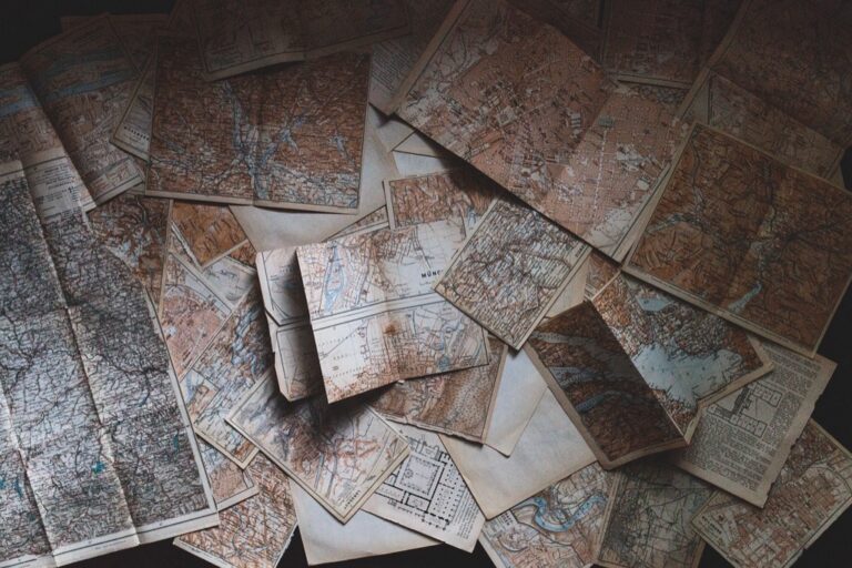
5 Best Map Scale Ideas for Visual Impact
You’re looking at maps all wrong if you think they’re just navigation tools. Traditional cartography confines creativity within rigid scales and geographic accuracy, but artists are breaking these boundaries to transform how we visualize space and meaning.
The big picture: Map scales no longer need to represent literal distances when they can convey emotion, time, memory, and abstract concepts instead. Creative minds are reimagining these fundamental cartographic elements as powerful artistic mediums that challenge our perception of place and space.
Disclosure: As an Amazon Associate, this site earns from qualifying purchases. Thank you!
Transform Traditional Geographic Scales Into Emotional Landscapes
Moving beyond conventional measurement systems opens new possibilities for cartographic storytelling that resonates on a human level.
P.S. check out Udemy’s GIS, Mapping & Remote Sensing courses on sale here…
Use Personal Memory Distances Instead of Miles
Distance becomes subjective when you measure space through emotional significance rather than standard units. A childhood home might feel “three summers away” from your current location, while a place of heartbreak could register as “a lifetime of distance” despite being geographically close. Replace traditional mile markers with memory anchors like “one conversation deep” or “two forgiveness spans wide.” This approach transforms your map into a personal geography where emotional proximity matters more than physical measurement, creating scales that reflect how you actually experience distance in meaningful relationships and significant life events.
Replace Elevation Markers With Intensity Levels
Emotional peaks and valleys carry more weight than topographical features when you’re mapping human experience. Transform elevation data into intensity gradients that reflect the emotional landscape of places. Mark areas as “overwhelming heights” instead of 5,000 feet, or label valleys as “quiet reflection zones” rather than using traditional contour lines. Your intensity scale might range from “gentle whisper level” to “life-changing summit,” allowing viewers to understand not just the physical terrain but the emotional impact of each location. This technique helps you create maps that show how places feel rather than simply how high they sit above sea level.
Create Time-Based Scale References
Time perception varies dramatically based on experience, making it a powerful alternative to standard geographic scales. Design your map scales using temporal references that connect to human experience: “fifteen-minute worry walks,” “afternoon dream distances,” or “weekend adventure spans.” A single city block might measure “one deep conversation long” while a cross-country journey could span “three life chapters wide.” This temporal approach acknowledges that some places expand or contract in our perception based on what happens there, creating scales that reflect how time actually feels rather than how clocks measure it.
Experiment With Non-Linear Scale Progressions for Visual Impact
Breaking free from linear measurement systems opens new possibilities for creating visually compelling cartographic art. Non-linear progressions can transform how viewers perceive spatial relationships on your maps.
Apply Fibonacci Sequences to Distance Measurements
You’ll discover that Fibonacci sequences create naturally harmonious spacing between map elements. Start with intervals of 1, 1, 2, 3, 5, 8 units to establish distance markers that feel organic rather than mechanical. This mathematical progression mirrors patterns found in nature, making your map scales feel more intuitive to viewers. The golden ratio inherent in Fibonacci sequences produces visual balance that draws the eye naturally across your cartographic composition.
Use Logarithmic Scaling for Dramatic Effect
Logarithmic scales compress vast distances while expanding smaller ones, creating powerful visual drama in your maps. You can represent continental distances alongside neighborhood details by using base-10 logarithms where each unit represents a tenfold increase. This technique works particularly well for population density maps or elevation profiles where you need to show extreme variations. The compressed scaling creates striking visual contrasts that emphasize the most significant geographic features.
Incorporate Musical Intervals as Scale References
Musical intervals provide mathematically precise yet emotionally resonant scaling systems for artistic maps. You can use perfect fifths (3:2 ratio) or octaves (2:1 ratio) to create distance measurements that feel harmonious to viewers. Major thirds (5:4 ratio) work well for subtle geographic transitions, while diminished fifths create tension in contested territories. This approach transforms your map into a visual symphony where spatial relationships follow musical mathematics rather than geographic conventions.
Incorporate Human-Centered Measurements for Relatable Art
Transitioning from mathematical harmonies to human experience creates maps that resonate with viewers on a visceral level. You’ll find that replacing abstract measurements with relatable human references transforms your cartographic art into something audiences can immediately understand and connect with.
Replace Standard Units With Body-Based Measurements
Substitute traditional distance markers with human body measurements like arm spans, footsteps, or hand widths to create intimate scale references. You can mark distances as “200 paces” instead of meters, or show building heights as “15 people tall.” These measurements connect viewers to the landscape through their own physical experience, making your map feel personal and accessible rather than clinical.
Use Walking Time Instead of Geographic Distance
Convert spatial measurements into temporal experiences by showing how long it takes to walk between locations rather than exact mileage. Mark your map with “5-minute stroll” or “hour-long hike” to help viewers understand space through movement and effort. This approach reflects how people naturally think about distance—through the time investment required to traverse it.
Scale Elements According to Personal Significance
Size map features based on emotional importance rather than geographic accuracy to create powerful visual hierarchies. You can enlarge childhood homes, favorite cafes, or meaningful landmarks while shrinking insignificant areas. This technique transforms your map into a personal narrative where scale reflects memory and attachment, creating art that speaks to individual experience over objective measurement.
Blend Multiple Scale Systems Within Single Artistic Maps
Creating cartographic art that challenges conventional boundaries requires merging different scale systems to produce visually compelling and conceptually rich works.
Combine Microscopic and Macroscopic Perspectives
Juxtapose intimate local details with vast geographic overviews to create dramatic scale contrasts that capture viewers’ attention. You’ll achieve striking visual tension by showing individual building textures alongside continental boundaries, or depicting personal garden layouts within global migration patterns. This technique forces viewers to reconsider their relationship with space and scale simultaneously.
Layer Historical and Contemporary Scale References
Overlay medieval league measurements with modern GPS coordinates to create temporal depth that speaks to cartographic evolution. You can reference Roman mile markers alongside current highway systems, or combine Victorian-era survey chains with satellite imagery precision. This layering technique creates maps that function as time capsules, revealing how human understanding of distance has transformed.
Merge Scientific and Poetic Measurement Systems
Integrate precise geodetic measurements with metaphorical distance concepts to bridge analytical and emotional mapping approaches. You’ll create compelling contrasts by combining elevation contours with “heights of joy” or merging coordinate grids with “degrees of longing.” This fusion produces maps that satisfy both technical accuracy requirements and artistic expression goals.
Utilize Abstract Conceptual Scales for Metaphorical Expression
Abstract conceptual scales transform traditional cartographic measurements into powerful symbolic tools that communicate meaning beyond physical geography. You’ll create maps that speak to deeper human experiences by replacing conventional distance markers with metaphorical systems.
Represent Emotional Distance Through Visual Scale
Create scale bars that measure relationships rather than kilometers by using symbols like hearts, lightning bolts, or broken chains. You can establish emotional proximity through visual weight—placing beloved locations closer together regardless of actual distance while pushing traumatic or forgotten places toward map edges. Design graduated symbols that represent intimacy levels, with childhood homes appearing larger than distant acquaintances’ neighborhoods. This approach transforms your map into a psychological landscape where emotional significance determines spatial relationships and creates immediate viewer connection through universally understood human experiences.
Use Color Intensity as Scale Indicators
Replace traditional elevation keys with color gradients that represent emotional intensity or conceptual importance. You’ll assign deep, saturated colors to locations with profound meaning while using pale, washed-out tones for indifferent spaces. Create custom color scales where warm reds indicate passion or anger, cool blues represent tranquility or sadness, and vibrant yellows mark joy or discovery. Design color legends that explicitly connect hue intensity to emotional weight rather than altitude measurements. This technique allows viewers to instantly understand the map’s emotional topography through intuitive color associations that transcend language barriers.
Apply Textural Density for Depth Perception
Develop texture-based scales that communicate conceptual layers through visual density and tactile suggestion. You can use fine crosshatching for uncertain memories, bold stippling for vivid experiences, and smooth areas for peaceful spaces. Create textural gradients that move from chaotic scribbles in stressful zones to flowing organic patterns in comfortable areas. Design custom texture legends that explain how different mark-making techniques correspond to emotional states or memory clarity. This approach adds dimensional quality to flat maps while engaging viewers’ tactile imagination and creating sophisticated visual hierarchies that communicate multiple meaning layers simultaneously.
Conclusion
Your artistic mapping journey doesn’t end with traditional measurement systems. By experimenting with these innovative scale approaches you’ll discover new ways to communicate human experiences through cartographic art.
The beauty of reimagined map scales lies in their ability to make the invisible visible. Whether you’re working with emotional distances or musical intervals your maps can become powerful storytelling tools that resonate with viewers on multiple levels.
Start small with one technique that speaks to you. Try replacing miles with memories or elevation with emotional intensity. As you gain confidence you can layer multiple scale systems to create increasingly complex and compelling artistic works.
Remember that the most impactful artistic maps challenge viewers’ expectations while maintaining enough familiarity to guide their understanding. Your creative interpretation of scale can transform ordinary geographic information into extraordinary artistic expression.
Frequently Asked Questions
What is the difference between traditional maps and artistic maps?
Traditional maps prioritize geographic accuracy and strict scale measurements for navigation purposes. Artistic maps push beyond these boundaries to convey emotions, memories, and abstract ideas. While traditional cartography focuses on physical accuracy, artistic mapping transforms cartographic elements into powerful mediums that challenge our understanding of space and place, creating more subjective and emotionally resonant representations.
How can emotional landscapes replace traditional geographic scales?
Emotional landscapes measure distance through personal memory rather than miles, creating subjective spatial experiences. Instead of elevation markers, intensity levels capture emotional peaks and valleys of different locations. Time-based scale references emphasize how our perception of time alters place significance, resulting in maps that resonate with human experiences rather than relying solely on physical measurements.
What are non-linear scale progressions in cartographic art?
Non-linear scale progressions use mathematical sequences like Fibonacci numbers for distance measurements, creating harmonious and organic spacing. Logarithmic scaling compresses vast distances while expanding smaller ones for dramatic effect. Musical intervals can serve as scale references, incorporating mathematical harmony and emotional resonance to transform maps into visual symphonies that transcend traditional geographic conventions.
How do human-centered measurements make maps more relatable?
Human-centered measurements replace standard units with body-based references like arm spans or footsteps, making maps more personal and accessible. Walking time substitutes geographic distance, helping viewers understand space through movement and effort. Map features are scaled according to personal significance, where emotional importance dictates size, creating narratives that reflect individual experiences rather than objective measurements.
What does blending multiple scale systems achieve in artistic maps?
Blending multiple scale systems creates visually compelling and conceptually rich works. It combines microscopic and macroscopic perspectives for dramatic contrasts, layers historical and contemporary references to show cartographic evolution, and merges scientific and poetic measurement systems. This fusion produces maps that satisfy both technical accuracy and artistic expression, enriching our understanding of space and experience.
How do abstract conceptual scales work in emotional mapping?
Abstract conceptual scales transform traditional measurements into symbolic tools communicating deeper human experiences. They represent emotional distance through visual scales, use symbols to measure relationships, and establish emotional proximity based on significance. Color intensity serves as scale indicators through gradients representing emotional weight, while textural density conveys conceptual layers, creating psychologically engaging maps that reveal emotional landscapes.