5 Challenges of Scale in Global vs Local Maps That Distort Data
Why it matters: You’re navigating a complex world where maps serve vastly different purposes — from finding your neighborhood coffee shop to tracking global supply chains. The challenge of scale becomes critical when cartographers must balance comprehensive global coverage with precise local detail.
Explore and map the wilderness for the Queen in Cartographers! Draw unique terrain shapes and score points based on randomly selected goals each game, but beware of monster ambushes.

The big picture: Every time you switch between zooming out to see continents and zooming in to see street names you’re experiencing the fundamental tension that map makers face daily. Scale decisions determine whether you’ll get the broad context you need or the granular accuracy that makes maps actually useful for navigation and decision-making.
Disclosure: As an Amazon Associate, this site earns from qualifying purchases. Thank you!
Challenge 1: Distortion Issues When Transitioning Between Global and Local Perspectives
You’ll encounter significant distortion problems when switching between global and local map scales. Every projection system introduces geometric compromises that become more pronounced as you transition between different scale levels.
P.S. check out Udemy’s GIS, Mapping & Remote Sensing courses on sale here…
Map Projection Limitations at Different Scales
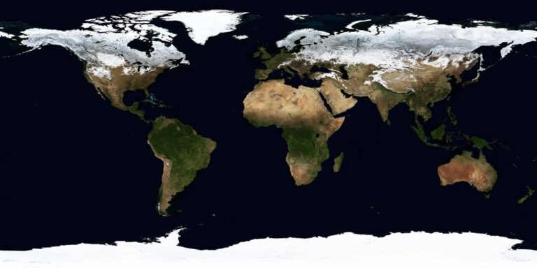
Mercator projections work well for navigation but severely distort polar regions when viewing global data. You’ll notice Greenland appears larger than Africa on global Mercator maps, yet local-scale maps maintain accurate proportional relationships. Web mapping platforms like Google Maps use Web Mercator (EPSG:3857) for seamless zooming, but this creates area distortions of up to 160% at high latitudes. Your global supply chain visualizations might misrepresent shipping distances between northern ports compared to equatorial routes.
Loss of Spatial Accuracy in Global Representations
Global-scale maps sacrifice positional precision to display worldwide data effectively. You’ll find that features positioned accurately at 1:24,000 scale can shift by hundreds of meters when generalized for 1:50,000,000 global views. USGS topographic maps maintain sub-meter accuracy locally but lose this precision in continental overviews. Your GPS coordinates collected in the field won’t align perfectly with small-scale continental datasets, creating registration errors of 50-200 meters depending on the projection transformation applied.
Plan your next adventure with the 2025 National Geographic Road Atlas, covering the United States, Canada, and Mexico. Its durable, folded format (11 x 15 in) makes it ideal for hiking and camping trips.

Coordinate System Compatibility Problems
Different coordinate systems create alignment issues when overlaying global and local datasets. You’ll encounter problems when combining WGS84 global data with local state plane coordinates or UTM zones. NAD83 coordinates can differ from WGS84 by up to 2 meters in North America, while local datum transformations introduce additional shifts. Your GIS software requires proper transformation parameters when switching between EPSG:4326 (WGS84) and local coordinate systems like EPSG:2263 (New York State Plane) to maintain spatial accuracy across scale transitions.
Challenge 2: Data Resolution Conflicts Between Global and Local Mapping Systems
Data resolution conflicts emerge when your mapping systems attempt to bridge vastly different scales of geographic information. You’ll encounter significant disparities in detail levels that can compromise map accuracy and user experience.
Varying Levels of Detail Across Scale Boundaries
Global datasets typically provide generalized features with simplified geometries that lose critical local variations. You’ll find coastlines smoothed into broad curves while local maps reveal intricate harbors and inlets. Building footprints disappear entirely from global views yet remain essential for local navigation systems. This detail mismatch creates jarring transitions when users zoom between scales, particularly in urban areas where dense infrastructure requires high-resolution representation. Your challenge involves maintaining visual continuity while preserving essential local information that users expect at detailed zoom levels.
Navigate with ease using this 7-inch GPS navigator, featuring real-time voice guidance and pre-loaded 2025 maps. Customize routes based on your vehicle type to avoid restrictions and receive speed & red light warnings.

Inconsistent Data Collection Standards
Different mapping organizations employ varying collection methodologies that create compatibility issues across scale boundaries. Global datasets often use satellite imagery with 10-30 meter resolution while local surveys achieve sub-meter accuracy through GPS and lidar collection. You’ll encounter temporal discrepancies where global updates occur annually but local data refreshes monthly or weekly. Attribution standards also differ significantly – global datasets might classify all water bodies as “water” while local systems distinguish between rivers, streams, ponds, and retention basins. These inconsistencies force you to implement complex data harmonization processes.
Storage and Processing Limitations for Multi-Scale Data
Managing multi-resolution datasets requires exponentially increasing storage capacity as detail levels multiply across geographic extents. You’ll face processing bottlenecks when rendering systems attempt to handle global datasets alongside high-resolution local data simultaneously. Memory constraints become critical when users rapidly transition between scales, forcing systems to cache multiple resolution levels. Database indexing strategies must accommodate both broad geographic queries and precise local searches efficiently. Your infrastructure costs escalate significantly when supporting seamless transitions between global overviews and detailed local views within single mapping applications.
Challenge 3: Standardization Problems Across Different Geographic Scales
Standardization challenges multiply when you’re working across different geographic scales. Each scale level often employs distinct conventions that don’t translate seamlessly.
Inconsistent Symbology and Legend Systems
Symbol standards vary dramatically between global and local mapping systems, creating confusion when you transition between scale levels. Global maps typically use simplified iconography like basic geometric shapes for cities, while local maps employ detailed symbols showing specific building types, infrastructure elements, and land use patterns. International mapping organizations like ISO and national agencies often maintain separate symbol libraries, forcing you to convert between different visual languages. Your users struggle to interpret these shifting symbolic conventions, particularly when overlaying datasets from multiple sources or switching between regional and worldwide views.
Conflicting Classification Schemes
Classification systems present major compatibility issues when you’re integrating multi-scale geographic data. Global land cover databases use broad categories like “urban areas” or “forest,” while local surveys classify dozens of specific subtypes such as “mixed deciduous woodland” or “high-density residential.” Administrative boundary classifications also differ – what constitutes a “city” varies between countries and mapping authorities. You’ll encounter conflicts when European CORINE land cover data meets U.S. National Land Cover Database classifications, requiring extensive crosswalking and potential data loss during translation between systems.
Varying Coordinate Reference Systems
Coordinate reference systems create alignment nightmares when you’re combining global and local datasets. Global mapping relies on systems like WGS84 for worldwide compatibility, while local surveys often use region-specific projections optimized for minimal distortion in particular areas. State plane coordinate systems in the U.S., UTM zones, and national grid systems each prioritize local accuracy over global consistency. You’ll face coordinate transformation errors that can shift features by several meters, causing misalignment issues in GIS applications and compromising spatial analysis accuracy when integrating datasets across different reference frameworks.
Challenge 4: User Interface and Navigation Complexity in Multi-Scale Maps
Multi-scale mapping systems create unique interface challenges that complicate user experience across different zoom levels. You’ll encounter navigation difficulties that stem from the fundamental tension between global context and local detail precision.
Seamless Zoom Transition Difficulties
Smooth zooming between scales requires complex data management systems that most mapping platforms struggle to implement effectively. You’ll notice jarring transitions when switching from global overviews to local details, as the system loads different datasets with varying resolutions. Performance bottlenecks occur when your mapping software attempts to render high-resolution local data while maintaining global context awareness. Buffer zones between scale levels often create visual inconsistencies, where features appear to shift or disappear during zoom operations, disrupting your spatial understanding.
Information Overload at Different Scale Levels
Information density varies dramatically across scale transitions, creating cognitive challenges for map users. You’ll encounter cluttered interfaces at local scales where every street, building, and landmark competes for visual attention. Global scales present the opposite problem – oversimplified representations that omit critical navigation details you need for decision-making. Layer management becomes complex when your interface must accommodate both satellite imagery and detailed street networks simultaneously. Icon scaling algorithms often fail to maintain readability, leaving you with symbols that are either too small to interpret or oversized enough to obscure underlying geography.
Cognitive Load Management for End Users
Mental processing demands increase exponentially when navigating between global and local map contexts. You’ll experience decision fatigue when constantly switching between overview modes and detail views to complete simple navigation tasks. Context switching penalties occur as your brain adapts to different information hierarchies, symbol systems, and spatial relationships at each scale level. Memory limitations become apparent when you attempt to retain global positioning while focusing on local navigation details. Interface complexity compounds these challenges through inconsistent control schemes, varying interaction methods, and scale-dependent feature availability that disrupts your workflow continuity.
Challenge 5: Technical Integration Challenges Between Global and Local Map Systems
Integrating global and local mapping systems presents complex technical hurdles that often require specialized infrastructure and careful architecture planning. These integration challenges compound the previous issues you’ve encountered with data resolution and standardization.
Software Compatibility Issues
You’ll encounter significant compatibility problems when connecting different mapping platforms that weren’t designed to work together. Global mapping systems like ESRI ArcGIS Enterprise often use different data formats, APIs, and rendering engines than local GIS solutions such as QGIS or proprietary municipal systems. Version conflicts between software packages create additional barriers, particularly when older local systems can’t communicate with modern cloud-based global platforms. Database compatibility becomes critical when you’re trying to merge PostgreSQL-based local systems with cloud-native global solutions using different spatial indexing methods.
Real-Time Data Synchronization Problems
Maintaining synchronized data between global and local systems requires robust infrastructure that many organizations lack. You’ll face latency issues when local updates need to propagate to global systems, especially in areas with limited internet connectivity. Bandwidth constraints become problematic when synchronizing high-resolution local datasets with global repositories that may have different update frequencies. Conflict resolution algorithms struggle when simultaneous edits occur at different scale levels, potentially creating data inconsistencies. Many organizations rely on batch processing rather than true real-time updates, creating temporary discrepancies between global and local map views.
Cross-Platform Performance Optimization
Optimizing performance across different mapping platforms demands careful resource allocation and caching strategies. You’ll need to implement multi-tier caching systems that serve appropriate data resolution levels based on user zoom levels and device capabilities. Server load balancing becomes complex when handling requests that span multiple scale levels, requiring intelligent routing between global and local data sources. Mobile performance suffers particularly when applications attempt to maintain connections to both global and local mapping services simultaneously. Memory management challenges arise when applications cache both global overview data and detailed local datasets, potentially overwhelming device resources.
Conclusion
These scale challenges highlight why seamless multi-scale mapping remains one of the most complex technical hurdles in modern cartography. You’ll encounter these issues whether you’re developing GIS applications or simply trying to understand why your favorite mapping platform sometimes feels clunky when switching between views.
The key takeaway is that there’s no perfect solution – only careful compromises. Smart mapping systems acknowledge these limitations and work around them through intelligent design choices and robust technical infrastructure.
As mapping technology continues evolving you can expect to see more sophisticated approaches to handling scale transitions. Until then understanding these fundamental challenges helps you make better decisions about which mapping tools and approaches work best for your specific needs.
Frequently Asked Questions
What makes map-making so complex?
Map-making is complex because cartographers must balance comprehensive global coverage with detailed local information. Different maps serve various purposes, from locating businesses to managing supply chains, requiring constant decisions about scale and detail level that significantly impact navigation usefulness.
How do map projections affect accuracy?
Map projection systems like Mercator can distort geographic features, especially at high latitudes, leading to misrepresentations in global data. These distortions cause spatial accuracy loss when features shift significantly during generalization for broader views.
What are coordinate system compatibility issues?
Different coordinate systems create alignment problems when overlaying datasets in GIS applications. This occurs because systems prioritize either local accuracy or global consistency, potentially causing misalignment when switching between global and local scales.
Why do data resolution conflicts occur in mapping?
Data resolution conflicts arise from varying detail levels across scale boundaries. Global datasets use generalized features and lower-resolution satellite imagery, while local maps rely on high-accuracy surveys, creating inconsistencies when transitioning between scales.
What standardization problems exist across geographic scales?
Each scale level uses distinct conventions that don’t translate seamlessly. Global maps employ simplified iconography and broad categories, while local maps use detailed symbols and specific subtypes, creating compatibility issues when integrating multi-scale data.
How do user interface challenges affect map navigation?
Seamless zooming requires complex data management systems that many platforms struggle to implement, resulting in jarring transitions. Users face cognitive challenges from varying information density, leading to decision fatigue and increased mental processing demands.
What technical integration challenges exist in multi-scale mapping?
Technical challenges include software compatibility issues with incompatible data formats and APIs, real-time synchronization problems due to latency constraints, and cross-platform performance optimization requiring effective resource allocation and caching strategies.