9 Best Large Format Map Printing Tips
Why it matters: Large format map printing demands precise coordination between you and your printer to avoid costly mistakes and delays that can derail your project timeline.
The challenge: Most businesses struggle with file preparation technical requirements and communication gaps that lead to reprints color mismatches and budget overruns.
What you’ll learn: This guide breaks down the essential coordination steps from initial consultation to final delivery ensuring your large format maps meet professional standards while staying within budget and schedule constraints.
Disclosure: As an Amazon Associate, this site earns from qualifying purchases. Thank you!
P.S. check out Udemy’s GIS, Mapping & Remote Sensing courses on sale here…
How to Choose the Right Printer for Large Format Maps
Selecting the right printing partner determines whether your cartographic project meets professional standards or falls short of expectations.
Research Specialized Large Format Printing Services
You’ll find that specialized large format printers understand the unique demands of cartographic reproduction better than general commercial printers. Look for companies that specifically advertise GIS mapping services, topographic printing, or architectural plan reproduction. These printers typically maintain color-calibrated workflows and offer media options like waterproof synthetic papers, canvas, and archival-quality stocks that standard print shops don’t carry.
Print durable, waterproof documents with Koala Waterproof Paper. This tear-resistant, matte paper is compatible with most laser printers, making it ideal for maps, menus, and vital records.

Evaluate Equipment Capabilities and Technology
Your printer’s equipment directly impacts your map’s final quality and available size options. Verify they operate wide-format inkjet printers capable of handling your required dimensions – many projects need 36-inch or 44-inch roll widths. Ask about their color gamut capabilities, particularly for accurate reproduction of terrain colors and water features. Modern large format printers should offer pigment-based inks for longevity and UV-resistant properties essential for field maps.
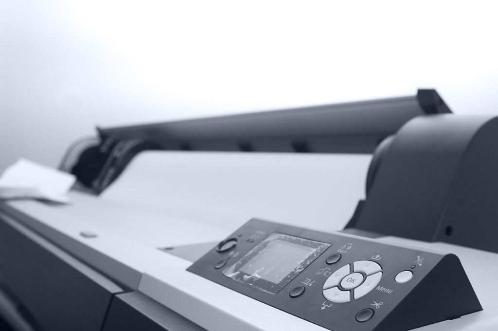
Get professional-quality wide-format prints up to 13" x 19" at high speeds with this reliable printer. Features include a user-friendly 4.3" color touchscreen and automatic 2-sided printing, copying, scanning, and faxing.

Assess Experience with Cartographic Projects
You need a printer who understands cartographic conventions and technical requirements. Request samples of previous mapping projects, particularly those similar to your scale and complexity. Experienced cartographic printers recognize the importance of maintaining fine line weights for contour intervals, preserving text legibility at various scales, and accurately reproducing coordinate grid systems. They’ll also understand projection distortions and how printing processes might affect geographic accuracy near map edges.
How to Prepare Your Map Files for Professional Printing
Proper file preparation determines the success of your large format map printing project. You’ll need to address technical specifications before submitting files to avoid costly reprints and delays.
Optimize Resolution and File Format Requirements
Set your resolution to 300 DPI minimum for large format maps to ensure crisp text and clear line work at final size. Vector formats like PDF or EPS provide the best scalability for cartographic elements, while raster backgrounds should maintain 150-300 DPI depending on viewing distance. Your printer will specify preferred formats, but PDF/X-1a remains the industry standard for professional map reproduction.
Set Up Proper Color Profiles and Calibration
Embed SWOP CMYK color profiles in your map files to ensure accurate color reproduction during printing. You’ll need to convert RGB colors to CMYK early in your design process since RGB displays wider color gamuts than print capabilities. Test critical colors like water blue and vegetation green with your printer’s color charts, and avoid using pure black (0,0,0,100) for large areas—use rich black (40,30,30,100) instead.
Create Bleed Areas and Crop Marks
Add 0.25-inch bleed areas around your entire map composition to prevent white edges after trimming. You’ll extend background colors, borders, and imagery beyond the final trim size while keeping critical text and symbols at least 0.125 inches inside the trim line. Include crop marks and registration marks outside the bleed area using your design software’s built-in tools to guide precise cutting and alignment during finishing.
How to Communicate Technical Specifications Effectively
Clear communication with your printer about technical requirements prevents costly revisions and ensures your large format maps meet professional standards. Establishing precise specifications upfront creates a roadmap for successful project completion.
Define Paper Size and Material Requirements
Specify exact dimensions including trim size and finished dimensions to prevent scaling issues during production. Standard large format sizes include 24″×36″, 36″×48″, and custom dimensions based on your mapping requirements.
Communicate substrate preferences clearly – whether you need weather-resistant synthetic papers for outdoor use, archival bond papers for preservation, or specialty materials like canvas for display purposes. Include weight specifications (typically 20-32 lb for bond papers) and surface finish requirements such as matte or satin finishes that enhance readability under various lighting conditions.
Specify Color Accuracy and Finishing Options
Request Pantone color matching or provide specific CMYK values for critical map elements like boundary lines, water features, and legend symbols. Establish acceptable color tolerance levels (typically ±5% Delta E for professional cartographic work) to maintain consistency across multiple print runs.
Enjoy refreshing water with the Avalon Bottom Loading Water Cooler. It offers hot, cold, and room temperature options, a BioGuard anti-microbial coating, and a child safety lock for peace of mind.

Detail finishing requirements including mounting options, lamination specifications, and binding methods. Specify whether you need UV-resistant coatings for outdoor applications or anti-glare treatments for indoor displays. Include folding patterns if creating portable field maps or specify flat delivery requirements for wall-mounted installations.
Establish Quality Control Standards
Define acceptable print quality metrics including line weight consistency, text legibility at specified viewing distances, and color registration tolerances. Request proof prints for critical projects and establish approval workflows before full production runs.
Specify inspection criteria for common cartographic elements – ensure elevation contours maintain consistent line weights, text remains sharp at minimum 6-point sizes, and color separations align within 0.5mm tolerance. Establish protocols for handling reprints if quality standards aren’t met, including timeline adjustments and cost responsibilities for various quality issues.
How to Manage Timeline and Production Schedules
Effective timeline management prevents project delays and ensures your large format maps arrive when needed. Production schedules require careful coordination between design completion, printer availability, and delivery deadlines.
Plan for Proofing and Revision Cycles
Build multiple proof rounds into your schedule to catch errors before final production. Digital proofs typically require 1-2 business days for review, while physical proofs need 3-5 days including shipping time. Plan for at least two revision cycles – one for technical accuracy and another for final quality checks. Complex cartographic projects often need additional rounds to verify coordinate systems, legend accuracy, and color matching specifications.
Account for Large Format Printing Lead Times
Large format map production requires 5-10 business days depending on paper selection and finishing requirements. Standard paper stocks print faster than specialty materials like weather-resistant synthetics or archival papers. Rush orders typically cost 25-50% more and may compromise quality control processes. Submit your final files at least two weeks before your deadline to accommodate normal production workflows and avoid premium charges.
Create professional documents with Neenah 90 lb white index cardstock. This 8.5" x 11" pack of 300 sheets delivers high-resolution images and jam-free printing on both inkjet and laser printers.

Build in Buffer Time for Unexpected Delays
Add 20-30% buffer time to your overall project timeline to handle unforeseen complications. Equipment malfunctions, material shortages, and file compatibility issues can extend production by several days. Weather conditions may delay shipping, especially for rolled map deliveries. Include contingency plans for critical deadlines by identifying backup printers or alternative delivery methods that maintain your quality standards while meeting essential timing requirements.
How to Handle Proofing and Quality Control Processes
Proofing serves as your final checkpoint before expensive large format production begins. Quality control processes catch costly errors that could compromise your map’s accuracy and professional appearance.
Request Digital Proofs Before Final Production
Digital proofs give you precise color representation and layout verification without physical printing costs. Request high-resolution PDF proofs that show actual CMYK values and verify text legibility at 100% zoom. Your printer should provide proofs that match their production ICC profiles, allowing you to spot color shifts or registration issues before committing to full-scale printing.
Conduct On-Site Press Checks When Possible
Press checks let you monitor color consistency and material handling during actual production runs. Schedule visits during your map’s printing window to observe ink density, registration alignment, and substrate feeding. You’ll catch issues like color banding or material buckling before completing the entire print run, potentially saving hundreds of dollars in reprints.
Verify Color Accuracy and Detail Reproduction
Color verification requires matching your proof standards against printed samples using standardized lighting conditions. Check critical cartographic elements like elevation contours, boundary lines, and legend symbols for clarity and accuracy. Use a 10x loupe to examine fine details and ensure text remains readable at your map’s intended viewing distance.
Get clear, close-up views with the Carson LumiLoupe 10x stand magnifier. Its transparent base allows ambient light to illuminate your subject, perfect for detailed work in various hobbies and professions.

How to Coordinate Delivery and Installation Services
Successful large format map delivery requires careful coordination between printing completion and final installation. You’ll need to orchestrate multiple service providers while ensuring your maps remain protected throughout the entire process.
Arrange Proper Packaging and Transportation
Arrange specialized packaging that protects large format maps during transit. You’ll need acid-free tubes or flat shipping containers with protective foam layers to prevent creasing and moisture damage. Request tracking numbers and signature confirmation for high-value cartographic materials. Consider climate-controlled shipping for temperature-sensitive substrates like vinyl or fabric-backed maps to maintain dimensional stability.
Safeguard your pennies with LIGHTHOUSE square coin tubes. These durable, acid-free tubes feature secure push-top caps and stack neatly for easy storage.

Schedule Installation and Mounting Services
Schedule professional mounting services at least one week before your deadline to accommodate potential delays. You’ll want installers experienced with large format graphics who understand proper alignment techniques for multi-panel maps. Coordinate site access permissions and verify wall conditions beforehand. Request installation photos as documentation and establish clear quality standards for bubble-free mounting and precise registration between map sections.
Plan for Storage and Handling Requirements
Plan adequate storage space with controlled temperature and humidity levels between 65-75°F and 45-55% relative humidity. You’ll need flat storage racks or vertical map cases to prevent warping and creasing during temporary storage periods. Designate clean handling areas with cotton gloves available for staff who’ll touch the printed surfaces. Establish protocols for map orientation and stacking order to prevent damage from weight compression or improper support.
Conclusion
Successfully coordinating with printers for large format maps requires careful attention to every detail from initial planning through final installation. When you establish clear communication channels and maintain professional relationships with experienced cartographic printers you’ll consistently achieve superior results that meet your project’s demanding standards.
Remember that investing time in proper preparation and quality control processes ultimately saves you money and prevents costly delays. Your attention to technical specifications and proofing cycles ensures that your large format maps will serve their intended purpose effectively.
The effort you put into coordinating these complex printing projects pays dividends in the form of professional-grade maps that accurately represent your data and withstand the test of time.
Frequently Asked Questions
What makes a printer qualified for large format map printing?
Look for printers with specialized wide-format inkjet equipment and pigment-based inks for quality and longevity. They should offer GIS mapping services and have experience with cartographic projects. Qualified printers understand technical requirements like coordinate systems, scale accuracy, and mapping conventions essential for professional cartographic reproduction.
What file format and resolution should I use for large format maps?
Use a minimum resolution of 300 DPI for crisp text and clear line work. Vector formats like PDF or EPS are ideal for scalability. Follow the industry standard PDF/X-1a format with embedded SWOP CMYK color profiles. Convert RGB colors early in the design process to ensure accurate color reproduction.
How should I prepare my map files to avoid printing errors?
Create proper bleed areas and crop marks to prevent white edges after trimming. Keep critical elements within safe margins and embed SWOP CMYK profiles. Set up your files at 300 DPI minimum resolution and use vector formats when possible. Double-check that all fonts are embedded or outlined.
What paper materials work best for large format maps?
Choose materials based on your map’s intended use. Weather-resistant papers are ideal for outdoor applications, while archival materials ensure longevity for historical maps. Standard options include coated papers for vibrant colors, uncoated for natural appearance, and synthetic materials for durability in harsh conditions.
How long does large format map printing typically take?
Production typically takes 5-10 business days depending on material choices and complexity. Add time for proofing cycles, which may require multiple rounds. Build in a 20-30% buffer to your timeline to accommodate potential delays like equipment issues or shipping complications.
What should I expect during the proofing process?
Digital proofs provide precise color representation and layout verification before production begins. On-site press checks allow you to monitor color consistency during printing runs. Use standardized lighting conditions and magnification tools to verify detail reproduction and ensure all cartographic elements meet professional standards.
How should large format maps be packaged and delivered?
Maps require specialized packaging like acid-free tubes or flat shipping containers to prevent damage. Climate-controlled shipping is recommended for sensitive materials. Professional mounting services should be scheduled in advance, with installers experienced in large format graphics and proper site access coordination.
What storage conditions are needed for large format maps?
Maintain controlled temperature (65-70°F) and humidity levels (45-55% RH) to prevent warping or fading. Use flat storage racks rather than rolling for long-term preservation. Implement clean handling protocols with cotton gloves and ensure storage areas are free from direct sunlight and environmental contaminants.