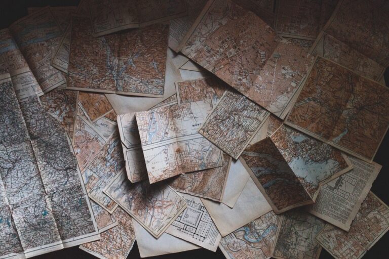
7 Best Drone Map Art Ideas
Why it matters: Drone mapping technology has revolutionized how we capture and visualize landscapes, but you don’t have to limit these detailed aerial datasets to purely technical applications.
The big picture: Artists and creatives are discovering innovative ways to transform drone-generated maps into stunning visual art that bridges the gap between technology and human expression.
What’s next: From abstract installations to interactive digital experiences, these seven artistic approaches will inspire you to see drone mapping data through an entirely new creative lens.
Disclosure: As an Amazon Associate, this site earns from qualifying purchases. Thank you!
P.S. check out Udemy’s GIS, Mapping & Remote Sensing courses on sale here…
Transform Drone Maps Into Abstract Digital Art
You can reimagine your drone mapping data as captivating abstract digital artwork that reveals hidden beauty in technical information. This artistic approach transforms functional geographic data into visually striking compositions that bridge the gap between scientific precision and creative expression.
Create Geometric Patterns From Flight Paths
Convert your drone’s flight trajectories into mesmerizing geometric compositions by mapping GPS coordinates onto digital canvases. You’ll extract waypoint data from flight logs and transform them into interconnected line networks that create intricate patterns. Adobe Illustrator and Processing software excel at converting coordinate data into scalable vector graphics. These flight path visualizations often reveal surprising symmetries and rhythmic patterns that mirror the systematic nature of aerial surveying missions.
Learn Adobe Illustrator with the 2025 release of this comprehensive guide. Master essential skills through hands-on lessons.

Apply Color Gradients to Elevation Data
Transform your Digital Elevation Models (DEMs) into stunning gradient artworks by assigning custom color palettes to height values. You can map elevation ranges to artistic color schemes rather than traditional topographic browns and greens. QGIS and ArcGIS Pro offer advanced symbology tools for creating smooth color transitions across terrain data. Consider using unconventional palettes like neon gradients or monochromatic schemes to emphasize topographic features in unexpected ways that highlight landscape contours as artistic elements.
Generate Fractals From Mapping Algorithms
Extract mathematical patterns from your photogrammetry algorithms to create intricate fractal artwork that reflects the computational processes behind drone mapping. You’ll access the iterative calculations used in Structure from Motion (SfM) processing and visualize them as recursive geometric forms. Software like Mandelbulb 3D and custom Python scripts can transform point cloud generation algorithms into complex fractal structures. These visualizations showcase the underlying mathematical beauty of photogrammetric reconstruction while creating unique abstract compositions.
Design Interactive 3D Sculptures Using Topographical Data
You’ll transform your drone-captured terrain data into tangible art pieces that viewers can touch and experience. This approach bridges the gap between digital mapping and physical sculpture.
Convert Height Maps Into Physical Textures
Transform your elevation data into sculptural surfaces using 3D printing or CNC milling techniques. You can extract height values from your drone maps and convert them into STL files for fabrication. Materials like foam, wood, or polymer create distinct textural experiences when carved according to your topographical data. Scale your terrain vertically to emphasize subtle elevation changes that might otherwise go unnoticed in traditional 2D representations.
Create 3D art with the SCRIB3D P1 3D Pen! This easy-to-use pen features adjustable speed control and includes PLA filament, a stencil book, and project guide to get you started.

Build Layered Installations From Contour Lines
Create stunning vertical installations by separating your contour data into individual elevation layers. You’ll cut each contour line from materials like acrylic, wood, or metal and stack them at precise intervals. This technique reveals the three-dimensional structure hidden within your flat drone maps. Vary the spacing between layers to create dramatic visual effects or maintain consistent intervals for scientific accuracy.
Incorporate LED Lighting for Dynamic Effects
Enhance your topographical sculptures with programmable LED systems that respond to the terrain data itself. You can map lighting intensity to elevation values or use color gradients to represent different geographical features. Motion sensors allow viewers to interact with your sculpture, triggering lighting changes as they move around the piece. Fiber optic cables embedded within layered installations create stunning internal illumination effects.
Protect your property with this wireless driveway alarm system. It features a long 1/2-mile range and a motion sensor that detects movement up to 50 feet away, reducing false alarms.

Develop Mixed Media Collages With Aerial Photography
Mixed media collages transform drone photography into layered artistic compositions that blend digital precision with tactile materials. This approach allows you to explore the intersection between technological mapping data and traditional artistic mediums.
Combine Drone Images With Traditional Painting
You can create stunning hybrid artworks by printing drone photographs as backgrounds and painting directly over them with acrylics or oils. Start with large-format prints of your aerial maps and use translucent glazes to highlight specific geographic features. Apply bold brushstrokes to emphasize elevation changes or add abstract elements that complement the map’s natural patterns. This technique bridges the gap between digital documentation and expressive interpretation.
This large print edition of the Bhagavad Gita of Vyasa offers an accessible reading experience. Its large format enhances readability for comfortable study.

Layer Transparent Materials Over Map Prints
Transparent overlays add depth and visual complexity to your drone map artwork through strategic layering techniques. Place vellum sheets with hand-drawn elements over printed aerial photographs to create ethereal effects. Use colored acetate films to shift the mood of different terrain sections or add frosted mylar for areas requiring subtle emphasis. Stack multiple transparent layers at varying distances to achieve dimensional lighting effects that change as viewers move around the piece.
Create elegant invitations and crafts with this 50-sheet pack of 8.5 x 11 inch translucent vellum paper. The 68lb weight vellum is printer-friendly for both laser and inkjet printers and works well with various drawing mediums.

Integrate Found Objects From Mapped Locations
Physical artifacts from surveyed locations bring authentic texture and narrative depth to your collage compositions. Collect soil samples, dried vegetation, small stones, or weathered materials from the areas you’ve mapped with drones. Embed these objects directly into the artwork using gel mediums or create raised sections that correspond to elevation data. This approach transforms abstract mapping information into tangible experiences that viewers can touch and examine closely.
Achieve a matte finish with Liquitex Matte Gel Medium. This lightweight, non-toxic medium thickens acrylic paint while drying translucent, and it's fully intermixable with Liquitex acrylics.

Create Immersive Video Installations From Flight Footage
Transform your drone mapping sequences into captivating video installations that surround viewers with aerial perspectives. These immersive environments blend technical precision with artistic vision to create memorable spatial experiences.
Synchronize Multiple Drone Perspectives
Coordinate several drone cameras capturing the same terrain from different angles and altitudes to create multi-dimensional viewing experiences. Use software like DaVinci Resolve or Adobe Premiere Pro to sync footage using audio waveforms or visual markers placed during mapping flights. Position synchronized screens at varying heights and angles to replicate the original flight positions. This technique allows viewers to observe how elevation changes appear across different vantage points simultaneously. The synchronized approach reveals mapping data relationships that remain hidden in single-perspective presentations.
Add Ambient Soundscapes to Mapping Sequences
Layer carefully crafted audio tracks beneath your drone footage to enhance the emotional impact of aerial mapping data. Record natural sounds from the mapped locations during ground surveys or create synthetic soundscapes that reflect terrain characteristics using software like Ableton Live or Logic Pro. Match audio frequencies to elevation changes so valleys produce deeper tones while peaks generate higher frequencies. Include subtle drone motor sounds at low volumes to maintain technical authenticity. The combination transforms silent mapping footage into multisensory experiences that engage viewers beyond visual observation.
Project Onto Curved Surfaces for Wraparound Experience
Mount projectors to display drone mapping footage on curved screens or dome surfaces that envelop viewers in aerial perspectives. Use projection mapping software like MadMapper or TouchDesigner to calibrate multiple projectors for seamless curved displays. Calculate viewing angles to ensure terrain features maintain proper proportions across the curved surface. Position viewers at the calculated focal point where the mapping data appears most accurate and immersive. This wraparound approach simulates the experience of flight while maintaining the scientific integrity of your mapping sequences.
Produce Textile Art Inspired By Drone Survey Patterns
Transform your drone mapping data into tactile textile creations that merge digital precision with traditional fabric arts. These techniques translate aerial survey information into wearable and displayable art forms.
Weave Geographic Data Into Fabric Designs
Convert elevation changes into warp and weft patterns using computerized looms or traditional weaving techniques. You’ll assign different thread colors to specific altitude ranges, creating topographical maps in fabric form. Dense urban areas become tightly woven sections while open landscapes translate to looser weave patterns. Digital jacquard looms excel at reproducing complex survey data with precise thread placement and color transitions.
Embroider Flight Paths Onto Canvas
Stitch drone flight trajectories directly onto canvas using GPS coordinate data as your embroidery guide. You’ll create layered compositions where different thread weights represent varying flight altitudes and speeds. Machine embroidery software converts your flight path files into stitch patterns automatically. Hand embroidery allows for artistic interpretation while maintaining the geometric precision of your original survey routes.
Create Quilts Representing Landscape Features
Design quilt blocks that correspond to specific terrain features captured in your drone surveys. You’ll use fabric textures and colors to represent different land uses – rough burlap for agricultural areas and smooth silk for water bodies. Each quilt square represents a mapped grid section, creating large-scale landscape representations when assembled. Traditional piecing techniques combined with modern fabric printing produce detailed topographical quilts.
Generate Music Compositions From Mapping Data
Transform drone mapping information into auditory experiences by converting geographic data into musical elements. This sonic interpretation creates an entirely new dimension for experiencing spatial information through sound.
Convert Elevation Changes Into Musical Notes
Assign specific musical pitches to elevation values from your drone surveys to create melodic compositions. Higher elevations translate to higher notes while lower areas become deeper tones, creating natural musical landscapes that mirror terrain features.
Use MIDI software like Ableton Live or Logic Pro to map altitude data directly to note sequences. Set your lowest elevation point as C2 and highest as C6, then scale intermediate values proportionally. This creates recognizable melodies that follow ridge lines and valley patterns from your drone mapping data.
Translate GPS Coordinates to Rhythmic Patterns
Convert latitude and longitude coordinates into drum patterns and rhythmic sequences that represent flight paths. Each GPS point becomes a beat marker, with coordinate precision determining rhythm complexity and timing intervals.
Apply decimal place values from coordinates to create polyrhythmic structures. Use longitude changes for kick drum patterns and latitude shifts for snare placement. Programs like Max/MSP or Pure Data excel at converting coordinate streams into real-time rhythmic compositions that mirror your drone’s movement patterns.
Use Drone Flight Speeds for Tempo Variations
Transform velocity data from drone flights into dynamic tempo changes throughout your musical composition. Faster flight segments create accelerated tempos while hovering periods produce slower, contemplative passages that reflect the mapping process itself.
Import flight log files containing speed measurements into digital audio workstations. Map velocity ranges from 0-30 mph to tempo changes between 60-180 BPM. This creates natural musical phrasing that matches the drone’s survey behavior, with tempo peaks during rapid transit and gentle passages during detailed data collection phases.
Build Augmented Reality Experiences With Drone Maps
Transform drone mapping data into immersive AR experiences that blend digital art with real-world environments. Modern AR development platforms enable artists to create location-aware installations that respond to geographic features captured in drone surveys.
Overlay Digital Art Onto Real Landscapes
Position virtual sculptures or paintings directly onto mapped terrain using AR frameworks like Unity ARCore or Apple’s ARKit. You’ll need to align your drone’s GPS coordinates with the AR anchor points to ensure accurate placement of digital elements. Export elevation data from your mapping software as 3D mesh files that serve as collision surfaces for AR objects. Test different lighting conditions and viewing angles to maintain visual coherence between your digital art and the physical landscape features.
Create Interactive Storytelling Applications
Develop narrative experiences where users unlock story elements by visiting specific GPS locations from your drone survey data. You can program trigger zones using the geographic boundaries captured in your mapping flights to activate audio narrations or visual effects. Integrate historical imagery or time-lapse sequences from repeated drone flights to show landscape changes over time. Design branching storylines that adapt based on the user’s movement patterns through the mapped area.
Develop Location-Based Art Installations
Build permanent or temporary AR artworks that activate when viewers approach specific coordinates from your drone mapping dataset. You’ll want to use the terrain analysis from your surveys to identify optimal viewing positions and sight lines for your AR content. Program installations that respond to environmental data like elevation changes or land use patterns captured in your drone imagery. Configure multiple AR layers that reveal different artistic interpretations as users explore various altitudes or perspectives within the mapped space.
Conclusion
Drone mapping technology offers you endless possibilities for artistic expression that extend far beyond traditional surveying applications. Whether you’re drawn to digital art physical installations textile work musical compositions or augmented reality experiences the data captured by drones becomes your creative medium.
These seven artistic approaches demonstrate how you can transform technical information into meaningful art that engages viewers on multiple sensory levels. From interactive sculptures to immersive soundscapes each method bridges the gap between scientific precision and human creativity.
Your artistic journey with drone mapping data is just beginning. Start experimenting with one technique that resonates with your creative vision and discover how geographic information can become the foundation for compelling artistic expression.
Frequently Asked Questions
What is drone mapping art?
Drone mapping art is the creative transformation of technical drone survey data into visual, audio, or interactive artistic expressions. Artists use elevation data, flight paths, topographical information, and aerial imagery to create abstract digital artwork, sculptures, music compositions, and immersive installations that blend scientific precision with creative vision.
How can elevation data be turned into visual art?
Elevation data can be transformed into art through color gradients where different heights are represented by varying colors, creating topographical rainbow maps. Artists also convert height maps into physical textures using 3D printing or CNC milling, and build layered installations by stacking contour lines cut from different materials.
What are some digital art techniques using drone maps?
Digital techniques include reimagining drone maps as abstract artwork, creating geometric patterns from flight paths, generating fractals from mapping algorithms, and applying color theory to topographical data. Artists use software to manipulate drone imagery, creating compositions that highlight the hidden beauty within technical mapping information.
Can drone mapping data be used to create music?
Yes, drone mapping data can generate music compositions by converting elevation changes into musical notes, with higher elevations corresponding to higher pitches. GPS coordinates can be translated into rhythmic patterns, and drone flight speeds can influence tempo variations, creating melodic landscapes that reflect terrain features.
How do artists create interactive installations from drone maps?
Artists develop augmented reality experiences that overlay digital sculptures onto mapped terrain using GPS alignment. They create location-based installations that activate when viewers approach specific coordinates, and build interactive storytelling applications that unlock narrative elements based on user movement through mapped environments.
What materials are used in physical drone mapping art?
Physical drone mapping art incorporates various materials including different fabrics for textile representations, metals and plastics for 3D printed sculptures, wood and acrylic for layered contour installations, and LED lighting for dynamic topographical displays. Artists also integrate found objects from mapped locations for authentic texture.
How can drone footage be enhanced for artistic purposes?
Drone footage can be enhanced through synchronization of multiple perspectives to create multi-dimensional viewing experiences, addition of ambient soundscapes that match audio frequencies to elevation changes, and projection mapping on curved surfaces for wraparound immersive experiences that simulate flight while maintaining scientific accuracy.
What software is needed for drone mapping art?
Artists use various software including Ableton Live or Max/MSP for music generation, AR development frameworks for augmented reality experiences, 3D modeling software for sculpture creation, and video editing programs for immersive installations. The choice depends on the specific artistic medium and desired outcome.