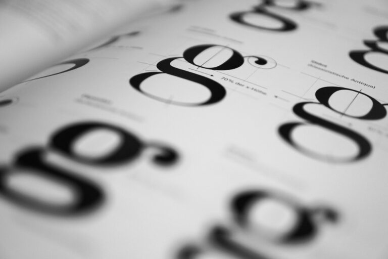
7 Best Map Typography Ideas
Typography transforms ordinary maps into extraordinary visual storytelling tools that capture attention and communicate information more effectively than traditional cartographic approaches.
You’ll discover how creative font choices street names that curve with roads and size variations that emphasize geographic importance can turn basic maps into engaging design pieces that users actually want to explore.
Smart typography decisions help your maps stand out in crowded digital spaces while improving readability and user experience across different devices and platforms.
Disclosure: As an Amazon Associate, this site earns from qualifying purchases. Thank you!
P.S. check out Udemy’s GIS, Mapping & Remote Sensing courses on sale here…
Use Varying Font Sizes to Create Visual Hierarchy
Font size creates natural reading priorities that guide users through your map’s information layers. Strategic sizing transforms chaotic label clusters into organized, scannable content that enhances navigation efficiency.
Establish Primary Landmarks With Large Typography
Major cities and prominent features demand the largest font sizes to anchor your map’s visual structure. Use 14-16 point fonts for capitals and significant urban centers, while secondary cities work well at 10-12 points. Large typography for key landmarks like national parks or mountain ranges creates instant recognition points that help users orient themselves within your map’s geographic context.
Guide Reader Attention Through Strategic Sizing
Progressive font scaling creates natural reading paths that lead users from major to minor features systematically. Start with primary roads at 10 points, scale secondary roads to 8 points, and reduce residential streets to 6 points. This hierarchical approach prevents visual overwhelm while ensuring users can quickly identify the most relevant information for their navigation needs without searching through cluttered labels.
Balance Readability With Aesthetic Appeal
Maintain legibility standards while creating visual interest through careful size relationships and spacing considerations. Keep body text above 8 points for mobile compatibility, use 1.5x line spacing for dense label areas, and ensure 3:1 contrast ratios between text and background colors. Test your size hierarchy at various zoom levels to confirm that essential information remains readable across different viewing contexts and device specifications.
Incorporate Hand-Lettered Elements for Artistic Flair
Hand-lettered typography transforms sterile digital maps into engaging visual narratives that capture viewer attention and create memorable geographic experiences.
Add Personality Through Custom Calligraphy
Custom calligraphy injects distinctive character into your map labels while maintaining professional cartographic standards. You’ll achieve optimal results by digitizing hand-drawn lettering using vector graphics software like Adobe Illustrator or Inkscape. Create multiple calligraphic variations for different feature types – flowing scripts for water bodies, bold strokes for mountain ranges, and elegant cursive for historical districts. Test your calligraphy at various zoom levels to ensure readability remains consistent across different viewing scales and device types.
Create scalable vector graphics with XML using SVG Essentials. This book teaches you to produce high-quality images that remain sharp at any size.

Create Unique Place Names With Brush Lettering
Brush lettering techniques produce organic, textured typography that distinguishes local landmarks from standard geographic labels. You can scan physical brush strokes and convert them to vector paths, maintaining the authentic feel while preserving scalability for digital applications. Focus brush lettering on culturally significant locations like neighborhoods, parks, or heritage sites where artistic expression enhances the storytelling aspect. Combine different brush weights and styles to establish visual hierarchy while keeping the overall aesthetic cohesive throughout your map composition.
Blend Digital and Analog Typography Techniques
Hybrid typography workflows combine hand-drawn elements with digital precision to create polished yet authentic map labels. Start by sketching letterforms on paper, then digitize and refine them using font creation software like FontForge or Glyphs. This approach allows you to maintain the organic quality of hand lettering while achieving the consistency required for professional cartographic work. Layer digital effects like subtle shadows or textures onto your hand-lettered base to enhance depth and visual interest without compromising legibility standards.
Experiment With Typography as Geographic Features
Typography can become an integral part of your map’s landscape rather than simply labeling it. This approach transforms text into visual elements that enhance geographic storytelling.
Transform Rivers Into Flowing Text Paths
You’ll create dynamic water features by converting river names into curved text that follows the natural flow of waterways. Position typography to mirror meandering streams using path tools in your mapping software. Adobe Illustrator‘s Type on Path feature excels for this technique, allowing you to adjust letter spacing and baseline shifts to match water movement. This method works especially well for prominent rivers like the Mississippi or Amazon, where the text becomes part of the geographic narrative.
Enjoy refreshing water with the Avalon Bottom Loading Water Cooler. It offers hot, cold, and room temperature options, a BioGuard anti-microbial coating, and a child safety lock for peace of mind.

Use Letters to Form Mountain Ranges
You can construct mountain silhouettes using oversized letterforms that spell out range names or peak identifiers. Stack bold sans-serif letters to create jagged mountain profiles, adjusting character spacing to form realistic ridgelines. QGIS and ArcGIS Pro support creative text manipulation through expression builders and advanced labeling options. This technique proves particularly effective for iconic ranges like the Rockies or Alps, where typography reinforces the dramatic vertical landscape while maintaining readability at various zoom levels.
Create Coastal Outlines With Curved Typography
You’ll define shorelines using flowing text that traces coastal boundaries, transforming ocean and bay names into geographic boundaries themselves. Employ curved text tools to match natural coastline contours, creating seamless integration between typography and topography. Mapbox Studio offers excellent curved text capabilities for web-based applications. This approach works brilliantly for complex coastlines like those found in Norway’s fjords or Maine’s rocky shores, where text becomes both informative and structurally defining.
Apply Color Psychology in Typographic Choices
Color psychology transforms typographic elements into powerful communication tools that enhance your map’s effectiveness and user engagement.
Select Colors That Reflect Geographic Characteristics
Choose typography colors that mirror the natural environment you’re mapping to create intuitive user connections. Desert regions work best with warm earth tones like ochre and sienna for place names, while coastal areas benefit from cool blues and teals. Forest labels gain authenticity with deep greens, and urban typography performs well in neutral grays or industrial blues that echo metropolitan environments.
Use Contrast to Enhance Map Readability
Implement high contrast ratios between text and background elements to ensure legibility across different viewing conditions. Light typography on dark water features maintains visibility, while dark text over light terrain provides optimal readability. Test your contrast ratios using accessibility tools like WebAIM’s contrast checker, aiming for at least 4.5:1 for normal text and 3:1 for large text elements.
Coordinate Typography Colors With Map Elements
Synchronize your text colors with existing map symbology to create visual harmony and reduce cognitive load. Match road labels to corresponding line colors using slightly darker or lighter variations, and align boundary text with administrative colors while maintaining sufficient contrast. Use your map’s established color palette as a foundation, selecting typography hues that complement rather than compete with geographic features.
Achieve a flawless, even complexion with e.l.f. Flawless Satin Foundation. This lightweight, vegan formula provides medium coverage and a semi-matte finish for all-day wear, while hydrating your skin with glycerin.

Integrate Directional Typography Along Routes
Directional typography transforms static route information into dynamic visual navigation aids that guide users naturally through your map’s transportation networks.
Align Text With Road and Path Curves
Align your text directly with road curves to create intuitive visual connections between labels and their corresponding transportation features. Use QGIS’s curved labeling engine or ArcGIS Pro’s advanced text placement tools to automatically follow polyline geometries. Set label offset distances between 2-4 map units to maintain readability while preserving the curved relationship. Test alignment angles at major intersections to prevent text overlap conflicts.
Create Dynamic Movement Through Text Placement
Create visual momentum by positioning text elements to suggest directional flow along transportation corridors. Implement graduated spacing between characters using tools like Mapbox Studio’s text-pitch property to emphasize route direction. Vary letter spacing from 0.5 to 2.0 points based on road hierarchy—tighter spacing for local streets and wider spacing for highways. Apply subtle rotation angles following the natural curve progression of your route geometry.
Guide Navigation With Strategic Typography Flow
Guide user attention systematically through your transportation network using strategic typography hierarchy and placement patterns. Position primary route names at consistent intervals every 500-800 pixels to maintain visual continuity without overwhelming the display. Implement z-index layering in your mapping software to ensure directional labels appear above background elements but below critical navigation symbols. Coordinate text flow direction with your map’s overall reading pattern for optimal user comprehension.
Combine Multiple Typefaces for Thematic Distinction
Strategic typeface combinations transform your maps into sophisticated visual hierarchies that communicate geographic relationships through typographic contrast.
Differentiate Geographic Features With Font Families
Assign distinct typeface categories to specific feature types for immediate visual recognition. Use serif fonts like Times New Roman for historical districts and heritage sites, sans-serif fonts like Helvetica for modern infrastructure and urban areas, and script fonts for natural features like rivers and parks. This systematic approach creates intuitive associations between typography and geography, allowing users to quickly identify feature categories without reading detailed labels.
Create Cultural Context Through Typography Selection
Choose typefaces that reflect regional character and cultural significance to enhance your map’s storytelling potential. Select fonts inspired by local architectural styles, such as Art Deco-influenced typography for 1920s districts or clean modernist fonts for contemporary business centers. Incorporate culturally appropriate typefaces for ethnic neighborhoods, like selecting fonts with Asian character sets for Chinatowns or using calligraphic styles that echo local artistic traditions.
Maintain Cohesion While Adding Visual Interest
Balance typographic variety with visual harmony by establishing consistent weight and size relationships across different font families. Limit your palette to 2-3 complementary typeface families and maintain consistent spacing, alignment, and color schemes throughout your design. Use a master typography style guide that defines specific applications for each font family, ensuring that creative variety enhances rather than disrupts your map’s overall readability and professional appearance.
Utilize Typography Transparency and Layering Effects
Typography transparency and layering create sophisticated visual depth while maintaining essential map information accessibility. These techniques allow you to present complex geographic data without overwhelming your map users.
Create Depth Through Overlapping Text Elements
Overlapping typography establishes visual hierarchy by positioning text elements at different depths within your cartographic composition. Position primary labels at full opacity in the foreground while placing secondary information with reduced transparency behind major features. Use tools like Adobe Illustrator or QGIS to create stacked text arrangements where neighborhood names appear beneath major street labels. This technique mimics natural reading patterns where your eye processes information in layers, allowing users to focus on primary navigation elements first while maintaining access to detailed geographic context through subtle background typography.
Learn Adobe Illustrator with the 2025 release of this comprehensive guide. Master essential skills through hands-on lessons.

Use Opacity to Prevent Map Clutter
Opacity adjustments reduce visual noise while preserving essential geographic information in dense urban mapping environments. Set secondary labels to 60-70% opacity to maintain readability without competing with primary navigation features. Apply graduated transparency to elevation contour labels, making them visible for reference but unobtrusive during general map use. Software like Mapbox Studio and ArcGIS Pro offer precise opacity controls that let you fine-tune text visibility based on zoom levels. This approach ensures your map remains functional across different scales while preventing information overload that can frustrate users navigating complex geographic areas.
Layer Typography for Enhanced Visual Impact
Layered typography combines multiple text elements at varying opacities to create rich, informative map compositions. Place large, semi-transparent area names beneath detailed street labels to provide geographic context without interfering with navigation functionality. Stack historical place names at low opacity behind contemporary labels to add cultural depth while maintaining modern usability. Use drop shadows and background halos with transparency settings to ensure text legibility over varied terrain features. This technique works particularly well in tourist maps where you need to balance detailed navigation information with broader geographic storytelling, creating maps that serve both practical and educational purposes.
Conclusion
Typography transforms your maps from basic navigation tools into powerful storytelling mediums that captivate and guide users effectively. By implementing these creative techniques you’ll elevate your cartographic work beyond conventional design standards.
Remember that successful map typography balances artistic expression with functional clarity. Your creative choices should always serve the user’s needs while enhancing the overall visual experience.
The key lies in thoughtful experimentation and consistent testing across different platforms and viewing conditions. Start with one or two techniques that align with your project’s goals and gradually expand your typographic toolkit as you gain confidence.
Your maps have the potential to become memorable visual experiences that users will appreciate and trust for their navigation needs.
Frequently Asked Questions
How does typography enhance map design beyond basic labeling?
Typography transforms maps from simple navigation tools into compelling visual storytelling mediums. Creative font choices, such as curving street names and varying sizes to emphasize geographic significance, make maps more engaging and appealing to users. Thoughtful typography improves readability, user experience, and helps maps stand out in crowded digital landscapes while maintaining professional standards.
What is the best approach to creating visual hierarchy with font sizes on maps?
Use larger typography for major landmarks and cities to anchor the map’s visual structure, then employ progressive font scaling to guide attention from primary to minor features. This creates a clear information hierarchy that enhances navigation efficiency. Balance readability with aesthetic appeal by testing size hierarchies across different viewing contexts to ensure accessibility.
How can hand-lettered elements be incorporated into professional map design?
Hand-lettered elements add artistic flair while maintaining professionalism through custom calligraphy for map labels and brush lettering techniques for unique place names. Digitize hand-drawn lettering for various feature types to create engaging visual narratives. This approach works particularly well for culturally significant locations, blending digital and analog techniques for polished yet authentic results.
What are innovative ways to integrate typography as geographic features?
Transform river names into flowing text paths that mimic waterway movement using Adobe Illustrator’s Type on Path feature. Construct mountain silhouettes with oversized letterforms representing range names through QGIS and ArcGIS Pro. Define shorelines with curved typography tracing coastal boundaries using Mapbox Studio tools for seamless text-topography integration.
How should color psychology be applied to map typography?
Select typography colors that reflect geographic characteristics—warm earth tones for deserts, cool blues for coastal areas. Maintain high contrast ratios between text and background for legibility across viewing conditions. Coordinate typography colors with existing map symbology to create visual harmony and reduce cognitive load, ensuring text complements rather than competes with features.
What is directional typography and how does it improve navigation?
Directional typography transforms static route information into dynamic visual navigation aids by aligning text with road curves and creating intuitive label-feature connections. Use tools like QGIS and ArcGIS Pro for effective placement. Position text elements to suggest directional flow with graduated spacing and subtle rotation, maintaining visual continuity for optimal user comprehension.
How can multiple typefaces be effectively combined in map design?
Assign distinct typeface categories to specific feature types—serif fonts for historical sites, sans-serif for modern infrastructure. Select typefaces reflecting regional character and cultural significance to enhance storytelling potential. Balance typographic variety with consistent weight and size relationships using a limited palette of complementary typefaces to maintain cohesion and readability.
What are the benefits of typography transparency and layering effects?
Typography transparency creates sophisticated visual depth while maintaining information accessibility. Use primary labels at full opacity in the foreground with secondary information at reduced transparency to establish visual hierarchy. Adjust opacity to prevent map clutter while ensuring essential geographic information remains readable, combining multiple text elements for rich, informative compositions.