7 Best Big Data Visualization Techniques
Why it matters: You’re drowning in data but struggling to make it meaningful through traditional mapping approaches.
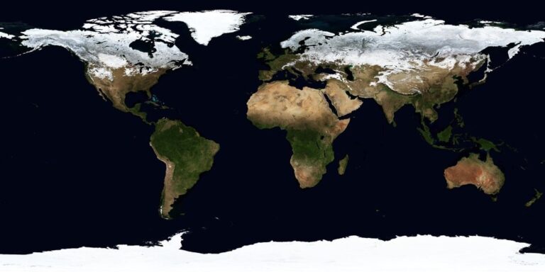
The big picture: Modern cartographic design transforms overwhelming datasets into compelling visual stories that drive decision-making across industries from urban planning to environmental science.
What’s next: These seven visualization techniques will help you unlock your data’s potential and create maps that actually communicate insights rather than just display information.
Disclosure: As an Amazon Associate, this site earns from qualifying purchases. Thank you!
P.S. check out Udemy’s GIS, Mapping & Remote Sensing courses on sale here…
Heat Maps: Transforming Data Density Into Visual Temperature
Heat maps convert numerical data into color-coded visualizations that reveal patterns invisible in traditional mapping approaches. They use thermal color schemes to represent data intensity across geographic space.
Population Density Visualization
Population density heat maps reveal settlement patterns and demographic clustering with remarkable clarity. You’ll transform census data into thermal gradients where red zones indicate high-density urban cores and blue areas show sparse rural populations. Tools like QGIS and ArcGIS Pro offer built-in density analysis functions that calculate population per square kilometer automatically. These visualizations help urban planners identify overcrowded neighborhoods, plan infrastructure projects, and allocate emergency services effectively across metropolitan areas.
Traffic Pattern Analysis
Traffic flow heat maps expose congestion patterns and transportation bottlenecks throughout road networks. You can process GPS tracking data, mobile phone signals, and traffic sensor readings to create thermal visualizations of vehicle density. Popular mapping platforms like Mapbox and Google Maps Platform provide APIs for real-time traffic data integration. Transportation engineers use these heat maps to optimize signal timing, identify accident-prone intersections, and design efficient routing systems for emergency vehicles during peak hours.
Track vehicles and assets with the LandAirSea 54 GPS Tracker. Get real-time location alerts and historical playback using the SilverCloud app, with a long-lasting battery and discreet magnetic mount.

Climate Data Representation
Climate heat maps transform meteorological measurements into intuitive temperature and precipitation visualizations. You’ll process weather station data, satellite imagery, and atmospheric models to create thermal representations of temperature variations, rainfall patterns, and extreme weather events. Software like R with ggplot2 or Python’s matplotlib libraries excel at processing large climate datasets. Environmental scientists rely on these visualizations to track climate change impacts, predict drought conditions, and communicate weather risks to public audiences.
Get real-time weather data with the Ambient Weather WS-2902. This WiFi-enabled station measures wind, temperature, humidity, rainfall, UV, and solar radiation, plus it connects to smart home devices and the Ambient Weather Network.

Choropleth Maps: Color-Coding Geographic Regions by Data Values
Choropleth maps transform statistical data into color-coded geographic regions, creating immediate visual understanding of data distribution patterns. You’ll find these maps essential for displaying quantitative information across defined boundaries like states, counties, or countries.
Economic Indicators by State or Country
GDP per capita visualization helps you identify economic disparities across regions using graduated color schemes from light to dark. You can map unemployment rates, median household income, and industrial output to reveal economic clustering patterns. Interactive choropleth maps in ArcGIS Online or QGIS allow users to hover over regions for detailed economic statistics, while automated classification methods like natural breaks ensure accurate data representation.
Demographic Distribution Patterns
Population density mapping uses color intensity to show settlement concentrations across administrative boundaries. You’ll effectively display age demographics, education levels, and ethnic composition through carefully selected color palettes that avoid cultural bias. Census data choropleth maps require proper normalization techniques to account for varying geographic area sizes, ensuring your visualization accurately represents per-capita or percentage-based demographic patterns rather than raw population counts.
Election Results and Political Data
Voting pattern visualization transforms electoral data into compelling geographic narratives using red-blue color schemes or multi-party palettes. You can display voter turnout rates, party affiliation percentages, and swing state analysis through choropleth techniques. Real-time election mapping requires careful data classification intervals and neutral color choices to maintain objectivity, while incorporating temporal animation capabilities helps show political shifts across multiple election cycles.
Flow Maps: Illustrating Movement and Connection Patterns
Flow maps excel at revealing directional movement patterns and connections between geographic locations. You’ll transform complex migration routes, trade networks, and transportation data into clear visual narratives that highlight directional relationships and volume distributions.
Migration Data Visualization
Track population movements using curved lines or arrows that connect origin and destination points across your map. You’ll represent migration volume through line thickness variations, with major population flows appearing as bold connections and smaller movements as thinner lines. Tools like ArcGIS Pro’s Flow Mapping capabilities and QGIS’s flow line plugins help you process census migration data effectively. Color-coding by migration type—international, interstate, or seasonal—adds analytical depth to your population movement visualizations.
Trade Route Analysis
Visualize commercial connections by mapping trade flows between ports, cities, and economic regions using directional flow lines. You’ll display trade volume through line width scaling, where major shipping routes appear as thick corridors and smaller trade connections show as narrow pathways. D3.js libraries and Tableau’s flow mapping features enable you to animate trade data over time periods. Import/export ratios become clear when you use contrasting colors for incoming versus outgoing trade flows across your mapped regions.
Transportation Network Flows
Map traffic patterns and passenger movements across transportation systems using flow visualization techniques that reveal network bottlenecks and capacity distributions. You’ll analyze subway ridership data, highway traffic counts, and flight patterns through directed flow mapping. GTFS data integration with CartoDB or Mapbox allows you to visualize public transit flows dynamically. Peak hour traffic concentrations become apparent when you adjust flow line opacity and thickness based on volume measurements throughout your transportation network analysis.
Dot Density Maps: Representing Quantity Through Point Distribution
Dot density maps transform overwhelming datasets into intuitive visualizations by distributing points across geographic areas to represent statistical quantities. Each dot represents a specific value, creating powerful visual narratives that reveal spatial patterns and clustering distributions.
Population Distribution Techniques
Population density mapping uses systematically placed dots to represent demographic concentrations across regions. You’ll assign each dot a specific value like 1,000 people then distribute them proportionally within census boundaries. Urban clustering patterns emerge naturally through this technique, revealing settlement hierarchies and migration trends. Tools like ArcGIS Pro and QGIS offer automated dot placement algorithms that maintain statistical accuracy while avoiding visual overlap in dense metropolitan areas.
Resource Location Mapping
Natural resource distribution becomes immediately apparent through strategic dot placement representing extraction sites, mineral deposits, or agricultural production zones. You can map oil wells, mining operations, or timber harvests using weighted dot values that correspond to production capacity or economic output. Infrastructure mapping benefits from this approach when visualizing utility networks, communication towers, or renewable energy installations across large territories using color-coded dots for different resource types.
Event Occurrence Patterns
Temporal event clustering reveals through dot density techniques when mapping incidents like crime occurrences, disease outbreaks, or natural disasters over specific time periods. You’ll represent each event as a single dot positioned at precise coordinates with temporal filtering capabilities. Emergency response planning utilizes these patterns to identify high-risk zones and optimize resource allocation. Interactive platforms like Leaflet and Mapbox enable real-time dot updates for dynamic event monitoring and pattern analysis.
3D Terrain Visualization: Adding Dimensional Depth to Data
3D terrain visualization transforms flat geographic data into immersive dimensional experiences that reveal spatial relationships impossible to detect in traditional 2D mapping. You’ll discover how elevation modeling creates compelling visual narratives that enhance data interpretation.
Elevation-Based Data Representation
Elevation-Based Data Representation uses digital elevation models (DEMs) to create realistic topographic foundations for your datasets. You can overlay population density, temperature readings, or economic indicators onto accurate terrain surfaces using tools like ArcGIS Pro or QGIS with GDAL processing. This technique reveals how geographic features influence data patterns—showing how mountain ranges affect precipitation or valleys concentrate urban development. NASA’s SRTM and USGS 3DEP datasets provide high-resolution elevation data that transforms abstract statistics into geographically contextualized visualizations.
Achieve a flawless, even complexion with e.l.f. Flawless Satin Foundation. This lightweight, vegan formula provides medium coverage and a semi-matte finish for all-day wear, while hydrating your skin with glycerin.

Layered Information Display
Layered Information Display stacks multiple datasets vertically above terrain surfaces to create comprehensive analytical views. You can position demographic data as colored surfaces above topographic bases while displaying transportation networks as elevated lines and point data as floating markers. Tools like Blender GIS, CesiumJS, or ArcGIS Pro enable precise layer management with adjustable transparency and height scaling. This approach helps you identify correlations between elevation, infrastructure, and socioeconomic patterns while maintaining visual clarity through strategic layer ordering and color coding.
Interactive 3D Exploration Tools
Interactive 3D Exploration Tools enable dynamic navigation through complex datasets using web-based platforms and desktop applications. You can implement smooth zoom, pan, and rotation controls with libraries like Three.js, Cesium, or Mapbox GL JS for web deployment. Desktop solutions include ArcGIS Scene Viewer and QGIS’s Qgis2threejs plugin for detailed analysis workflows. These tools support real-time data filtering, temporal animations, and user-driven exploration that reveals hidden patterns through interactive manipulation. Touch-enabled interfaces and VR compatibility expand accessibility for stakeholder presentations and collaborative analysis sessions.
Animated Time-Series Maps: Showing Data Evolution Over Time
Animated time-series maps transform static geographic data into dynamic visual stories that reveal how patterns change across temporal dimensions. These powerful visualizations help you communicate complex temporal relationships that remain hidden in traditional static mapping approaches.
Historical Trend Visualization
Historical trend visualization captures long-term patterns by animating sequential map frames across extended time periods. You’ll create compelling narratives using annual population growth data from census records or decade-by-decade urban expansion imagery from satellite sources. GIS platforms like ArcGIS Pro and QGIS offer timeline animation tools that automatically generate smooth transitions between temporal datasets. Configure frame rates between 2-5 seconds per time interval to allow proper pattern recognition while maintaining viewer engagement throughout your animated sequence.
Real-Time Data Updates
Real-time data updates enable continuous map refreshes using live data streams from APIs, sensors, and monitoring systems. You’ll integrate dynamic datasets like traffic conditions from Google Maps API or weather patterns from NOAA feeds into interactive mapping platforms. JavaScript libraries including Leaflet and D3.js support real-time data binding with automatic refresh intervals ranging from seconds to minutes. Configure WebSocket connections or REST API polling to maintain current information display while managing server load and bandwidth constraints effectively.
Temporal Pattern Recognition
Temporal pattern recognition reveals cyclical trends, seasonal variations, and anomalous events through systematic time-series analysis within your cartographic displays. You’ll identify recurring patterns like daily traffic congestion cycles, monthly precipitation variations, or annual migration routes using statistical overlay techniques. Implement color-coded temporal legends and pattern highlighting to emphasize significant changes or deviations from normal ranges. Advanced visualization tools support pattern detection algorithms that automatically flag unusual temporal behaviors for further investigation and analysis.
Interactive Dashboard Integration: Combining Multiple Visualization Techniques
Interactive dashboards transform individual mapping techniques into comprehensive analytical environments that reveal complex data relationships across multiple dimensions.
Multi-Layer Data Exploration
Stack multiple visualization types within single dashboard interfaces to create powerful analytical environments. You’ll combine heat maps with choropleth overlays while integrating flow lines and dot density patterns simultaneously. D3.js and Observable notebooks enable seamless layer switching through JavaScript controls. Toggle between demographic heat maps and economic choropleth data using opacity sliders and checkbox filters. Layer management tools in ArcGIS Dashboards support up to 15 simultaneous data layers with independent styling controls.
User-Controlled Filtering Options
Dynamic filtering systems empower users to customize data displays through interactive parameter controls and temporal sliders. You’ll implement dropdown menus for categorical variables while providing range sliders for continuous datasets like population density or income levels. Tableau’s filter actions connect multiple visualizations through coordinated brushing techniques. Real-time query builders in Power BI allow users to construct custom data views using AND/OR logic operators across multiple attribute fields.
Cross-Referenced Data Analysis
Coordinated multiple views link separate visualization panels through synchronized selection and highlighting mechanisms across different chart types. You’ll connect scatter plots with choropleth maps so selecting data points automatically highlights corresponding geographic regions. Plotly Dash frameworks support bidirectional data binding between map selections and statistical charts. Correlation matrices integrate with geographic displays to reveal spatial relationships between variables like housing costs and transportation access patterns.
Conclusion
These seven visualization techniques give you powerful tools to transform complex datasets into compelling cartographic narratives. Whether you’re revealing migration patterns through flow maps or uncovering temporal trends with animated visualizations you’ll find that the right approach depends entirely on your data’s nature and your audience’s needs.
Remember that effective big data visualization isn’t just about choosing flashy graphics—it’s about selecting the technique that best communicates your story. Start with simple heat maps or choropleth visualizations before advancing to interactive dashboards and 3D terrain models.
Your cartographic success lies in matching visualization methods to data types while keeping user experience at the forefront. With these techniques in your toolkit you’re ready to create maps that don’t just display information but reveal meaningful insights that drive informed decision-making.
Frequently Asked Questions
What are heat maps and how do they help visualize data?
Heat maps convert numerical data into color-coded visualizations that reveal patterns invisible in traditional mapping. They use color intensity to represent data density or values, making complex datasets instantly understandable. Popular applications include population density mapping, traffic pattern analysis, and climate data visualization, helping urban planners identify overcrowded areas and environmental scientists track climate change impacts.
How do choropleth maps differ from other visualization techniques?
Choropleth maps color-code geographic regions based on statistical data, providing immediate visual understanding of data distribution patterns. Unlike heat maps that show intensity, choropleth maps categorize areas into distinct color bands representing different value ranges. They’re ideal for displaying economic indicators, demographic data, and election results across defined geographic boundaries.
What are flow maps best used for?
Flow maps excel at illustrating movement and connection patterns between geographic locations. They use directional lines or arrows to show relationships, with line thickness representing volume or intensity. Common applications include visualizing migration routes, trade networks, transportation flows, and supply chain movements. They’re perfect for understanding how people, goods, or information move across geographic spaces.
How do dot density maps work?
Dot density maps distribute points across geographic areas where each dot represents a specific statistical value. This technique transforms overwhelming datasets into intuitive visualizations by showing spatial clustering and distribution patterns. They’re effective for population mapping, resource location visualization, and event occurrence patterns like crime or disease outbreaks over time.
What advantages do 3D terrain visualizations offer?
3D terrain visualizations transform flat geographic data into immersive dimensional experiences, revealing spatial relationships impossible to detect in 2D mapping. They use digital elevation models to overlay datasets onto accurate terrain surfaces, showing how geographic features influence data patterns. Multiple datasets can be layered vertically for comprehensive analytical views with interactive exploration capabilities.
Why are animated time-series maps important?
Animated time-series maps transform static geographic data into dynamic visual stories that reveal how patterns change over time. They capture historical trends through sequential map frames, provide real-time data updates, and enable temporal pattern recognition. This technique is crucial for identifying cyclical trends, anomalies, and long-term changes in geographic datasets.
What is interactive dashboard integration?
Interactive dashboard integration combines multiple visualization techniques into comprehensive analytical environments. It allows multi-layer data exploration by stacking different visualization types, offers user-controlled filtering options, and enables cross-referenced data analysis through synchronized selection mechanisms. Tools like D3.js, Tableau, and Plotly Dash support these advanced visualization implementations for complex data relationships.