7 Best Projection Techniques for Thematic Maps
Creating compelling thematic maps requires more than just plotting data points on a standard world map projection. The projection technique you choose fundamentally shapes how your audience interprets spatial relationships and can either enhance or distort your message entirely.
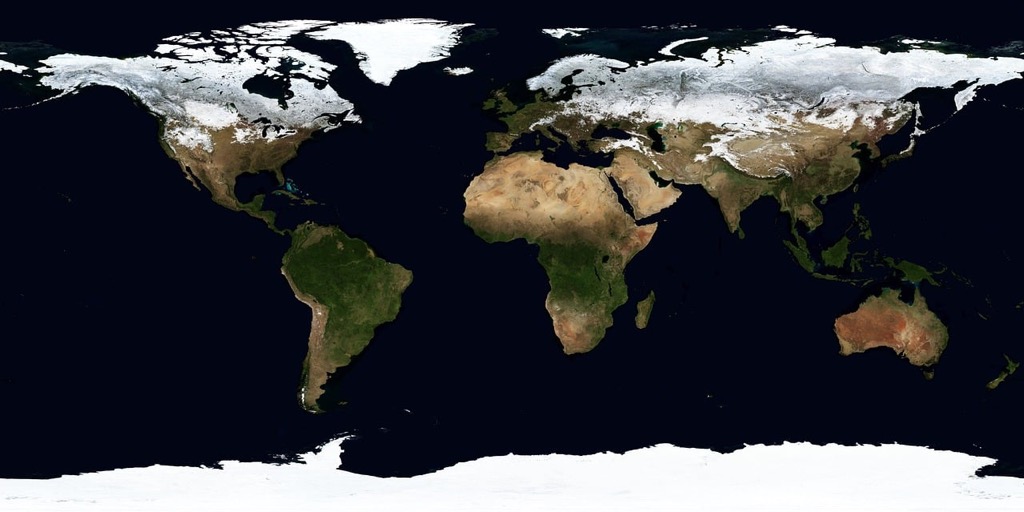
While basic projections like Mercator work for general navigation these seven advanced techniques offer superior solutions for specific thematic mapping challenges. You’ll discover how equal-area projections preserve statistical accuracy for demographic data how conformal projections maintain shape integrity for climate visualization and how compromise projections balance multiple distortion factors simultaneously.
These sophisticated approaches transform raw geographic data into powerful visual narratives that communicate complex spatial patterns with precision and clarity.
Disclosure: As an Amazon Associate, this site earns from qualifying purchases. Thank you!
P.S. check out Udemy’s GIS, Mapping & Remote Sensing courses on sale here…
Understanding Map Projections and Their Role in Thematic Cartography
Map projections transform the three-dimensional Earth onto flat surfaces, creating the mathematical foundation for every thematic map you’ll create. Your projection choice directly affects how viewers interpret spatial patterns and statistical relationships in your data.
What Are Map Projections
Map projections are mathematical transformations that convert geographic coordinates from Earth’s curved surface to a flat plane. Each projection uses specific algorithms to translate latitude and longitude into x-y coordinates on your map. The process involves systematic distortion of one or more spatial properties including area, shape, distance, and direction. No projection preserves all properties simultaneously – you must choose which characteristics to maintain based on your thematic mapping objectives.
Why Projection Choice Matters for Thematic Maps
Projection selection fundamentally shapes how audiences perceive your data patterns and statistical relationships. Equal-area projections maintain accurate size relationships crucial for demographic analysis and population density mapping. Conformal projections preserve local angles and shapes essential for weather pattern visualization and terrain analysis. Your projection choice can dramatically alter visual emphasis – Greenland appears larger than Africa on Mercator projections but shows its true relative size on equal-area alternatives.
Types of Distortion in Map Projections
All map projections introduce four types of geometric distortion that affect thematic interpretation. Area distortion changes the relative size of regions, impacting choropleth maps and density visualizations. Shape distortion alters the geometry of geographic features, affecting boundary accuracy and pattern recognition. Distance distortion modifies measurements between points, influencing network analysis and accessibility mapping. Angular distortion changes directional relationships, impacting flow maps and navigation elements within your thematic displays.
Azimuthal Equidistant Projection for Distance-Based Analysis
You’ll find azimuthal equidistant projection invaluable when your thematic mapping requires accurate distance measurements from a central reference point. This projection maintains true distances and directions from its center point to all other locations on the map.
Key Characteristics and Properties
Distance preservation from center point defines this projection’s core strength, making it unique among coordinate systems. You get accurate angular relationships radiating outward from your chosen center, while maintaining constant scale along all meridians. The projection creates circular maps when showing hemispheres, with increasing area distortion as you move away from the central point. Distance measurements remain precise only from center to edge.
Best Use Cases for Thematic Applications
Radio broadcast coverage mapping represents the most common application, showing signal reach from transmission towers with geographic accuracy. You can effectively visualize earthquake epicenter impacts, airline route distances from hub airports, or telecommunication network coverage areas. Emergency response planning benefits from this projection when mapping evacuation zones or service territories. Migration pattern analysis works well when tracking movement from specific origin points.
Limitations and Considerations
Significant shape distortion occurs at map edges, making this projection unsuitable for general-purpose thematic mapping across large areas. You’ll encounter increasing area distortion with distance from center, affecting statistical data interpretation in peripheral regions. The projection works best for regional analysis rather than global datasets. Direction accuracy applies only from center outward, not between peripheral locations, limiting its utility for comprehensive spatial relationship analysis.
Albers Equal-Area Conic Projection for Statistical Choropleth Maps
The Albers Equal-Area Conic projection delivers exceptional accuracy for statistical choropleth maps across mid-latitude regions. You’ll find this projection preserves area relationships essential for demographic and economic data visualization.
Mathematical Foundation and Design
Achieve a flawless, even complexion with e.l.f. Flawless Satin Foundation. This lightweight, vegan formula provides medium coverage and a semi-matte finish for all-day wear, while hydrating your skin with glycerin.

Albers projection uses two standard parallels to minimize distortion across your mapping region. The mathematical formula transforms geographic coordinates using cone geometry, where Earth’s surface projects onto a cone intersecting at two latitude lines. You’ll achieve optimal results when standard parallels are positioned at one-sixth and five-sixths of your mapped area’s latitude range. This dual-parallel approach reduces scale distortion to less than 1% across most continental regions.
Advantages for Population and Economic Data
Population density mapping benefits significantly from Albers’ area preservation properties. Your choropleth maps maintain accurate proportional relationships between administrative units, preventing visual bias in statistical interpretation. Economic data visualization improves dramatically because equal-area properties ensure GDP comparisons remain mathematically valid across different geographic regions. Census data, agricultural statistics, and resource distribution maps achieve superior accuracy when you apply this projection technique.
Regional Applications and Modifications
North American mapping agencies standardize on Albers for continental-scale thematic maps. You can modify standard parallels for specific regions: use 29.5°N and 45.5°N for the continental United States, or 50°N and 70°N for Canada. State and provincial mapping programs often customize these parameters for local optimization. European cartographers adapt Albers for individual countries by adjusting the central meridian and standard parallels to minimize distortion within national boundaries.
Explore and map the wilderness for the Queen in Cartographers! Draw unique terrain shapes and score points based on randomly selected goals each game, but beware of monster ambushes.

Robinson Projection for Global Thematic Presentations
Explore the world with this 36"x24" physical wall map featuring current geographic details and Earth elevation profiles. Printed on rolled paper in the U.S.A. using the Robinson Projection.

The Robinson projection bridges the gap between mathematical accuracy and visual appeal for global thematic mapping. You’ll find this compromise projection particularly valuable when presenting worldwide data patterns to general audiences.
Compromise Approach to World Mapping
Get durable, tear-resistant posters made in the USA. Each 18" x 29" poster features high-quality 3 MIL lamination for lasting protection.

Robinson projection balances multiple distortion factors rather than eliminating specific types entirely. You get moderate area distortion of approximately 20% at high latitudes while maintaining recognizable continental shapes. This balanced approach works exceptionally well for global climate data, international trade flows, and demographic comparisons where extreme mathematical precision isn’t required. The projection’s curved meridians and gentle pole compression create visually pleasing world maps without the severe polar stretching found in cylindrical projections.
Aesthetic Appeal and Readability Benefits
Your audience will immediately recognize familiar continental outlines when you use Robinson projection for thematic presentations. The projection’s curved appearance closely matches how people expect world maps to look, reducing cognitive load when interpreting statistical data. Landmasses appear proportionally balanced without the exaggerated polar regions of Mercator or the compressed equatorial zones of equal-area alternatives. This natural appearance helps viewers focus on your thematic data rather than questioning unusual geographic shapes.
Common Applications in Atlas Production
Robinson projection dominates reference atlas production for general-purpose world maps showcasing population distribution, economic indicators, and environmental data. National Geographic standardized on Robinson for their world atlas series, establishing industry precedent for educational materials. You’ll see this projection frequently in textbooks, wall maps, and digital atlases where visual appeal outweighs strict mathematical requirements. Corporate presentations, international reports, and media graphics commonly employ Robinson when displaying global statistics to non-technical audiences who prioritize familiar geographic representation.
Goode’s Homolosine Projection for Continental Comparisons
Goode’s Homolosine projection combines sinusoidal and Mollweide projections to create an interrupted equal-area solution ideal for continental thematic mapping. This hybrid approach delivers accurate area preservation while minimizing shape distortion across landmasses.
Interrupted Design and Equal-Area Properties
Interrupted design preserves statistical accuracy by splitting ocean areas while maintaining continental integrity for thematic data analysis. You’ll find sinusoidal projection applied to equatorial regions where east-west extent dominates, while Mollweide handles higher latitudes more effectively. The projection maintains zero area distortion across all continental surfaces, ensuring demographic and economic data comparisons remain mathematically valid. Standard interruption lines typically follow 40°W, 30°E, 160°W, and 150°E meridians to optimize land area preservation.
Effective Display of Global Patterns
Global pattern visualization excels when continental relationships take priority over oceanic continuity in your thematic mapping projects. You can effectively display worldwide agricultural production, population density distributions, and natural resource patterns without the area distortion that compromises other projections. The familiar continental shapes enhance audience recognition while preserving proportional relationships essential for choropleth mapping. Climate zone mapping particularly benefits from this projection’s ability to maintain accurate temperature and precipitation data across continents.
Managing Discontinuities in Data Presentation
Data discontinuities require careful legend design and clear boundary marking to prevent misinterpretation in interrupted projection layouts. You should position oceanic data symbols strategically near continental margins where projection segments connect, maintaining visual flow despite mathematical breaks. Consider using consistent color schemes across projection lobes to reinforce data continuity, while employing subtle grid lines to guide viewer attention across interruption boundaries. Digital mapping platforms often provide specialized templates that automatically handle data wrapping across projection segments for seamless thematic display.
Lambert Conformal Conic Projection for Regional Weather and Climate Maps
Lambert Conformal Conic projection excels at preserving angular relationships and shape accuracy across mid-latitude regions. You’ll find this projection particularly valuable for weather analysis and climate visualization where maintaining accurate geometric relationships is essential for interpreting atmospheric patterns.
Conformal Properties and Shape Preservation
Conformal preservation maintains true angles at every point, ensuring that storm systems and weather fronts appear with correct geometric relationships. You’ll notice that circular pressure systems retain their shape without the elliptical distortion common in other projections. Scale varies minimally across the mapped region when you position standard parallels at one-sixth and five-sixths of your area’s latitude range. Shape distortion remains under 0.5% for areas within 15 degrees of the standard parallels.
Applications in Meteorological Cartography
Weather service agencies standardize on Lambert Conformal Conic for operational forecasting maps because it preserves the circular geometry of pressure systems and storm tracks. You can accurately represent temperature gradients, precipitation patterns, and wind flow directions without geometric distortion affecting interpretation. National Weather Service uses this projection for NEXRAD radar composites and surface analysis charts. European meteorological services apply modified Lambert parameters for continental weather mapping, ensuring consistent angular relationships across forecast regions.
Multi-Standard Parallel Configurations
Two-standard parallel configurations minimize scale distortion across your mapped region by distributing error evenly between the parallels. You’ll achieve optimal results by placing the first standard parallel at 30°N and the second at 60°N for North American applications. Scale factor remains between 0.998 and 1.002 across most continental areas when you calculate standard parallels using the one-sixth rule. Single-standard parallel configurations work effectively for smaller regions spanning less than 10 degrees of latitude, simplifying coordinate transformations while maintaining conformal accuracy.
Mollweide Projection for Global Distribution Analysis
Mollweide projection transforms global data visualization by combining mathematical precision with aesthetic appeal for worldwide statistical mapping. This equal-area projection proves essential when you need to present demographic, environmental, or economic data across continents with accurate proportional relationships.
Equal-Area Characteristics for Statistical Accuracy
Mollweide projection maintains true area relationships across all regions, ensuring statistical integrity in your thematic maps. Population density comparisons remain proportionally accurate between countries, preventing visual bias that affects data interpretation. Agricultural production maps benefit from preserved area ratios, allowing valid yield comparisons across different climate zones. Economic indicators like GDP per square kilometer display correctly, supporting accurate cross-regional analysis in your statistical presentations.
Elliptical Format and Visual Impact
The distinctive elliptical boundary creates an aesthetically pleasing global view that enhances audience engagement with your thematic content. Curved meridians reduce visual distortion near polar regions while maintaining familiar continental shapes for easy recognition. The 2:1 width-to-height ratio fits standard presentation formats effectively, optimizing screen space utilization. Central meridian positioning allows you to emphasize specific regions like the Atlantic or Pacific perspectives based on your mapping objectives.
Suitable Thematic Map Categories
Mollweide projection excels for demographic analysis, environmental monitoring, and resource distribution mapping across global scales. Population studies benefit from accurate density representations, while climate data visualization maintains proper area relationships for temperature and precipitation patterns. Agricultural mapping showcases crop distribution patterns effectively, and biodiversity studies display habitat ranges with correct proportional scaling. Economic development indicators and trade flow visualizations also perform well within this projection’s equal-area framework.
Winkel Tripel Projection for Balanced World Thematic Maps
The Winkel Tripel projection delivers optimal balance for global thematic mapping by averaging mathematical formulas from cylindrical and azimuthal projections. This hybrid approach creates moderate distortion across all geographic properties rather than extreme distortion in specific areas.
Minimizing Multiple Types of Distortion
Winkel Tripel reduces area distortion to approximately 4% in temperate regions while maintaining shape accuracy within 10% across most continental landmasses. You’ll achieve consistent scale relationships that preserve statistical integrity for demographic data visualization. The projection’s averaging algorithm combines Aitoff and equirectangular formulas, creating balanced distortion patterns that prevent extreme shape elongation at polar regions. Your thematic maps benefit from proportional accuracy that supports valid statistical comparisons between geographic regions without the severe area inflation common in cylindrical projections.
National Geographic Society Adoption
National Geographic adopted Winkel Tripel in 1998 as their standard world map projection after extensive cartographic analysis comparing distortion characteristics. You’re following established professional cartographic practice when selecting this projection for reference mapping applications. The society’s research demonstrated superior visual balance compared to Robinson and Mollweide alternatives, particularly for educational and reference materials. Their endorsement established industry credibility for Winkel Tripel in atlas production, wall maps, and educational resources where balanced geographic representation takes priority over specialized mathematical properties.
Modern Applications in Digital Cartography
Digital mapping platforms integrate Winkel Tripel for interactive global dashboards displaying economic, environmental, and demographic data patterns. You can implement this projection in GIS software like ArcGIS Pro and QGIS using EPSG:54019 coordinate reference system. Web mapping applications utilize Winkel Tripel for storytelling maps that require familiar geographic shapes without extreme polar distortion. Your interactive thematic maps benefit from consistent user experience across zoom levels, while the projection’s balanced distortion properties support accurate data interpretation in business intelligence dashboards and environmental monitoring systems.
Conclusion
Mastering these seven advanced projection techniques will transform your thematic mapping capabilities and enhance data visualization accuracy. Each projection serves specific analytical purposes – from the Albers Equal-Area Conic’s statistical precision to the Robinson’s visual appeal for global presentations.
Your choice of projection directly impacts how audiences interpret spatial relationships and statistical patterns. The Winkel Tripel’s balanced approach works well for general-purpose mapping while specialized projections like Lambert Conformal Conic excel in meteorological applications.
Success in thematic cartography requires matching projection characteristics to your specific data requirements and audience needs. These sophisticated techniques provide the foundation for creating compelling visual narratives that communicate geographic insights effectively and maintain statistical integrity across different scales and regions.
Frequently Asked Questions
What is map projection and why is it important for thematic mapping?
Map projection is the mathematical process of transforming the three-dimensional Earth onto a flat surface using specific algorithms to convert geographic coordinates. It’s crucial for thematic mapping because the chosen projection significantly influences how audiences perceive spatial relationships and interpret statistical data, making the selection process fundamental to effective data visualization.
What are the main types of geometric distortion in map projections?
The four main types of geometric distortion are area, shape, distance, and angular distortion. Each projection handles these distortions differently – equal-area projections preserve area relationships for statistical accuracy, conformal projections maintain shape integrity, while compromise projections balance multiple distortion factors for general-purpose mapping applications.
When should I use the Azimuthal Equidistant projection?
Use the Azimuthal Equidistant projection when you need accurate distance measurements from a central reference point. It’s ideal for radio broadcast coverage mapping, earthquake impact visualization, and emergency response planning. However, it has significant shape distortion at edges and is best suited for regional analysis rather than large-area mapping.
What makes the Albers Equal-Area Conic projection effective for statistical maps?
The Albers Equal-Area Conic projection preserves area relationships crucial for demographic and economic data visualization. It uses two standard parallels to minimize distortion, achieving less than 1% scale distortion across continental regions. This makes it perfect for population density mapping and GDP comparisons while preventing visual bias in statistical interpretation.
Why is the Robinson projection popular for global thematic maps?
The Robinson projection balances mathematical accuracy with visual appeal, making it ideal for global presentations. It maintains recognizable continental shapes with moderate area distortion (approximately 20% at high latitudes). Its aesthetically pleasing curved meridians and gentle pole compression enhance readability and reduce cognitive load for audiences interpreting global data.
What are the advantages of Goode’s Homolosine projection?
Goode’s Homolosine combines sinusoidal and Mollweide projections to create an interrupted equal-area solution that preserves area accuracy while minimizing shape distortion across landmasses. The interrupted design maintains continental integrity, making it excellent for visualizing global patterns like agricultural production and population density distributions across continents.
When is the Lambert Conformal Conic projection most useful?
The Lambert Conformal Conic projection excels for weather analysis and climate visualization because it preserves angular relationships and shape accuracy across mid-latitude regions. Weather services use it for operational forecasting maps as it accurately represents temperature gradients, precipitation patterns, wind flow directions, and storm systems with correct geometric relationships.
What makes the Mollweide projection effective for global statistical mapping?
The Mollweide projection combines mathematical precision with aesthetic appeal for worldwide statistical mapping. As an equal-area projection, it maintains true area relationships ensuring statistical integrity in demographic, environmental, and economic data. Its distinctive elliptical format enhances audience engagement while preserving accurate proportional relationships across continents.
Why did National Geographic choose the Winkel Tripel projection?
National Geographic adopted Winkel Tripel in 1998 because it offers optimal balance for global mapping by averaging cylindrical and azimuthal projection formulas. It minimizes area distortion to approximately 4% in temperate regions while maintaining shape accuracy within 10% across most continental landmasses, making it ideal for reference mapping applications.