5 Best Digital Mapping Tools for Community Preservation
Why it matters: You’re witnessing a digital revolution where indigenous communities are reclaiming their narratives through innovative mapping technologies that document centuries of ancestral knowledge.
The big picture: Traditional histories often overlook indigenous perspectives but modern mapping tools now allow these communities to preserve their stories in ways that command respect and recognition from mainstream society.
What’s happening: From land rights advocacy to cultural preservation initiatives indigenous groups across North America are discovering that visual storytelling through maps creates powerful tools for education economic development and political empowerment.
Disclosure: As an Amazon Associate, this site earns from qualifying purchases. Thank you!
P.S. check out Udemy’s GIS, Mapping & Remote Sensing courses on sale here…
Preserving Cultural Identity Through Digital Storytelling
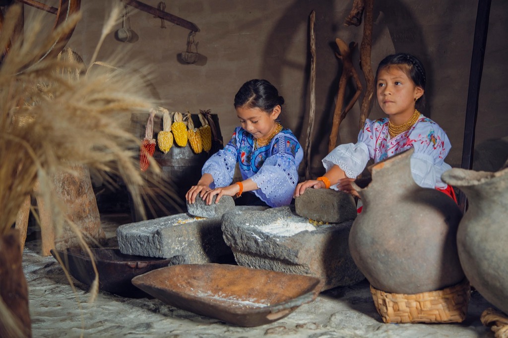
Digital storytelling platforms transform how indigenous communities document and share their cultural narratives with global audiences. You’ll discover powerful methods that combine traditional knowledge with modern technology to create lasting cultural records.
Creating Interactive Heritage Maps
Build dynamic heritage maps using ArcGIS Online or StoryMaps to showcase sacred sites and cultural landmarks. You can layer historical photographs, audio recordings, and traditional stories onto geographic locations. Interactive features like pop-up windows display ceremonial significance, seasonal activities, and ancestral connections. These maps enable community members to click through generations of cultural knowledge while preserving sensitive information through controlled access settings.
Documenting Traditional Place Names
Record indigenous place names using field mapping apps like Avenza Maps or QField to capture accurate GPS coordinates. You’ll document pronunciation guides, cultural meanings, and historical context for each location. Traditional names often reflect seasonal patterns, resource availability, or spiritual significance that colonial mapping overlooked. Store this data in multilingual databases that preserve original languages alongside English translations for future generations.
Recording Oral Traditions Digitally
Capture elder storytelling sessions using high-quality audio equipment paired with GPS location data for geographic context. You can synchronize these recordings with map features to create immersive cultural experiences. Digital archives preserve languages, creation stories, and traditional ecological knowledge that might otherwise disappear. Cloud-based storage ensures community access while maintaining cultural protocols through permission-based sharing systems.
Record studio-quality audio anywhere with the Focusrite Scarlett Solo 4th Gen. This interface features a huge 120dB dynamic range and an improved Air mode to enhance vocals and instruments.

Strengthening Land Rights and Sovereignty Claims
Mapping indigenous community histories provides crucial legal documentation that supports land rights and sovereignty claims in court proceedings. Your detailed cartographic evidence can establish the foundation for successful legal challenges and treaty negotiations.
Achieve a flawless, even complexion with e.l.f. Flawless Satin Foundation. This lightweight, vegan formula provides medium coverage and a semi-matte finish for all-day wear, while hydrating your skin with glycerin.

Providing Historical Evidence for Legal Cases
Historical maps serve as compelling legal evidence in indigenous land rights cases by documenting traditional territories and resource use patterns. You’ll create comprehensive cartographic records that show seasonal migration routes, hunting grounds, and sacred sites with precise GPS coordinates and historical references. Federal courts increasingly accept GIS-generated maps as primary evidence when they’re supported by oral histories, archaeological data, and ethnographic research. Your mapping documentation must include metadata showing data collection methods, source credibility, and temporal accuracy to meet legal standards for admissibility in court proceedings.
Demonstrating Continuous Occupation
Continuous occupation mapping establishes unbroken indigenous presence on ancestral lands through multi-generational settlement patterns and land use documentation. You’ll layer historical aerial photographs, government survey records, and community-generated data to create timeline visualizations showing persistent occupation despite colonial disruption attempts. Archaeological site locations, traditional burial grounds, and ceremonial areas provide additional evidence of long-term territorial connections that predate modern property boundaries. Your occupation maps must demonstrate cultural continuity through documented land management practices, resource harvesting cycles, and seasonal residence patterns spanning multiple decades or centuries.
Supporting Treaty Negotiations
Treaty negotiation maps clarify territorial boundaries and resource rights by visualizing complex legal descriptions and overlapping jurisdictional claims. You’ll develop comprehensive base maps that incorporate traditional territory boundaries, current land use patterns, and proposed settlement areas using authoritative government datasets and community knowledge. Modern GIS platforms like ArcGIS Pro enable you to create interactive maps that support real-time boundary adjustments and resource allocation discussions during negotiation sessions. Your treaty support maps should include mineral rights, water access, hunting territories, and cultural site protections with clear symbology that’s accessible to both legal teams and community members.
Revitalizing Indigenous Languages and Knowledge Systems
Mapping indigenous community histories creates powerful connections between ancestral languages and the landscapes where they originated. Geographic documentation helps communities preserve linguistic heritage while strengthening cultural identity.
Connecting Geographic Locations to Linguistic Heritage
Geotagging traditional place names preserves linguistic connections to specific locations through GPS coordinates and audio recordings. You can document pronunciation variations across different tribal dialects using field recording apps like FieldTrip GB or Survey123. Traditional names often contain ecological knowledge about seasonal patterns, wildlife behavior, and resource availability that modern maps completely miss. Collaborative mapping projects allow elders to share linguistic knowledge while training younger community members in traditional naming systems.
Preserving Traditional Ecological Knowledge
Digital documentation of indigenous land management practices captures centuries of environmental wisdom through interactive mapping platforms. You can record traditional fire management techniques, seasonal harvesting locations, and medicinal plant gathering sites using ArcGIS Field Maps. Traditional ecological knowledge includes sophisticated understanding of ecosystem relationships that complement modern scientific approaches. Cloud-based storage systems ensure this knowledge remains accessible to future generations while maintaining community control over sensitive information.
Teaching Youth Through Place-Based Learning
Interactive heritage maps engage young people by connecting traditional knowledge to familiar geographic locations through storytelling technology. You can develop educational apps that overlay historical indigenous territories with current landscapes, showing cultural continuity across generations. Place-based learning helps youth understand their cultural heritage through direct experience with ancestral lands and traditional practices. Digital platforms allow students to contribute their own research while learning from elders about traditional ecological relationships.
Building Economic Opportunities Through Cultural Tourism
Mapping indigenous histories creates powerful foundations for sustainable tourism ventures that honor cultural heritage while generating meaningful economic benefits for communities.
Developing Indigenous-Led Tourism Initiatives
Cultural mapping empowers you to design authentic tourism experiences that showcase traditional territories and ancestral sites. Digital heritage maps identify culturally significant locations like sacred sites, traditional hunting grounds, and historical settlements that can become focal points for guided tours. Interactive trail systems allow visitors to explore indigenous landscapes while learning about traditional land management practices. Community-controlled mapping ensures that sensitive areas remain protected while accessible locations become economic assets. These initiatives create employment opportunities for indigenous guides, storytellers, and cultural interpreters while maintaining community ownership of their narratives.
Creating Educational Resources for Visitors
Educational mapping resources transform complex indigenous histories into engaging learning experiences for tourists and researchers. Interactive digital maps featuring traditional place names, historical events, and cultural practices provide visitors with comprehensive context before and during their visits. QR codes linked to audio recordings of elders sharing oral histories create immersive storytelling experiences at specific locations. Multi-layered mapping platforms allow visitors to explore different time periods and cultural themes according to their interests. These resources ensure that visitors gain authentic understanding of indigenous perspectives while respecting cultural protocols and boundaries established by community members.
Learn world geography with The World Game! Identify countries, flags, and capitals while boosting memory skills in this fun, educational card game for 2-5 players ages 8+.

Generating Revenue for Community Development
Tourism revenue streams from mapped cultural sites fund essential community infrastructure and cultural preservation programs. Entrance fees to mapped heritage sites generate direct income that supports elder care programs, language revitalization initiatives, and youth education projects. Licensed use of mapping data for educational institutions and research organizations creates ongoing revenue sources. Gift shop sales of maps, books, and cultural materials provide additional income while sharing indigenous knowledge with broader audiences. Revenue-sharing agreements with tourism operators ensure that communities receive fair compensation for access to their traditional territories and cultural knowledge.
Fostering Intergenerational Connection and Healing
Mapping indigenous community histories creates sacred bridges between generations, transforming trauma into healing through shared storytelling and cultural preservation.
Bridging Gaps Between Elders and Youth
Collaborative mapping sessions bring elders and youth together to document traditional knowledge while building meaningful relationships. Youth learn digital mapping skills while elders share ancestral wisdom about sacred sites and territorial boundaries. Interactive workshops combine traditional storytelling with modern GPS technology, creating digital archives that preserve elder knowledge for future generations. These shared experiences strengthen cultural identity while teaching technical skills that empower youth to become community historians and digital storytellers.
Processing Historical Trauma Through Mapping
Mapping traumatic historical events provides communities with tools for collective healing by visualizing the full scope of their experiences. Documenting forced relocations, residential school locations, and cultural disruption sites helps communities understand intergenerational trauma patterns. Visual storytelling through maps transforms painful histories into powerful narratives of survival and resilience. Community members can process complex emotions by seeing their ancestors’ journeys mapped chronologically, creating opportunities for healing ceremonies and therapeutic discussions about historical injustices.
Strengthening Community Bonds
Shared mapping projects unite community members around common cultural preservation goals while building social connections across family groups. Collaborative field work to document sacred sites creates opportunities for informal mentorship and knowledge sharing between generations. Digital mapping workshops bring together community members with diverse skills, fostering cooperation and mutual support. These projects generate pride in cultural heritage while creating lasting friendships and professional networks that strengthen community resilience and collective action capabilities.
Conclusion
Mapping indigenous community histories represents far more than technological innovationâit’s a pathway to cultural renaissance and community empowerment. These digital tools place storytelling power directly into your hands allowing you to share your narratives on your own terms.
The transformation extends beyond preservation into active community building. You’re not just documenting the past but creating bridges between generations while establishing foundations for sustainable economic growth.
Most importantly these mapping initiatives restore agency over your cultural narrative. You’re reclaiming space in historical records challenging dominant perspectives and ensuring your voices shape how your stories are told and remembered for generations to come.
Frequently Asked Questions
How are modern mapping technologies helping indigenous communities reclaim their narratives?
Modern mapping technologies enable indigenous communities to document and share their stories on their own terms, moving beyond traditional histories that often overlook their perspectives. These digital tools allow respectful documentation of ancestral knowledge, cultural sites, and traditional territories, giving communities control over how their heritage is presented and preserved for future generations.
What are the main applications of visual storytelling through maps for indigenous groups?
Indigenous communities use mapping for multiple purposes including land rights advocacy, cultural preservation, education, economic development, and political empowerment. These visual tools help document sacred sites, traditional territories, and cultural landmarks while supporting legal claims and creating educational resources that share authentic indigenous perspectives with broader audiences.
How do interactive heritage maps preserve sensitive cultural information?
Interactive heritage maps created with tools like ArcGIS Online allow communities to showcase cultural landmarks and sacred sites while maintaining control over sensitive information. These platforms enable selective sharing, where communities can choose what details to make public while keeping sacred or private knowledge restricted to appropriate community members only.
Why is documenting traditional place names important for indigenous communities?
Traditional place names carry deep cultural meanings and historical context that connect communities to their ancestral landscapes. Field mapping apps help preserve these linguistic treasures by recording not just the names but their pronunciations, meanings, and associated stories, ensuring this vital cultural knowledge isn’t lost as languages face endangerment.
How does mapping strengthen indigenous land rights and sovereignty claims?
Mapping provides crucial legal documentation for court proceedings by creating visual evidence of traditional territories, resource use patterns, and continuous occupation. Historical maps and GIS data help establish unbroken indigenous presence on ancestral lands, while treaty negotiation maps clarify territorial boundaries and support discussions with interactive tools during legal proceedings.
What role does mapping play in preserving traditional ecological knowledge?
Digital mapping captures centuries of environmental wisdom by documenting traditional land management practices, seasonal patterns, and ecological relationships. This preservation ensures that valuable knowledge about sustainable resource use, wildlife behavior, and environmental stewardship developed over generations remains accessible for future decision-making and education.
How can mapped indigenous histories support sustainable tourism development?
Mapping creates foundations for indigenous-led tourism by identifying cultural sites and designing authentic experiences that honor heritage while generating economic benefits. Educational mapping resources help visitors gain authentic understanding of indigenous perspectives, while tourism revenue from mapped sites can fund community infrastructure and cultural preservation programs.
What is the significance of collaborative mapping sessions for intergenerational connection?
Collaborative mapping sessions bridge gaps between elders and youth by combining traditional knowledge with modern technology. These sessions empower young people with digital skills while preserving elder wisdom about sacred sites and cultural practices, strengthening community bonds and fostering mentorship relationships across generations.
How does mapping traumatic historical events contribute to community healing?
Mapping traumatic events like forced relocations and cultural disruptions helps visualize collective experiences, transforming painful histories into narratives of survival and resilience. This documentation process aids in collective healing by acknowledging past injustices while celebrating community strength and cultural continuity despite historical challenges.
What makes digital storytelling platforms effective for sharing indigenous narratives?
Digital storytelling platforms allow indigenous communities to reach global audiences while maintaining control over their narratives. These tools enable multimedia presentations combining maps, photos, audio, and video to create engaging, authentic stories that educate others about indigenous cultures, histories, and contemporary issues from indigenous perspectives.