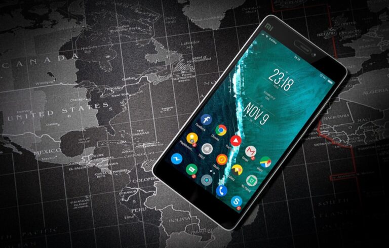
6 Best Map Testing Methods for User Experience
Why it matters: Your map’s usability can make or break user engagement — and poor testing methods leave you guessing about what actually works.
The big picture: User-centered testing transforms maps from confusing interfaces into intuitive navigation tools that guide users exactly where they need to go.
What’s ahead: We’ll break down six proven testing methods that reveal how real users interact with your maps so you can optimize for better performance and user satisfaction.
Disclosure: As an Amazon Associate, this site earns from qualifying purchases. Thank you!
P.S. check out Udemy’s GIS, Mapping & Remote Sensing courses on sale here…
Understanding User-Centered Map Testing and Its Importance
User-centered map testing puts real users at the center of your design validation process. You’ll systematically observe how people interact with your cartographic interfaces to identify navigation barriers and usability gaps that desk research can’t reveal.
Map testing validates design assumptions by measuring actual user behavior against your intended workflows. Professional cartographers know that intuitive map design requires understanding cognitive load patterns and spatial reasoning limitations that affect how users process geographic information.
Explore and map the wilderness for the Queen in Cartographers! Draw unique terrain shapes and score points based on randomly selected goals each game, but beware of monster ambushes.

Testing reveals critical performance metrics including task completion rates, error frequencies, and time-to-target measurements. You’ll discover whether users can successfully locate destinations, interpret symbology, and navigate between different map scales without frustration or confusion.
Your testing methodology should address three core validation areas: information hierarchy effectiveness, visual symbol recognition, and interaction workflow efficiency. These elements determine whether users can extract meaningful insights from your cartographic data or abandon the interface due to cognitive overload.
Usability Testing: Observing Real User Interactions With Maps
Usability testing provides direct observation of how users interact with your map interfaces under controlled conditions. This method captures authentic user behavior patterns that reveal critical insights about navigation efficiency and cognitive processing.
Setting Up Controlled Testing Environments
Create standardized testing conditions that replicate real-world usage scenarios while maintaining consistency across all sessions. You’ll need screen recording software like Camtasia or OBS Studio, eye-tracking equipment such as Tobii Pro units, and standardized task scripts that guide participants through specific navigation objectives.
Recruit representative participants from your target user demographic, ensuring they match your intended audience’s technical proficiency and domain knowledge. Set up distraction-free testing rooms with consistent lighting and comfortable seating arrangements that won’t influence user performance during map interaction sessions.
Recording and Analyzing User Behavior Patterns
Document comprehensive interaction data including mouse movements, click patterns, scroll behaviors, and time spent on different map areas using analytics tools like Hotjar or FullStory. You’ll capture hesitation points, backtracking instances, and zoom level preferences that indicate user confidence levels.
Analyze behavioral metrics such as task completion rates, error frequencies, and navigation pathway efficiency to identify consistent patterns across multiple users. Look for common interaction sequences, preferred entry points, and areas where users consistently struggle to process cartographic information effectively.
Identifying Navigation Pain Points and Confusion Areas
Map confusion hotspots by analyzing where users repeatedly click incorrectly, spend excessive time hovering, or abandon tasks entirely. These areas often indicate poor visual hierarchy, unclear symbology, or inadequate contrast between map elements and background features.
Document specific usability barriers including legend interpretation difficulties, scale transition problems, and feature identification challenges that prevent users from completing their intended tasks. Focus on recurring issues that appear across multiple test sessions, as these represent systematic design problems requiring immediate attention.
Card Sorting: Organizing Map Information Architecture
Card sorting reveals how users naturally categorize and prioritize map elements, providing crucial insights for organizing complex geographic information systems. This method uncovers the mental frameworks users apply when processing spatial data.
Creating Meaningful Category Groups for Map Elements
Group related map features by asking participants to sort cards representing different elements like transportation networks, landmarks, and terrain features into logical categories. You’ll discover natural clustering patterns that reflect user expectations rather than technical database structures. Document how users combine base layers with overlays, revealing intuitive grouping strategies that improve navigation efficiency. Test various element combinations including points of interest, administrative boundaries, and infrastructure components to understand user-driven organization principles.
Understanding User Mental Models of Spatial Information
Spatial cognition patterns emerge when users organize geographic information according to their real-world experience and cultural frameworks. You’ll identify how participants conceptualize scale relationships, hierarchical data structures, and geographic proximity rules. Users often group elements by functional relationships rather than cartographic conventions, such as linking parking areas with retail locations instead of categorizing them as transportation infrastructure. These insights reveal cognitive shortcuts that influence how effectively users process complex map interfaces.
Optimizing Map Layer Organization Based on User Logic
Layer hierarchy optimization requires restructuring your map’s information architecture to match discovered user mental models rather than technical data organization. You’ll reorganize layer groups based on task-oriented workflows, placing frequently co-accessed elements within the same interface sections. Implement user-derived categorization schemes that prioritize functional relationships over traditional cartographic classifications. Test reorganized layer structures with follow-up card sorting sessions to validate improvements and ensure the new architecture supports efficient spatial decision-making processes.
Eye Tracking Studies: Revealing Visual Attention Patterns
Eye tracking technology transforms map testing by capturing precise visual behavior data that reveals how users actually scan and process cartographic information. This method provides objective measurements of attention patterns that supplement subjective feedback from traditional usability testing.
Measuring Gaze Patterns and Fixation Points
Eye tracking systems record exact coordinates where users focus their attention on map interfaces, measuring fixation duration and saccade movements between different map elements. You’ll capture heat maps showing concentrated viewing areas and identify which symbols, labels, and geographic features attract initial attention. These measurements reveal cognitive processing patterns by documenting how long users spend examining specific map components before making navigation decisions.
Identifying Visual Hierarchy Issues in Map Design
Gaze pattern analysis exposes disconnects between intended and actual visual hierarchy in your cartographic designs. You’ll discover when users skip important navigation elements or focus excessively on decorative features that don’t support task completion. Eye tracking data shows whether critical information like scale bars, legends, and directional indicators receive adequate visual attention during typical map reading workflows.
Optimizing Map Element Placement for Better Scanning
Strategic placement of map components follows natural eye movement patterns revealed through tracking studies. You’ll position essential navigation tools within primary scan paths and arrange information layers to support efficient visual processing. This data-driven approach helps you place search functions, zoom controls, and layer toggles in locations that align with users’ instinctive scanning behaviors rather than relying on conventional interface arrangements.
A/B Testing: Comparing Different Map Design Variations
A/B testing transforms map optimization by enabling direct performance comparisons between design alternatives. You’ll generate quantifiable data that eliminates guesswork from design decisions while revealing which visual approaches enhance user navigation efficiency.
Testing Alternative Navigation Methods and Controls
Testing navigation variations reveals which control schemes maximize user efficiency across different map interfaces. You’ll compare traditional zoom buttons against scroll-wheel controls, measuring completion times for standard navigation tasks. Side-by-side testing of menu placement options shows whether hamburger menus or persistent toolbars improve task success rates. Pan-and-zoom gesture combinations require validation against click-and-drag alternatives to determine optimal interaction patterns. Document specific performance differences between touch controls and mouse-based navigation to optimize cross-platform usability standards.
Comparing Color Schemes and Symbol Effectiveness
Color scheme testing identifies which palette combinations enhance map readability while maintaining visual hierarchy effectiveness. You’ll test high-contrast schemes against subtle gradients, measuring symbol recognition accuracy across different demographic groups. Alternative icon designs require systematic comparison through recognition speed tests that reveal which symbols communicate spatial concepts most effectively. Colorblind accessibility testing validates palette choices across vision variations, ensuring universal map comprehension. Test cultural color associations to avoid unintended meaning conflicts that compromise international map usability.
Measuring Performance Metrics Across Design Options
Performance measurement quantifies user efficiency differences between competing map design approaches through standardized testing protocols. You’ll track task completion rates, error frequencies, and time-to-target metrics across design variations to identify optimal configurations. Click-through analysis reveals which design elements encourage exploration versus immediate task completion. Heat map comparisons show attention distribution patterns between different visual hierarchies, highlighting which designs guide users toward essential navigation elements. Statistical significance testing validates performance differences, ensuring design decisions reflect genuine usability improvements rather than random variation.
First-Click Testing: Analyzing Initial User Decision Making
First-click testing captures the critical moment when users first encounter your map interface, measuring whether their initial instinct leads them toward task completion. This method tracks where users click first when presented with a specific navigation goal, revealing the immediate decision-making process that determines overall interaction success.
Understanding User Instincts and Immediate Reactions
First-click testing reveals the intuitive pathways users follow when processing map information for the first time. You’ll discover which visual elements naturally draw attention and trigger interaction, helping identify whether your interface design aligns with user expectations. Testing participants’ immediate reactions exposes the gap between designer intentions and user mental models. Common patterns emerge showing users gravitate toward familiar navigation symbols, prominent text labels, or high-contrast visual elements that suggest interactivity.
Identifying Successful Entry Points in Map Interfaces
Successful entry points in map testing correlate strongly with task completion rates, making first-click accuracy a reliable predictor of overall user success. You’ll find that interfaces with clear visual hierarchy guide users toward correct starting points, while cluttered designs scatter attention across multiple competing elements. Strategic placement of primary navigation tools within the natural scanning pattern improves first-click success rates significantly. Heat map analysis from first-click testing reveals which interface zones consistently attract user attention and generate productive interactions.
Reducing Cognitive Load Through Improved First Impressions
Reducing cognitive load through strategic first-impression design minimizes the mental processing required for users to identify their next action. You’ll optimize map interfaces by eliminating visual noise that competes with essential navigation elements, creating clear pathways for user decision-making. Simplified color schemes and consistent iconography reduce the cognitive burden of interpreting interface meaning during initial encounters. Testing different information density levels helps identify the optimal balance between comprehensive functionality and immediate usability for your specific user base.
Contextual Inquiry: Studying Maps in Real-World Environments
Contextual inquiry captures authentic user behavior by observing map interactions in actual environments where navigation decisions matter. This field-based approach reveals critical insights that laboratory testing can’t replicate.
Observing Users in Their Natural Navigation Contexts
Observing users in natural settings reveals authentic navigation patterns that controlled environments can’t capture. You’ll witness how people actually hold devices, interact with touchscreens while walking, and switch between map views when making real-time decisions. Field observations show users frequently referencing landmarks, asking for directions, and rotating devices to match their orientation. Document these behaviors by following users through complete navigation tasks, recording decision points where they pause or change direction. Natural context reveals multitasking behaviors like checking maps while managing children, carrying packages, or talking on phones.
Understanding Environmental Factors Affecting Map Usage
Environmental conditions dramatically influence map usability in ways laboratory testing can’t predict. Bright sunlight reduces screen visibility, forcing users to seek shade or cup hands around devices to view maps clearly. Rain, snow, and wind affect touchscreen responsiveness and device handling, while crowded spaces limit users’ ability to stop and study detailed map information. Cold weather reduces finger dexterity, making small touch targets difficult to select accurately. You’ll discover that users prefer simpler map interfaces outdoors, relying more on voice navigation and audio cues when environmental factors complicate visual interaction with detailed cartographic elements.
Gathering Insights About Mobile Versus Desktop Map Preferences
Mobile and desktop map usage patterns reveal distinct user preferences that inform design decisions across platforms. Desktop users spend more time studying detailed map features, comparing multiple routes, and exploring surrounding areas before making navigation decisions. Mobile users prioritize quick destination input, clear turn-by-turn directions, and simplified visual interfaces that work with one-handed operation. You’ll find that mobile users frequently switch between map and satellite views to confirm landmarks, while desktop users prefer layered information displays. Context switching between devices shows users often plan routes on desktop computers, then transfer destinations to mobile devices for actual navigation.
This HP 14" laptop is designed for portability and productivity. It features an Intel Celeron N4020 processor, 4GB RAM, 64GB storage, and a micro-edge HD display for immersive visuals.

Conclusion
These six user-centered testing methods provide the foundation for creating maps that truly serve your users’ needs. By implementing usability testing eye tracking A/B testing card sorting first-click analysis and contextual inquiry you’ll gather the data-driven insights necessary to optimize your cartographic interfaces.
Achieve a flawless, even complexion with e.l.f. Flawless Satin Foundation. This lightweight, vegan formula provides medium coverage and a semi-matte finish for all-day wear, while hydrating your skin with glycerin.

The key lies in combining multiple testing approaches to build a comprehensive understanding of user behavior. Each method reveals different aspects of the user experience from initial navigation instincts to real-world usage patterns.
Remember that effective map testing isn’t a one-time activity—it’s an ongoing process that should evolve with your users’ changing needs. Start with the methods that align best with your current resources and gradually expand your testing toolkit as you build expertise in user-centered design practices.
Frequently Asked Questions
What is user-centered map testing?
User-centered map testing places real users at the core of the design validation process, allowing designers to systematically observe how people interact with cartographic interfaces. This approach helps identify navigation barriers and usability gaps that traditional desk research might miss, validating design assumptions by measuring actual user behavior against intended workflows.
What are the key performance metrics measured in map testing?
Key performance metrics include task completion rates, error frequencies, and time-to-target measurements. These metrics reveal users’ abilities to locate destinations, interpret map symbols, and navigate between different map scales. Testing also measures cognitive load patterns and spatial reasoning limitations that influence how users process geographic information.
How does usability testing work for map interfaces?
Usability testing observes real user interactions with map interfaces under controlled conditions using screen recording software, eye-tracking equipment, and standardized task scripts. Participants from the target demographic complete specific tasks while researchers document interaction patterns, mouse movements, and click behaviors to identify navigation pain points and confusion areas.
What is card sorting in map design testing?
Card sorting reveals how users naturally categorize and prioritize map elements, uncovering the mental frameworks people use when processing spatial data. This technique helps designers create meaningful category groups for map features based on user expectations rather than technical structures, optimizing map layer organization to align with user-driven insights.
How do eye tracking studies improve map design?
Eye tracking captures precise visual behavior data, showing how users scan and process cartographic information. The technology records fixation duration and eye movements, generating heat maps that reveal concentrated viewing areas. This helps identify visual hierarchy issues and enables designers to strategically position essential navigation tools within users’ natural scan paths.
What is A/B testing for maps?
A/B testing compares different map design variations to generate quantifiable data for design decisions. It involves testing alternative navigation methods, menu placements, and color schemes while measuring performance metrics like task completion rates and error frequencies. This data-driven approach ensures design choices reflect genuine usability improvements rather than assumptions.
What is first-click testing in map interfaces?
First-click testing analyzes where users click first when presented with a navigation goal, revealing intuitive pathways and successful entry points. This method helps designers understand user instincts and immediate reactions, enabling optimization of first impressions and reducing cognitive load through strategic design choices like simplified color schemes.
What is contextual inquiry for map testing?
Contextual inquiry studies map usage in real-world environments, capturing authentic user behavior that laboratory testing cannot replicate. This field-based approach observes users in their natural navigation contexts, revealing how people interact with maps while multitasking or dealing with environmental factors like weather, crowding, or device limitations.
How do mobile and desktop map users differ?
Mobile users prioritize quick, simplified interactions due to smaller screens and on-the-go usage contexts, while desktop users engage more deeply with detailed map features and complex navigation tasks. Understanding these distinct preferences helps designers tailor map interfaces to meet specific platform needs and optimize user experience across devices.