
7 Best Time Zone Map Techniques
Mapping timezones effectively can make or break your data visualization project. Whether you’re building a global scheduling app or displaying international business hours, the way you represent time zones on maps directly impacts user comprehension and decision-making. Smart timezone visualization techniques help users instantly grasp complex temporal relationships across geographic boundaries.
Most developers and designers struggle with timezone representation because traditional mapping approaches often create visual clutter and confusion. Standard techniques like color-coding or text labels frequently overwhelm users with too much information at once. The key lies in choosing visualization methods that balance clarity with functionality while maintaining clean aesthetics.
Disclosure: As an Amazon Associate, this site earns from qualifying purchases. Thank you!
Use Color-Coded Time Zone Bands
Color-coded time zone bands provide the most intuitive visual approach for displaying temporal boundaries across geographic regions. This method transforms complex time zone data into immediately recognizable visual patterns that users can interpret at a glance.
P.S. check out Udemy’s GIS, Mapping & Remote Sensing courses on sale here…
Assign Distinct Colors to Each Time Zone
Select contrasting hues from opposite sides of the color wheel to maximize visual separation between adjacent time zones. Use tools like ColorBrewer or Adobe Color to generate harmonious palettes with sufficient contrast ratios. Assign cooler blues and greens to eastern zones and warmer oranges and reds to western regions to create a natural progression that follows the sun’s path across your mapped area.
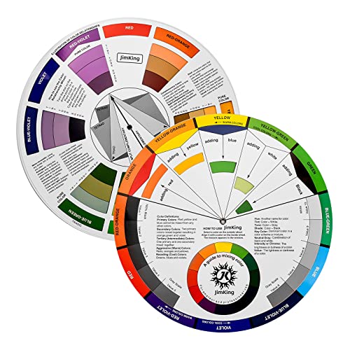
Easily organize and understand color relationships with this rotating color wheel. Ideal for artists and designers, it features a durable, UV-coated design for lasting use and clear color identification.
Create a Clear Color Legend for Reference
Position your legend in the map’s lower-left corner or as a vertical strip along the right margin for optimal accessibility. Include UTC offset values alongside each color swatch and use 12-hour format labels like “EST (UTC-5)” for broader user comprehension. Test your legend placement across different screen sizes to ensure it remains visible and doesn’t obscure critical geographic features or time zone boundaries.
Ensure Color Accessibility for Colorblind Users
Apply pattern overlays or texture fills in addition to color coding to accommodate users with deuteranopia or protanopia color vision deficiencies. Use tools like Stark or Colour Contrast Analyser to verify your color combinations meet WCAG 2.1 AA standards with minimum 4.5:1 contrast ratios. Consider implementing toggle controls that allow users to switch between standard color schemes and high-contrast alternatives for improved universal accessibility.
Implement Interactive Digital Overlays
Interactive digital overlays transform static timezone maps into dynamic tools that respond to user engagement. You’ll enhance user experience by adding real-time data access and contextual information layers.
Add Clickable Time Zone Information
Clickable timezone regions provide instant access to essential temporal data without cluttering your map interface. You can implement polygon-based clickable areas that trigger information panels when users select specific timezone boundaries. Configure click events to display UTC offset values, daylight saving time status, and timezone abbreviations like EST or PST. Modern mapping libraries such as Leaflet and Mapbox GL JS offer built-in event handlers for polygon interactions. Position your clickable information boxes consistently across the interface to maintain visual hierarchy and ensure users develop predictable interaction patterns.
Display Current Local Time on Hover
Hover functionality delivers immediate time information without requiring user clicks or navigation away from the main map view. You should implement mouseover events that trigger real-time clock displays showing current local time for each timezone region. Use JavaScript’s Date object with timezone-specific calculations to ensure accuracy across different regions and daylight saving transitions. Display time in both 12-hour and 24-hour formats to accommodate global user preferences. Position hover tooltips consistently relative to cursor location while preventing overlap with map boundaries or other interface elements.
Include Pop-up Windows with Detailed Data
Pop-up windows accommodate comprehensive timezone information that extends beyond basic time displays. You can create detailed data panels that include business hours, sunrise/sunset times, and upcoming daylight saving transitions for selected regions. Structure your pop-ups with tabbed interfaces or expandable sections to organize multiple data types without overwhelming users. Include comparison tools that allow users to view multiple timezone details simultaneously for scheduling applications. Implement responsive design principles to ensure pop-up windows function effectively across desktop and mobile devices while maintaining readability at different screen sizes.
Apply Gradient Shading Techniques
Gradient shading creates visual depth and continuity across timezone boundaries, eliminating the harsh lines that traditional zone mapping produces. This technique transforms your map from a collection of discrete regions into a flowing representation of temporal progression.
Create Smooth Transitions Between Zones
Build seamless visual bridges between adjacent timezone regions using alpha transparency gradients that blend at borders. Start with 100% opacity at each zone’s center and gradually reduce to 25% opacity at boundaries. This creates natural transitions that guide the eye smoothly across continental time differences without losing zone identity.
Use Light-to-Dark Gradients for Visual Flow
Apply consistent directional shading from light eastern zones to darker western regions, following Earth’s natural rotation pattern. Begin with pale yellows or light blues for UTC+12 zones and progress through deeper blues or purples for UTC-12 regions. This intuitive approach mirrors sunrise-to-sunset progression that users naturally understand.
Maintain Consistent Gradient Patterns
Establish uniform gradient intervals across all timezone representations to prevent visual confusion and ensure map readability. Use identical opacity steps of 15-20% between adjacent zones and maintain consistent hue progressions throughout your color palette. Apply the same gradient direction and intensity across both northern and southern hemispheres for global consistency.
Display Time Zone Boundaries with Clear Lines
Sharp boundary delineation creates visual structure that separates your timezone mapping from ambiguous geographic representations. Professional cartographers rely on precise line work to establish clear temporal divisions that users can interpret instantly.
Explore and map the wilderness for the Queen in Cartographers! Draw unique terrain shapes and score points based on randomly selected goals each game, but beware of monster ambushes.

Mark International Date Line Prominently
Bold line styling at 180° longitude establishes the world’s most critical temporal boundary. You’ll want to use a distinctive stroke weight of 3-4 pixels with high contrast colors like deep red or navy blue against your base map. Position UTC+12 and UTC-12 labels clearly on opposite sides of the line to reinforce the 24-hour time difference that occurs here.
Show Political vs Natural Time Zone Divisions
Different boundary types require distinct visual treatments to communicate their underlying logic. Use solid lines for political boundaries where countries override natural timezone divisions and dashed lines for theoretical UTC boundaries based on 15-degree longitude intervals. This distinction helps users understand why timezone shapes deviate from perfect vertical strips across your map.
Use Different Line Styles for Various Boundaries
Varied stroke patterns create a visual hierarchy that organizes complex boundary information. Apply thick solid lines (2-3px) for major timezone boundaries, medium dashed lines (1-2px) for seasonal daylight saving transitions, and thin dotted lines (1px) for historical or disputed boundaries. Consistent styling across your entire map ensures users quickly recognize each boundary type’s significance.
Incorporate Clock Icons and Time Displays
Visual time indicators transform timezone maps from static references into functional scheduling tools that communicate temporal information at a glance.
Position Analog Clocks in Major Cities
Place analog clock faces directly over metropolitan areas to provide immediate time reference points for your map users. You’ll want to size these clocks proportionally to city importance, using 24-hour format faces for international clarity. Position clocks at consistent heights above city labels to maintain visual hierarchy, and ensure they’re large enough to read the hour hands clearly at your map’s intended viewing scale.
Personalize your gear with this 50-pack of 1" vintage clock face stickers. Made with waterproof vinyl, these durable decals easily adhere to laptops, phones, and more.

Show Digital Time Stamps for Key Locations
Display precise digital timestamps alongside major urban centers using a consistent HH:MM format that updates based on local timezone rules. You should anchor these timestamps to specific coordinate points, positioning them in callout boxes or directly beneath city names. Choose high-contrast typography that remains legible across different map backgrounds, and include AM/PM indicators when using 12-hour format to prevent scheduling confusion.
Update Times in Real-Time for Digital Maps
Implement JavaScript-based time updating functions that refresh your digital timestamps every minute to maintain accuracy for live applications. You’ll need to account for daylight saving time transitions using libraries like Moment.js or native Intl.DateTimeFormat APIs. Configure your update intervals based on map usage patterns—every 60 seconds for scheduling applications, or every 15 minutes for reference maps to reduce server load while maintaining practical utility.
Add Customizable User Location Features
Personalizing timezone maps transforms them from static references into dynamic tools that adapt to individual user needs.
Enable Personal Time Zone Highlighting
Develop location detection capabilities that automatically identify and emphasize the user’s current timezone with enhanced visual prominence. Implement geolocation APIs to detect user coordinates and cross-reference them with timezone boundary datasets. Apply distinctive highlighting such as bold borders or increased opacity to the user’s zone while maintaining subtle visual treatment for other regions. Include manual override options for users who want to highlight different locations based on travel plans or business requirements.
Provide Distance and Time Calculations
Integrate calculation tools that display real-time distance measurements and time differences between the user’s location and selected map points. Utilize great circle distance formulas to calculate accurate geographic distances across curved Earth surfaces. Present time zone offsets dynamically as users hover over different regions, showing both current time differences and daylight saving adjustments. Include flight time estimates and business hour overlap indicators to support practical scheduling decisions for international communications.
Allow Multiple Location Comparisons
Build comparison interfaces that enable simultaneous tracking of multiple timezone locations relevant to the user’s workflow. Create selectable bookmark systems where users can pin frequently referenced cities or regions for quick access. Display comparative time grids showing current times across all selected locations in a compact sidebar format. Include scheduling optimization features that identify optimal meeting windows when multiple international participants are involved in collaborative projects.
Include Daylight Saving Time Indicators
Daylight saving time transitions create significant complexity in timezone mapping that affects millions of users worldwide. You’ll need specialized indicators to communicate these temporal shifts clearly and prevent scheduling confusion.
Mark Regions That Observe DST Changes
Pattern overlays distinguish DST-observing regions from those maintaining consistent UTC offsets year-round. You can apply diagonal hatching or dotted patterns to areas like Europe and North America that shift their clocks seasonally. Create a distinct visual hierarchy using solid fills for non-DST regions and textured overlays for DST zones. This approach prevents users from assuming uniform time behavior across all mapped territories.
Show Current DST Status with Visual Cues
Status indicators communicate active daylight saving periods through color-coded borders or corner symbols. You should implement bright accent colors—like orange or yellow—around timezone boundaries currently observing DST. Add small clock icons with “DST” labels positioned near major cities to reinforce temporal status. Update these visual cues automatically based on current dates to maintain accuracy throughout seasonal transitions.
Provide Historical DST Information
Timeline controls enable users to view past and future DST patterns across different regions. You can integrate slider widgets that adjust the map display for specific dates, revealing historical timezone configurations. Include data layers showing DST rule changes—like the 2007 U.S. extensions—that affected scheduling systems globally. Store this information in accessible popup windows or side panels linked to clickable timezone regions.
Conclusion
Effective timezone mapping transforms complex temporal data into intuitive visual experiences that serve your users’ real-world needs. By combining thoughtful design principles with interactive functionality you’ll create maps that aren’t just informative but genuinely useful for global decision-making.
Remember that successful timezone visualization balances aesthetic appeal with practical functionality. Whether you’re implementing color-coded regions interactive overlays or real-time indicators each element should enhance rather than complicate the user experience.
Your choice of visualization techniques will ultimately depend on your specific audience and use case. The key is maintaining clarity while providing the depth of information your users need to navigate our interconnected world with confidence.
Frequently Asked Questions
What is the main purpose of timezone mapping in data visualization?
Timezone mapping in data visualization serves to help users understand global time differences for applications like international scheduling, displaying business hours across regions, and making informed decisions about timing for global communications. It transforms complex temporal data into visual formats that enhance user comprehension and decision-making.
Why do traditional timezone mapping methods often fail?
Traditional timezone mapping methods frequently create visual clutter and confusion because they don’t prioritize clarity and functionality. They often overwhelm users with too much information at once, lack proper visual hierarchy, and fail to provide intuitive ways for users to understand time relationships across different geographic regions.
How do color-coded time zone bands improve visualization?
Color-coded time zone bands provide an intuitive visual approach by assigning distinct colors to each timezone, using contrasting hues for maximum visual separation. This method includes clear color legends with UTC offset values, ensures accessibility for colorblind users through pattern overlays, and creates immediate visual understanding of temporal boundaries across geographic regions.
What are interactive digital overlays and how do they help?
Interactive digital overlays transform static timezone maps into dynamic, responsive tools. They include clickable timezone regions that provide instant access to temporal data, hover functionality displaying current local times, and pop-up windows with detailed information like business hours and daylight saving status, all without cluttering the interface.
How does gradient shading enhance timezone visualization?
Gradient shading creates visual depth and continuity across timezone boundaries using smooth alpha transparency transitions between adjacent zones. This technique guides the eye across time differences while maintaining zone identity through consistent gradient patterns, uniform opacity steps, and cohesive hue progressions applied globally across the map.
What’s the importance of clear boundary delineation in timezone maps?
Clear boundary delineation separates time zones using sharp lines and prominently marks the International Date Line with bold, high-contrast colors. It differentiates between political boundaries (solid lines) and theoretical UTC boundaries (dashed lines), creating visual hierarchy through varied stroke patterns for major boundaries, seasonal transitions, and disputed areas.
How do visual time indicators improve timezone maps?
Visual time indicators transform timezone maps into functional scheduling tools by incorporating analog clocks over major cities and digital timestamps for key locations. These elements provide immediate time reference points, update in real-time using JavaScript functions, and consider daylight saving time transitions to maintain accuracy for live applications.
What are customizable user location features?
Customizable user location features adapt timezone maps to individual needs through geolocation APIs that highlight the user’s current timezone. They include distance and time calculation tools, enable multiple location comparisons for tracking several time zones simultaneously, and optimize scheduling for international communications through personalized visual prominence.
How should daylight saving time (DST) be handled in timezone visualization?
DST should be handled using pattern overlays like diagonal hatching to distinguish DST-observing regions from consistent UTC offset areas. Visual cues such as color-coded borders and clock icons indicate current DST status with automatic updates. Timeline controls with slider widgets allow users to view historical and future DST patterns.
What makes a timezone map accessible for all users?
An accessible timezone map incorporates pattern overlays or texture fills for colorblind users, verifies color combinations against accessibility standards, and provides multiple ways to convey information beyond color alone. It includes clear legends, consistent formatting, and interactive elements that work with assistive technologies while maintaining visual clarity for all users.