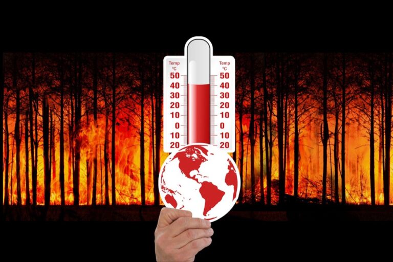
6 Best Climate Maps for Precision
Climate maps shape critical decisions about everything from urban planning to disaster preparedness, but they’re missing a crucial ingredient: the deep environmental knowledge that local communities have gathered over generations. You’ve probably never considered how indigenous weather patterns, traditional farming wisdom, or neighborhood-specific microclimates could revolutionize the accuracy of climate modeling. Integrating this local expertise with satellite data and computer models creates dramatically more precise and actionable climate maps that better serve the communities they’re meant to protect.
Disclosure: As an Amazon Associate, this site earns from qualifying purchases. Thank you!
Traditional Weather Stations Provide Limited Coverage
Get real-time weather data with the Ambient Weather WS-2902. This WiFi-enabled station measures wind, temperature, humidity, rainfall, UV, and solar radiation, plus it connects to smart home devices and the Ambient Weather Network.

Weather monitoring networks face significant geographic constraints that create substantial gaps in climate data collection. You’ll find that standard meteorological stations concentrate heavily in populated areas while leaving vast regions unmapped.
Remote Areas Often Lack Monitoring Infrastructure
Remote mountainous regions experience the most severe data collection challenges due to harsh terrain and limited accessibility. You’ll discover that many wilderness areas spanning thousands of square kilometers rely on single weather stations positioned hours away from actual microclimates. Arctic territories and desert landscapes particularly suffer from sparse monitoring networks where stations may be separated by 200+ miles. Installation costs for automated weather equipment in these locations often exceed $50,000 per station before considering ongoing maintenance requirements.
P.S. check out Udemy’s GIS, Mapping & Remote Sensing courses on sale here…
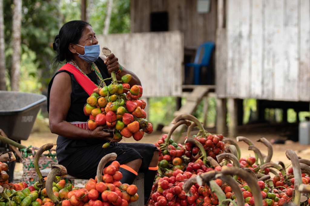
Indigenous Communities Fill Critical Data Gaps
Indigenous populations possess generations of localized weather observations that complement sparse instrumental records in remote territories. You’ll benefit from their detailed knowledge of seasonal precipitation patterns, wind direction changes, and temperature variations that occur within specific valleys or coastal areas. Native communities often maintain oral traditions documenting extreme weather events dating back centuries, providing historical climate context unavailable through conventional meteorological databases. Their understanding of microclimatic conditions helps you identify critical monitoring locations that automated systems might overlook completely.
Community-Based Observations Capture Microclimatic Variations
Local observers capture weather variations that standard monitoring stations miss, creating detailed climate portraits of specific areas.
Local Farmers Understand Seasonal Precipitation Patterns
Farmers track rainfall variations across their fields, noting differences between hilltops and valleys that automated stations can’t detect. They document frost pockets, wind patterns, and soil moisture changes throughout growing seasons. Their observations reveal precipitation gradients within single watersheds, showing how topography affects local weather. Farm records often span decades, providing historical context for climate shifts. You’ll find farmers can identify microclimates within quarter-mile distances that significantly impact crop yields.
Coastal Residents Track Storm Surge Behaviors
Coastal communities monitor wave heights, tidal variations, and flooding patterns across different shoreline sections. They document how storm surges behave around jetties, inlets, and beach formations that standard gauges don’t capture. Residents track erosion rates, sand movement, and water temperature changes throughout seasonal cycles. Their observations reveal localized flooding risks that vary dramatically within coastal neighborhoods. You’ll discover residents can predict surge behavior based on wind direction and tide timing combinations.
Historical Knowledge Extends Climate Records Beyond Instrumental Data
Traditional weather stations only provide data from the past 150 years, creating significant gaps in our understanding of long-term climate patterns. Local communities bridge these gaps through generations of accumulated weather knowledge.
Oral Traditions Document Long-Term Weather Patterns
Oral traditions preserve climate information spanning centuries before instrumental records began. Elder storytellers in Alaska’s Inupiat communities describe ice formation patterns from the 1800s, documenting freeze dates that occurred two weeks earlier than current observations. These narratives capture extreme weather events like the severe winter of 1886 across the Great Plains, which Indigenous tribes remember through detailed accounts of animal behavior and survival strategies. Pacific Northwest tribes maintain oral records of major flooding cycles dating back 400 years, identifying return intervals that modern hydrological models struggle to detect.
Cultural Calendars Reveal Seasonal Timing Changes
Cultural calendars track seasonal transitions with precision that rivals modern phenological studies. Māori communities in New Zealand use traditional planting calendars based on star positions and weather signs, revealing that spring planting seasons now occur 10-14 days earlier than historical norms. Inuit hunting calendars document sea ice formation timing shifts of up to three weeks compared to traditional patterns. Agricultural communities across the Midwest maintain planting diaries spanning multiple generations, showing corn planting dates advancing by 6-8 days per decade since the 1950s.
Local Expertise Identifies Regional Climate Indicators
Local experts possess intimate knowledge of ecosystem changes that reveal critical climate patterns invisible to distant monitoring systems. Their observations create detailed regional climate profiles that enhance mapping accuracy.
Traditional Ecological Knowledge Highlights Ecosystem Responses
Traditional knowledge holders track plant phenology changes with remarkable precision. Indigenous communities monitor when specific trees leaf out, when berries ripen, and how flowering periods shift across decades. These observations reveal temperature and precipitation changes that affect entire ecosystems. Elders document wildlife migration timing, noting how caribou routes change with shifting ice patterns or how bird arrival dates move earlier each spring. Their ecosystem-based indicators provide climate mapping with biological validation that complements instrumental measurements.
Community Members Recognize Early Warning Signs
Community members identify subtle environmental changes that signal major climate shifts. Farmers notice earlier frost dates, changes in pest emergence, and shifts in soil moisture patterns across their fields. Fishermen track water temperature changes, algae bloom timing, and fish migration patterns that indicate ocean warming trends. Coastal residents observe erosion rates, storm surge patterns, and vegetation changes that reveal sea level rise impacts. These early warning observations help climate mappers identify critical threshold points where ecosystems begin experiencing irreversible changes.
Ground-Truth Validation Improves Satellite Data Accuracy
Satellite sensors often misinterpret local conditions due to atmospheric interference and surface complexity. Local ground-truth validation transforms raw satellite data into reliable climate maps you can trust for critical decision-making.
Local Observers Verify Remote Sensing Measurements
Local weather observers validate satellite temperature readings by comparing thermal infrared data with ground-based thermometer measurements. You’ll find community volunteers recording daily temperatures at specific locations, catching satellite errors caused by cloud cover or surface reflection. Indigenous communities track snow depth measurements that verify satellite snow cover estimates, revealing discrepancies between automated detection and actual conditions. Coastal residents monitor sea surface temperatures, confirming satellite thermal readings and identifying calibration drift that affects regional climate models.
Community Networks Provide Real-Time Calibration Data
Community observation networks deliver continuous calibration datasets that improve satellite accuracy through real-time adjustments. You benefit from citizen science networks like CoCoRaHS, where volunteers submit daily precipitation measurements that calibrate satellite rainfall estimates. Local farming cooperatives track soil moisture levels, validating satellite-derived agricultural indices and improving drought monitoring accuracy. Indigenous weather stations provide temperature and humidity readings that help adjust satellite atmospheric corrections, ensuring your climate maps reflect actual ground conditions rather than algorithmic assumptions.
Participatory Mapping Enhances Spatial Resolution
Participatory mapping transforms climate data collection by increasing observation density beyond what traditional monitoring networks can achieve. You’ll discover how community involvement creates detailed spatial datasets that capture microclimatic variations across landscapes.
Citizen Scientists Contribute High-Density Observations
Citizen scientists generate observation networks with densities up to 100 times greater than traditional weather stations. You’ll find programs like iNaturalist documenting phenological changes across neighborhoods, creating datasets with observations every few hundred meters instead of every 50 kilometers. Participants record specific microclimatic conditions like frost formation in valley bottoms, urban heat island effects between city blocks, and snowpack variations across elevation gradients. These high-resolution observations reveal climate patterns that sparse institutional networks miss entirely.
Mobile Technology Enables Widespread Data Collection
Mobile apps transform smartphones into portable weather stations, enabling real-time climate data collection across vast territories. You can use applications like Globe Observer and eBird to submit georeferenced observations including cloud cover, precipitation timing, and temperature readings with GPS coordinates accurate to within 3 meters. Smartphone sensors automatically capture altitude, atmospheric pressure, and humidity data while participants photograph environmental conditions. This technology democratizes climate monitoring by reducing equipment costs from thousands of dollars per station to zero, expanding data collection into previously unmapped regions.
Experience vivid content on the Galaxy A16 5G's 6.7" display and capture stunning photos with its triple-lens camera. Enjoy peace of mind with a durable design, six years of updates, and Super Fast Charging.

Conclusion
When you combine local knowledge with modern climate mapping technology you’re creating a powerful partnership that benefits everyone. Communities gain access to more accurate climate information while scientists receive invaluable ground-truth data that improves their models.
This collaborative approach transforms climate mapping from a top-down scientific exercise into a community-driven effort that serves real people facing real challenges. Your local observations matter more than you might think – they fill critical gaps that satellites and weather stations simply can’t address.
The future of climate resilience depends on this integration. By embracing both traditional wisdom and cutting-edge technology you’re helping build climate maps that truly reflect the complex environmental realities of your community.
Frequently Asked Questions
What is local environmental knowledge and why is it important for climate mapping?
Local environmental knowledge refers to the weather observations, traditional practices, and ecological insights that communities have gathered over generations. It’s crucial for climate mapping because it provides detailed microclimatic information, historical context, and ground-truth validation that enhances the accuracy of satellite data and computer models, especially in remote or undermonitored regions.
How do indigenous communities contribute to climate data collection?
Indigenous communities possess centuries of accumulated weather knowledge through oral traditions, cultural calendars, and seasonal practices. They document freeze dates, extreme weather events, seasonal timing shifts, and ecosystem changes that span far beyond the 150-year record of traditional weather stations, providing invaluable long-term climate context for mapping efforts.
What are the limitations of traditional weather monitoring networks?
Traditional weather monitoring networks primarily focus on populated areas, leaving vast remote regions unmapped, particularly mountainous and Arctic territories. These networks only provide 150 years of data and often miss microclimatic variations. Installation costs and harsh terrain make expanding coverage challenging, creating significant data gaps.
How do local farmers enhance climate mapping accuracy?
Local farmers track rainfall variations across their fields, documenting differences between hilltops and valleys, frost pockets, and wind patterns that significantly impact crop yields. Their detailed field observations and long-term records provide historical context for climate shifts and capture microclimatic conditions that standard monitoring stations often miss.
What role do coastal communities play in climate monitoring?
Coastal residents monitor wave heights, tidal variations, and flooding patterns, revealing localized flooding risks that vary dramatically within neighborhoods. Their observations help predict storm surge behaviors based on specific environmental conditions, providing crucial data for understanding coastal climate impacts and improving disaster preparedness strategies.
How does ground-truth validation improve satellite data accuracy?
Local observers verify satellite measurements by comparing them with ground-based data like temperature and snow depth. Community networks provide real-time calibration data that corrects atmospheric interference and surface complexity issues that can cause satellites to misinterpret local conditions, ensuring climate maps reflect actual ground conditions.
What is participatory mapping and how does it benefit climate science?
Participatory mapping involves community members contributing climate observations through citizen science programs and mobile technology. This approach increases observation density up to 100 times greater than traditional networks, captures microclimatic variations across landscapes, and democratizes climate monitoring by transforming smartphones into portable data collection tools.
How do traditional knowledge holders track ecosystem changes?
Traditional knowledge holders document plant phenology changes, wildlife migration timing, and subtle environmental shifts like earlier frost dates and changes in pest emergence. Elders track when trees leaf out, berries ripen, and how flowering periods shift across decades, identifying critical threshold points where ecosystems experience irreversible climate changes.
What technologies enable widespread community-based climate monitoring?
Mobile apps like Globe Observer and eBird transform smartphones into portable weather stations, enabling real-time data collection across vast territories. Citizen science initiatives like CoCoRaHS allow volunteers to submit daily measurements, while programs like iNaturalist document phenological changes, creating high-density observation networks that reduce equipment costs.
Why is integrating local knowledge with modern technology important for climate resilience?
Integrating local knowledge with satellite data and computer models creates more precise and effective climate maps that better serve communities. This combination fills data gaps in remote areas, provides historical context beyond instrumental records, and captures microclimatic variations essential for accurate climate modeling and disaster preparedness planning.