5 Best Remote Sensing Technologies for Climate Research
Why it matters: Climate change threatens ecosystems worldwide and you need accurate data to understand its impacts. Remote sensing technology gives scientists the power to monitor environmental changes across vast areas that would be impossible to study on foot.
The big picture: Satellites and aerial sensors now capture detailed information about everything from melting ice sheets to shifting vegetation patterns. These advanced tools help researchers track climate trends in real-time and predict future changes with unprecedented accuracy.
What’s next: Five key remote sensing approaches are revolutionizing how we analyze climate data and each offers unique advantages for understanding our changing planet.
Disclosure: As an Amazon Associate, this site earns from qualifying purchases. Thank you!
P.S. check out Udemy’s GIS, Mapping & Remote Sensing courses on sale here…
Satellite-Based Optical Imaging for Vegetation and Land Use Monitoring
Optical satellite sensors capture reflected sunlight across multiple wavelengths to reveal detailed information about Earth’s surface features. You’ll find this technology essential for tracking vegetation changes and land use patterns that directly relate to climate impacts.
Multispectral and Hyperspectral Data Collection
Multispectral sensors like Landsat 8 and Sentinel-2 collect data across 4-13 spectral bands including visible light near-infrared and shortwave infrared wavelengths. You can use these datasets to distinguish between different vegetation types water bodies and urban surfaces with 10-30 meter spatial resolution. Hyperspectral sensors such as NASA’s AVIRIS capture hundreds of narrow spectral bands providing detailed chemical fingerprints of surface materials for precise species identification and stress detection.
NDVI Analysis for Ecosystem Health Assessment
Normalized Difference Vegetation Index (NDVI) calculations use red and near-infrared reflectance values to measure vegetation density and health across landscapes. You’ll see healthy vegetation produce NDVI values between 0.3-0.8 while stressed or sparse vegetation shows lower values near 0.1-0.3. Time-series NDVI analysis from satellites like MODIS reveals seasonal patterns drought impacts and long-term vegetation trends that indicate ecosystem responses to changing climate conditions.
Deforestation and Urban Expansion Tracking
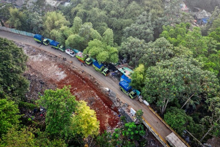
Change detection algorithms compare satellite images from different time periods to identify areas where forests have been cleared or cities have expanded. You can track deforestation rates using Landsat data spanning over 40 years with studies showing global forest loss of approximately 10 million hectares annually. Urban growth mapping utilizes nighttime lights data from VIIRS sensors combined with daytime optical imagery to monitor city expansion patterns and their impact on surrounding natural areas.
Thermal Infrared Remote Sensing for Temperature Pattern Analysis
Thermal infrared sensors capture heat radiation from Earth’s surface to reveal critical temperature patterns across different environments. This technology provides essential data for understanding climate change impacts through precise temperature measurements.
Capture thermal data with the AMG8833 infrared imager. This compact module measures temperatures from 0°C to 80°C with ±2.5°C accuracy and is compatible with Raspberry Pi and Arduino via I2C.

Land Surface Temperature Measurements
Satellite-based thermal sensors measure land surface temperatures with accuracy levels reaching ±1°C across diverse terrain types. You’ll find instruments like MODIS and Landsat’s Thermal Infrared Sensor (TIRS) collecting data every 8-16 days to track seasonal temperature variations. These measurements reveal warming trends in arctic regions, desert expansion patterns, and agricultural stress indicators. The data helps you identify temperature anomalies that signal ecosystem changes and extreme weather events developing across continental scales.
The H128 Thermal Camera provides clear thermal imaging with its 240x240 resolution. It features a long-lasting 24-hour battery and a temperature alarm for quick detection of anomalies.

Ocean Temperature Monitoring Systems
Sea surface temperature monitoring relies on Advanced Very High Resolution Radiometer (AVHRR) and Visible Infrared Imaging Radiometer Suite (VIIRS) sensors to track oceanic thermal patterns. You can access daily temperature data with spatial resolutions of 1-4 kilometers covering global ocean surfaces. This monitoring reveals coral bleaching events, El Niño/La Niña cycles, and ocean current shifts that influence regional climate patterns. The thermal data also identifies marine heatwaves and tracks their duration and intensity across ocean basins.
Urban Heat Island Detection Methods
Thermal mapping techniques using sensors like ASTER and Landsat TIR identify urban heat islands with temperature differences of 2-8°C compared to surrounding areas. You’ll observe how concrete surfaces, reduced vegetation, and building density create distinct thermal signatures in metropolitan regions. These measurements help urban planners assess heat exposure risks and evaluate cooling strategies like green roofs and tree canopy expansion. The data reveals temporal patterns showing peak heating during summer months and identifies vulnerable neighborhoods requiring climate adaptation measures.
Radar Interferometry for Ice Sheet and Glacier Monitoring
Radar interferometry provides precise measurements of ice sheet dynamics by analyzing phase differences between radar signals collected at different times. You’ll find this technique particularly valuable for monitoring remote polar regions where traditional ground-based measurements aren’t feasible.
Synthetic Aperture Radar Applications
Synthetic aperture radar (SAR) systems penetrate through clouds and operate in complete darkness, making them ideal for continuous polar monitoring. You can use SAR data from satellites like Sentinel-1 and RADARSAT-2 to track ice flow velocities across entire ice sheets. These systems measure surface displacement with millimeter-level accuracy by comparing radar backscatter patterns over time, revealing detailed movement patterns of glaciers and ice streams.
Ice Thickness and Movement Measurements
Ice thickness measurements through radar interferometry combine surface elevation data with penetrating radar signals to calculate ice depth across vast areas. You’ll achieve movement tracking by analyzing pixel displacement between sequential SAR images, measuring velocities up to several meters per year. Differential interferometry techniques help you identify acceleration zones where glaciers are speeding up due to climate warming, providing critical data for ice loss calculations.
Polar Region Climate Change Indicators
Polar ice sheet monitoring reveals accelerating retreat rates and thinning patterns that serve as key climate indicators. You can detect annual ice loss volumes exceeding 150 billion tons in Greenland and Antarctica using interferometric analysis. Radar data shows increased surface melting events, changing flow dynamics, and ice shelf collapse patterns that directly correlate with rising global temperatures and sea level contributions.
Lidar Technology for Atmospheric and Forest Structure Analysis
Lidar systems emit laser pulses to measure precise distances and create detailed three-dimensional maps of Earth’s surface and atmosphere. This active remote sensing technology provides critical data for understanding both atmospheric composition and forest structure changes related to climate impacts.
Atmospheric Aerosol and Cloud Profiling
Atmospheric lidar systems measure aerosol concentrations and cloud properties by analyzing backscattered laser light at different altitudes. NASA’s CALIPSO satellite uses polarized lidar to distinguish between dust particles, smoke, and ice crystals in the atmosphere. You’ll find these measurements reveal pollution transport patterns, volcanic ash distributions, and aerosol interactions with cloud formation. Ground-based lidar networks like EARLINET provide continuous atmospheric profiling data across multiple locations, tracking seasonal changes in atmospheric composition that influence regional climate patterns.
Forest Canopy Height and Biomass Estimation
Forest lidar penetrates tree canopies to measure precise canopy heights and estimate biomass across large areas. ICESat-2’s photon-counting lidar creates detailed vertical profiles of forest structure, revealing canopy gaps and understory vegetation. You can use these measurements to calculate above-ground biomass with 85% accuracy compared to field measurements. Airborne lidar systems provide higher resolution data for local studies, measuring individual tree heights and crown dimensions. This technology tracks deforestation rates, forest recovery patterns, and changes in carbon storage capacity over time.
Carbon Storage Assessment Techniques
Carbon storage assessments combine lidar-derived forest structure data with allometric equations to estimate biomass carbon content. You’ll use canopy height measurements and crown volume calculations to determine total carbon stocks in forest ecosystems. GEDI mission data provides global forest biomass estimates with 20-meter resolution, revealing carbon distribution patterns across different forest types. Ground validation studies calibrate these remote measurements against field samples, ensuring accuracy in carbon accounting. This approach supports climate mitigation strategies by quantifying forest carbon sequestration potential and monitoring changes in terrestrial carbon pools.
Microwave Remote Sensing for Soil Moisture and Precipitation Studies
Microwave remote sensing provides continuous monitoring capabilities for hydrological processes that are essential for understanding climate change impacts on water cycles. You’ll find these sensors particularly valuable because they penetrate clouds and operate effectively in all weather conditions.
Passive Microwave Radiometry Applications
Passive microwave radiometry measures natural thermal emissions from Earth’s surface to detect moisture variations across different landscapes. You can access data from sensors like SMAP (Soil Moisture Active Passive) and AMSR-E that capture brightness temperatures at multiple frequencies. These measurements reveal soil dielectric properties that directly correlate with water content levels. The technology works by detecting electromagnetic radiation naturally emitted by the ground surface, allowing scientists to map moisture patterns without active signal transmission.
Soil Moisture Content Monitoring
Soil moisture content monitoring through microwave sensors provides critical data for drought assessment and agricultural planning in changing climate conditions. You’ll observe how sensors detect moisture levels in the top 5 centimeters of soil with accuracy rates of ±0.04 cubic meters per cubic meter. Satellites like SMOS (Soil Moisture and Ocean Salinity) deliver global coverage every 3 days at 40-kilometer resolution. This data helps track seasonal moisture patterns and identify regions experiencing increased aridity due to climate shifts.
Precipitation Pattern Analysis Methods
Precipitation pattern analysis methods utilize microwave frequencies to measure rainfall intensity and distribution across large geographic areas. You can track precipitation events using sensors like GPM (Global Precipitation Measurement) that detect raindrops and ice particles through their microwave signatures. These systems provide rainfall estimates with 0.1 millimeter per hour precision at 10-kilometer spatial resolution. The data reveals changing precipitation patterns including increased storm intensity and shifting seasonal rainfall distributions that indicate climate change impacts on regional water resources.
Conclusion
These five remote sensing approaches represent your most powerful tools for understanding climate change at both local and global scales. Each technique offers unique advantages that complement traditional ground-based monitoring methods.
By combining optical imaging thermal infrared radar interferometry Lidar and microwave sensing you’ll gain comprehensive insights into environmental changes happening across our planet. These technologies provide the accuracy and coverage needed to track climate impacts in real-time.
The integration of multiple remote sensing methods strengthens your ability to make informed decisions about climate adaptation and mitigation strategies. As these technologies continue advancing you’ll have even more precise data to guide environmental policy and conservation efforts in the years ahead.
Frequently Asked Questions
What is remote sensing and why is it important for climate research?
Remote sensing uses satellites and aerial sensors to monitor environmental changes over large, difficult-to-access areas. It’s crucial for climate research because it provides detailed, real-time data on climate trends like melting ice sheets and shifting vegetation patterns, enabling scientists to track changes and make accurate predictions about future climate impacts.
How does satellite-based optical imaging help monitor climate change?
Satellite-based optical imaging captures reflected sunlight to monitor vegetation changes and land use patterns related to climate impacts. Using sensors like Landsat 8 and Sentinel-2, scientists collect multispectral data across different wavelengths to differentiate surface types and track environmental changes over time.
What is NDVI and how does it assess ecosystem health?
The Normalized Difference Vegetation Index (NDVI) measures vegetation density and health by analyzing how plants reflect different wavelengths of light. This index helps scientists assess ecosystem health over time, revealing changes in plant growth patterns and vegetation stress that indicate climate change impacts.
How does thermal infrared remote sensing work?
Thermal infrared remote sensing captures heat radiation from Earth’s surface to analyze temperature patterns across different environments. Satellite-based thermal sensors measure land surface temperatures with high accuracy, revealing warming trends in arctic regions, desert expansion, and agricultural stress indicators.
What makes radar interferometry effective for ice monitoring?
Radar interferometry uses synthetic aperture radar (SAR) systems that can penetrate clouds and operate in darkness, making them ideal for continuous polar region monitoring. These systems analyze phase differences in radar signals to provide millimeter-level accuracy in tracking ice flow velocities and glacier movements.
How does Lidar technology contribute to climate research?
Lidar emits laser pulses to create detailed three-dimensional maps of Earth’s surface and atmosphere. It measures atmospheric aerosol concentrations, cloud properties, forest canopy heights, and biomass, providing crucial data for understanding pollution transport, deforestation rates, and carbon storage capacity.
What role does microwave remote sensing play in climate monitoring?
Microwave remote sensing continuously monitors hydrological processes essential for understanding climate change impacts on water cycles. It uses passive microwave radiometry to detect soil moisture variations and measures precipitation patterns, helping scientists track drought conditions and changing rainfall distributions.
Experience smooth, tear-free gaming and video with the Acer KB272 G0bi 27" Full HD monitor, featuring Adaptive-Sync (FreeSync Compatible) and a rapid 1ms response time. Enjoy vibrant colors with 99% sRGB coverage and versatile connectivity through HDMI and VGA ports.

How accurate are remote sensing measurements for climate data?
Remote sensing provides highly accurate measurements, with radar systems achieving millimeter-level precision for ice monitoring and thermal sensors offering detailed temperature readings. This accuracy enables scientists to detect subtle environmental changes and create reliable climate models for future predictions.