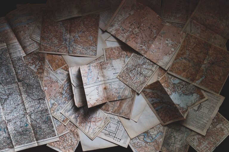
5 Best Mapping Tools for Citizen Science
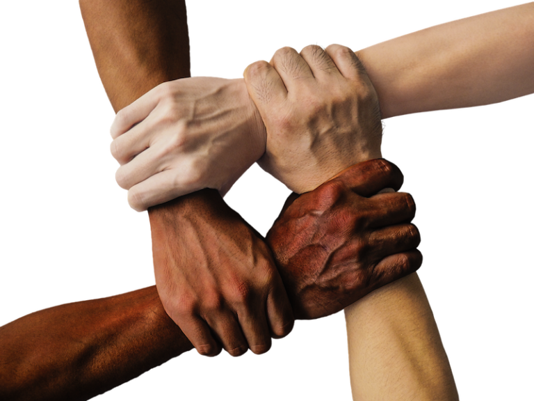
The big picture: You’re witnessing a mapping revolution that’s putting unprecedented power directly into ordinary people’s hands. Traditional cartography once required expensive equipment and specialized training but citizen science is democratizing how we create understand and interact with maps of our world.
Why it matters: From tracking climate change to identifying urban infrastructure gaps you can now contribute to mapping projects that shape policy decisions and scientific research. This shift isn’t just changing who makes maps—it’s transforming what gets mapped and how quickly we can respond to emerging challenges in our communities.
Disclosure: As an Amazon Associate, this site earns from qualifying purchases. Thank you!
Crowdsourced Data Collection Will Revolutionize Geographic Accuracy
Citizen science transforms mapping accuracy by harnessing the collective power of thousands of ground-level observers. You’ll see unprecedented precision as community-driven data collection fills critical gaps in traditional mapping systems.
P.S. check out Udemy’s GIS, Mapping & Remote Sensing courses on sale here…
Real-Time Updates From Ground-Level Observers
Real-time data streams from citizen scientists provide immediate geographic updates that traditional mapping can’t match. You’ll receive instant notifications about road closures, new construction, or environmental changes through platforms like Waze and iNaturalist. These ground-level observers capture conditions as they happen, creating dynamic maps that reflect current reality rather than outdated satellite imagery. Professional cartographers now integrate this live data to maintain accuracy that would require massive resources using conventional methods.
Explore and map the wilderness for the Queen in Cartographers! Draw unique terrain shapes and score points based on randomly selected goals each game, but beware of monster ambushes.

Filling Gaps in Remote and Underserved Areas
Remote areas benefit dramatically from citizen science mapping initiatives that reach where professional surveyors rarely venture. You’ll find communities using smartphones and GPS devices to map informal settlements, rural infrastructure, and disaster-affected regions through projects like OpenStreetMap’s Missing Maps campaign. These volunteer mappers document critical features like water sources, medical facilities, and transportation networks in underserved areas. The resulting geographic data proves invaluable for humanitarian organizations, urban planners, and emergency responders who need accurate information about previously unmapped territories.
Experience vivid content on the Galaxy A16 5G's 6.7" display and capture stunning photos with its triple-lens camera. Enjoy peace of mind with a durable design, six years of updates, and Super Fast Charging.

Enhanced Precision Through Community Verification
Community verification systems create multiple validation layers that significantly improve mapping accuracy beyond single-source data collection. You’ll see platforms like Mapillary and KartaView where citizens photograph street-level features, allowing multiple users to confirm or correct geographic information. This crowd-sourced validation process catches errors that automated systems miss, particularly in identifying address changes, business locations, and infrastructure modifications. The collective intelligence of local communities provides quality control that rivals professional surveying teams while covering vastly larger geographic areas.
Democratized Access to Mapping Technology Will Empower Local Communities
The mapping revolution extends beyond data collection accuracy to fundamentally reshape who controls geographic information in your neighborhood.
Mobile Apps Making Cartography Accessible to Everyone
User-friendly mapping applications eliminate traditional barriers that once required expensive software and specialized training. Apps like Survey123, KoBoToolbox, and Fulcrum transform your smartphone into a professional-grade data collection device with GPS coordinates, photo integration, and offline capabilities. Community members now create detailed maps using intuitive interfaces that automatically handle coordinate systems and data formatting. Open-source platforms like QGIS mobile enable advanced cartographic functions without licensing costs, while web-based tools like Felt allow collaborative map creation through simple drag-and-drop interfaces.
Reducing Dependency on Professional Surveying Services
Local organizations bypass expensive consulting contracts by training community volunteers to conduct basic mapping tasks using accessible technology. Municipalities save thousands of dollars annually by deploying citizen mappers equipped with RTK-enabled smartphones achieving sub-meter accuracy for infrastructure assessments. Community land trusts utilize volunteer teams with handheld GPS units to document property boundaries and environmental features at fraction of traditional surveying costs. Educational institutions partner with neighborhoods to provide technical training while students gain field experience mapping local assets like parks, utilities, and transportation networks.
Enabling Grassroots Environmental Monitoring
Environmental advocacy groups leverage citizen science mapping to document pollution sources, habitat changes, and climate impacts with unprecedented detail and frequency. Community members use water quality sensors paired with mobile apps to create real-time contamination maps that inform regulatory agencies. Neighborhood volunteers track urban heat islands, air quality fluctuations, and stormwater issues through coordinated mapping campaigns using standardized protocols. Indigenous communities map traditional ecological knowledge alongside modern environmental data, creating comprehensive resource management tools that combine ancestral wisdom with contemporary mapping technology.
Get accurate water quality readings with this 3-in-1 TDS meter. It measures TDS, EC, and temperature with a reliable titanium alloy probe and features an easy-to-read backlit LCD.
Collaborative Mapping Platforms Will Accelerate Discovery and Documentation
Collaborative mapping platforms are transforming how quickly you can respond to emerging geographic challenges and document critical environmental changes. These digital ecosystems combine real-time data collection with community expertise to create comprehensive mapping solutions.
Rapid Response to Natural Disasters and Climate Change
Emergency response teams use platforms like Ushahidi and Crisis Mapping to coordinate disaster relief within hours of catastrophic events. You’ll find citizen scientists uploading flood boundaries, damaged infrastructure locations, and evacuation route conditions directly from affected areas. Hurricane tracking through OpenStreetMap contributors provides real-time updates that complement official meteorological data, while wildfire mapping volunteers document burn perimeters and air quality measurements faster than traditional survey methods.
Biodiversity Tracking Through Citizen Observations
Species distribution mapping accelerates through platforms like iNaturalist and eBird, where your wildlife observations contribute to global biodiversity databases. Phenology networks track seasonal changes in plant and animal behavior across vast geographic regions using volunteer naturalists equipped with smartphones. Invasive species monitoring relies on citizen scientists to document new populations and range expansions, creating early warning systems that professional researchers couldn’t maintain alone.
Historical and Cultural Site Preservation
Archaeological site documentation benefits from collaborative platforms that crowdsource GPS coordinates and photographic evidence of endangered cultural landmarks. You can contribute to heritage mapping projects through Field Papers and Survey123, recording oral histories alongside geographic locations. Indigenous communities use these platforms to document traditional place names and cultural significance, preserving knowledge that conventional cartography often overlooks while maintaining control over sensitive cultural information.
AI-Powered Analysis of Citizen-Generated Data Will Improve Map Intelligence
Artificial intelligence transforms raw citizen contributions into sophisticated geographic insights. Machine learning algorithms identify patterns in volunteer data that would take human analysts months to discover.
Machine Learning Algorithms Processing Volunteer Contributions
Automated data validation streamlines the quality control process for millions of citizen observations. AI systems like TensorFlow and PyTorch analyze GPS coordinates, photo timestamps, and attribute data to flag inconsistencies in real-time. These algorithms learn from verified submissions to improve accuracy rates, reducing manual review time by 80% while maintaining professional mapping standards.
Natural language processing extracts geographic information from text descriptions and social media posts. Tools like spaCy and NLTK identify location references, hazard reports, and infrastructure changes from citizen narratives, converting unstructured data into mappable coordinates for emergency response and urban planning applications.
Automated Pattern Recognition in Geographic Data
Computer vision algorithms analyze citizen-submitted photographs to identify geographic features automatically. OpenCV and YOLO frameworks detect road conditions, building damage, vegetation changes, and infrastructure elements from smartphone images, creating detailed attribute databases without manual photo interpretation.
Spatial clustering techniques reveal hidden geographic relationships in citizen data collections. K-means and DBSCAN algorithms identify hotspots of environmental issues, traffic problems, and community assets that individual observations might miss, helping planners understand broader spatial patterns across neighborhoods and regions.
Predictive Modeling Based on Community Input
Time series analysis forecasts geographic changes using historical citizen observations. ARIMA and Prophet models predict flood risks, urban growth patterns, and environmental degradation based on volunteer monitoring data, enabling proactive planning decisions and resource allocation.
Ensemble modeling techniques combine multiple citizen data sources for enhanced prediction accuracy. Random Forest and XGBoost algorithms integrate weather observations, traffic reports, and infrastructure assessments to create comprehensive risk models that inform emergency preparedness and infrastructure maintenance schedules.
Open-Source Mapping Initiatives Will Transform Scientific Research Standards
Open-source mapping initiatives are reshaping how researchers approach geographic studies by eliminating proprietary software barriers and creating transparent methodologies. These platforms establish new benchmarks for data sharing and collaborative research across institutions.
Breaking Down Traditional Academic Barriers
Universities can’t afford expensive GIS software licenses for every research project, but open-source platforms like QGIS and PostGIS provide professional-grade mapping capabilities at zero cost. Graduate students access the same powerful spatial analysis tools that were previously restricted to well-funded laboratories. Research teams collaborate seamlessly across institutions without worrying about software compatibility issues or licensing restrictions.
Creating Transparent and Reproducible Geographic Studies
Open-source mapping protocols allow researchers to document every step of their spatial analysis workflow, making studies fully reproducible. Scientific journals increasingly require authors to share their complete methodology, including code and data processing steps, ensuring peer review accuracy. Version control systems like Git track changes in mapping projects, creating permanent records of research decisions and eliminating the “black box” problem in geographic studies.
Fostering International Collaboration on Global Challenges
Cross-border research teams use shared open-source platforms to tackle climate change mapping and disaster response coordination without proprietary software barriers. Developing nations contribute valuable local geographic knowledge to global datasets using free mapping tools, leveling the playing field in international research partnerships. Real-time collaborative editing features enable researchers from different continents to work simultaneously on the same mapping projects.
Conclusion
The future of mapping belongs to you and millions of other citizen scientists worldwide. You’re witnessing a fundamental shift where geographic knowledge creation moves from exclusive institutions to inclusive communities.
Your smartphone has become a powerful mapping tool that rivals professional surveying equipment. When you contribute to mapping projects you’re not just collecting data – you’re building more accurate and responsive geographic systems that serve real community needs.
Get accurate leveling with the KEZERS 32X Optical Level Kit. It features 32X magnification, a self-leveling system, and comes with a tripod and grade rod for easy setup.

This citizen-driven approach creates mapping solutions that traditional cartography simply can’t match in speed scale and local relevance. You’re part of a movement that’s making geographic information more democratic accessible and actionable for everyone.
Frequently Asked Questions
What is citizen science mapping and how does it work?
Citizen science mapping allows ordinary people to contribute to map creation using smartphones, GPS devices, and user-friendly apps. Volunteers collect geographic data from their local areas, document environmental changes, and verify existing map information. This collaborative approach combines community knowledge with modern technology to create more accurate and comprehensive maps than traditional professional surveying alone.
How accurate is crowdsourced mapping data compared to professional surveys?
Crowdsourced mapping can achieve exceptional accuracy through community verification systems and multiple validation layers. While individual contributions may vary, the collective input from numerous volunteers often catches errors that automated systems miss. Machine learning algorithms now help validate citizen data, maintaining professional mapping standards while covering larger geographic areas than traditional surveying teams.
What tools do citizen mappers use to collect geographic data?
Citizen mappers primarily use smartphone apps like Survey123, KoBoToolbox, and platforms like Mapillary and KartaView. These user-friendly tools require no specialized training or expensive equipment. Volunteers also utilize GPS devices, cameras for photographic documentation, and open-source software like QGIS for more advanced mapping tasks, making cartography accessible to everyone.
Stay connected anywhere with this compact satellite communicator. Enjoy two-way messaging, interactive SOS, and TracBack routing for confident navigation. Battery lasts up to 14 days in tracking mode.

How is AI improving citizen science mapping efforts?
AI enhances citizen mapping through machine learning algorithms that validate volunteer contributions and identify data patterns. Natural language processing extracts geographic information from text and social media, while computer vision analyzes citizen photos to automatically identify geographic features. Predictive modeling using community input enables better planning and resource allocation for various projects.
What are the main benefits of community-based mapping over traditional methods?
Community-based mapping provides real-time updates, covers underserved areas often overlooked by professionals, and offers significant cost savings. Local volunteers can document critical features immediately, respond faster to environmental changes, and provide cultural context that professional surveyors might miss. This approach also empowers communities to control their geographic information and advocate for local needs.
How do open-source mapping platforms support scientific research?
Open-source platforms like QGIS and PostGIS eliminate expensive software barriers, making professional-grade mapping tools accessible to all researchers. These platforms promote reproducible research through transparent methodologies and shared workflows. They enable international collaboration on global challenges and allow developing nations to contribute valuable local knowledge to worldwide datasets without proprietary software restrictions.