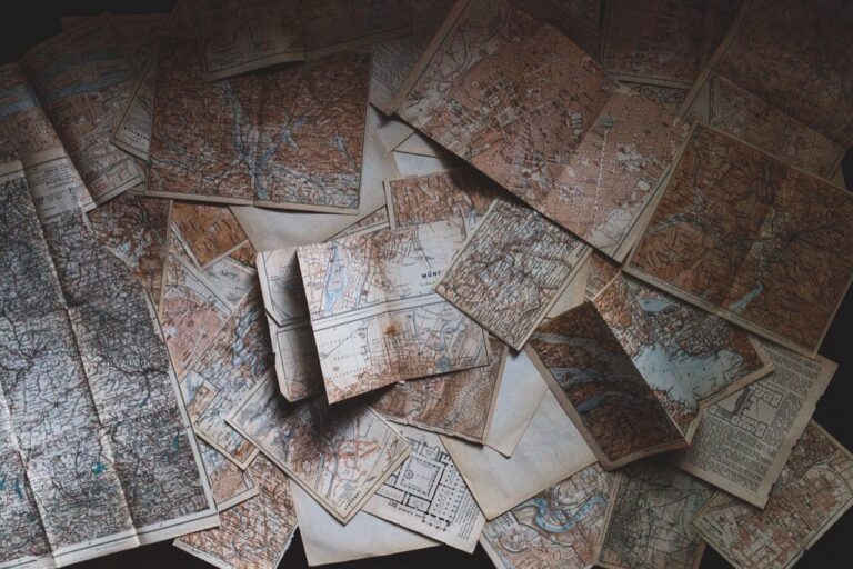
5 Methods for Digitizing Analog Maps That Preserve History
You’ve got stacks of precious analog maps collecting dust – historical surveys, hand-drawn property boundaries, or vintage topographical charts that hold incredible value but remain trapped in paper form. The big picture: Converting these physical maps into digital formats isn’t just about preservation; it’s about unlocking their potential for modern analysis, sharing, and integration with today’s GIS systems.
Navigate the US with ease using this Rand McNally map. Its large, clear print ensures readability for trip planning and travel.

Why it matters: Digital maps can be searched, layered with other data, and accessed instantly from anywhere – transforming static paper into dynamic, interactive resources.
What’s ahead: We’ll walk you through five proven methods that range from simple smartphone scanning to professional-grade digitization techniques, each with distinct advantages depending on your budget, accuracy needs, and technical expertise.
Disclosure: As an Amazon Associate, this site earns from qualifying purchases. Thank you!
P.S. check out Udemy’s GIS, Mapping & Remote Sensing courses on sale here…
Method 1: High-Resolution Scanning for Map Digitization
High-resolution scanning transforms your analog maps into precise digital files while preserving every cartographic detail. This method works exceptionally well for most paper maps and delivers professional results with the right equipment.
Choosing the Right Scanner for Large Format Maps
Flatbed scanners with 11×17-inch beds handle most standard topographic maps effectively. Professional-grade models like the Epson Expression 12000XL support formats up to A3+ size and deliver exceptional color accuracy. For oversized maps exceeding standard dimensions, wide-format scanners such as the Canon imagePROGRAF series accommodate rolls up to 44 inches wide. Consider your map collection’s largest dimensions before investing in equipment, as many historical survey maps require specialized large-format capabilities.
Get clear, detailed scans of photos and documents with the Epson Perfection V39 II. Its 4800 dpi resolution captures fine details, while one-touch buttons simplify scanning.

Optimal Scanning Settings and Resolution Requirements
Scan your maps at 600 DPI minimum to capture fine cartographic details like contour lines and elevation markers. Higher resolutions of 1200 DPI work best for maps requiring precise measurements or containing small text elements. Set your scanner to 24-bit color depth even for black-and-white maps to preserve subtle tonal variations in older prints. Use TIFF format for archival purposes since it maintains lossless compression, while PDF works well for general distribution and file sharing needs.
Post-Scan Image Processing and Enhancement
Adobe Photoshop and GIMP provide essential tools for cleaning scanned map images and correcting distortions. Remove dust spots, scratches, and fold marks using healing brushes while preserving original cartographic information. Adjust contrast and brightness to enhance readability of faded text and symbols without over-processing the image. Use geometric correction tools to fix perspective distortion from uneven scanning, ensuring your digital maps maintain accurate spatial relationships for GIS integration and professional mapping applications.
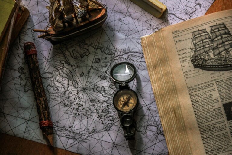
Method 2: Digital Photography Techniques for Map Conversion
Photography offers a versatile alternative to scanning when you’re working with oversized maps or lack access to professional scanning equipment. This method delivers excellent results with proper camera setup and lighting.
Professional Camera Setup and Lighting Considerations
Position your camera directly above the map using a copy stand or tripod to eliminate perspective distortion. Use a DSLR or mirrorless camera with manual exposure settings for consistent results across multiple shots. Set up diffused lighting from at least two angles to eliminate shadows and hotspots. Shoot in RAW format to maximize post-processing flexibility for color and exposure adjustments.
Digitize photos and documents quickly with the compact Cosmo Mini 500 Copy Stand. Made in the USA, it features a floating magnet board with precision grids and supports cameras or smartphones up to 3 lbs.

Capturing Multiple Sections for Seamless Stitching
Divide large maps into overlapping sections with 20-30% overlap between adjacent photos for reliable stitching points. Maintain consistent camera height and exposure settings throughout the entire capture session. Use a systematic grid pattern starting from one corner to ensure complete coverage. Mark reference points on your setup to maintain precise positioning between shots for optimal alignment during post-processing.
Color Correction and Geometric Distortion Fixes
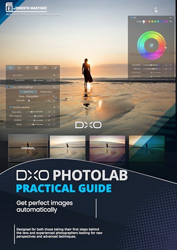
Apply lens distortion correction first using your camera’s built-in profiles or dedicated software like DxO PhotoLab. Balance white levels and adjust color temperature to match the original map’s appearance under neutral lighting conditions. Use perspective correction tools to square up any remaining geometric distortions from slight camera angles. Process all sections identically before stitching to ensure uniform color and exposure across the final composite image.
Master photo editing with DxO PhotoLab! Achieve perfect images automatically using its powerful processing and intuitive interface.
Method 3: Vector Tracing and Redrawing Digital Maps
Vector tracing transforms raster map images into scalable digital formats that maintain precision at any zoom level. This method creates editable geographic features perfect for GIS analysis and professional cartographic production.
Manual Digitization Using CAD Software
Manual digitization gives you complete control over feature accuracy and attribute assignment. AutoCAD Map 3D and QGIS provide robust head-up digitizing tools for tracing roads, boundaries, and topographic features directly over your scanned map image. You’ll work systematically through each map layer, creating separate vector files for different feature types like roads, water bodies, and elevation contours. This approach requires more time but delivers the highest accuracy for complex cartographic details and ensures proper topology for advanced spatial analysis.
Semi-Automated Vectorization Tools and Processes
Semi-automated tools accelerate the digitization process while maintaining quality control over critical features. ArcScan for ArcGIS automatically traces linear features like contour lines and converts raster cells into vector polygons using intelligent recognition algorithms. R2V software specializes in converting engineering drawings and maps into CAD-compatible vectors with minimal manual intervention. You’ll still need to clean up automated results and verify feature connectivity, but these tools can reduce digitization time by 60-80% compared to manual methods.
Quality Control and Accuracy Verification Methods
Quality control ensures your vector data meets professional cartographic standards and GIS compatibility requirements. Compare your digitized features against the original map using overlay analysis in your GIS software, checking for geometric accuracy within acceptable tolerance levels. Topology validation identifies gaps, overlaps, and connectivity errors that could compromise spatial analysis results. Create control points from known geographic coordinates to verify spatial registration accuracy, and maintain detailed metadata documenting your digitization methods, coordinate systems, and accuracy assessments for future reference.
Method 4: Professional Map Digitization Services
Professional digitization services offer expertise and advanced equipment that can deliver superior results for complex or valuable analog maps. These specialized companies handle everything from basic scanning to complete GIS-ready datasets with guaranteed accuracy standards.
Outsourcing to Specialized Geographic Data Companies
Geographic data companies like Sanborn Map Company and Hi-Target Surveying provide comprehensive digitization services using professional-grade scanners and experienced cartographers. These firms typically handle large-format maps up to 60 inches wide with specialized equipment that maintains sub-millimeter accuracy. You’ll receive georeferenced files, vector layers, and metadata documentation that meets industry standards. Most companies offer turnaround times between 2-4 weeks depending on map complexity and quantity.
Explore and map the wilderness for the Queen in Cartographers! Draw unique terrain shapes and score points based on randomly selected goals each game, but beware of monster ambushes.

Cost-Benefit Analysis of Professional vs DIY Approaches
Professional services cost $15-50 per map depending on size and complexity, while DIY approaches require equipment investments of $500-3,000 plus significant time commitments. You’ll save 80-90% of your time by outsourcing, allowing focus on analysis rather than digitization. Professional results include quality assurance, proper georeferencing, and industry-standard file formats that eliminate common DIY errors. Consider professional services when handling irreplaceable historical maps or requiring precise accuracy for legal documentation.
Service Selection Criteria and Quality Standards
Evaluate providers based on their scanning resolution capabilities (minimum 600 DPI), file format options, and georeferencing accuracy guarantees. Look for companies offering ISO 19115 metadata standards and FGDC-compliant documentation. Request sample outputs and verify their experience with your specific map types, whether topographic, cadastral, or thematic maps. Quality providers should offer revision cycles, accuracy reports, and coordinate system transformations to match your project requirements.
Method 5: Mobile Apps and Portable Scanning Solutions
Modern mobile technology offers convenient alternatives for map digitization when traditional scanning equipment isn’t available. These portable solutions provide flexibility for field work and quick digitization projects.
Smartphone Apps for Quick Map Digitization
Experience vivid content on the Galaxy A16 5G's 6.7" display and capture stunning photos with its triple-lens camera. Enjoy peace of mind with a durable design, six years of updates, and Super Fast Charging.

CamScanner transforms your smartphone into a powerful scanning device capable of producing high-quality map images. You’ll achieve optimal results by positioning your phone directly above the map and using the app’s automatic edge detection feature. Adobe Scan offers professional-grade image processing that automatically corrects perspective distortion and enhances contrast for better readability. Microsoft Lens excels at handling large maps through its panoramic stitching feature, allowing you to capture oversized documents in multiple sections. These apps typically export files in PDF or JPEG formats with resolutions reaching 300-600 DPI, making them suitable for basic digitization needs.
Portable Document Scanners for Field Work
Epson WorkForce ES-300W delivers professional scanning quality in a compact design weighing just 3.7 pounds. You can scan maps up to 8.5″ x 14″ directly to cloud storage or your mobile device via Wi-Fi connectivity. Brother DS-940DW offers battery-powered operation for true portability, scanning at resolutions up to 600 DPI without requiring external power sources. Fujitsu ScanSnap iX100 provides single-pass duplex scanning and connects wirelessly to smartphones and tablets for immediate processing. These portable scanners typically cost between $150-$400 and produce archive-quality TIFF files suitable for GIS applications while maintaining the convenience of field deployment.
Cloud-Based Processing and Storage Options
Google Drive automatically processes scanned images through its built-in OCR capabilities, making text elements searchable within your digitized maps. You’ll access 15GB of free storage with seamless integration across devices and platforms. Dropbox offers advanced file versioning that preserves multiple iterations of your digitized maps, ensuring you can revert to earlier versions if needed. Microsoft OneDrive provides collaborative features allowing team members to annotate and edit digitized maps simultaneously. Adobe Creative Cloud combines storage with professional editing tools, enabling you to enhance scanned maps using Photoshop and Illustrator directly from cloud storage with automatic syncing across devices.
Conclusion
You now have five proven methods to transform your analog maps into valuable digital assets. Whether you choose high-resolution scanning for precision work or mobile apps for quick field digitization each approach serves specific needs and budgets.
Your choice depends on factors like map size accuracy requirements and available resources. For historical or legally important documents professional services offer guaranteed results while DIY methods provide cost-effective solutions for personal projects.
The digital transformation of your maps opens doors to modern GIS integration enhanced searchability and long-term preservation. You’ll gain the ability to layer data analyze patterns and share your cartographic resources with colleagues worldwide.
Start with the method that best matches your current situation and technical comfort level. Your analog maps contain valuable geographic information that deserves preservation and the enhanced functionality that digital formats provide.
Frequently Asked Questions
What are the main benefits of converting analog maps to digital format?
Digital maps offer enhanced usability through searchability, data layering capabilities, and instant access. They preserve valuable historical surveys and vintage charts while enabling integration with Geographic Information Systems (GIS). Unlike static paper maps, digital versions become interactive resources that support modern analysis and can be easily shared and stored without risk of physical deterioration.
What scanning resolution should I use for digitizing maps?
Use a minimum of 600 DPI for capturing fine cartographic details, though higher resolutions may be necessary for maps with intricate features. For archival purposes, save files in TIFF format to maintain maximum quality. Choose flatbed scanners for standard-sized maps and wide-format scanners for oversized maps to ensure proper coverage and detail preservation.
Can I use my smartphone to digitize maps effectively?
Yes, smartphone apps like CamScanner, Adobe Scan, and Microsoft Lens offer convenient digitization options with automatic edge detection and panoramic stitching features. While not as precise as professional scanning equipment, mobile solutions work well for quick digitization when traditional equipment isn’t available, especially for fieldwork or immediate access needs.
What’s the difference between raster and vector map digitization?
Raster digitization creates image files through scanning or photography, preserving the original map appearance but limiting editability. Vector digitization involves tracing map features to create scalable, editable digital formats ideal for GIS analysis. Vector maps maintain precision at any zoom level and allow for data attribute assignment to individual features.
When should I consider professional map digitization services?
Consider professional services for irreplaceable historical maps, when sub-millimeter accuracy is required, or for legal documentation purposes. Professional services typically cost $15-50 per map but provide guaranteed accuracy, advanced equipment, and expertise. They’re especially valuable for large-format maps or when you lack the necessary equipment and technical skills.
What software can I use for cleaning and processing scanned maps?
Adobe Photoshop and GIMP are excellent tools for post-scan image processing, offering features for cleaning images, correcting distortions, and enhancing readability. For vector tracing, consider AutoCAD Map 3D, QGIS, ArcScan for ArcGIS, or R2V software. These tools help ensure accurate GIS integration and professional-quality results.
How do I handle oversized maps that don’t fit standard scanners?
For oversized maps, use wide-format scanners or employ digital photography techniques. When photographing, capture multiple overlapping sections and use image stitching software to create seamless composites. Ensure proper lighting and camera positioning to avoid distortion, and maintain consistent overlap between sections for accurate reconstruction.
What file formats should I use for archival map storage?
Use TIFF format for archival purposes as it provides lossless compression and maintains maximum image quality. For working files and web sharing, consider PNG for images with transparency needs or JPEG for smaller file sizes. Always maintain master TIFF files while creating compressed versions for specific applications.