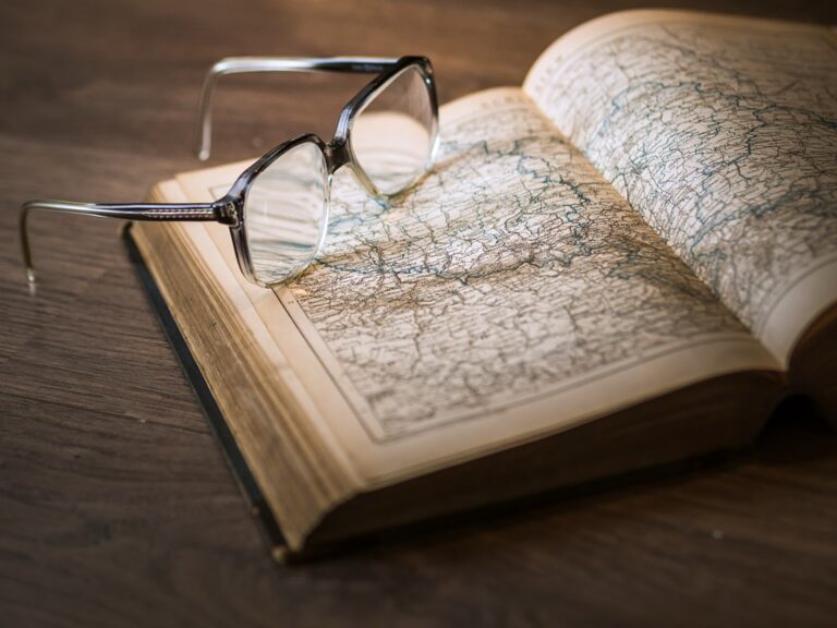
8 Ancient Tools That Shaped Cartography
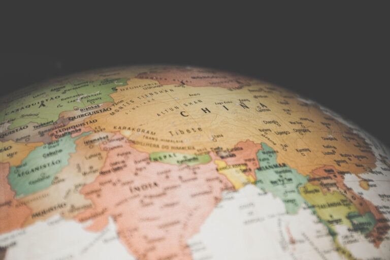
Cartography, the art and science of map-making, has been pivotal in humanity’s understanding of our world. The tools that ancient cartographers used were ingenious, shaping the course of history and exploration.
Cartography, more than map drawing, is the art of translating our three-dimensional world onto a flat surface. Ancient cartographers, like original virtual reality developers, aimed for an immersive experience from a distance. These unsung heroes laid the foundations for navigation, trade, and understanding of Earth.
Despite lacking modern tech, they used seemingly magical tools to measure the heavens and Earth precisely, showcasing human innovation. The legacy of ancient cartography extends beyond maps, embodying a spirit of discovery and thirst for knowledge. These tools were keys to unlocking new worlds, influencing today’s digital maps on our smartphones.
The Samsung Galaxy S25 Ultra adapts to your needs with intelligent AI assistance. Capture stunning photos and videos with the AI Camera's noise reduction and enjoy effortless switching from your old device.

Disclosure: As an Amazon Associate, this site earns from qualifying purchases. Thank you!
1. The Astrolabe’s Influence
The astrolabe is an ancient astronomical instrument that’s as beautiful as it is functional. It’s like a Swiss Army knife for the stars, capable of solving several kinds of problems in spherical astronomy. Mariners and astronomers used it extensively to measure the altitude of stars and planets, which in turn helped them figure out their position on Earth.
Imagine holding the night sky in your hands—that’s the kind of power the astrolabe conferred on its user. It was a game-changer for navigation, particularly before the advent of the magnetic compass. The tool’s ability to provide celestial navigation made it indispensable for sea voyages that ventured beyond sight of land.
Despite its sophistication, the astrolabe was eventually outshone by newer technologies. But let’s not kid ourselves, it was the iPhone of its day—everyone who was anyone in the world of exploration and science had to have one. Its influence on cartography and navigation is nothing short of legendary.
2. Groma: Roman Surveying Tool
The groma might not be a household name, but it was the Roman surveyor’s best friend. Picture a wooden cross with weights hanging from each end—simple, yet incredibly effective for aligning straight roads and plotting land divisions. It was essentially the ancient world’s version of a laser level.
Roman engineers would’ve been lost without this nifty device. They used it to lay out their famous grid-based cities and perfectly straight roads that crisscrossed the empire. It’s no exaggeration to say that the groma helped shape the physical layout of Western civilization.
While it may not have directly charted seas or stars, the groma’s impact on cartography lies in the groundwork it laid (quite literally). Ensuring the precise division of space on land, indirectly influenced the accuracy of maps that depicted those territories.
3. The Quadrant’s Quadrants
The quadrant, a quarter-circle panel with angle measurements, is like the grandparent of the protractor. Seafarers and astronomers used it for measuring celestial bodies’ altitudes above the horizon, which was crucial for navigation. The quadrant was a staple in the toolkits of medieval and Renaissance explorers.
Using a quadrant feels a bit like reaching out to touch the sky. By lining up a sighting object with a celestial body, navigators could determine their latitude, a fundamental aspect of ancient cartography. It was the GPS of yesteryears, guiding voyagers across uncharted waters.
While the quadrant might seem quaint by today’s standards, its role in the evolution of cartography is undeniable. It helped sailors and scholars alike understand the heavens about the Earth, bridging the gap between the two in a way that earlier tools couldn’t.
4. Kamal: Navigating by Stars
The kamal is a lesser-known navigational aid, hailing from the Arabic world. It’s a simple rectangle of wood attached to a string with knots, used to measure the altitude of stars above the horizon. By holding the kamal at a specific distance from the eye, navigators could gauge their position north or south of the equator.
The beauty of the kamal lies in its simplicity. It didn’t require advanced knowledge of mathematics or astronomy—just a steady hand and a clear night sky. It was the perfect tool for the seafaring traders who traversed the Indian Ocean and the Arabian Sea.
Though rudimentary, the kamal played a significant role in the spice trade and the spread of culture. It’s a prime example of how necessity is the mother of invention, with sailors creating a tool tailored to their needs, which in turn shaped the maps of the regions they explored.
5. Dioptra: Greek Precision
The dioptra could be considered the ancient forerunner to the modern theodolite, used for precise angle measurements. Greek surveyors and astronomers found it invaluable for measuring celestial and terrestrial angles alike. With the dioptra, they could align buildings astronomically, and even estimate the size and distance of distant objects.
This tool was about precision and perfection, hallmarks of Greek civilization. By using the dioptra, ancient Greeks could produce maps with impressive accuracy, far surpassing what one might expect from the technology of the time. It’s like they had a sixth sense of spatial awareness.
The dioptra’s influence on cartography is profound, providing a level of detail that was previously unattainable. It’s no stretch to say that this tool helped lay the foundation for the precise surveying methods that would come to define modern cartography.
6. The Versatile Cross-Staff
The cross-staff, also known as the Jacob’s staff, is a simple yet versatile instrument that dates back to the 14th century. It consists of a long staff with a perpendicular crosspiece that slides along its length. By aligning the crosspiece with a celestial body, navigators could measure its angle above the horizon to determine latitude.
The cross-staff was like a trusty sidekick for explorers of the high seas. It was more portable and user-friendly than its cousin, the astrolabe, making it a popular choice among sailors. You could think of it as the “point-and-shoot” camera of celestial navigation.
While the cross-staff eventually gave way to more sophisticated tools, its contributions to cartography and navigation are noteworthy. It democratized the art of navigation, making it accessible to a broader range of seafarers and contributing to the Age of Discovery.
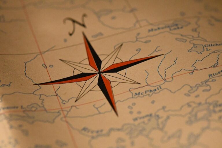
7. Cartographic Compass Rose
The compass rose is a figure on maps and nautical charts used to display the orientation of the cardinal directions—North, East, South, and West. It’s like a signpost for mariners, providing a reference point for navigation. The compass rose is both practical and artistic, often adorned with elaborate designs and flourishes.
Understand nautical charts with U.S. Chart No. 1, 13th Edition. This guide decodes symbols, abbreviations, and terms used on both paper and electronic navigational charts.

In ancient times, the compass rose was more than just decoration; it was a critical tool for orientation. Before GPS and digital maps, the compass rose helped travelers and traders navigate the vast oceans and track their progress on voyages.
The compass rose continues to be a symbol of navigation and exploration. It’s a reminder of a time when the world was a bigger place, full of mystery and potential for discovery. Every time we glance at a map, the compass rose points us in the direction of adventure.
8. The Jacob’s Staff Explained
The Jacob’s staff, not to be confused with the cross-staff, was another vital tool for ancient astronomers and surveyors. It’s a pole with a sliding crosspiece, and by adjusting the crosspiece’s position and sighting along it, users could measure angles with a fair degree of accuracy. This tool was especially useful for land surveying and determining the height of objects.
Using Jacob’s staff was a bit like playing a full-scale game of “connect the dots” with the landscape. It allowed surveyors to plot out land with a precision that seems remarkable even by today’s standards. You could say it was the unsung hero of property disputes and land grants.
The Jacob’s staff’s impact on cartography is substantial, as it allowed for the creation of more accurate land maps. These detailed maps were crucial for the development of cities, the allocation of resources, and the expansion of empires.
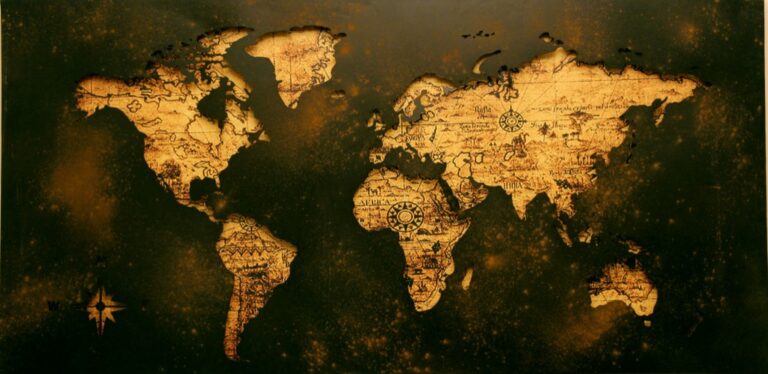
Conclusion: Legacy of Tools
The ancient tools of cartography are the unsung heroes of history. They not only shaped the maps of their time but also charted a course for future generations. The precision, ingenuity, and creativity imbued in these instruments are a testament to the human spirit’s unyielding desire to understand and navigate our world.
As we rely on satellites and software to guide us today, it’s humbling to remember the astrolabe, dioptra, and kamal. These tools remind us that exploration is not just about reaching a destination but also about the journey of discovery itself. They are the silent guides that led humankind from terra incognita to the interconnected global village we know today.
The legacy of these ancient cartographic tools is alive in every map we use and every journey we take. They remind us that curiosity and the pursuit of knowledge are as old as civilization itself, and that’s something to be celebrated.