7 Best Interactive Map Features for Engagement
The big picture: Static maps don’t have to be boring anymore. You can transform flat geographical representations into engaging digital experiences that capture your audience’s attention and boost user engagement.
Why it matters: Interactive elements in static maps help you tell better stories with your data while keeping viewers engaged longer. Whether you’re building a website dashboard or creating content for social media, these techniques bridge the gap between traditional cartography and modern digital storytelling.
What’s next: We’ll explore seven practical ways to add interactive features to your static maps without requiring advanced coding skills or expensive software.
Disclosure: As an Amazon Associate, this site earns from qualifying purchases. Thank you!
P.S. check out Udemy’s GIS, Mapping & Remote Sensing courses on sale here…
Add Clickable Hotspots for Detailed Information
Clickable hotspots transform static maps into dynamic information hubs that respond to user interaction. You’ll create targeted access points where viewers can discover additional layers of geographic data without cluttering your base map design.
Location-Based Pop-Ups and Tooltips
Implement point-based hotspots using HTML image maps or JavaScript libraries like Leaflet to trigger information windows. Position these interactive zones over key landmarks, cities, or data collection points on your static map image. Configure pop-ups to display location names, coordinates, elevation data, or custom descriptions when users hover or click specific areas. Test hotspot boundaries carefully to ensure accurate geographic targeting and prevent overlap between adjacent interactive zones.
Layered Content Reveals
Design progressive disclosure systems that reveal additional map layers through hotspot activation. Structure your content hierarchy with base information visible initially and detailed datasets appearing on demand. Organize supplementary layers like demographic data, historical imagery, or infrastructure details behind individual hotspots. Optimize layer switching animations to provide smooth transitions between different data visualizations while maintaining spatial context and orientation.
Contextual Data Displays
Connect hotspots to external databases or JSON files containing location-specific metrics and statistics. Format data displays using charts, graphs, or structured tables that appear alongside your static map interface. Synchronize real-time data feeds with hotspot locations to show current weather conditions, traffic patterns, or sensor readings. Validate data accuracy through automated checks and establish refresh intervals that balance information currency with system performance requirements.
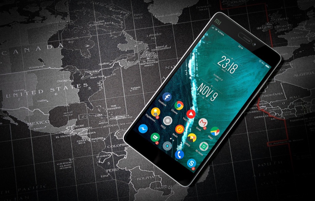
Implement QR Codes for Mobile Integration
QR codes transform your static maps into mobile-accessible interactive experiences. They create seamless connections between printed materials and digital content.
Quick Access to Digital Resources
Generate QR codes that link directly to supplementary map data, GPS coordinates, or detailed location information. Position these codes strategically near specific geographic features or points of interest on your static map. Users can scan codes with their smartphones to access real-time weather data, historical photographs, or interactive 3D models of landmarks. Mobile scanning eliminates the need for manual URL entry, reducing friction between your static map and digital resources while maintaining clean visual design.
Experience vivid content on the Galaxy A16 5G's 6.7" display and capture stunning photos with its triple-lens camera. Enjoy peace of mind with a durable design, six years of updates, and Super Fast Charging.

Bridging Physical and Digital Experiences
Connect printed maps to dynamic online content through strategically placed QR codes that enhance spatial understanding. Museums, visitor centers, and educational institutions use this technique to link wall-mounted static maps with mobile-optimized websites containing audio tours, video content, or augmented reality experiences. Physical touchpoints like trail maps can connect hikers to real-time trail conditions, safety alerts, or wildlife sighting databases. This integration extends your map’s utility beyond its static limitations while preserving the tangible benefits of printed materials.
Dynamic Content Updates
Update linked content without reprinting your static maps by connecting QR codes to content management systems or cloud-based databases. Restaurant location maps can link to current menus, hours, or special offers that change frequently. Real-time information flows through QR connections, allowing static tourism maps to provide updated attraction schedules, ticket availability, or seasonal accessibility information. This approach maintains cost-effective static printing while delivering fresh, relevant data that keeps your maps valuable and current for extended periods.
Create Overlay Transparencies for Multi-Layer Visualization
Overlay transparencies transform static maps into multi-dimensional data visualization tools through interactive layer control systems. You’ll create professional map interfaces that reveal complex spatial relationships through user-controlled transparency adjustments.
Temporal Data Comparisons
Build comparison sliders that let users adjust transparency levels between historical and current map datasets. You can overlay demographic changes from census data using 50-70% transparency settings for optimal visibility. Population density maps, land use changes, and urban development patterns work exceptionally well with temporal overlays. JavaScript libraries like Leaflet’s layer control enable smooth transitions between time periods while maintaining cartographic clarity.
Thematic Layer Switching
Toggle between thematic datasets using transparent overlay controls that highlight different geographic variables. You’ll create interactive legend systems where users select environmental data, economic indicators, or infrastructure layers. Census tract boundaries can overlay with income data at 60% transparency while transportation networks remain visible underneath. CSS opacity controls and SVG layering provide precise transparency management for multiple data themes.
Before and After Demonstrations
Showcase dramatic geographic changes through interactive transparency sliders that reveal transformation over time. Natural disaster impact maps, urban redevelopment projects, and environmental monitoring datasets excel with before-and-after overlays. You can implement dual-image transparency controls where users drag sliders to reveal underlying conditions. Historical aerial photography combined with current satellite imagery creates compelling visual narratives through controlled transparency adjustments.
Incorporate Augmented Reality Markers
Augmented reality markers transform static maps into immersive experiences by overlaying digital content onto real-world locations. These markers bridge the gap between traditional cartography and cutting-edge visualization technology.
AR-Enhanced Geographic Features
Position AR markers at key geographic locations to unlock detailed topographic models, elevation profiles, and terrain cross-sections when viewed through mobile devices. These markers enable users to visualize complex landforms, geological formations, and watershed boundaries in three-dimensional space. You’ll create deeper spatial understanding by allowing viewers to explore terrain features that aren’t visible on traditional flat representations, making physical geography more accessible and engaging.
Interactive 3D Models and Visualizations
Deploy 3D visualization markers that activate architectural models, historical reconstructions, and infrastructure overlays when scanned with AR-enabled devices. These markers can display building heights, urban development timelines, and proposed construction projects in their actual geographic context. You’ll enhance spatial planning discussions by enabling stakeholders to visualize how new developments will impact existing neighborhoods, complete with accurate scale and positioning relative to surrounding structures.
Real-Time Data Integration
Connect AR markers to live data feeds that display current weather conditions, traffic patterns, air quality measurements, and demographic statistics directly over map locations. These markers update automatically, showing real-time sensor data, social media trends, and economic indicators tied to specific geographic coordinates. You’ll provide users with dynamic contextual information that changes based on current conditions, making your static maps responsive to real-world events and temporal variations.
Design Touch-Sensitive Areas for Tactile Exploration
Touch-sensitive areas transform static maps into responsive surfaces that react to physical interaction. You’ll create intuitive navigation experiences that feel natural to users across different devices and accessibility needs.
Pressure-Sensitive Content
Pressure-sensitive regions detect varying touch intensities to reveal layered geographic information. You can configure light touches to display basic location names while firm presses unveil detailed demographic data or historical timelines. Modern capacitive screens support pressure differentiation through JavaScript touch events, allowing you to create maps where gentle taps show elevation contours and sustained pressure reveals geological cross-sections. This technique works particularly well for educational maps where users naturally explore content depth through touch intensity.
Multi-Touch Gesture Recognition
Multi-touch gestures enable complex map interactions through finger combinations and movements. You’ll implement pinch-to-zoom for scale transitions, two-finger rotation for orientation changes, and three-finger swipes for layer switching between thematic datasets. Touch libraries like Hammer.js recognize gesture patterns, letting you assign specific map functions to different finger movements. Two-finger taps can toggle between satellite and terrain views while circular gestures activate time-series animations showing urban development patterns or climate data changes over decades.
Accessible Interface Options
Accessible touch interfaces ensure tactile map exploration works for users with diverse abilities and devices. You’ll design high-contrast touch zones with adjustable sensitivity levels and audio feedback for visually impaired users. Voice commands can supplement touch interactions, allowing users to navigate between map regions or access data through speech recognition. Screen reader compatibility requires proper ARIA labels for interactive elements, while haptic feedback on supported devices provides tactile confirmation of successful interactions with geographic features and data points.
Read comfortably with this lightweight, full-page 5X magnifying glass. Its large viewing area and ergonomic handle make it ideal for seniors and those with low vision to easily read small print.

Embed NFC Technology for Seamless Connectivity
Near Field Communication (NFC) technology transforms static maps into smart navigation tools that respond automatically when users bring compatible devices within close proximity. You’ll create intuitive map experiences that require minimal user interaction while delivering precise location-based information.
Proximity-Based Information Sharing
Position NFC tags at strategic map locations to deliver instant content when users tap their smartphones against designated areas. You can embed detailed geographic coordinates, elevation data, and survey benchmarks directly into each tag’s memory chip. Program tags to share GPX files, KML overlays, or direct links to supplementary cartographic resources. Users receive topographic cross-sections, soil composition data, or historical land use records simply by holding their device near the embedded tag for two seconds.
Automated Device Pairing
Configure NFC tags to establish automatic connections between users’ devices and your mapping infrastructure without manual network setup. You can program tags to connect smartphones directly to dedicated mapping servers, GPS base stations, or real-time kinematic (RTK) correction services. Tags automatically transfer Wi-Fi credentials, Bluetooth pairing codes, and API access tokens needed for advanced mapping applications. This eliminates complex device configuration while ensuring users access the most current geodetic reference systems and coordinate transformations.
Location-Triggered Actions
Deploy NFC triggers that initiate specific mapping workflows based on precise geographic positioning and user requirements. You can program tags to automatically launch surveying applications, activate GPS logging with predetermined accuracy settings, or begin photogrammetric capture sequences. Tags trigger coordinate system conversions, datum transformations, and projection adjustments specific to local mapping zones. Users simply tap designated map areas to start elevation profiling, boundary surveys, or environmental data collection protocols without navigating complex menu systems.
Integrate LED and Smart Lighting Systems
Transform your static maps into dynamic visual experiences using programmable LED arrays and smart lighting technology that responds to user proximity and interaction patterns.
Control 8x8 LED dot matrix displays with this 5V MAX7219 module. It supports cascading multiple modules via input/output interfaces for larger displays.

Dynamic Visual Indicators
Programmable LED strips create real-time navigation paths across your map surface, guiding users through geographic sequences with customizable color patterns. Position RGB LED arrays beneath translucent map materials to highlight specific regions, transportation routes, or demographic data through synchronized color changes. Control these systems using Arduino microcontrollers or Raspberry Pi devices that respond to touch sensors, creating immediate visual feedback when users explore different map areas.
Control these 100ft RGB LED strip lights via Bluetooth app or remote to customize colors and brightness. Sync them to music for a dynamic party atmosphere and set timers for automatic on/off.

Color-Coded Information Systems
Smart lighting networks display complex geographic data through intuitive color gradients that represent elevation changes, population density, or economic indicators across your map regions. Configure LED panels to cycle through different data layers, allowing users to switch between environmental conditions, traffic patterns, or historical timelines using simple button controls. Implement RGB color mapping standards where specific hues consistently represent identical data categories across multiple map displays.
Motion-Activated Illumination
PIR motion sensors trigger targeted illumination sequences when users approach specific map sections, automatically highlighting relevant geographic features or points of interest without manual interaction. Install proximity detectors that activate LED backlighting for detailed inset maps, cross-sections, or supplementary charts when users move within detection range. Program motion-responsive systems to display contextual information through sequential lighting patterns that guide attention to related map elements and geographic connections.
Protect your property with this wireless driveway alarm system. It features a long 1/2-mile range and a motion sensor that detects movement up to 50 feet away, reducing false alarms.

Conclusion
Your static maps don’t have to remain static anymore. With these seven interactive integration methods you can transform basic geographic displays into engaging digital experiences that captivate your audience and deliver information more effectively.
The beauty of these techniques lies in their accessibility â you don’t need advanced coding skills or expensive software to implement most of them. Whether you’re adding simple QR codes or experimenting with LED lighting systems each approach offers unique advantages for different use cases and budgets.
Create professional LED strip light installations with this 10-pack of 6.6ft U-shaped aluminum channels. The milky cover diffuses light for a softer glow, while the channel protects strips from dust and damage.

Start small with clickable hotspots or mobile-responsive overlays then gradually incorporate more sophisticated elements like AR markers or NFC technology as your confidence grows. Your enhanced maps will not only improve user engagement but also set your content apart in today’s competitive digital landscape.
Frequently Asked Questions
What are the main benefits of making static maps interactive?
Interactive static maps enhance user engagement by transforming passive viewing into active exploration. They improve storytelling with geographic data, making information more accessible and memorable for website visitors and social media audiences. These enhanced maps provide deeper insights without requiring expensive software or advanced coding skills.
How do clickable hotspots work on static maps?
Clickable hotspots serve as dynamic information hubs that users can interact with to access additional geographic data. They prevent map cluttering by hiding detailed information until needed. Users simply click on designated areas to reveal location-specific content, creating a cleaner, more organized viewing experience.
What are QR codes used for in interactive mapping?
QR codes bridge physical and digital map experiences by linking to supplementary data, GPS coordinates, or real-time information. Users scan codes with smartphones to access weather updates, historical photos, audio tours, or augmented reality content. This technology keeps static maps relevant without requiring reprinting when information updates.
How do overlay transparencies enhance map visualization?
Overlay transparencies enable multi-layer visualization where users control transparency levels to reveal complex spatial relationships. This technique works well for temporal data comparisons, thematic layer switching between datasets, and before-and-after demonstrations of geographic changes like urban development or natural disasters.
What makes augmented reality markers effective for maps?
AR markers transform static maps into immersive 3D experiences by overlaying digital content onto real-world locations. They unlock detailed topographic models, architectural visualizations, and real-time data like weather conditions directly over map locations, making geographic information more engaging and comprehensible.
How do touch-sensitive areas improve map accessibility?
Touch-sensitive areas create intuitive navigation experiences across devices while accommodating diverse user abilities. They feature pressure-sensitive content, multi-touch gesture recognition, and accessible interface options including high-contrast zones, audio feedback, and voice commands for enhanced usability.
What advantages does NFC technology offer for interactive maps?
NFC technology creates smart navigation tools that respond automatically when compatible devices approach. Users receive instant geographic data, coordinates, and elevation information by tapping smartphones against strategically placed NFC tags, enabling seamless connections without manual setup or complex interactions.