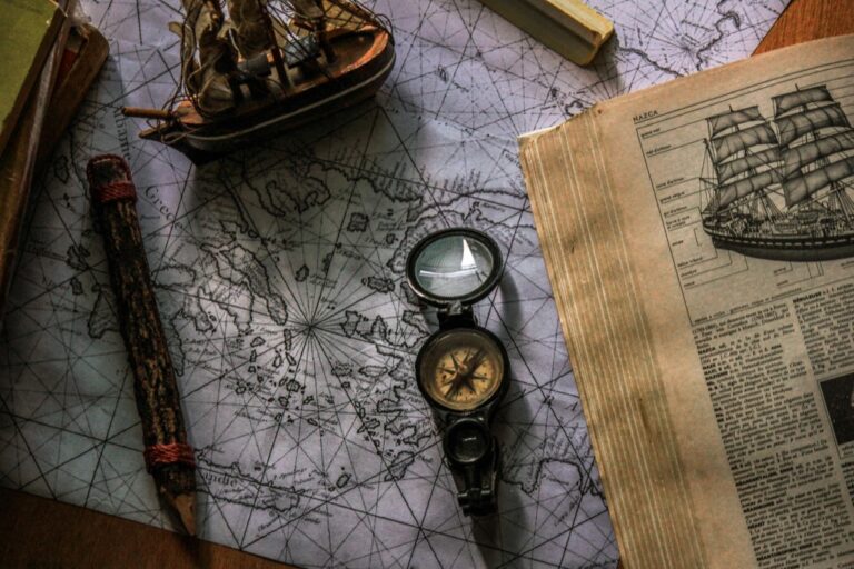
5 Best Historical Map Digitization Techniques
Why it matters: You’re watching centuries of irreplaceable cartographic history transform into digital treasures through cutting-edge preservation techniques that most people have never heard of.
The big picture: Historical map digitization goes far beyond simple scanning — specialized methods can capture invisible details, restore faded coastlines, and reveal hidden layers that traditional photography completely misses.
What’s next: These five rare techniques are revolutionizing how museums, libraries, and researchers preserve and share ancient maps that would otherwise crumble into dust.
Disclosure: As an Amazon Associate, this site earns from qualifying purchases. Thank you!
P.S. check out Udemy’s GIS, Mapping & Remote Sensing courses on sale here…
Photogrammetric Reconstruction Method
You’ll find photogrammetric reconstruction transforms damaged or fragmented historical maps into precise 3D models using multiple photographs. This technique captures dimensional data that traditional scanning methods miss entirely.
Explore history's most significant maps with *Great Maps*. This book delves into cartographic masterpieces and their historical context.

Multi-Angle Photography Setup
Position your camera system at predetermined angles around the historical map using calibrated equipment. You’ll need at least 15-20 overlapping photographs from different positions to ensure complete coverage of the map surface. Professional photogrammetry requires controlled lighting conditions and fixed camera settings throughout the entire capture sequence. Scale bars and reference points must be placed strategically around the map’s perimeter to establish accurate measurements during processing.
3D Surface Modeling Process
Process your multi-angle photographs through specialized software like Agisoft Metashape or RealityCapture to generate point clouds. You’ll create dense mesh models that capture every surface irregularity including paper texture and topographical relief features. The software automatically identifies matching points between photographs and calculates precise spatial coordinates for each surface element. Quality control involves removing noise artifacts and ensuring mesh continuity across the entire map surface.
Texture Mapping and Color Correction
Apply high-resolution textures to your 3D mesh using the original photograph data to recreate authentic surface appearance. You’ll need to correct color variations between different camera angles and compensate for uneven lighting conditions during capture. Advanced texture mapping software allows you to blend multiple image sources seamlessly while preserving historical color accuracy. Final color correction involves matching digital output to standardized museum lighting conditions for consistent reproduction quality.
Hyperspectral Imaging Technology
Hyperspectral imaging captures hundreds of narrow wavelength bands across the electromagnetic spectrum, revealing map details invisible to conventional cameras. This advanced technique penetrates faded inks and damaged surfaces to recover historical information.
Spectral Band Analysis
Spectral Band Analysis examines specific wavelengths between 400-2500 nanometers to identify different materials and inks on historical maps. You’ll capture 200-400 distinct spectral bands simultaneously, creating a data cube that reveals the unique spectral signature of each map element. This process distinguishes between iron gall inks, carbon-based inks, and various pigments used in different historical periods. Modern hyperspectral cameras like the Specim FX10 provide laboratory-grade precision for identifying original cartographic materials versus later additions or alterations.
Hidden Text and Detail Recovery
Hidden text recovery uses infrared and near-infrared wavelengths to penetrate surface stains and reveal obscured cartographic information. You can detect text written beneath overpainting, water damage, or deliberate erasures by analyzing wavelengths between 700-1000 nanometers. This technique successfully recovers place names, boundary lines, and annotations that disappeared over centuries. The Bodleian Library’s recent work with 16th-century Venetian maps demonstrates how hyperspectral imaging reveals original coastlines hidden beneath later geographical corrections.
Wavelength-Specific Processing
Wavelength-Specific Processing isolates individual spectral bands to enhance different map features using specialized software algorithms. You’ll process each wavelength band separately to maximize contrast and clarity for specific elements like text, borders, or decorative features. Principal component analysis and independent component analysis separate overlapping spectral signatures from different historical materials. Software like ENVI or SpecTIR’s HyperCore processes these complex datasets, generating false-color composites that highlight previously invisible map details with remarkable precision.
Infrared Reflectography Technique
Infrared reflectography penetrates surface materials to reveal hidden cartographic information beneath visible layers. This non-invasive technique uses near-infrared wavelengths (700-2500 nanometers) to examine historical maps without causing damage.
Penetrating Surface Layers
Infrared radiation passes through many surface materials that block visible light, including varnishes, overpainting, and accumulated dirt layers. You’ll capture images using specialized infrared-sensitive cameras equipped with silicon or indium gallium arsenide sensors. The technique works particularly well with carbon-based inks, which absorb infrared radiation strongly while many surface coatings remain transparent. Most historical maps benefit from wavelengths between 1000-1700 nanometers for optimal penetration depth.
Revealing Underlying Cartographic Elements
Hidden cartographic features become visible through infrared reflectography when surface materials obscure original map elements. You can uncover erased boundary lines, deleted place names, and preliminary sketches that cartographers covered during map creation. The technique reveals pentimenti – artist’s changes of mind – showing how historical maps evolved during their creation process. Vatican Library’s work with 15th-century portolan charts demonstrates how infrared imaging exposes underlying compass roses and navigation lines invisible to standard photography.
Digital Enhancement Protocols
Digital processing amplifies infrared reflectography results through specialized software workflows that maximize contrast between hidden and visible elements. You’ll apply histogram equalization to expand tonal ranges, use unsharp masking to enhance edge definition, and employ false-color processing to highlight specific wavelength responses. Band arithmetic techniques isolate optimal infrared channels while noise reduction algorithms preserve fine cartographic details. Post-processing typically involves gamma correction and selective area enhancement to bring forward the most significant hidden features.
Laser Scanning and LiDAR Integration
Laser scanning technology revolutionizes historical map preservation by capturing three-dimensional surface data with millimeter-level precision. You’ll achieve comprehensive documentation that traditional photography can’t match.
High-Resolution Surface Capture
Capture surface details at resolutions down to 0.1mm using structured light scanners like the DAVID SLS-3 or Artec Eva systems. You’ll document every crease, tear, and texture variation across your historical maps. Position multiple scanning angles to eliminate shadows and ensure complete coverage of raised elements like wax seals or embossed cartouches. Modern laser scanners generate up to 2 million points per second, creating detailed surface models that preserve aging effects and physical deterioration patterns for future restoration work.
Capture detailed 3D scans quickly with the Einstar handheld scanner. It delivers high-quality data with 0.1mm resolution and authentic color thanks to its built-in RGB camera.

Dimensional Accuracy Preservation
Maintain geometric precision within ±0.05mm tolerances using calibrated laser measurement systems throughout your digitization workflow. You’ll preserve original map scales and proportional relationships that photographic methods often distort. Establish control points using survey-grade equipment to maintain spatial accuracy across large format maps measuring over 1 meter. LiDAR integration compensates for paper warping and mounting irregularities, ensuring your digital output reflects true historical dimensions rather than storage-induced deformations.
Point Cloud Data Processing
Process millions of data points using specialized software like CloudCompare or Geomagic Wrap to generate workable 3D models from raw laser scan data. You’ll filter noise artifacts and align multiple scan sessions into unified coordinate systems. Apply mesh decimation algorithms to reduce file sizes while preserving critical surface features for web-based viewing platforms. Convert point cloud data into standard formats like PLY or OBJ for compatibility with museum database systems and scholarly research applications.
Raking Light Photography Method
Raking light photography method reveals surface textures and raised elements on historical maps through controlled angle illumination. This technique creates dramatic shadows that highlight embossed details, watermarks, and surface irregularities invisible under normal lighting conditions.
Oblique Illumination Setup
Position LED light panels at 15-30 degree angles to create optimal shadow casting across your map’s surface. You’ll need adjustable lighting rigs with color temperature controls set to 5000K for neutral illumination. Mount lights on articulating arms allowing precise positioning adjustments during capture sessions. Configure dual-light setups with opposing angles to minimize harsh shadows while maintaining texture definition. Use polarizing filters to reduce glare from metallic inks and glossy varnishes commonly found on period maps.
This LED video light kit provides adjustable, high-quality lighting for various applications. It features dimmable brightness, multiple color temperatures (2800-6500K), and an adjustable tripod stand for easy positioning.

Surface Texture Enhancement
Adjust contrast levels during post-processing to amplify subtle surface variations captured through raking light exposure. You’ll maximize embossed text visibility by increasing shadow depth through selective curve adjustments in editing software. Apply unsharp masking filters specifically to shadow areas to enhance edge definition without affecting highlight regions. Focus stacking techniques become essential when working with warped or buckled maps where depth of field limitations affect overall sharpness across the surface.
Shadow-Based Detail Extraction
Isolate shadow information using luminosity masks to reveal previously hidden cartographic elements like erasures and overwritten text. You can separate shadow channels from highlight data to process each independently for maximum detail recovery. Digital enhancement algorithms specifically designed for archaeological documentation work effectively on raking light captures. Apply directional sharpening filters aligned with your light angle to emphasize linear features like coastlines and border demarcations that benefit from shadow definition.
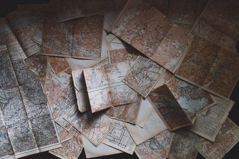
Conclusion
These advanced digitization techniques are revolutionizing how you can preserve and access historical cartographic treasures. From photogrammetric reconstruction to laser scanning technology each method offers unique advantages for different preservation challenges.
The future of historical map preservation lies in combining these specialized approaches. You’ll find that museums and research institutions worldwide are increasingly adopting these technologies to create comprehensive digital archives that safeguard our cartographic heritage.
As these techniques become more accessible you can expect to see unprecedented discoveries in historical maps. The digital revolution in cartographic preservation isn’t just about technology – it’s about unlocking centuries of hidden knowledge for future generations to explore and study.
Frequently Asked Questions
What is historical map digitization and why is it important?
Historical map digitization involves converting ancient maps into digital formats using advanced preservation techniques. This process goes beyond simple scanning, utilizing specialized methods to uncover hidden details and restore faded elements. It’s crucial for preserving irreplaceable artifacts, ensuring their longevity, and making them accessible to researchers, museums, and the public worldwide.
How does photogrammetric reconstruction work for damaged maps?
Photogrammetric reconstruction creates precise 3D models from damaged or fragmented maps using multiple overlapping photographs. The process requires 15-20 images taken from different angles under controlled lighting. Specialized software generates point clouds and dense mesh models that capture every surface irregularity, followed by texture mapping and color correction for historical authenticity.
What makes hyperspectral imaging effective for historical maps?
Hyperspectral imaging captures hundreds of narrow wavelength bands across the electromagnetic spectrum, revealing details invisible to conventional cameras. This technology can penetrate faded inks and damaged surfaces to recover historical information. It distinguishes between different types of inks and pigments, and can even reveal hidden text using infrared wavelengths.
How does infrared reflectography reveal hidden map details?
Infrared reflectography uses near-infrared wavelengths to penetrate surface materials without causing damage. This non-invasive method effectively uncovers erased boundary lines, deleted place names, and preliminary sketches hidden beneath surface coatings. The Vatican Library has successfully used this technique with 15th-century portolan charts to expose underlying compass roses and navigation lines.
What advantages does laser scanning offer for map preservation?
Laser scanning captures three-dimensional surface data with millimeter-level precision, providing comprehensive documentation that traditional photography cannot match. High-resolution surface capture maintains dimensional accuracy within ±0.05mm tolerances, documenting minute details like creases and tears. The resulting point cloud data creates workable 3D models compatible with museum databases and research applications.
How does raking light photography enhance map digitization?
Raking light photography uses controlled angle illumination to reveal surface textures and raised elements on historical maps. This technique creates dramatic shadows that highlight embossed details and surface irregularities invisible under normal lighting. Combined with specialized post-processing and shadow-based detail extraction methods, it significantly enhances the visibility of hidden cartographic elements.