7 Best Map Design Tips for Accuracy and Appeal
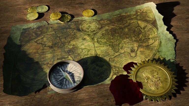
You’ve likely encountered maps that either prioritize cold scientific precision or artistic flair—but rarely both. The challenge of creating cartographic works that satisfy rigorous data standards while captivating viewers has puzzled mapmakers for centuries. Whether you’re a data visualization professional or simply fascinated by the intersection of science and art, finding this balance can transform how people connect with geographic information.
Disclosure: As an Amazon Associate, this site earns from qualifying purchases. Thank you!
Understanding the Foundation: Scientific Accuracy in Cartographic Design
Achieve a flawless, even complexion with e.l.f. Flawless Satin Foundation. This lightweight, vegan formula provides medium coverage and a semi-matte finish for all-day wear, while hydrating your skin with glycerin.

You’ll build stronger artistic maps when you establish solid technical foundations first. Scientific accuracy forms the bedrock that supports creative cartographic expression.
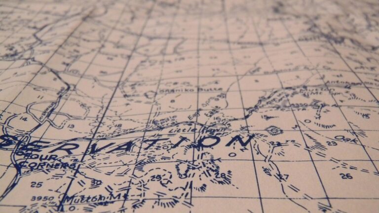
Essential Geographic Principles
Coordinate systems anchor your artistic vision to real-world locations. You must select appropriate datum references like WGS84 or NAD83 based on your mapping region. Spatial relationships between features need mathematical precision – a 10-degree angle error makes artistic liberties look like cartographic mistakes. Your creative choices work best when they enhance rather than compromise fundamental geographic relationships. Standard reference frameworks like State Plane or UTM coordinates provide the structural integrity your artistic maps require.
P.S. check out Udemy’s GIS, Mapping & Remote Sensing courses on sale here…
Data Integrity Requirements
Source verification protects your artistic credibility through technical rigor. You’ll need authoritative datasets from agencies like USGS, Census Bureau, or OpenStreetMap contributors with documented accuracy standards. Metadata documentation becomes crucial – recording data collection dates, coordinate precision, and attribute completeness prevents artistic interpretation from masking data flaws. Your quality control should include topology checks, attribute validation, and geometric accuracy assessments. Clean datasets enable confident artistic choices without sacrificing cartographic integrity.
Scale and Projection Considerations
Map projection selection directly impacts your artistic design possibilities. You must match projection properties to your creative goals – Mercator preserves angles for navigation themes while Albers Equal Area maintains accurate regional comparisons. Scale relationships determine which geographic details you can stylize without losing meaning. Your artistic simplification should follow established generalization principles like Douglas-Peucker algorithms for line smoothing. Understanding projection distortion patterns helps you place artistic emphasis where geographic accuracy remains strongest.
Embracing Creative Freedom: Artistic Expression in Map Making
Your artistic vision can flourish within the framework of solid geographic principles. Creative expression enhances map communication by making complex spatial data more accessible and memorable for diverse audiences.
Visual Storytelling Elements
Symbolization creates emotional connections through purposeful icon selection and feature representation. You’ll establish narrative flow using hierarchical visual elements like arrows indicating movement patterns or graduated symbols showing temporal changes. Consider incorporating illustrated landmarks alongside traditional cartographic symbols to build geographic context. Effective visual storytelling balances informative content with engaging graphics that guide readers through your spatial narrative.
Color Theory and Aesthetic Choices
Color palettes must serve both scientific accuracy and visual appeal through careful selection of hues that maintain data integrity. You’ll apply perceptually uniform color spaces like CIELAB to ensure consistent visual intervals between data classes. Monochromatic schemes work effectively for single-variable displays while diverging palettes highlight contrasts around meaningful breakpoints. Consider colorblind accessibility by testing your choices with simulation tools and avoiding problematic red-green combinations.
Stylistic Interpretation Techniques
Artistic rendering transforms standard cartographic elements through creative stylization while preserving spatial relationships. You’ll experiment with texture mapping to add visual interest to area features using patterns that complement your overall design aesthetic. Hand-drawn styling techniques can soften technical precision for public-facing maps. Balance artistic flourishes with functional requirements by maintaining clear figure-ground relationships and ensuring critical geographic information remains easily readable across different viewing contexts.
Prioritizing Key Information: Hierarchy of Scientific Data
Effective artistic maps require systematic data prioritization that maintains scientific integrity while supporting visual storytelling. You’ll need to establish clear information hierarchies that guide both technical accuracy and creative expression.
Critical Geographic Features
Identify essential geographic elements that form your map’s scientific foundation before adding artistic flourishes. Topographic features like elevation contours, water bodies, and political boundaries demand accurate positioning and mathematical precision. You should prioritize coastlines, major rivers, and elevation changes as primary elements since these features anchor spatial relationships and provide geographic context. Secondary features like vegetation zones, climate patterns, or cultural landmarks can receive artistic interpretation without compromising core geographic accuracy. This hierarchical approach ensures your artistic vision enhances rather than obscures fundamental spatial information.
Essential Measurement Standards
Maintain consistent measurement protocols throughout your artistic mapping process to preserve scientific credibility. Distance calculations, area measurements, and coordinate precision must follow established cartographic standards regardless of visual styling choices. You’ll need to verify scale accuracy across different map regions and ensure projection distortions don’t compromise measurement integrity. Use standardized units consistently and document any approximations or generalizations in your metadata. Tools like GDAL and PostGIS help maintain measurement accuracy while allowing creative freedom in visual presentation. Remember that artistic interpretation shouldn’t alter fundamental spatial relationships or quantitative data.
Core Navigation Elements
Establish reliable wayfinding components that support both scientific accuracy and artistic design goals. Grid systems, coordinate references, and directional indicators must remain functionally accurate even when stylized creatively. You should include north arrows, scale bars, and coordinate grids as foundational elements that can be artistically enhanced without losing functionality. Legend symbols and labeling hierarchies need clear visual distinction while maintaining aesthetic coherence with your artistic vision. Consider how artistic elements like custom fonts, decorative borders, or stylized symbols can complement rather than compete with essential navigation information for optimal user experience.
Incorporating Visual Metaphors: Creative Representation Methods
Visual metaphors transform scientific data into intuitive representations that resonate with your audience while maintaining geographic accuracy.
Symbolic Design Elements
Geometric symbols replace traditional markers with culturally meaningful shapes that reflect local geography. Mountain peaks become triangular forms scaled to actual elevation data, while water bodies adopt flowing organic curves based on bathymetric measurements. Icon systems incorporate recognizable imagery—trees for forests, wheat stalks for agricultural zones—ensuring each symbol maintains proportional accuracy to the underlying spatial data. Abstract patterns represent complex phenomena like climate zones or population density through artistic textures that preserve statistical relationships between data points.
Thematic Illustration Approaches
Narrative visualization weaves geographic features into cohesive visual stories while respecting topographic constraints. Historical trade routes become illustrated pathways showing authentic geographic challenges merchants faced, with artistic embellishments highlighting key waypoints verified through archaeological data. Artistic rendering techniques transform elevation models into painterly landscapes that maintain accurate slope calculations and drainage patterns. Conceptual mapping represents abstract geographic concepts—migration patterns, economic flows, or cultural boundaries—through artistic interpretations grounded in quantitative research and spatial analysis.
Cultural Context Integration
Regional artistic traditions inform your visual choices while adhering to cartographic standards. Japanese-inspired minimalist aesthetics enhance topographic clarity, while Aboriginal dot painting techniques represent sacred site locations with documented geographic coordinates. Historical design elements incorporate period-appropriate artistic styles for temporal maps, ensuring architectural representations match archaeological evidence and settlement patterns align with historical records. Local symbolism connects communities to their geography through culturally significant imagery—totems, traditional patterns, or indigenous mapping conventions—validated through ethnographic research and community consultation.
Utilizing Color Psychology: Balancing Beauty with Functionality
Color choices in cartographic design directly impact both data interpretation and viewer engagement. Strategic color application enhances scientific communication while creating visually compelling maps that draw audiences into geographic narratives.
Scientific Color Standards
Standardized color schemes ensure consistent data interpretation across professional mapping applications. You’ll find that ColorBrewer palettes provide mathematically proven color combinations for quantitative data visualization. Sequential schemes like Blues or Reds work best for continuous data ranges, while diverging palettes such as RdYlBu effectively highlight deviations from central values. Qualitative schemes using distinct hues help differentiate categorical data without implying hierarchical relationships. These scientifically tested combinations maintain perceptual uniformity and statistical validity in your cartographic work.
Emotional Impact of Color Choices
Color psychology influences how viewers interpret and remember geographic information presented in your maps. Warm colors like reds and oranges naturally draw attention to critical features while suggesting urgency or importance in thematic data. Cool blues and greens create calming associations with water bodies and vegetation while conveying stability in demographic visualizations. Earth tones including browns and tans establish natural connections with topographic features and historical themes. You can leverage these psychological responses to guide viewer attention toward key spatial relationships while maintaining scientific objectivity in data presentation.
Accessibility and Readability Factors
Universal design principles ensure your color choices remain functional for all viewers regardless of visual capabilities. Approximately 8% of men and 0.5% of women experience color vision deficiencies that affect red-green discrimination. You should test your maps using ColorBrewer’s colorblind-safe options or simulation tools like Coblis to verify accessibility. High contrast ratios between background and foreground elements improve readability across different viewing conditions and print media. Pattern fills and texture overlays provide additional visual cues that complement color coding for enhanced data comprehension.
Implementing Modern Technology: Digital Tools for Enhanced Accuracy
Modern mapping software transforms how you’ll balance scientific precision with artistic expression. Digital tools provide unprecedented control over data accuracy while expanding creative possibilities through advanced visualization capabilities.
GIS Integration Techniques
GIS platforms like QGIS and ArcGIS Pro enable precise spatial analysis while supporting artistic cartographic output. You’ll maintain coordinate system accuracy through built-in projection tools that automatically handle datum transformations. Layer management systems let you separate scientific data from artistic elements, ensuring base geographic information remains mathematically correct. Vector styling engines provide advanced symbolization options that preserve underlying spatial relationships. Database connectivity features allow real-time validation against authoritative datasets like USGS topographic files and Census Bureau boundaries, maintaining scientific integrity throughout your creative process.
Interactive Design Elements
Interactive mapping libraries such as Leaflet and D3.js offer dynamic visualization while preserving geographic accuracy. You’ll implement zoom-dependent styling that reveals appropriate detail levels without compromising spatial precision. Tooltip functionality displays exact coordinate values and metadata alongside artistic visual elements. Layer toggle controls let users switch between scientific base layers and artistic interpretations. Animation features can illustrate temporal geographic changes while maintaining accurate spatial-temporal relationships. Web-based deployment ensures your artistic maps remain accessible across devices while preserving projection accuracy through proper coordinate system handling.
Real-Time Data Visualization
APIs from sources like NOAA and USGS enable live data integration that maintains both currency and cartographic standards. You’ll connect to streaming datasets for weather patterns, seismic activity, and environmental monitoring while applying consistent artistic styling. Automated data validation routines check incoming information against established quality thresholds before visualization. Time-series animation capabilities display temporal changes in geographic phenomena while preserving accurate spatial relationships. Dashboard frameworks combine multiple real-time feeds into cohesive artistic presentations that highlight important patterns without sacrificing data integrity or overwhelming users with excessive information density.
Testing and Refinement: Validation Through User Feedback
You’ll need systematic feedback collection to validate your artistic mapping decisions against scientific accuracy requirements. Professional validation ensures your creative choices support rather than compromise geographic integrity.
Scientific Community Review
Submit your maps to subject matter experts who can evaluate technical accuracy within your specific domain. Geologists, climatologists, and oceanographers possess specialized knowledge that validates your artistic interpretations of complex scientific data. Request detailed feedback on coordinate precision, data representation methods, and adherence to disciplinary standards. Document their suggestions systematically, prioritizing corrections that affect spatial accuracy before addressing aesthetic preferences. Professional peer review through cartographic societies and academic institutions provides credible validation that strengthens both your technical foundation and artistic credibility.
Artistic Peer Assessment
Engage fellow designers and visual artists to evaluate your map’s aesthetic effectiveness and communication clarity. Creative professionals can identify visual hierarchy issues, color balance problems, and stylistic inconsistencies that scientific reviewers might overlook. Organize structured critique sessions focusing on visual storytelling, symbolization effectiveness, and overall design coherence. Request specific feedback on how artistic elements enhance or detract from data comprehension. Art directors and graphic designers bring valuable perspectives on visual communication that complement your cartographic expertise, helping refine artistic choices while maintaining geographic precision.
End-User Experience Testing
Conduct usability testing with your target audience to measure map effectiveness in real-world applications. Deploy A/B testing comparing different artistic treatments of identical geographic data to identify which approaches improve user comprehension. Monitor user interaction patterns, noting where viewers focus attention and encounter navigation difficulties. Collect quantitative metrics on task completion rates and qualitative feedback on visual appeal and information clarity. Test across diverse user groups including domain experts, general public, and stakeholders with varying technical backgrounds to ensure your artistic scientific maps serve their intended communication purposes effectively.
Conclusion
Creating scientifically accurate artistic maps requires dedication to both technical precision and creative vision. You’ll find that establishing strong geographic foundations while embracing innovative visual storytelling techniques leads to maps that truly resonate with your audience.
The key lies in treating scientific accuracy as your creative framework rather than a limitation. When you prioritize data integrity and proper cartographic principles you’re actually creating more opportunities for meaningful artistic expression.
Your success depends on leveraging modern digital tools effectively while maintaining focus on user experience. Remember that the most impactful artistic maps are those that make complex geographic information both accessible and visually compelling.
The balance between science and art in mapmaking isn’t just achievable—it’s essential for creating maps that inform educate and inspire your viewers in today’s data-driven world.
Frequently Asked Questions
What is the main challenge in creating artistic scientific maps?
The primary challenge is balancing scientific accuracy with artistic appeal. Mapmakers must satisfy rigorous data standards while creating visually captivating designs. This requires maintaining geographic precision and coordinate system accuracy while incorporating creative elements that engage viewers and enhance the communication of spatial information.
Why is scientific accuracy important as the foundation for artistic maps?
Scientific accuracy serves as the bedrock for credible cartographic expression. Essential geographic principles like proper coordinate systems, mathematical precision in spatial relationships, and verified data sources ensure that artistic choices don’t compromise the map’s integrity. Without this foundation, creative elements lose their educational and practical value.
How do map projections and scale affect artistic design possibilities?
Map projection selection and scale considerations directly influence creative design options. Different projections offer varying distortion patterns that can be leveraged artistically, while scale determines the level of detail possible. These technical choices guide mapmakers in making informed creative decisions while preserving geographic accuracy and spatial relationships.
What role does color theory play in scientific mapmaking?
Color theory is crucial for maintaining both scientific accuracy and visual appeal. Strategic color application enhances data communication through standardized schemes like ColorBrewer palettes. Colors must consider accessibility for colorblind users, emotional impact through warm/cool psychology, and high contrast for readability while supporting the map’s scientific message.
How can visual metaphors be incorporated while maintaining accuracy?
Visual metaphors transform scientific data into intuitive representations through symbolic design elements and thematic illustrations. Cultural context can inform visual choices using regional artistic traditions, but all creative elements must respect topographic constraints, maintain proportional accuracy, and be validated through community consultation and ethnographic research.
What modern tools help balance scientific precision with artistic expression?
GIS platforms like QGIS and ArcGIS Pro enable precise spatial analysis while supporting artistic output. Interactive mapping libraries such as Leaflet and D3.js create dynamic visualizations maintaining geographic accuracy. Real-time data APIs from NOAA and USGS allow live data integration with consistent artistic styling and effective layer management.
How should mapmakers prioritize information for artistic scientific maps?
Systematic data prioritization involves establishing clear information hierarchies that guide both technical accuracy and creative expression. Critical geographic features like elevation contours and political boundaries must be accurately represented first. Consistent measurement standards and reliable navigation components should remain functionally accurate even when creatively stylized.
Why is user testing important for artistic scientific maps?
Testing validates artistic decisions against scientific accuracy requirements through professional expert review and end-user experience evaluation. This process ensures technical accuracy, enhances aesthetic effectiveness, and measures real-world communication success. User feedback helps refine the balance between artistic appeal and scientific functionality for optimal map performance.