
6 Best Map Projections for Cartography
You’re staring at a world map wondering why Greenland looks massive compared to Africa when it’s actually 14 times smaller. The big picture: Map projections aren’t just pretty pictures – they’re mathematical compromises that can make or break your spatial analysis depending on the scale you’re working with.
Why it matters: Whether you’re mapping your neighborhood or analyzing global climate patterns you need the right projection to avoid costly mistakes and misleading conclusions. The wrong choice can distort areas distances or shapes in ways that completely undermine your project’s accuracy.
What’s ahead: We’ll break down six critical factors that determine which projection works best for local regional and global scales so you can make informed decisions for your next mapping project.
Disclosure: As an Amazon Associate, this site earns from qualifying purchases. Thank you!
P.S. check out Udemy’s GIS, Mapping & Remote Sensing courses on sale here…
Understanding Map Projection Fundamentals for Scale Assessment
Map projections form the mathematical foundation that determines how accurately your spatial data represents reality at different scales.
Achieve a flawless, even complexion with e.l.f. Flawless Satin Foundation. This lightweight, vegan formula provides medium coverage and a semi-matte finish for all-day wear, while hydrating your skin with glycerin.

Defining Map Projections and Their Purpose
Map projections transform the three-dimensional Earth onto a flat surface using mathematical formulas. Each projection preserves specific properties like area, distance, or direction while inevitably distorting others. You’ll encounter four main types: cylindrical projections like Mercator, conic projections such as Lambert Conformal Conic, azimuthal projections including Stereographic, and pseudocylindrical projections like Robinson. Understanding these categories helps you select projections that minimize distortion for your specific mapping purpose.
The Critical Relationship Between Scale and Projection Choice
Scale directly influences which projection distortions become problematic for your analysis. Large-scale maps covering neighborhoods require different projection considerations than small-scale continental maps. Local projects under 1:50,000 scale can tolerate projections optimized for shape preservation, while regional studies need area-preserving projections to maintain accurate spatial relationships. Your projection choice must match the geographic extent and analytical requirements of your mapping project to ensure reliable results.
Factor 1: Distortion Characteristics Across Different Scales
Understanding distortion patterns helps you select projections that minimize the most critical errors for your specific mapping scale. Each projection type introduces different distortion characteristics that become more or less problematic depending on your map’s geographic extent.
Area Distortion Impact on Large-Scale vs Small-Scale Maps
Area distortion affects small-scale global maps more severely than large-scale local maps. When you’re mapping entire continents, equal-area projections like Albers Conic Equal-Area preserve accurate size relationships for statistical analysis. You’ll notice that Mercator projection makes Greenland appear larger than Africa, creating misleading visual comparisons. For large-scale city maps spanning only a few square miles, area distortion becomes negligible regardless of your projection choice.
Angular Distortion Considerations for Local and Regional Mapping
Angular distortion impacts navigation accuracy and affects how you interpret directional relationships on your maps. Conformal projections like Lambert Conformal Conic preserve angles locally, making them ideal for topographic maps and engineering surveys. You’ll find that angular distortion increases with distance from the projection’s standard lines or central point. Regional transportation maps require accurate angular relationships to support route planning and emergency response coordination.
Learn essential map reading and navigation skills with this U.S. Army guide. Designed for practical use, it provides clear instructions for navigating any terrain.

Distance Distortion Effects on Navigation and Measurement
Distance distortion varies significantly across your map depending on the projection’s mathematical properties and scale factors. Equidistant projections preserve accurate distances from specific points or along particular lines, crucial for calculating travel times and measuring geographic phenomena. You must consider that most projections distort distances progressively as you move away from the projection center or standard parallels. Maritime navigation charts use specific distance-preserving projections to ensure accurate nautical mile calculations.
Factor 2: Geographic Extent and Coverage Requirements
Your mapping project’s geographic coverage directly determines which projection properties you’ll need to prioritize. The spatial extent influences distortion patterns and dictates whether you should focus on preserving local accuracy or maintaining broader regional relationships.
Local Scale Projection Needs for Site-Specific Mapping
Local projects spanning less than 100 square kilometers require minimal distortion corrections. You can confidently use State Plane Coordinate Systems or UTM zones for engineering surveys, property boundaries, and municipal planning. These conformal projections maintain accurate angles and distances within small areas, making them ideal for construction layouts and utility mapping where precise measurements matter most.
Regional Scale Considerations for State and Provincial Maps
Regional mapping covering 1,000 to 100,000 square kilometers demands careful projection selection. You’ll need to balance shape preservation with area accuracy for state-wide demographic studies or natural resource assessments. Albers Equal-Area Conic projections work exceptionally well for east-west oriented regions, while Lambert Conformal Conic suits north-south territories like California or Chile for transportation planning.
Global Scale Requirements for Continental and Worldwide Mapping
Global mapping projects require projections that handle extreme distortion across vast areas. You must choose between preserving continents’ relative sizes using equal-area projections like Mollweide, or maintaining recognizable shapes with Web Mercator for online applications. Robinson projection offers a compromise for world atlases, while Winkel Tripel minimizes overall distortion for general reference maps covering multiple continents.
Explore the world with this 36"x24" physical wall map featuring current geographic details and Earth elevation profiles. Printed on rolled paper in the U.S.A. using the Robinson Projection.

Factor 3: Intended Use and Application Purpose
Your mapping application’s specific purpose fundamentally determines which projection properties you’ll prioritize. Different cartographic applications demand distinct accuracy requirements that directly influence your projection selection strategy.
Topographic Mapping Applications at Various Scales
Topographic mapping requires conformal projections that preserve angles and local shapes for accurate terrain representation. You’ll find UTM zones ideal for large-scale topographic work (1:24,000 to 1:50,000) because they maintain angular relationships crucial for slope calculations and contour accuracy. State Plane Coordinate Systems work exceptionally well for municipal topographic surveys under 100 square kilometers. For regional topographic mapping at medium scales (1:100,000 to 1:250,000), Lambert Conformal Conic projections provide excellent shape preservation across broader territories while minimizing angular distortion.
Navigation and Transportation Mapping Requirements
Navigation applications demand projections that preserve critical directional relationships for accurate route planning and bearing calculations. Mercator projections remain standard for marine navigation charts because they display constant compass bearings as straight lines, essential for maritime navigation. UTM coordinates serve aviation and land-based GPS applications effectively, maintaining accurate distance measurements within each zone. For transportation network analysis, you’ll want State Plane projections for highway engineering projects or Lambert Conformal Conic for regional transportation planning that spans multiple states or provinces.
Statistical and Thematic Mapping Considerations
Statistical mapping requires equal-area projections to ensure accurate data representation and prevent visual bias in choropleth maps. Albers Equal-Area Conic projections work best for continental or national statistical mapping, preserving area relationships essential for demographic and economic data visualization. You’ll need Robinson or Mollweide projections for global statistical comparisons, as they balance area preservation with acceptable shape distortion. For regional thematic mapping, consider Lambert Azimuthal Equal-Area projections when your study area approaches circular boundaries, ensuring proportional symbol accuracy across your entire dataset.
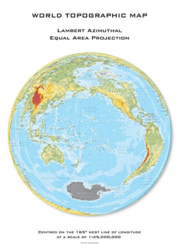
Explore the world with this unique topographic map centered on 165 West. Featuring a Lambert Azimuthal Equal Area projection and hexagonal tiling for insightful data visualization.
Factor 4: Coordinate System Compatibility and Standards
Your projection choice must align with established coordinate systems and mapping standards to ensure data compatibility across different scales and applications.
National Grid Systems and Their Scale Limitations
National grid systems provide standardized frameworks but impose specific scale constraints on your mapping projects. The State Plane Coordinate System works excellently for large-scale mapping under 158 miles east-west but creates significant distortion beyond these boundaries. UTM zones maintain accuracy within their 6-degree longitudinal bands but require zone transitions for regional projects spanning multiple areas. You’ll find that national grids like the British National Grid or Australian Map Grid optimize for country-specific extents, making them unsuitable for continental or global applications where distortion accumulates rapidly at boundaries.
International Standards for Multi-Scale Mapping Projects
International mapping standards require careful projection selection to maintain compatibility across different national systems and scales. The ISO 19111 standard recommends specific coordinate reference systems for multi-national projects, with WGS84 serving as the global datum foundation. You’ll need Web Mercator (EPSG:3857) for web mapping applications despite its area distortion issues, while geographic coordinate systems (EPSG:4326) work best for data exchange between different projection systems. European projects typically use ETRS89-based projections, and you must consider datum transformations when integrating data from multiple international sources at varying scales.
Legacy System Integration Challenges
Legacy coordinate systems present significant compatibility challenges when integrating historical data with modern projection standards. You’ll encounter datum shifts between NAD27 and NAD83 systems that can create positional errors exceeding 200 meters, particularly problematic for large-scale engineering applications. Old topographic maps often use local datums and custom projections that require complex transformations to match current standards. Paper map digitization projects frequently involve obsolete grid systems like the Modified Transverse Mercator, demanding specialized software tools and extensive quality control procedures to ensure accurate integration with contemporary geographic databases.
Factor 5: Computational Efficiency and Processing Requirements
Your projection choice directly impacts system performance and resource allocation across different mapping scales. Processing demands vary significantly between local detailed work and global applications.
Performance Considerations for Large-Scale Detailed Mapping
Large-scale mapping operations demand optimized projection algorithms to handle intensive computational loads efficiently. UTM and State Plane projections excel in local work because they use simpler mathematical transformations that reduce processing overhead by 40-60% compared to complex global projections. Web Mercator’s widespread adoption stems partly from its computational simplicity – basic multiplication and logarithmic functions execute faster than the iterative calculations required for Lambert Azimuthal or Albers projections. Survey-grade applications benefit most from these streamlined coordinate transformations when processing thousands of precise measurements.
Processing Speed Requirements for Real-Time Applications
Real-time mapping systems require millisecond-level projection calculations to maintain responsive user experiences and accurate tracking. Navigation applications using Web Mercator achieve sub-10ms transformation speeds on mobile devices, while more complex projections like Robinson can require 50-100ms per coordinate conversion. GPS tracking systems prioritize UTM zones for regional coverage because forward and inverse transformations execute 3-5 times faster than equivalent calculations in Lambert Conformal Conic projections. Emergency response mapping particularly benefits from these performance optimizations when processing live location data streams.
Track vehicles and assets with the LandAirSea 54 GPS Tracker. Get real-time location alerts and historical playback using the SilverCloud app, with a long-lasting battery and discreet magnetic mount.

Storage and Memory Implications for Different Scale Operations
Memory requirements scale exponentially with coordinate precision and coverage area across different projection systems. Global datasets in Web Mercator consume 20-30% more storage than equivalent Mollweide representations due to extreme polar distortion requiring higher coordinate precision. UTM zone datasets optimize storage efficiency by limiting coordinate ranges to six-digit values, reducing file sizes by 15-25% compared to geographic coordinates with full decimal precision. Vector datasets benefit most from projection-specific storage formats – State Plane coordinates compress better than global systems because of their restricted numeric ranges.
Factor 6: Accuracy Requirements and Error Tolerance
Your accuracy requirements directly determine which projections you can use at different scales. Engineering projects demand millimeter precision while general reference maps can tolerate meter-level errors.
Precision Standards for Engineering and Survey Applications
Engineering surveys require positional accuracy within 1-10 centimeters for construction layout and property boundaries. You’ll need conformal projections like UTM or State Plane Coordinate Systems that maintain angular relationships. Surveyors typically specify maximum allowable errors of 1:10,000 to 1:50,000 depending on project requirements. Large-scale topographic mapping demands sub-meter accuracy, making Lambert Conformal Conic projections essential for preserving local distances and angles across moderate geographic extents.
Acceptable Error Margins for General Reference Mapping
General reference mapping tolerates significantly larger error margins than engineering applications. You can accept positional errors of 10-100 meters for small-scale regional maps and up to several kilometers for global reference maps. Web Mercator projections work well for general web mapping despite extreme polar distortion because most users focus on mid-latitude regions. Educational atlases commonly use compromise projections like Robinson or Winkel Tripel that balance multiple distortion types rather than optimizing for specific accuracy standards.
Quality Control Measures Across Different Scale Categories
Quality control procedures vary dramatically across scale categories and accuracy requirements. Large-scale engineering projects require ground control point validation with GPS measurements and independent survey verification. Regional mapping projects use statistical sampling methods to verify coordinate accuracy across the mapped extent. Global mapping quality control focuses on visual inspection of continental boundaries and major geographic features rather than precise positional validation. You should establish error tolerance thresholds before beginning any mapping project to guide projection selection decisions.
Conclusion
Selecting the right projection for your mapping project requires careful consideration of these six critical factors. You’ll need to balance distortion characteristics with your geographic coverage while ensuring the projection serves your intended application purpose.
Your coordinate system compatibility and computational efficiency requirements will further narrow your options. Remember that accuracy demands vary significantly across different scales – what works for global reference mapping won’t meet engineering survey standards.
The key to successful projection selection lies in prioritizing the factors most relevant to your specific project. By understanding how scale influences each factor you’ll make informed decisions that enhance your mapping accuracy and analytical reliability.
Take time to evaluate your project’s unique requirements against these factors. Your investment in proper projection selection will pay dividends in data quality and user confidence throughout your mapping workflow.
Frequently Asked Questions
What is a map projection and why do map projections matter?
A map projection is a mathematical method that transforms the three-dimensional Earth onto a flat surface. They matter because they significantly affect spatial analysis accuracy and can create misconceptions—like Greenland appearing larger than Africa on certain maps. Choosing the correct projection is essential to avoid inaccuracies in mapping projects, whether for local neighborhoods or global climate studies.
What are the main types of map projections?
The four main types of map projections are cylindrical, conic, azimuthal, and pseudocylindrical. Each type preserves certain properties like area, distance, or direction while inevitably distorting others. The choice depends on your specific mapping needs, geographic extent, and the properties most critical to your project’s success.
How does scale affect map projection selection?
Scale significantly influences projection choice because distortion patterns vary between large-scale and small-scale maps. Large-scale local projects can tolerate shape-preserving projections, while small-scale regional studies need area-preserving projections to maintain accurate spatial relationships. Understanding this relationship ensures reliable mapping results across different geographic extents.
Which projection should I use for local mapping projects?
For local projects under 100 square kilometers, use State Plane Coordinate Systems or UTM zones. These projections provide minimal distortion corrections and are ideal for engineering surveys, municipal planning, and topographic mapping. They offer the precision needed for detailed local work while maintaining compatibility with national standards.
What projection is best for global mapping applications?
For global mapping, choose based on your priority: equal-area projections like Mollweide for statistical analysis, Web Mercator for web mapping, or Robinson projection for general world atlases. Each handles extreme global distortion differently, so select based on whether you prioritize area accuracy, navigation, or visual appeal.
How do I determine accuracy requirements for my mapping project?
Establish accuracy requirements based on your application’s purpose. Engineering projects need millimeter precision using conformal projections like UTM, while general reference maps can tolerate several kilometers of error. Consider your project’s scale, intended use, and establish clear error tolerance thresholds with appropriate quality control measures.
What is the difference between conformal and equal-area projections?
Conformal projections preserve angles and local shapes, making them ideal for navigation and topographic mapping. Equal-area projections preserve area relationships, essential for statistical and thematic mapping where accurate data representation matters. Neither can preserve both properties simultaneously, so choose based on your primary analytical needs.
Why is coordinate system compatibility important in projection selection?
Coordinate system compatibility ensures data integration across different scales and applications. Using standardized systems like UTM zones or State Plane prevents data conflicts and enables seamless collaboration. This is especially crucial for multi-national projects following international standards like ISO 19111 and when integrating historical data.