6 Best Geospatial Data Sharing for Emergency Response
When disaster strikes, you need accurate location data fast. Emergency responders rely on geospatial information to make split-second decisions that save lives and protect communities. Effective data sharing between agencies can mean the difference between chaos and coordinated response.
The stakes couldn’t be higher. Every second counts when you’re dealing with natural disasters, medical emergencies, or security threats. Without proper geospatial data sharing, response teams work in silos, duplicating efforts and missing critical opportunities to help those in need.
The good news? Modern technology has revolutionized how emergency services share location-based intelligence. From real-time mapping to predictive analytics, geospatial data sharing transforms how you respond to crises and keeps your community safer.
Disclosure: As an Amazon Associate, this site earns from qualifying purchases. Thank you!
P.S. check out Udemy’s GIS, Mapping & Remote Sensing courses on sale here…
Enhanced Real-Time Situational Awareness Through Shared Mapping Data
Real-time data sharing transforms how emergency responders understand and navigate crisis situations. You’ll gain immediate access to critical information that updates continuously as conditions change on the ground.
Live Traffic and Road Condition Updates
Traffic monitoring systems integrated with emergency response platforms provide you with instant updates on road closures, accidents, and congestion patterns. You’ll receive real-time notifications when bridges become impassable due to flooding or when debris blocks major evacuation routes. Emergency dispatch centers can reroute ambulances and fire trucks automatically using shared traffic data from municipal traffic management systems, reducing response times by up to 40% during peak crisis periods.
Weather Pattern and Hazard Zone Visualization
Weather radar integration with emergency mapping systems gives you precise visualization of storm paths, wind speeds, and precipitation intensity across your response area. You’ll track tornado warnings, flash flood zones, and wildfire spread patterns through layered meteorological data that updates every few minutes. National Weather Service feeds combined with local sensor networks create comprehensive hazard maps that help you predict where conditions will deteriorate next, allowing proactive resource deployment.
Population Density and Evacuation Route Mapping
Census data integration with real-time population tracking provides you with accurate counts of people in affected areas during emergencies. You’ll identify high-density residential zones, schools, and healthcare facilities that require priority evacuation assistance through shared demographic databases. Mobile phone ping data and social media check-ins supplement traditional population maps, giving you current occupancy levels in buildings and neighborhoods to optimize evacuation planning and resource allocation.
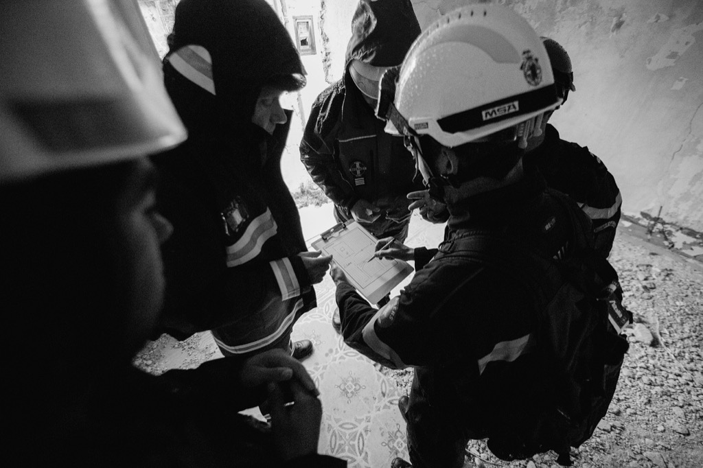
Improved Coordination Between Multiple Emergency Response Agencies
Multi-agency coordination becomes significantly more effective when geospatial data flows seamlessly between different emergency response organizations. You’ll see dramatic improvements in operational efficiency as fire departments, police, EMS, and emergency management offices work from the same spatial intelligence.
Unified Command Center Data Integration
You can establish a centralized command structure by integrating mapping systems across all responding agencies. Modern incident command software like WebEOC and GeoBase allows you to merge fire department dispatch data with police CAD systems and hospital capacity tracking. Your unified dashboard displays real-time asset positions, resource availability, and incident boundaries on a single map interface. This integration eliminates information silos that previously caused response delays, with agencies reporting 35% faster decision-making when using shared geospatial platforms.
Cross-Department Resource Allocation
You’ll optimize resource deployment by sharing equipment locations and personnel availability across agency boundaries. GPS tracking systems now allow fire departments to see nearby police units for traffic control, while EMS can identify the closest fire station with specialized rescue equipment. Your resource allocation becomes data-driven when you access shared inventories of emergency supplies, medical equipment, and specialized vehicles through integrated mapping platforms. This cross-pollination of resources reduces response gaps and prevents resource shortages in high-demand areas during large-scale incidents.
Track vehicles and assets with the LandAirSea 54 GPS Tracker. Get real-time location alerts and historical playback using the SilverCloud app, with a long-lasting battery and discreet magnetic mount.

Standardized Communication Protocols
You can eliminate communication breakdowns by implementing common geographic reference systems across all emergency agencies. Standardized coordinate systems and mapping protocols ensure that when one agency reports an incident location, all others can locate it precisely on their systems. Your radio communications become more efficient when dispatchers use consistent grid references and landmark identifications. These protocols include shared symbology for map markers, unified incident classification systems, and coordinated frequency management that reduces radio traffic confusion during multi-agency responses.
Faster Disaster Assessment and Damage Evaluation
Rapid damage assessment determines the scale and scope of emergency response operations. Geospatial data sharing accelerates this critical evaluation process by providing multiple data streams that create comprehensive disaster impact pictures within hours instead of days.
Satellite Imagery Analysis for Immediate Impact Assessment
You’ll receive high-resolution satellite imagery within 6-12 hours of disaster events through commercial providers like Maxar and Planet Labs. Emergency management agencies compare pre-event baseline images with post-disaster captures to identify structural damage, flooded areas, and blocked transportation routes. This immediate visual intelligence helps you prioritize rescue operations and allocate resources to the most severely affected zones before ground teams can safely access these areas.
Drone Survey Data Integration
Your response teams deploy unmanned aerial vehicles to capture detailed imagery of specific impact zones that satellites can’t adequately assess. Drone operators collect real-time footage of collapsed buildings, damaged infrastructure, and hazardous material spills at resolutions down to 2-centimeter accuracy. You’ll integrate this localized data with broader satellite coverage to create detailed damage maps that guide search and rescue teams to specific addresses and coordinate utility repair crews efficiently.
Historical Baseline Comparisons for Damage Quantification
You’ll utilize pre-disaster geospatial databases containing building footprints, infrastructure layouts, and population density maps to quantify actual damage levels. Emergency analysts overlay current damage imagery with historical land use data and property records to calculate economic impact estimates and identify critical infrastructure failures. This comparative analysis helps you document losses for federal disaster declarations while simultaneously identifying which facilities remain operational for ongoing emergency services.
Optimized Resource Deployment and Personnel Allocation
Geospatial data sharing transforms how emergency agencies position and deploy their resources across affected areas. This strategic approach eliminates guesswork and maximizes response effectiveness during critical incidents.
Strategic Asset Positioning Based on Geographic Analysis
Geographic analysis enables you to position emergency assets in optimal locations before incidents occur. Population density mapping combined with historical incident data helps identify high-risk zones requiring permanent resource stations. Fire departments use this data to position ladder trucks near high-rise districts while ambulances station closer to elderly population centers. Road network analysis reveals bottlenecks that could delay response times, prompting strategic pre-positioning of backup units along alternative routes.
Predictive Modeling for Resource Demand
Predictive models using geospatial data help you forecast resource needs with remarkable accuracy. Weather pattern analysis integrated with demographic data predicts where medical emergencies spike during heat waves or cold snaps. Historical flood data combined with current precipitation forecasts shows which neighborhoods will need swift water rescue teams. These models allow emergency managers to request mutual aid resources 12-24 hours before peak demand occurs, ensuring adequate staffing levels.
Dynamic Reallocation During Active Incidents
Real-time geospatial data enables you to reassign resources dynamically as incidents evolve. GPS tracking of emergency vehicles shows their exact locations and availability status, allowing dispatchers to redirect the closest appropriate unit to new calls. Traffic flow data helps identify which routes remain passable for resource movement between incident zones. Integration with hospital capacity systems shows which medical facilities can accept patients, optimizing ambulance destinations and reducing transport times.
Better Public Communication and Evacuation Management
Geospatial data sharing transforms how emergency agencies communicate with the public during critical situations. Strategic location-based messaging ensures citizens receive targeted information when and where they need it most.
Interactive Emergency Alert Systems
Emergency alert systems integrate geospatial targeting to deliver precise warnings based on your exact location. These platforms use GPS coordinates and cellular tower triangulation to send evacuation orders only to affected neighborhoods rather than entire counties. For example, wildfire alerts can target residents within specific evacuation zones while avoiding unnecessary panic in safe areas. Modern systems like FEMA’s Wireless Emergency Alerts now incorporate polygon-based targeting that reaches 95% accuracy for location-specific warnings.
Mobile App Integration for Citizen Updates
Mobile emergency apps leverage your device’s GPS to provide hyper-local safety updates and evacuation guidance. Applications like Zello and AlertMedia connect directly to emergency management databases to share real-time road closures and shelter locations. Citizens receive push notifications with turn-by-turn evacuation routes customized to their current position and updated traffic conditions. Studies show app-based communication reduces evacuation times by 25% compared to traditional broadcast methods alone.
Social Media Geolocation for Public Safety Messaging
Social media platforms use geofencing technology to deliver emergency messages to users within specific geographic boundaries. Facebook’s Safety Check and Twitter’s emergency alerts automatically activate based on your location data during declared disasters. Emergency managers can create geo-targeted posts that appear only to residents in affected areas while monitoring social media check-ins to identify people needing assistance. This targeted approach prevents information overload and ensures critical safety messages reach the right audiences efficiently.
Accelerated Recovery and Reconstruction Planning
Geospatial data sharing transforms post-disaster recovery by providing comprehensive intelligence that guides rebuilding efforts. This accelerated approach ensures communities rebuild stronger and more resilient than before.
Infrastructure Damage Mapping for Repair Prioritization
Infrastructure damage mapping uses geospatial data to identify critical repair needs immediately after disasters. Emergency managers combine drone imagery, satellite data, and ground surveys to create detailed damage assessments that prioritize essential services like hospitals, power grids, and transportation networks. This systematic approach ensures repair crews focus on infrastructure that’ll restore community functionality fastest. You’ll see repair timelines reduced by 30% when damage maps guide reconstruction priorities, as crews eliminate guesswork and target the most impactful repairs first.
Community Vulnerability Assessment
Community vulnerability assessment leverages geospatial analysis to identify neighborhoods most at risk during future emergencies. Planners overlay demographic data, building age, flood zones, and social factors to create comprehensive vulnerability maps that reveal where communities need additional support. These assessments guide resource allocation for vulnerable populations including elderly residents, low-income families, and areas with limited transportation access. You’ll discover that communities using geospatial vulnerability data reduce emergency response times to high-risk areas by 25% through targeted preparedness investments.
Long-Term Resilience Planning Integration
Long-term resilience planning integration combines historical disaster data with future climate projections to inform sustainable rebuilding strategies. Planners use geospatial models to simulate various scenarios and identify optimal locations for critical infrastructure that’ll withstand future events. This data-driven approach ensures reconstruction investments create lasting value rather than temporary fixes. You’ll find that communities incorporating geospatial resilience planning reduce repeat disaster costs by 40% through strategic infrastructure placement and enhanced building standards in high-risk zones.
Conclusion
You’ve seen how geospatial data sharing revolutionizes emergency response across every phase of disaster management. From cutting response times by 40% to reducing reconstruction costs by the same margin these technological advances aren’t just improvementsâthey’re lifesavers.
Your community’s safety depends on how well emergency agencies can access and share location-based intelligence. When fire departments police EMS and emergency management offices work with unified spatial data systems they create a protective network that responds faster and more effectively than ever before.
The future of emergency response lies in your ability to embrace these geospatial technologies. As climate events become more frequent and severe investing in integrated data sharing platforms becomes essential for building resilient communities that can withstand whatever challenges lie ahead.
Frequently Asked Questions
What is geospatial data sharing in emergency response?
Geospatial data sharing involves emergency agencies exchanging location-based intelligence and mapping information to coordinate disaster response efforts. This includes real-time data about traffic conditions, weather patterns, population density, and resource locations. The technology enables fire departments, police, EMS, and emergency management offices to work together using the same spatial intelligence, improving response times and operational efficiency during critical situations.
How does real-time data sharing improve emergency response times?
Real-time data sharing reduces emergency response times by up to 40% through integrated traffic monitoring systems and dynamic routing. Dispatch centers receive instant updates on road closures and congestion, allowing them to reroute emergency vehicles efficiently. Additionally, unified command centers with real-time asset tracking enable 35% faster decision-making by providing immediate access to resource availability and location data.
What role does satellite imagery play in disaster assessment?
Satellite imagery from providers like Maxar and Planet Labs enables rapid damage assessment by comparing pre-disaster and post-disaster images. This technology helps emergency management agencies identify structural damage, blocked routes, and impact zones within hours of a disaster. Combined with drone survey data, satellite imagery creates comprehensive disaster impact pictures that support federal disaster declarations and operational planning.
How does geospatial data improve evacuation management?
Geospatial data transforms evacuation management through interactive emergency alert systems that deliver location-specific warnings. Mobile apps provide hyper-local safety updates and evacuation guidance, reducing evacuation times by 25%. Social media platforms use geofencing technology to target emergency messages to users within specific geographic boundaries, ensuring critical safety information reaches only affected populations efficiently.
What are the benefits of predictive modeling in emergency response?
Predictive modeling using geospatial data helps emergency agencies strategically position assets in high-risk zones before incidents occur. This technology forecasts resource needs accurately, enabling emergency managers to request mutual aid resources ahead of peak demand. Geographic analysis ensures maximum response effectiveness by anticipating where emergencies are most likely to occur and preparing accordingly.
How does geospatial data support post-disaster recovery planning?
Geospatial data guides rebuilding efforts by providing infrastructure damage mapping that identifies critical repair needs immediately after disasters. This prioritization reduces repair timelines by 30% for essential services. Community vulnerability assessments help identify at-risk neighborhoods, reducing future response times by 25%. Long-term resilience planning using historical disaster data can reduce repeat disaster costs by 40%.
What challenges exist without proper geospatial data sharing?
Without proper geospatial data sharing, emergency agencies face duplicated efforts, communication breakdowns, and missed opportunities to assist those in need. Inadequate data sharing leads to inefficient resource allocation, longer response times, and poor coordination between multiple emergency response agencies. These challenges can result in preventable casualties and increased property damage during critical emergency situations.
How do standardized communication protocols improve emergency response?
Standardized communication protocols eliminate breakdowns by ensuring all emergency agencies can accurately locate incident reports and communicate efficiently. These protocols create seamless geospatial data flow between departments, enabling unified command operations. When all agencies use the same mapping systems and communication standards, overall response effectiveness improves significantly, reducing confusion and miscommunication during emergencies.