6 Best Drone Camera Types for Aerial Mapping
Choosing the right drone camera for mapping projects can make or break your aerial surveying success. You’re facing dozens of camera options with different sensors, resolutions and price points that promise professional-grade mapping results.
The key lies in matching your camera type to your specific mapping needs – whether you’re creating topographic surveys, monitoring construction sites or conducting agricultural assessments. From RGB cameras for basic orthomosaics to multispectral sensors for precision agriculture, each camera type serves distinct mapping purposes with varying levels of accuracy and data output.
Explore multispectral image sensors using metasurfaces. This book delves into advancements in optical science and photonics.

Disclosure: As an Amazon Associate, this site earns from qualifying purchases. Thank you!
RGB Cameras: The Foundation of Aerial Mapping
Achieve a flawless, even complexion with e.l.f. Flawless Satin Foundation. This lightweight, vegan formula provides medium coverage and a semi-matte finish for all-day wear, while hydrating your skin with glycerin.

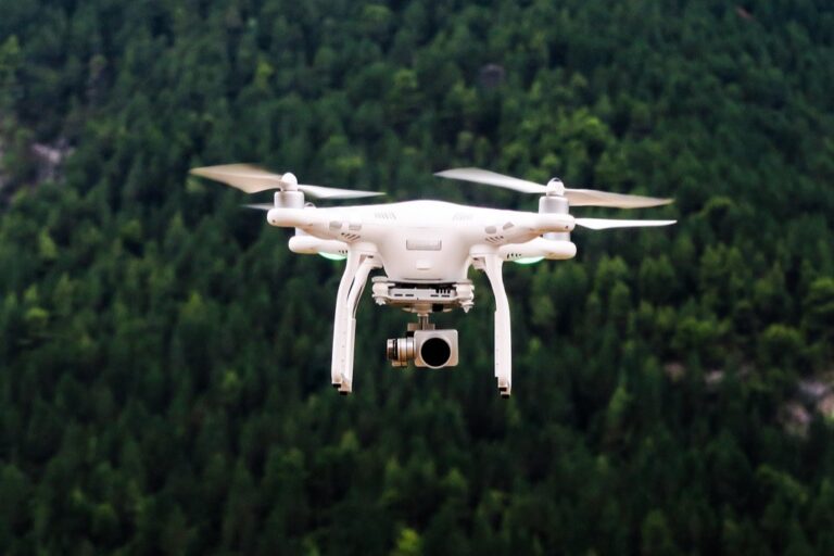
RGB cameras serve as the cornerstone technology for most aerial mapping operations, providing the visual spectrum data that forms the basis of orthomosaics and digital elevation models. You’ll find these cameras deliver the most straightforward path to creating accurate maps for surveying, construction monitoring, and basic photogrammetry projects.
P.S. check out Udemy’s GIS, Mapping & Remote Sensing courses on sale here…
High-Resolution Image Capture Capabilities
Modern RGB cameras capture images at resolutions exceeding 20 megapixels, with professional models like the DJI P4 RTK reaching 20MP and the senseFly eBee X achieving 24MP output. You’ll achieve ground sampling distances as fine as 1-2 centimeters per pixel when flying at appropriate altitudes. Higher resolution sensors enable you to extract detailed measurements from captured imagery, supporting precise volumetric calculations and feature identification across your mapping area.
Safely transport your DJI drone and accessories with this water-resistant backpack. It securely holds your controller, up to five batteries, a charger, and a 15" laptop, and can be used as a shoulder bag or backpack.
Cost-Effective Solution for Basic Mapping Needs
RGB cameras offer the most affordable entry point into professional drone mapping, with complete systems starting around $2,000 compared to $15,000+ for multispectral alternatives. You’ll cover standard surveying requirements including topographic mapping, progress monitoring, and stockpile measurements without specialized sensor investments. Budget-conscious operations benefit from RGB cameras’ ability to generate accurate orthomosaics and 3D models that meet most commercial mapping specifications while maintaining reasonable equipment costs.
Wide Compatibility with Mapping Software
RGB imagery integrates seamlessly with popular photogrammetry platforms including Pix4D, Agisoft Metashape, and DroneDeploy without requiring specialized processing workflows. You’ll process standard JPEG or RAW files through established pipelines that most mapping professionals already understand. Compatible software options range from cloud-based solutions like DroneDeploy to desktop applications like Metashape, giving you flexibility to choose processing methods that match your technical requirements and budget constraints.
Multispectral Cameras: Advanced Vegetation and Crop Analysis
Capture precise crop health data with the MicaSense RedEdge. This multispectral camera provides calibrated reflectance and five narrow bands for advanced agricultural analysis.

Multispectral cameras elevate your mapping capabilities beyond standard RGB imagery by capturing data across multiple electromagnetic spectrum bands. These specialized sensors unlock detailed agricultural insights that traditional cameras simply cannot provide.
Multiple Band Spectrum Analysis
Multispectral sensors capture data across 4-12 distinct spectral bands, typically including red-edge, near-infrared, and visible light wavelengths. You’ll access wavelengths between 400-1000 nanometers that reveal hidden plant characteristics invisible to standard cameras. Popular systems like the MicaSense RedEdge-MX capture five bands simultaneously, enabling precise spectral analysis. These multiple bands allow you to calculate vegetation indices like NDVI, GNDVI, and NDRE for comprehensive crop assessment. Each band provides unique information about plant health, stress levels, and photosynthetic activity that’s crucial for precision agriculture applications.
Precision Agriculture Applications
You’ll achieve field-level crop monitoring with centimeter-accurate spatial resolution using multispectral mapping systems. Variable rate application maps help optimize fertilizer, pesticide, and irrigation distribution based on actual plant needs across different field zones. Yield prediction models become significantly more accurate when incorporating multispectral data from multiple growing seasons. Disease detection capabilities allow early identification of crop stress before visible symptoms appear, potentially saving entire harvests. Integration with farm management software enables automated prescription mapping for modern precision agriculture equipment, streamlining your entire workflow from data collection to field application.
Vegetation Health Monitoring Features
Chlorophyll content analysis through specialized vegetation indices reveals plant stress levels weeks before visual symptoms become apparent. You’ll detect water stress, nutrient deficiencies, and disease pressure using normalized difference calculations across specific spectral bands. Temperature mapping capabilities in thermal-enabled multispectral systems identify irrigation inefficiencies and heat stress patterns. Biomass estimation algorithms provide accurate crop density measurements for yield forecasting and growth stage monitoring. Time-series analysis comparing multispectral data across multiple flights reveals seasonal growth patterns and helps optimize harvest timing for maximum crop quality and yield.
Hyperspectral Cameras: Ultra-Precise Material Identification
Hyperspectral cameras represent the pinnacle of spectral imaging technology for drone mapping applications. You’ll find these advanced sensors capture data across hundreds of narrow spectral bands, enabling material identification and analysis impossible with traditional RGB or multispectral systems.
Hundreds of Spectral Bands for Detailed Analysis
Hyperspectral sensors capture data across 100-400+ distinct spectral bands with bandwidths as narrow as 2-10 nanometers. You can identify specific materials by their unique spectral signatures, enabling precise mineral classification and chemical composition analysis. These systems generate massive datasets exceeding 1GB per flight, requiring specialized processing software like ENVI or SpecTIR. You’ll achieve material identification accuracy rates above 95% when properly calibrated.
Mining and Geological Survey Applications
Mining operations benefit from hyperspectral mapping’s ability to identify ore deposits and mineral compositions from aerial surveys. You can map alteration zones, distinguish between similar-looking minerals, and detect hydrothermal signatures indicating potential resource locations. These cameras excel at identifying clay minerals, carbonates, and sulfates across large survey areas. You’ll reduce ground-truthing requirements by 60-80% while maintaining geological accuracy standards for resource exploration and environmental compliance assessments.
Environmental Monitoring Capabilities
Environmental scientists use hyperspectral drones to detect pollution sources, monitor water quality, and assess ecosystem health with unprecedented precision. You can identify invasive plant species, track algal blooms in water bodies, and measure soil contamination levels through spectral analysis. These systems detect subtle environmental changes invisible to conventional sensors, including early stress indicators in vegetation and chemical pollutants in soil. You’ll achieve detection thresholds below 1 ppm for certain contaminants.
Thermal Infrared Cameras: Heat Signature Mapping Excellence
Thermal infrared cameras detect heat signatures across landscapes, revealing temperature variations invisible to standard RGB sensors. These specialized thermal sensors capture thermal radiation patterns, enabling precise temperature mapping across diverse mapping applications.
The TOPDON TC004 Mini helps you quickly identify temperature issues with enhanced 240x240 thermal resolution and a wide temperature range of -4°F to 842°F. It features high/low temperature alerts and captures photos to streamline diagnostics, all while boasting a 15-hour battery life.

Temperature Variation Detection
Thermal sensors measure surface temperatures with accuracy ranges of ±2°C to ±5°C depending on sensor quality. You’ll capture thermal data across temperature ranges from -20°C to 150°C, identifying heat anomalies in infrastructure, vegetation stress patterns, and ground temperature variations. Professional thermal cameras like FLIR Vue Pro R provide radiometric data with 14-bit thermal resolution, enabling quantitative temperature analysis for mapping projects requiring precise thermal measurements.
Building Inspection and Energy Auditing
Building thermal mapping reveals energy inefficiencies through heat loss visualization across rooftops, walls, and structural components. You’ll identify insulation gaps, air leaks, and thermal bridges with thermal accuracy enabling energy audit documentation. Thermal drone surveys reduce inspection time by 60-80% compared to traditional methods while providing comprehensive thermal imagery covering entire building envelopes, supporting energy efficiency assessments and maintenance planning.
Search and Rescue Operations
Search operations benefit from thermal mapping’s ability to detect human heat signatures across varied terrain conditions. You’ll locate missing persons through thermal contrast detection, even in dense vegetation or challenging weather conditions. Thermal cameras detect human body heat signatures from altitudes up to 400 feet, providing search teams with rapid area coverage and reducing search times by identifying heat sources requiring ground team investigation.
LiDAR Sensors: Three-Dimensional Terrain Mapping
Get accurate 360° scanning up to 12 meters with the compact FHL-LD19 LiDAR sensor. Resistant to bright light and weighing under 50g, it offers easy integration with ROS/ROS2/C/C++ SDK for robots and drones.

LiDAR technology generates precise three-dimensional point clouds through laser pulse measurements, capturing terrain elevations with centimeter-level accuracy. You’ll achieve vertical accuracy of 2-5cm and horizontal accuracy of 3-5cm using professional drone LiDAR systems. LiDAR sensors like Velodyne Puck or Riegl VUX-1 emit thousands of laser pulses per second, penetrating vegetation canopy to capture ground surface data essential for topographical mapping applications.
Point Cloud Data Generation
Point cloud datasets from LiDAR contain millions of georeferenced elevation points, creating detailed 3D terrain models for mapping analysis. You’ll process point clouds containing 100-500 points per square meter, enabling high-resolution digital elevation models and surface analysis. Software like CloudCompare or Trimble RealWorks processes LiDAR point clouds into deliverable formats including DEMs, contour maps, and volumetric calculations supporting engineering and surveying workflows.
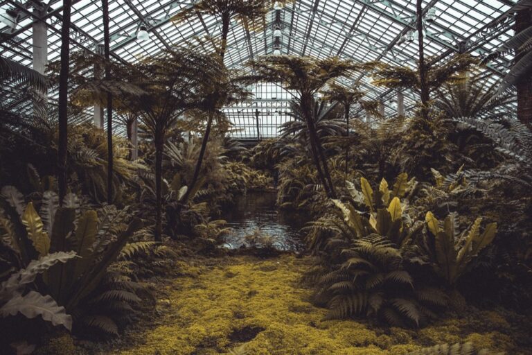
Forest Canopy and Elevation Mapping
Forest mapping utilizes LiDAR’s canopy penetration capabilities to measure both tree heights and underlying ground elevations simultaneously. You’ll capture canopy height models (CHM) and digital terrain models (DTM) in single flight missions, identifying individual tree crowns and forest structure metrics. LiDAR systems achieve 85-95% ground point classification accuracy beneath dense forest canopy, supporting forestry management and environmental monitoring applications.
High-Accuracy Topographical Surveys
Topographical surveys using LiDAR achieve survey-grade accuracy meeting ASPRS standards for large-scale mapping projects. You’ll generate contour maps, slope analysis, and elevation profiles with vertical accuracy sufficient for engineering design and construction planning. Professional LiDAR systems provide Class 1 accuracy supporting 1:1200 scale mapping requirements, reducing traditional ground survey needs while maintaining surveying precision standards for critical infrastructure projects.
Photogrammetry Cameras: Detailed 3D Model Creation
Photogrammetry cameras excel at capturing overlapping images that specialized software processes into detailed three-dimensional models. These high-resolution sensors create accurate digital representations of terrain, structures, and objects with millimeter-level precision.
Overlapping Image Processing
Photogrammetry cameras capture images with 80-90% forward overlap and 60-70% side overlap to ensure comprehensive coverage. You’ll need sufficient image overlap to generate accurate 3D point clouds and dense surface models. Processing software like Pix4D and Agisoft Metashape analyzes matching points between overlapping images to reconstruct precise three-dimensional geometry. Your flight planning software should automatically calculate optimal overlap percentages based on terrain complexity and desired accuracy levels.
Construction Site Monitoring
Construction monitoring benefits from photogrammetry’s ability to track progress and measure stockpile volumes with ±2-5cm accuracy. You can generate weekly or monthly comparisons showing excavation progress, material quantities, and infrastructure development. Photogrammetry cameras document construction phases for quality control and dispute resolution, creating permanent visual records linked to specific coordinates. Your construction clients receive accurate volume calculations for earthwork billing and progress reporting to stakeholders.
Archaeological Documentation
Archaeological sites require non-invasive documentation methods that photogrammetry cameras provide through detailed 3D modeling capabilities. You can capture artifact positions, excavation layers, and site topography without disturbing sensitive materials or structures. Photogrammetry creates permanent digital archives preserving archaeological context for future research and analysis. Your documentation workflow should include ground control points and scale references to ensure archaeological measurements meet professional standards and research requirements.
Conclusion
Your mapping success depends entirely on matching the right camera technology to your specific project requirements. Whether you’re conducting basic surveys with RGB cameras or performing complex environmental analysis with hyperspectral sensors each option serves distinct purposes that can make or break your results.
The key lies in understanding your accuracy needs budget constraints and data processing capabilities before making your selection. RGB cameras offer excellent value for standard mapping while specialized sensors like LiDAR and thermal cameras unlock advanced applications that traditional photography simply can’t achieve.
Remember that investing in the appropriate drone camera technology upfront will save you time money and frustration throughout your mapping projects. Choose wisely and your aerial surveys will deliver the precise actionable data you need to succeed.
Frequently Asked Questions
What type of drone camera is best for basic aerial mapping?
RGB cameras are ideal for basic aerial mapping projects. They capture high-resolution images (20+ megapixels) in the visual spectrum, making them perfect for surveying, construction monitoring, and basic photogrammetry. They’re cost-effective with complete systems starting around $2,000 and integrate seamlessly with popular photogrammetry software for straightforward processing.
How do multispectral cameras differ from RGB cameras?
Multispectral cameras capture data across 4-12 distinct spectral bands, including red-edge and near-infrared wavelengths, while RGB cameras only capture visible light. This allows multispectral sensors to calculate vegetation indices like NDVI, enabling precision agriculture applications such as crop health monitoring, disease detection, and yield prediction that RGB cameras cannot provide.
What makes hyperspectral cameras unique for drone mapping?
Hyperspectral cameras capture data across 100-400+ narrow spectral bands, enabling ultra-precise material identification based on unique spectral signatures. They’re particularly valuable for mining operations to identify ore deposits, geological surveys for mineral composition analysis, and environmental monitoring to detect pollution sources with detection thresholds below 1 ppm.
When should I use thermal infrared cameras for mapping?
Thermal infrared cameras are ideal when you need to detect heat signatures and temperature variations. They’re perfect for building inspections to identify energy inefficiencies, search and rescue operations to locate missing persons, and energy auditing. These sensors measure surface temperatures with ±2°C to ±5°C accuracy.
What is LiDAR technology and its mapping applications?
LiDAR uses laser pulses to generate precise three-dimensional point clouds, capturing terrain elevations with centimeter-level accuracy. It’s excellent for high-accuracy topographical surveys meeting ASPRS standards, forest mapping to measure tree heights and ground elevations simultaneously, and creating detailed 3D terrain models for environmental monitoring.
How do photogrammetry cameras create 3D models?
Photogrammetry cameras capture overlapping images that specialized software processes into detailed 3D models with millimeter-level precision. They require 80-90% forward overlap and 60-70% side overlap for comprehensive coverage. This technology is perfect for construction site monitoring, progress tracking, and archaeological documentation with ±2-5cm accuracy.
What factors should I consider when choosing a drone camera for mapping?
Consider your specific mapping requirements, budget constraints, required accuracy levels, and intended applications. RGB cameras suit basic mapping needs, multispectral for agriculture, hyperspectral for material identification, thermal for heat detection, LiDAR for precise 3D terrain mapping, and photogrammetry cameras for detailed 3D modeling projects.