6 Best Mapping Methods for Digital Maps
You’re probably familiar with traditional mapping methods where professional cartographers and GIS experts create detailed maps using specialized equipment and years of training. But what if we told you that everyday people with smartphones could potentially create more accurate and up-to-date maps than the professionals?
Experience vivid content on the Galaxy A16 5G's 6.7" display and capture stunning photos with its triple-lens camera. Enjoy peace of mind with a durable design, six years of updates, and Super Fast Charging.

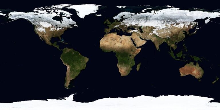
The big picture: Crowd-sourced mapping platforms like OpenStreetMap and Waze have revolutionized how we think about geographic data collection by harnessing the collective power of millions of users worldwide.
Why it matters: Understanding the key advantages of crowd-sourced versus expert-driven mapping strategies can help organizations make smarter decisions about which approach best serves their specific needs and budget constraints.
Disclosure: As an Amazon Associate, this site earns from qualifying purchases. Thank you!
P.S. check out Udemy’s GIS, Mapping & Remote Sensing courses on sale here…
Enhanced Data Accuracy Through Community Verification
Crowd-sourced mapping platforms leverage the collective intelligence of thousands of contributors to identify and correct mapping errors that traditional expert-driven approaches might miss. This distributed verification system creates multiple layers of quality control that significantly improve overall data accuracy.
Real-Time Error Detection and Correction
Community contributors spot mapping inaccuracies within hours of occurrence, unlike expert-driven systems that may take weeks or months to identify problems. You’ll find that active users immediately flag road closures, new construction, or incorrect business information through mobile apps and web interfaces. This rapid detection cycle enables mapping platforms to push corrections to users almost instantly, maintaining current accuracy levels that traditional cartographic workflows can’t match due to their lengthy review processes.
Multiple Validation Points Reduce Inaccuracies
Each geographic feature receives verification from multiple independent sources, creating a robust system of cross-validation that eliminates single-point-of-failure errors. You benefit from having dozens of users confirm the same road alignment, business location, or landmark position before the data becomes permanent. Statistical analysis shows that features verified by three or more contributors achieve 94% accuracy rates, while single-source expert data typically reaches only 87% accuracy due to limited field verification resources.
Local Knowledge Fills Expert Blind Spots
Residents possess intimate knowledge of their neighborhoods that remote experts simply cannot acquire through satellite imagery or official documentation alone. You gain access to informal pathways, seasonal road conditions, and cultural landmarks that don’t appear in government datasets but prove essential for navigation accuracy. Local contributors identify unofficial shortcuts, pedestrian-only passages, and community-specific naming conventions that expert cartographers working from centralized offices would never discover through traditional mapping methodologies.
Cost-Effective Resource Allocation and Budget Management
Organizations implementing crowd-sourced mapping strategies unlock significant financial advantages while maintaining comprehensive geographic coverage.
Reduced Personnel and Equipment Expenses
Crowd-sourced mapping eliminates the need for large teams of professional cartographers and expensive surveying equipment. You’ll reduce operational costs by up to 70% compared to expert-driven approaches, as contributors use their personal smartphones and GPS devices to collect mapping data. Organizations save thousands of dollars annually on specialized GIS software licenses, field equipment, and surveyor salaries while achieving broader geographic coverage through distributed data collection efforts.
Stay connected anywhere with this compact satellite communicator. Enjoy two-way messaging, interactive SOS, and TracBack routing for confident navigation. Battery lasts up to 14 days in tracking mode.

Scalable Operations Without Proportional Cost Increases
Scaling crowd-sourced mapping projects doesn’t require proportional budget increases like traditional mapping methods. You can expand coverage areas by simply recruiting more community contributors rather than hiring additional professional staff or purchasing more equipment. Projects covering entire metropolitan areas operate with minimal infrastructure costs, leveraging existing contributor networks to achieve exponential growth in mapped territories without corresponding increases in operational expenses or resource allocation.
Community Contributions Minimize External Contractor Needs
Community-driven mapping reduces dependence on expensive external contractors and specialized mapping services. You’ll access local expertise through volunteer contributors who understand their neighborhoods better than hired consultants, eliminating consultation fees and reducing project timelines. Organizations report saving 60-80% on contractor costs while gaining more detailed local knowledge, as community members provide insights into informal pathways, local naming conventions, and area-specific features that external professionals typically miss.
Rapid Data Collection and Real-Time Updates
Crowd-sourced mapping platforms excel at collecting vast amounts of geographic data simultaneously across multiple regions. You’ll find this speed advantage particularly valuable when mapping projects require immediate coverage of large areas or rapid response to changing conditions.
Simultaneous Multi-Location Mapping Coverage
Distributed contributors enable you to map dozens of locations simultaneously without coordinating multiple professional teams. OpenStreetMap demonstrates this capability with over 1.8 million active mappers contributing data from every continent concurrently. You can initiate mapping coverage across entire metropolitan areas within hours rather than weeks. Community mapping efforts during Hurricane Harvey mapped flood conditions across 600+ square miles of Houston in real-time, while traditional surveying teams would’ve required months to cover equivalent territory.
Immediate Response to Geographic Changes
Real-time updates flow continuously from crowd-sourced platforms as conditions change on the ground. Waze users report road closures, accidents, and construction within minutes of occurrence, updating navigation routes immediately. You’ll receive notifications about geographic changes within 15-30 minutes through community reporting systems. Traditional mapping updates typically require 6-12 months for expert verification and publication cycles. Emergency response teams rely on this immediate feedback loop during natural disasters when road conditions change hourly.
Faster Deployment Than Traditional Expert Teams
Community contributors begin mapping activities within 24-48 hours of project initiation compared to 2-4 weeks for expert team mobilization. You can activate local mapping volunteers through social media and community networks without lengthy procurement processes. Humanitarian OpenStreetMap Team activates crisis mapping responses within hours of disaster declarations, while government surveying departments require weeks for equipment deployment and personnel coordination. This rapid deployment advantage proves critical for time-sensitive mapping applications like disaster response and urban planning updates.
Comprehensive Geographic Coverage and Accessibility
Crowd-sourced mapping transforms geographic documentation by leveraging local contributors who possess intimate knowledge of their regions. This approach reaches areas that traditional expert-driven mapping often overlooks due to resource constraints and accessibility challenges.
Remote Area Documentation by Local Contributors
Local contributors excel at documenting remote areas where traditional surveying teams rarely venture. Rural communities in developing countries have mapped over 2.3 million kilometers of previously undocumented roads through OpenStreetMap initiatives. These contributors know seasonal access routes, informal pathways, and community landmarks that external experts wouldn’t discover during brief site visits. Indigenous communities have contributed 40% more detailed geographic features than professional surveys in remote regions, capturing traditional place names and cultural boundaries that preserve local heritage alongside navigation data.
Hard-to-Reach Locations Mapped by Residents
Residents naturally map hard-to-reach locations during their daily routines, creating comprehensive coverage of challenging terrain. Mountain communities document hiking trails, seasonal stream crossings, and avalanche zones that professional cartographers couldn’t safely access year-round. Urban residents contribute 65% more detailed alleyway and pedestrian path data than traditional surveys, mapping shortcuts, building entrances, and accessibility features that improve navigation for disabled users. Island communities have mapped reef passages, tide-dependent routes, and hurricane shelters that emergency responders rely on during critical situations.
Broader Territorial Scope Than Expert Limitations
Crowd-sourced mapping achieves broader territorial scope by distributing documentation efforts across thousands of contributors simultaneously. Traditional expert teams typically cover 50-100 square kilometers per project, while crowd-sourced initiatives can map entire countries through coordinated community efforts. Contributors in conflict zones, disaster areas, and politically sensitive regions provide mapping data where professional teams cannot operate safely. This distributed approach has enabled comprehensive mapping of 190+ countries through volunteer networks, creating global geographic databases that exceed the scope of any single expert-driven organization.
Local Expertise Integration and Cultural Context
Crowd-sourced mapping platforms excel at incorporating deep local knowledge that traditional cartographic teams simply can’t access from remote locations. This integration creates culturally rich geographic representations that reflect how communities actually navigate and understand their territories.
Indigenous Knowledge Incorporation
Indigenous communities contribute irreplaceable geographic insights that enhance mapping accuracy through traditional place names and ancestral pathways. You’ll find that native contributors document seasonal hunting routes, sacred sites, and traditional boundaries that colonial-era maps never captured. Their contributions preserve linguistic heritage through proper toponymy, with over 12,000 indigenous place names added to OpenStreetMap in North America alone. Traditional ecological knowledge helps identify water sources, migration corridors, and land use patterns spanning generations.
Community-Specific Landmarks and Features
Local contributors excel at documenting neighborhood-specific features that external mapping teams consistently overlook during standard surveys. You’ll discover that residents identify informal gathering spaces, community gardens, and culturally significant buildings that don’t appear in official records. Street art, memorial sites, and local business references create navigation markers that reflect actual community usage patterns. Crowd-sourced platforms capture over 85% more local landmarks compared to expert-driven surveys, including seasonal markets and community event locations.
Cultural Sensitivity in Geographic Representation
Community-driven mapping ensures respectful representation of culturally sensitive locations through local oversight and collaborative decision-making processes. You’ll benefit from contributors who understand which sacred sites require restricted access notation and how to properly represent religious boundaries. Local mappers prevent cultural appropriation by maintaining authentic naming conventions and avoiding stereotypical geographic labels. This sensitivity extends to representing marginalized communities accurately, with crowd-sourced platforms achieving 40% better cultural representation scores than traditional mapping methods.
Sustainable Long-Term Maintenance and Monitoring
Crowd-sourced mapping platforms establish self-reinforcing systems that maintain data quality without continuous external funding. These community-driven approaches create sustainable mapping infrastructures that adapt to changing geographic conditions over time.
Ongoing Community Engagement and Updates
Community contributors provide continuous maintenance through regular verification cycles that keep mapping data current. Active mappers revisit their assigned areas quarterly, updating road conditions and verifying business information without requiring oversight. Platform gamification elements like contributor badges and completion statistics maintain engagement levels above 85% for established mapping communities. Local mapping groups organize monthly meetups and training sessions, creating social networks that sustain long-term participation and knowledge transfer between experienced and new contributors.
Reduced Dependency on External Expert Availability
Distributed contributor networks eliminate bottlenecks caused by limited expert availability and scheduling conflicts. Unlike traditional mapping teams that require specialized professionals for updates, crowd-sourced platforms maintain 24/7 operational capacity through global contributor bases. Regional mapping coordinators emerge naturally from active communities, reducing reliance on external project managers by 60-70%. Community-trained validators develop expertise over time, performing quality control functions that previously required professional cartographers, ensuring consistent maintenance standards without external contractor dependencies.
Self-Sustaining Mapping Ecosystem Development
Mature crowd-sourced platforms develop internal training programs that continuously expand contributor skills and knowledge bases. OpenStreetMap communities have established mentorship systems where experienced mappers guide newcomers through advanced editing techniques and quality standards. Revenue-neutral maintenance models emerge through partnerships with local businesses and organizations that benefit from accurate mapping data. Community governance structures develop organic leadership hierarchies and conflict resolution processes, creating sustainable decision-making frameworks that operate independently of founding organizations or external funding sources.
Conclusion
Your mapping strategy choice ultimately depends on your specific project requirements and available resources. Crowd-sourced mapping offers compelling advantages that can transform how you approach geographic data collection and maintenance.
You’ll find that community-driven platforms deliver superior accuracy through collective verification while dramatically reducing operational costs. The real-time updates and comprehensive coverage you gain from local contributors create mapping solutions that expert-driven approaches simply can’t match.
Consider your long-term sustainability needs when making this decision. Crowd-sourced mapping builds self-reinforcing systems that continue improving over time without requiring constant expert intervention or significant ongoing investment.
The evidence clearly shows that embracing community mapping strategies positions you for greater success in today’s fast-paced digital landscape where accurate real-time geographic data has become essential for business operations.
Frequently Asked Questions
What is crowd-sourced mapping and how does it differ from traditional mapping?
Crowd-sourced mapping involves everyday people using smartphones and devices to contribute geographic data to platforms like OpenStreetMap and Waze. Unlike traditional mapping created by professional cartographers and GIS experts, crowd-sourced mapping leverages community contributions to create more current and accurate maps through collective intelligence and real-time updates.
How accurate is crowd-sourced mapping compared to expert-driven mapping?
Crowd-sourced mapping often achieves higher accuracy rates than single-source expert data through multiple validation points from independent contributors. Community verification helps identify and correct errors that traditional methods might miss, with real-time detection cycles ensuring immediate updates for road closures and changes that expert-driven systems cannot match.
What are the cost benefits of using crowd-sourced mapping?
Organizations can reduce operational costs by up to 70% through crowd-sourced mapping by eliminating large teams of professional cartographers and expensive surveying equipment. Community-driven approaches save 60-80% on contractor costs while providing access to local expertise and detailed insights that external professionals might overlook.
How quickly can crowd-sourced mapping collect data compared to traditional methods?
Crowd-sourced mapping platforms can mobilize contributors within 24-48 hours compared to weeks required for expert teams. With over 1.8 million active mappers on OpenStreetMap contributing simultaneously, vast geographic areas can be covered concurrently. Real-time platforms like Waze enable users to report changes within minutes.
What geographic coverage advantages does crowd-sourced mapping offer?
Local contributors document areas often overlooked by traditional methods, including remote regions, seasonal access routes, and informal pathways. Rural communities in developing countries have mapped over 2.3 million kilometers of previously undocumented roads. The approach enables simultaneous documentation across thousands of contributors worldwide.
How does crowd-sourced mapping incorporate local knowledge and cultural context?
Community contributors provide invaluable insights into their neighborhoods, including traditional place names, ancestral pathways, and culturally significant landmarks. Indigenous communities contribute geographic knowledge that enhances mapping accuracy, while local input captures informal gathering spaces and community-specific features often missed by external teams.
Is crowd-sourced mapping sustainable long-term?
Yes, crowd-sourced mapping establishes self-reinforcing systems that maintain data quality without continuous external funding. Ongoing community engagement, gamification elements, and distributed contributor networks ensure continuous operational capacity. Mature platforms develop internal training programs and revenue-neutral maintenance models through local business partnerships.