6 Best Satellite Map Projections for Accuracy
Why it matters: Traditional map projections distort satellite imagery in ways that can mislead your understanding of Earth’s true proportions and distances. You’re likely viewing satellite data through outdated projection methods that sacrifice accuracy for familiarity.
The big picture: Six innovative projection techniques are revolutionizing how scientists and analysts represent satellite imagery â offering more precise measurements and clearer visual interpretations of our planet’s features.
Disclosure: As an Amazon Associate, this site earns from qualifying purchases. Thank you!
Understanding the Importance of Projection Methods in Satellite Imagery
Satellite imagery projection methods determine how accurately you can measure, analyze, and interpret Earth’s surface features from space-based data. Your choice of projection directly affects the precision of geographic analysis and the reliability of spatial measurements.
P.S. check out Udemy’s GIS, Mapping & Remote Sensing courses on sale here…
Why Standard Projections Fall Short
Standard projections like Mercator and Robinson weren’t designed for satellite imagery analysis. They introduce significant area distortions that can skew your measurements by up to 400% in polar regions. You’ll encounter shape distortions that make coastlines appear artificially stretched and angular measurements that deviate from true ground conditions. These traditional methods also create distance errors that affect navigation calculations and spatial analysis workflows in modern GIS applications.
The Impact of Distortion on Data Analysis
Distortion in satellite imagery projections compromises your ability to calculate accurate area measurements for environmental monitoring. You’ll see vegetation coverage estimates that vary by 15-30% depending on the projection method used. Climate researchers face particular challenges when tracking ice sheet changes or forest loss patterns across different latitudes. Your temporal analysis becomes unreliable when comparing multi-date imagery that uses inconsistent projection parameters, leading to false change detection results and inaccurate trend assessments.
Exploring Equal-Area Projections for Accurate Surface Measurements
Equal-area projections preserve the relative size of surface features, making them essential for quantitative analysis of satellite imagery. These projections eliminate the area distortions that plague traditional mapping methods, ensuring your measurements remain proportionally accurate across different regions.
Mollweide Projection Benefits
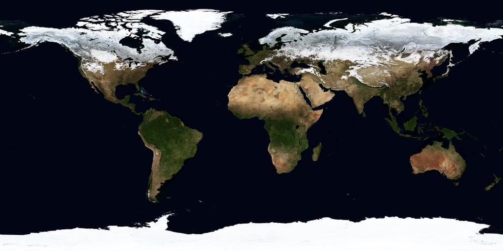
Mollweide projection maintains precise area relationships across the entire globe, making it ideal for global-scale environmental monitoring. You’ll get accurate measurements when calculating forest coverage, ocean areas, or continental comparisons from satellite data. This projection displays the full Earth as an ellipse, preserving area ratios while minimizing shape distortion near the equator. Your vegetation analysis and climate studies benefit from consistent area calculations that don’t inflate polar regions or shrink equatorial zones.
Albers Equal-Area Conic Applications
Albers Equal-Area Conic projection excels for regional satellite analysis within mid-latitude zones, particularly for continental-scale studies. You’ll achieve optimal results when analyzing landcover changes across countries or large watersheds using this projection. The conic design maintains area accuracy while reducing shape distortion along standard parallels, making it perfect for agricultural monitoring and urban development tracking. Your regional environmental assessments gain precision through consistent area measurements that support reliable change detection algorithms.
Implementing Conformal Projections for Shape Preservation
Conformal projections maintain accurate angular relationships and preserve local shapes, making them crucial for satellite imagery where precise geometric representation of features matters most.
Stereographic Projection Advantages
You’ll find stereographic projection excelling in polar satellite imagery where traditional projections fail dramatically. This conformal method preserves angles perfectly while minimizing distortion within moderate distances from the projection center. Meteorologists rely on stereographic projections for Arctic weather pattern analysis, while glaciologists use them for ice sheet monitoring. The projection’s circular boundary makes it ideal for polar-orbiting satellite data, maintaining shape accuracy across ice formations and coastal features that require precise geometric measurements.
Lambert Conformal Conic Uses
Lambert Conformal Conic projection serves as your go-to choice for mid-latitude regional satellite analysis requiring shape preservation. Aviation industries depend on this projection for flight path planning since it maintains accurate directional relationships across large areas. Weather services use Lambert Conformal Conic for radar composite imagery, ensuring storm shapes appear correctly for forecasting applications. The projection’s dual standard parallels minimize distortion across continental regions, making it essential for agricultural monitoring and urban development tracking where building shapes and field boundaries must remain geometrically accurate.
Utilizing Compromise Projections for Balanced Representation
Compromise projections offer a middle ground between the extremes of equal-area and conformal projections, providing moderate distortion across multiple properties for satellite imagery analysis. These projections balance shape, area, and distance distortions to create visually appealing and functionally practical representations of global satellite data.
Robinson Projection Features
Explore the world with this 36"x24" physical wall map featuring current geographic details and Earth elevation profiles. Printed on rolled paper in the U.S.A. using the Robinson Projection.

Robinson projection distributes distortion evenly across the globe, making it ideal for satellite imagery requiring balanced visual representation. Developed by Arthur Robinson in 1963, this projection maintains reasonable shape accuracy while keeping area distortion below 20% for most regions. You’ll find it particularly effective for global climate monitoring and environmental assessment applications. The projection’s curved meridians and parallels create a natural Earth-like appearance that enhances data interpretation for non-technical audiences. Its moderate distortion characteristics make it suitable for comparative analysis across different continental regions.
Winkel Tripel Projection Benefits
Get the perfect fit for your space with our durable and stylish mat! Available in two sizes: 80x55 cm (Small) and 100x69 cm (Medium).

Winkel Tripel projection minimizes the combination of area, angle, and distance distortions simultaneously, earning recognition as the National Geographic Society’s standard for world maps. This projection reduces maximum distortion to approximately 4.5% globally, making it exceptional for satellite imagery requiring high overall accuracy. You’ll appreciate its superior performance in mid-latitude regions where most populated areas exist. The projection maintains continental shapes better than Robinson while preserving reasonable area relationships. Its balanced approach makes it particularly valuable for satellite-based population studies, global resource mapping, and international development projects requiring accurate spatial representation.
Get durable, tear-resistant posters made in the USA. Each 18" x 29" poster features high-quality 3 MIL lamination for lasting protection.

Adopting Azimuthal Projections for Directional Analysis
Azimuthal projections excel at preserving accurate directional relationships from a central point, making them invaluable for satellite imagery applications requiring precise angular measurements and radial distance calculations.
Orthographic Projection Applications
Orthographic projection creates satellite imagery that mimics the Earth’s appearance from space, providing an intuitive three-dimensional perspective. You’ll find this projection particularly effective for atmospheric monitoring and weather pattern analysis, as it naturally represents cloud formations and storm systems as they appear from orbital viewpoints. The projection’s ability to show only one hemisphere eliminates edge distortions common in global projections, ensuring accurate shape representation for continental-scale environmental studies and oceanographic research.
Gnomonic Projection Advantages
Gnomonic projection transforms all great circle routes into straight lines, making it essential for satellite-based navigation and flight path planning applications. You can leverage this projection’s unique property to analyze optimal routing between ground stations and calculate accurate bearing measurements for telecommunications and GPS applications. The projection excels in polar regions where traditional projections fail, providing precise directional analysis for Arctic shipping routes and Antarctic research operations despite its limitation to areas smaller than a hemisphere.
Leveraging Cylindrical Projections for Global Coverage
Cylindrical projections wrap around Earth like a cylinder, creating rectangular maps that excel at displaying global satellite imagery with consistent east-west relationships. You’ll find these projections particularly valuable when working with continuous global datasets that require seamless edge-to-edge coverage.
Miller Cylindrical Projection Benefits
Miller cylindrical projection reduces the extreme polar distortion found in standard Mercator maps while maintaining familiar rectangular coordinates. You’ll appreciate how it compresses high-latitude regions by approximately 20% compared to Mercator, making polar satellite data more visually proportionate. This projection works exceptionally well for global climate visualization and atmospheric monitoring applications where you need to display worldwide patterns without the extreme stretching that renders polar regions unusable in traditional cylindrical formats.
Gall-Peters Projection Features
Gall-Peters projection preserves accurate area relationships across all latitudes, making it essential for quantitative satellite analysis requiring precise surface measurements. You’ll notice how landmasses appear vertically stretched near the equator but maintain their true proportional sizes, crucial for vegetation coverage analysis and land use classification. This equal-area property ensures your satellite-based measurements of agricultural zones, forest coverage, and urban development remain mathematically accurate regardless of latitude, providing reliable data for environmental monitoring and resource management applications.
Applying Pseudocylindrical Projections for Enhanced Visualization
Pseudocylindrical projections combine the best features of cylindrical and other projection types, creating curved meridians that reduce distortion while maintaining readability. These hybrid approaches offer significant advantages for satellite imagery representation across global datasets.
Goode Homolosine Projection Uses
You’ll find the Goode Homolosine projection exceptionally valuable for continental-scale satellite analysis since it interrupts oceans to minimize land distortion. This projection combines sinusoidal properties for tropical regions with Mollweide characteristics for polar areas, creating accurate area relationships essential for vegetation mapping and land use classification. Your satellite-based environmental monitoring benefits from its preserved area proportions, making it ideal for tracking deforestation patterns, agricultural productivity, and biodiversity assessments across multiple continents simultaneously.
Eckert IV Projection Advantages
You can leverage Eckert IV projection’s equal-area properties to maintain consistent scale relationships across your global satellite datasets. This pseudocylindrical approach reduces extreme polar stretching while preserving accurate area measurements crucial for climate monitoring applications. Your temperature and precipitation analyses become more reliable since the projection maintains proportional relationships between regions, enabling precise comparison of atmospheric phenomena. The projection’s curved meridians create visually appealing global maps that accurately represent satellite-derived data for environmental research and policy applications.
Conclusion
You now have six powerful projection methods that’ll transform how you work with satellite imagery. Each technique addresses specific distortion challenges while preserving the accuracy your applications demand.
Your choice of projection method directly impacts measurement precision and analytical reliability. Whether you’re monitoring climate change tracking urban development or analyzing vegetation patterns these alternative approaches offer superior accuracy compared to traditional methods.
The key lies in matching your projection to your specific needs. Equal-area projections excel for quantitative analysis while conformal projections maintain geometric accuracy for navigation applications. Compromise and specialized projections provide balanced solutions for complex global datasets.
Moving forward you’ll achieve more reliable results by selecting projections that align with your analytical goals rather than defaulting to familiar but inadequate traditional methods.
Frequently Asked Questions
What are the main problems with traditional map projections for satellite imagery?
Traditional map projections like Mercator and Robinson introduce substantial distortions in area and shape, particularly in polar regions where distortions can reach up to 400%. These inaccuracies compromise navigation calculations, spatial analysis in GIS applications, environmental monitoring, and climate research, leading to unreliable measurements and false change detection in temporal analyses.
Why are equal-area projections important for satellite imagery analysis?
Equal-area projections preserve the relative size of surface features, making them essential for accurate quantitative analysis. They ensure reliable measurements for vegetation analysis, climate studies, agricultural monitoring, and urban development tracking. The Mollweide and Albers Equal-Area Conic projections are particularly valuable for maintaining precise area relationships in global and regional satellite analysis.
What advantages do conformal projections offer for satellite imagery?
Conformal projections maintain accurate angular relationships and preserve local shapes, crucial for applications requiring precise geometric representation. The stereographic projection excels in polar regions for meteorology and glaciology, while the Lambert Conformal Conic is ideal for mid-latitude analysis, aviation, and weather services due to its ability to maintain directional accuracy.
How do compromise projections balance distortions in satellite imagery?
Compromise projections like Robinson and Winkel Tripel minimize distortions across multiple properties by distributing them evenly. The Robinson projection offers balanced distortion for global climate monitoring, while the Winkel Tripel provides superior accuracy and is used by National Geographic. Both provide visually appealing and functionally practical approaches to global satellite data representation.
What makes azimuthal projections valuable for satellite applications?
Azimuthal projections excel at preserving accurate directional relationships from a central point, making them invaluable for precise angular measurements and radial distance calculations. The orthographic projection mimics Earth’s appearance from space, while the gnomonic projection transforms great circle routes into straight lines, essential for navigation and flight path planning.
How do cylindrical projections improve global satellite imagery display?
Cylindrical projections create rectangular maps that excel at displaying global satellite imagery with consistent east-west relationships. The Miller Cylindrical reduces polar distortion while maintaining familiar coordinates, ideal for climate visualization. The Gall-Peters projection preserves accurate area relationships across all latitudes, crucial for vegetation coverage analysis and land use classification.
What benefits do pseudocylindrical projections provide for satellite analysis?
Pseudocylindrical projections combine features of cylindrical and other projection types, using curved meridians to reduce distortion while maintaining readability. The Goode Homolosine projection minimizes land distortion for continental-scale analysis, while the Eckert IV projection maintains equal-area properties essential for reliable climate monitoring and atmospheric analyses.