5 Engaging Map-Based Educational Tools That Transform Geography
Why it matters: Geography education has transformed from memorizing capitals to interactive digital exploration that makes learning spatial concepts stick.
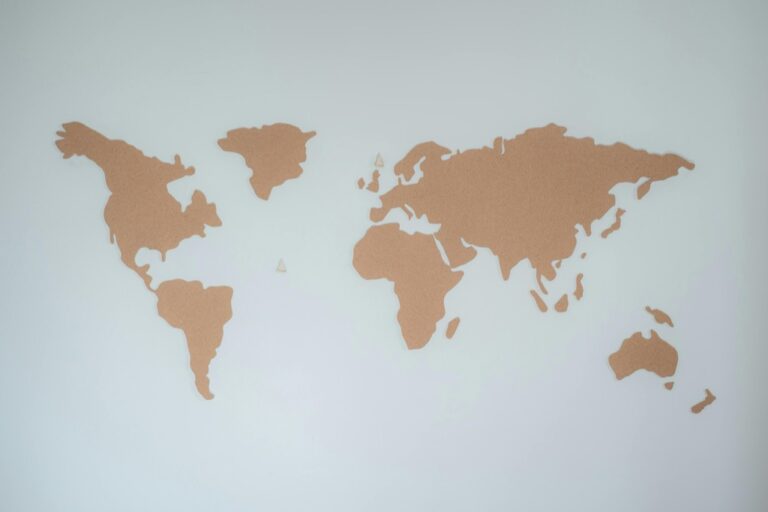
The big picture: Map-based educational tools now offer students immersive experiences that turn abstract geographic concepts into engaging visual adventures you can navigate and explore.
What’s next: We’ve identified five standout platforms that’ll revolutionize how your students connect with the world around them.
Disclosure: As an Amazon Associate, this site earns from qualifying purchases. Thank you!
P.S. check out Udemy’s GIS, Mapping & Remote Sensing courses on sale here…
Google Earth: Explore the World From Your Classroom
Google Earth transforms your classroom into a global exploration hub where students can virtually travel anywhere on Earth. This powerful platform combines satellite imagery, 3D modeling, and interactive features to create immersive learning experiences that bring geographic concepts to life.
Interactive 3D Globe Navigation
Navigate Earth’s surface using intuitive controls that let you zoom from space to street level in seconds. You’ll find students can tilt, rotate, and explore mountain ranges, ocean depths, and urban landscapes with smooth 3D navigation tools. The platform’s real-time rendering capabilities display terrain features, vegetation patterns, and human settlements with remarkable detail that makes geographic analysis engaging and accessible.
Historical Imagery and Time-Lapse Features
Access decades of satellite imagery to show how landscapes change over time through Google Earth’s historical timeline feature. You can demonstrate urban expansion, deforestation, glacier retreat, and natural disasters by sliding through years of archived imagery. Time-lapse animations reveal environmental changes that occurred over months or decades, helping students understand processes like coastal erosion, agricultural development, and climate impact visualization.
Virtual Field Trips and Street View Integration
Create immersive classroom experiences by combining Google Earth’s aerial views with Street View’s ground-level photography. You’ll guide students through virtual expeditions to remote locations like Antarctica research stations, Amazon rainforest paths, or ancient archaeological sites. The seamless integration allows learners to examine landmarks from multiple perspectives, exploring both regional geography and local cultural details without leaving their seats.
ArcGIS Online: Professional Mapping for Student Learning
ArcGIS Online transforms geography education by providing students with industry-standard Geographic Information Systems (GIS) tools in an accessible web format. This professional platform enables students to create sophisticated maps and analyze spatial data using the same technology employed by urban planners, environmental scientists, and government agencies worldwide.
Web-Based GIS Mapping Capabilities
You’ll access powerful mapping tools directly through your web browser without requiring specialized software installations. The platform offers customizable basemaps, symbol libraries, and layer management features that allow students to create professional-quality maps. Students can import CSV files, shapefiles, and web services to visualize demographic data, climate patterns, or economic indicators. The intuitive interface supports multiple coordinate systems and projection options, helping students understand how geographic data translates into visual representations.
Real-Time Data Analysis and Visualization
You can connect to live data feeds from government agencies, weather stations, and satellite imagery providers for current geographic analysis. The platform’s analytical tools enable students to perform buffer analysis, overlay operations, and statistical calculations on spatial datasets. Students can visualize population density changes, track natural disasters, or monitor environmental conditions using dynamic symbology and interactive charts. The system updates automatically when connected data sources change, providing students with authentic experiences using current geographic information.
Get real-time weather data with the Ambient Weather WS-2902. This WiFi-enabled station measures wind, temperature, humidity, rainfall, UV, and solar radiation, plus it connects to smart home devices and the Ambient Weather Network.

Collaborative Project Creation Tools
You’ll enable students to work together on mapping projects through shared workspaces and group permissions. The platform supports real-time collaboration where multiple students can edit the same map simultaneously while maintaining version control. Students can create story maps that combine narrative text with interactive maps, perfect for presenting research findings or geographic case studies. The sharing capabilities allow educators to distribute assignments, collect student work, and provide feedback directly within the platform environment.
National Geographic MapMaker: Standards-Aligned Geography Learning
Learn to craft compelling narratives using maps with insights from a master storyteller. This book offers practical lessons for creating place-based narratives that captivate your audience.

National Geographic MapMaker transforms classroom geography instruction by providing educators with curriculum-aligned mapping tools that meet educational standards. You’ll discover how this platform integrates seamlessly with existing lesson plans while offering comprehensive assessment capabilities.
Curriculum-Integrated Map Activities
MapMaker aligns directly with Next Generation Science Standards and C3 Framework social studies standards, offering pre-built activities that support your curriculum requirements. You can access ready-made lessons covering climate patterns, population density, and natural disasters that connect to specific grade-level objectives. The platform includes guided inquiry activities where students analyze migration patterns, compare economic development across regions, and investigate environmental changes over time. Each activity includes teacher guides with learning objectives, vocabulary lists, and discussion prompts that enhance student engagement while meeting educational benchmarks.
Customizable Layer Options for Different Topics
You’ll find over 200 data layers covering demographics, climate, economics, and physical geography that you can combine to create targeted learning experiences. The platform allows you to toggle between population density maps, precipitation data, and political boundaries to help students understand complex geographic relationships. Students can overlay natural disaster frequency with population centers to analyze risk patterns, or combine economic indicators with transportation networks to explore development themes. You can save custom layer combinations for repeated use across different classes, ensuring consistent delivery of your geography curriculum.
Assessment Tools and Progress Tracking
MapMaker includes built-in assessment features that let you create custom quizzes and track student progress through interactive mapping exercises. You can design formative assessments where students identify geographic features, analyze spatial patterns, or make predictions based on map data. The platform generates detailed reports showing individual student performance on map-reading skills, data interpretation, and geographic reasoning abilities. You’ll receive insights into which concepts students grasp quickly and which require additional instruction, allowing you to adjust your teaching strategies and provide targeted support where needed.
Seterra Geography Games: Gamified Map Learning Experience
Seterra transforms traditional geography drills into engaging digital challenges that make map memorization enjoyable and effective. This Swedish-developed platform combines competitive gaming elements with comprehensive geographic content to create lasting educational experiences.
Interactive Quiz-Based Map Challenges
Seterra delivers geography learning through fast-paced quiz formats that test your knowledge of countries, capitals, flags, and physical features. You’ll encounter drag-and-drop activities where you place countries on blank maps, multiple-choice questions about world capitals, and timed challenges that build geographic recall speed. The platform tracks your accuracy rates and completion times, creating competitive elements that motivate continued practice. Each quiz session adapts to your performance, focusing additional practice on areas where you struggle most.
Progressive Difficulty Levels for All Ages
Seterra’s adaptive difficulty system accommodates learners from elementary students to geography enthusiasts through carefully structured progression paths. You’ll begin with continental overviews before advancing to country-specific regions, then tackle challenging sections like African nations or European capitals. The platform offers beginner modes with highlighted borders and visual cues, intermediate levels with reduced assistance, and expert challenges featuring blank maps with minimal guidance. This scaffolded approach ensures you build confidence while gradually increasing geographic complexity.
Comprehensive Coverage of World Geography
Seterra encompasses over 400 geography games covering every continent, major geographic regions, and specialized topics like mountain ranges and river systems. You’ll explore detailed maps of individual countries, study regional groupings like Southeast Asia or Central America, and master physical geography through dedicated modules on landforms and bodies of water. The platform includes current political boundaries, updated country names, and recently recognized nations, ensuring your geographic knowledge reflects contemporary world conditions.
Story Maps: Narrative-Driven Geographic Education
Understand the structure of a one-hour TV drama pilot. This book provides a guide to story mapping for television.

Story Maps transform traditional geographic education by weaving compelling narratives around spatial data and interactive maps. You’ll discover how this innovative platform combines multimedia storytelling with precise geographic visualization to create immersive learning experiences.
Multimedia Storytelling with Geographic Context
Story Maps enable you to create dynamic presentations that blend high-resolution imagery, videos, and interactive maps into cohesive geographic narratives. You can embed satellite footage showing deforestation progression alongside historical photographs and expert interviews, creating multi-layered educational experiences. Students engage with complex geographic concepts through guided visual journeys that reveal environmental changes, cultural migrations, and urban development patterns across specific regions and time periods.
Student-Created Digital Geography Projects
You’ll empower students to become geographic storytellers by designing their own Story Maps projects investigating local environmental issues or historical events. Students can document neighborhood changes through time-lapse photography, interview community members about geographic transformations, and present their findings through professional-quality digital presentations. These student-created projects develop research skills, digital literacy, and geographic analysis capabilities while encouraging authentic connections between classroom learning and real-world geographic phenomena.
Cross-Curricular Integration Opportunities
Story Maps bridge geography education with history, science, and language arts through integrated project-based learning approaches. You can collaborate with science teachers to create climate change narratives that combine temperature data visualization with environmental impact stories. History teachers can partner with you to develop Story Maps exploring westward expansion routes, immigration patterns, or ancient civilization locations, while language arts integration occurs through narrative writing and multimedia presentation skills development.
Conclusion
These five map-based educational tools represent the future of geography education. By incorporating interactive platforms like Google Earth and ArcGIS Online into your curriculum you’ll transform passive learning into active exploration.
Your students will develop critical spatial thinking skills while engaging with real-world data and contemporary geographic challenges. These tools don’t just teach geography â they inspire curiosity about our interconnected world.
The shift from traditional memorization to hands-on digital exploration means your classroom becomes a gateway to global understanding. Your students will graduate with the geographic literacy and technological skills needed for success in our increasingly connected world.
Frequently Asked Questions
What are the main benefits of using digital tools in geography education?
Digital tools transform geography education by replacing traditional memorization with interactive, visual learning experiences. They enhance spatial understanding through immersive platforms, making geographic concepts more engaging and accessible. Students develop better analytical skills while connecting classroom learning to real-world geographic phenomena through satellite imagery, 3D modeling, and interactive features.
How does Google Earth enhance classroom geography learning?
Google Earth allows students to explore the globe using satellite imagery, 3D modeling, and interactive features. Key benefits include intuitive 3D navigation, access to historical imagery showing environmental changes over time, and virtual field trips through Street View integration. These tools help students analyze geographic patterns and understand global dynamics from their classroom.
What makes ArcGIS Online suitable for students?
ArcGIS Online provides industry-standard GIS tools in a user-friendly web format, allowing students to create sophisticated maps and analyze spatial data. The platform offers customizable basemaps, real-time data feeds, collaborative project capabilities, and analytical tools for visualizing demographic data, tracking natural disasters, and monitoring environmental conditions with authentic geographic information.
How does National Geographic MapMaker support curriculum standards?
MapMaker aligns with Next Generation Science Standards and C3 Framework social studies standards while integrating seamlessly with existing lesson plans. It offers pre-built activities on topics like climate patterns and population density, over 200 customizable data layers, and built-in assessment tools that help teachers track student progress and adjust instruction accordingly.
What makes Seterra Geography Games effective for learning?
Seterra gamifies geography learning through interactive quiz-based challenges covering countries, capitals, flags, and physical features. Its adaptive difficulty system accommodates all learning levels, progressing from basic continental overviews to complex challenges. With over 400 geography games and current political boundaries, it ensures comprehensive world geography coverage.
How do Story Maps combine storytelling with geography education?
Story Maps blend multimedia storytelling with interactive geographic visualization, creating immersive learning experiences. They combine high-resolution imagery, videos, and interactive maps into cohesive narratives that reveal environmental changes, cultural migrations, and urban development patterns. Students can create their own projects, developing research skills and digital literacy.
Can these digital geography tools integrate with other subjects?
Yes, these platforms offer excellent cross-curricular integration opportunities. Story Maps can collaborate with history, science, and language arts for comprehensive project-based learning. The tools support investigation of local environmental issues, historical events, and cultural studies, creating authentic connections between geography and other academic disciplines.