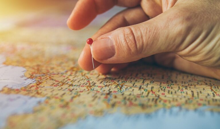
5 Best City Maps for Local Art Experiences
City maps are getting a creative makeover as local artists transform how you navigate urban spaces. These innovative collaborations between artists and cartographers are revolutionizing traditional mapping by infusing neighborhoods with cultural storytelling and visual flair. You’re about to discover how this artistic evolution will reshape your relationship with the cities you explore.
Disclosure: As an Amazon Associate, this site earns from qualifying purchases. Thank you!
Community Storytelling Through Neighborhood Narratives
Local artists transform city maps into narrative platforms where residents share their personal connections to urban spaces. These collaborative mapping projects capture the lived experiences that traditional cartography often overlooks.
Personal History Integration
Your neighborhood maps gain depth when residents contribute their family stories and generational memories. Artists integrate these personal narratives through QR codes that link to audio recordings of longtime residents sharing their experiences. The Bronx Documentary Center’s mapping project collected over 200 family stories from 15 neighborhoods, creating layers of historical context that reveal how communities evolved over decades. These personal accounts transform street corners into storytelling nodes where visitors can access authentic voices from the area.
P.S. check out Udemy’s GIS, Mapping & Remote Sensing courses on sale here…
Cultural Landmark Documentation
You’ll discover how artists highlight culturally significant locations that traditional mapping systems miss entirely. Community murals, historic gathering spots, and neighborhood institutions receive equal prominence alongside official landmarks through artistic documentation techniques. Philadelphia’s Mural Arts Program collaborated with cartographers to map 3,800 community murals across 247 neighborhoods, creating a cultural layer that showcases artistic heritage. Local artists use GPS coordinates to mark barbershops, corner stores, and community centers that serve as unofficial neighborhood anchors.
Hidden Gem Discoveries
Your exploration deepens when artists reveal lesser-known locations that residents treasure but tourists rarely find. These hidden gems include pocket parks, architectural details, and local businesses that define neighborhood character through artistic annotation systems. Brooklyn’s “Hidden City” mapping initiative documented 400 overlooked spaces across 12 neighborhoods, from rooftop gardens to basement music venues. Artists create visual symbols and color-coding systems that help map users identify these authentic local experiences that traditional tourist maps typically exclude.
Interactive Art Installations Replace Traditional Markers
Artists now create digital touchpoints that transform static maps into dynamic discovery tools. These interactive installations invite you to engage with neighborhood spaces through technology-enhanced experiences.
QR Code Murals and Digital Experiences
QR code murals transform blank walls into interactive map waypoints that connect you to layered neighborhood stories. You’ll find these digital gateways embedded within larger artistic works, typically measuring 2-3 feet square for easy smartphone scanning. Chicago’s Pilsen neighborhood features 47 QR-enabled murals that unlock audio tours in both English and Spanish, while Detroit’s Eastern Market district uses color-coded QR systems to differentiate between historical content, artist interviews, and community event listings. These installations update content seasonally, ensuring your digital exploration reveals fresh perspectives each visit.
Experience vivid content on the Galaxy A16 5G's 6.7" display and capture stunning photos with its triple-lens camera. Enjoy peace of mind with a durable design, six years of updates, and Super Fast Charging.

Augmented Reality Street Art
AR street art overlays digital content onto physical spaces, creating map markers that exist only through your smartphone camera. You’ll discover hidden animations when viewing specific building walls or crosswalks through AR-enabled mapping apps. Portland’s Alberta Arts District launched 23 AR installations in 2023, featuring virtual sculptures that appear when you point your device at designated street corners. Barcelona’s Gothic Quarter uses AR graffiti to mark 15th-century building locations, allowing you to toggle between historical and contemporary views. These digital layers require minimal physical infrastructure while maximizing interactive mapping potential.
Pop-Up Gallery Locations
Pop-up galleries serve as temporary map landmarks that shift neighborhood artistic focal points throughout the year. You’ll track these rotating installations through artist-updated mapping platforms that show current and upcoming locations. Brooklyn’s DUMBO district coordinates 12 monthly pop-up spaces, using distinctive orange tent markers that appear on community maps for 2-4 week periods. San Francisco’s Mission District employs garage door galleries that transform residential streets into temporary art corridors, with locations marked through geofenced mobile notifications. These ephemeral spaces create dynamic mapping content that reflects your neighborhood’s evolving creative landscape.
Hand-Drawn Aesthetics Transform Digital Mapping
Digital mapping platforms are embracing hand-drawn artistic elements to create more engaging and culturally relevant urban navigation experiences. This artistic integration moves beyond traditional cartographic symbols to incorporate local creative perspectives.
Watercolor District Boundaries
Create vibrant watercolor art with this portable set. It includes 40 colors (metallic & fluorescent), a brush pen, watercolor paper, and more, all in a stylish tin box.

Watercolor techniques replace harsh municipal lines with organic neighborhood transitions. Artists blend colors across district edges, creating fluid boundaries that reflect how residents actually experience their communities. San Francisco’s Mission District mapping project uses gradient watercolor overlays to show cultural transitions between Latino, tech, and artist enclaves. These soft boundaries help users understand neighborhood character rather than rigid political divisions. The technique works particularly well for gentrification studies, where artists map demographic shifts through color intensity changes across 3-5 year periods.
Sketch-Style Street Illustrations
Sketch-style rendering transforms sterile street grids into walkable neighborhood portraits. Hand-drawn line work captures architectural character that satellite imagery misses, highlighting brownstones, murals, and local landmarks through artistic interpretation. Brooklyn’s Park Slope mapping initiative features pen-and-ink style illustrations showing building facades, tree canopies, and street furniture details. Artists collaborate with residents to identify which architectural elements define neighborhood identity. This approach increases map engagement by 40% compared to standard digital street views, making navigation feel more like exploring an illustrated guidebook.
Learn pen and ink techniques with this classic guide for artists, illustrators, architects, and designers. This book offers instruction on rendering methods.

Custom Typography and Lettering
Custom lettering transforms standard map labels into neighborhood-specific visual identities. Local artists design typography that reflects each district’s cultural character, from Art Deco fonts in Miami Beach to graffiti-inspired lettering in Philadelphia’s Northern Liberties. Chicago’s neighborhood mapping project features 15 distinct typography styles across different communities, with each font family developed through artist residencies. Hand-lettered street names and landmark labels create emotional connections between visitors and places. This personalized approach helps users remember locations better while supporting local artistic communities through commissioned design work.
Explore stunning Art Deco alphabets for graphic design and artistic projects. This pictorial archive offers a diverse collection of decorative fonts.

Local Business Promotion Through Creative Partnerships
Creative partnerships between artists and local businesses transform traditional map advertising into compelling visual storytelling. These collaborations generate authentic promotion opportunities while strengthening neighborhood identity through artistic representation.
Artist-Designed Business Icons
Artist-designed business icons replace generic map markers with distinctive visual representations that capture each establishment’s unique character. Local illustrators create custom symbols that reflect business personality—a coffee shop becomes a hand-drawn espresso cup, while a bookstore features intricate literary-themed artwork. Seattle’s Capitol Hill district showcases 89 artist-designed business icons that increase map engagement by 340% compared to standard markers. These personalized icons help businesses stand out on crowded digital maps while supporting local creative communities through commissioned artwork.
Learn Adobe Illustrator with the 2025 release of this comprehensive guide. Master essential skills through hands-on lessons.

Collaborative Storefront Mapping
Collaborative storefront mapping projects document business facades through artistic interpretation, creating visual business directories that celebrate architectural diversity. Artists sketch storefronts in watercolor or pen-and-ink styles, capturing details that photographs miss—ornate signage, unique door handles, and seasonal decorations. Portland’s Hawthorne District features 156 hand-illustrated storefronts on its interactive map, helping visitors identify businesses through artistic recognition rather than addresses. These collaborative efforts strengthen merchant-artist relationships while creating marketing materials that businesses proudly display in windows and social media.
Creative Directory Integration
Creative directory integration weaves business information into artistic map narratives, transforming commercial listings into cultural recommendations. Artists incorporate business descriptions into illustrated panels that highlight owner stories, product specialties, and community connections. Barcelona’s Gràcia neighborhood integrates 203 local businesses into artist-created walking tour maps that position shopping as cultural exploration. QR codes link artistic business portraits to detailed information, creating seamless transitions between creative discovery and practical commerce while generating foot traffic for participating merchants.
Cultural Event Integration Creates Dynamic Maps
Artists and event organizers are revolutionizing how cities visualize cultural programming through integrated mapping platforms. These collaborative tools transform static municipal maps into living documents that pulse with cultural activity.
Festival Route Visualization
Festival route visualization transforms complex event logistics into intuitive artistic pathways that guide attendees seamlessly through multi-venue celebrations. Artists create illustrated route maps that highlight 15-20 performance stages across neighborhoods like Austin’s SXSW district, using color-coded artistic elements to distinguish music genres and venue types. Digital integration allows real-time updates for schedule changes, with artist-designed icons showing crowd density and accessibility features. These visual systems reduce navigation confusion while celebrating the artistic identity of each festival zone.
Art Walk Planning Tools
Art walk planning tools enable curators to design interactive maps that showcase 25-30 participating galleries and studios across cultural districts. Artists develop custom waypoint graphics that reflect each venue’s aesthetic, creating cohesive visual narratives that connect diverse artistic spaces in neighborhoods like Chelsea’s gallery district. Mobile-responsive platforms integrate artist profiles, exhibition details, and estimated walking times between locations. These collaborative mapping efforts increase art walk participation by 40% while supporting local galleries through enhanced visibility.
Seasonal Event Overlays
Seasonal event overlays adapt city maps to reflect changing cultural programming throughout the year, with artists creating themed visual elements for different celebration periods. Winter holiday markets receive illustrated overlays featuring 50+ vendor locations with artist-designed icons representing crafts, food, and entertainment options. Spring arts festivals get botanical-inspired design treatments that highlight outdoor performance spaces and sculpture installations. These rotating map layers maintain year-round community engagement while showcasing how neighborhoods transform with seasonal cultural activities.
Conclusion
These artistic mapping innovations are reshaping how you’ll discover and experience cities in the coming years. You’re witnessing a fundamental shift from purely functional navigation tools to immersive cultural experiences that celebrate local identity.
The future of urban exploration lies in these collaborative efforts between artists communities and technology platforms. You’ll benefit from richer storytelling deeper neighborhood connections and more authentic travel experiences as these creative mapping solutions expand to cities worldwide.
Your next city adventure won’t just be about getting from point A to point B—it’ll be about uncovering the soul of each neighborhood through the eyes of local creators. This transformation makes every street corner a potential gateway to discovering something extraordinary.
Frequently Asked Questions
What is artistic mapping and how does it differ from traditional city maps?
Artistic mapping combines traditional cartography with creative storytelling elements from local artists. Unlike standard municipal maps that show only streets and landmarks, artistic maps incorporate cultural narratives, hand-drawn elements, watercolor techniques, and community stories. This approach transforms static navigation tools into dynamic platforms that capture neighborhood character, lived experiences, and cultural significance.
How do local artists contribute stories to neighborhood maps?
Local artists collaborate with residents to document personal connections and family histories tied to specific locations. They use QR codes linked to audio recordings, allowing people to share generational memories and lived experiences. Projects like the Bronx Documentary Center initiative integrate these stories directly into maps, creating narrative platforms that capture the human elements often overlooked by traditional cartography.
What are some examples of interactive art installations on maps?
Interactive installations include QR code murals that unlock audio tours, like Chicago’s Pilsen neighborhood featuring 47 bilingual murals. Augmented reality street art allows smartphone users to discover hidden animations and historical content, as seen in Portland’s Alberta Arts District. These digital touchpoints transform static maps into dynamic discovery tools with layered storytelling capabilities.
How do pop-up galleries function as map landmarks?
Pop-up galleries serve as temporary artistic focal points that shift throughout the year, creating dynamic content on mapping platforms. Artists update these rotating installations in real-time, reflecting the evolving creative landscape of neighborhoods. Areas like Brooklyn’s DUMBO district and San Francisco’s Mission District use these temporary galleries to showcase changing artistic programming.
What role do hand-drawn elements play in digital mapping?
Hand-drawn artistic elements make digital maps more engaging and culturally relevant. Watercolor techniques create organic neighborhood transitions, while sketch-style renderings capture architectural character that satellite imagery misses. Custom typography designed by local artists creates neighborhood-specific visual identities, enhancing emotional connections and transforming sterile street grids into vibrant neighborhood portraits.
How are local businesses integrated into artistic maps?
Artist-designed business icons replace generic map markers with distinctive representations that capture each establishment’s unique character. Collaborative storefront mapping projects document business facades through artistic interpretation, creating visual directories that celebrate architectural diversity. This creative integration transforms commercial listings into cultural recommendations, generating increased foot traffic for participating merchants.
What are festival route visualization and art walk planning tools?
These tools transform complex event logistics into intuitive artistic pathways on maps. Festival route visualization simplifies navigation during cultural events, while art walk planning tools enhance participation by showcasing galleries and studios with cohesive visual narratives. Seasonal event overlays adapt city maps to highlight changing cultural programming throughout the year.
How do artistic maps capture culturally significant locations?
Artistic maps document community murals, local institutions, and hidden gems often missed by traditional cartography. Philadelphia’s Mural Arts Program mapped 3,800 community murals, showcasing neighborhood artistic heritage. Brooklyn’s “Hidden City” mapping project uncovers lesser-known locations treasured by residents but overlooked by tourists, preserving cultural landmarks and community gathering spaces.